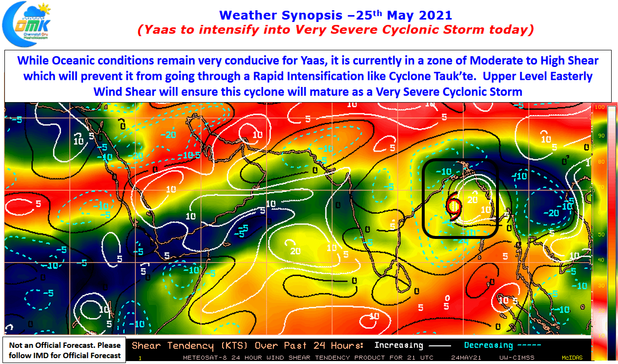
Severe Cyclonic Storm Yaas now lies about 350 kms away from Puri over Bay Of Bengal, in the area straddling Central & North Bay. As it slowly makes its way towards North Coastal Odisha & adjoining areas of West Bengal & Bangladesh it is likely to become a very severe cyclonic storm in the next…
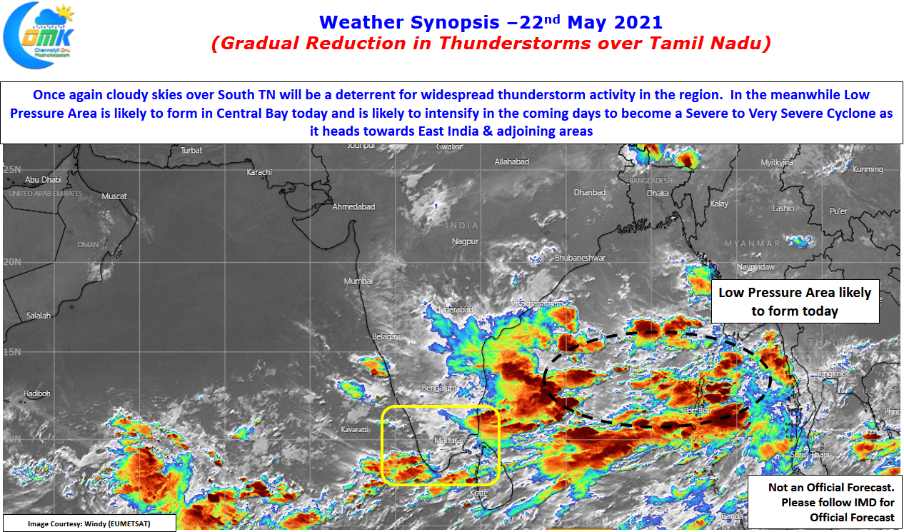
Gradual reduction in Thunderstorms over Tamil Nadu
In a classic burst of pre monsoon thunderstorms the last couple of days have seen many parts of Tamil Nadu saw moderate to intense thunderstorm activity. The capital city Chennai saw successive days of rains with some of the southern suburbs nearly accumulating 10 cms of rains during these two days as wind instabilities triggered…
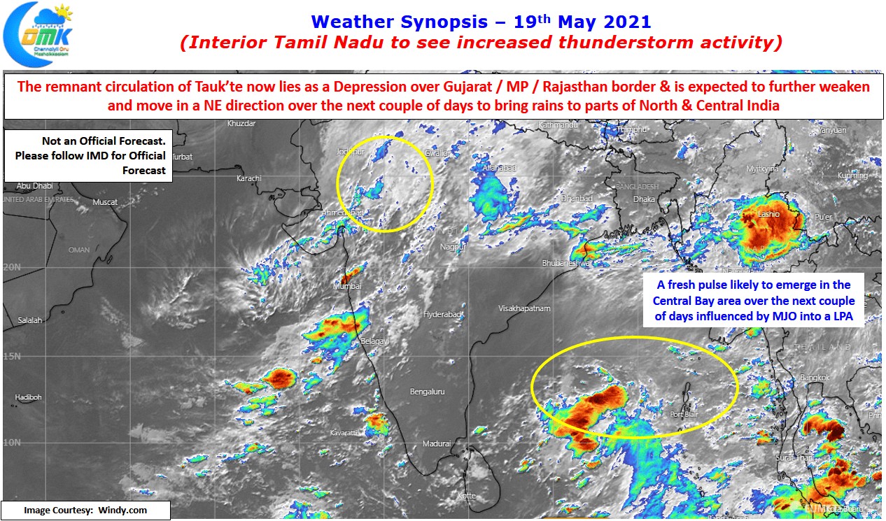
Increased thunderstorm activity over Interior Tamil Nadu
The Extremely Severe Cyclonic Storm after making a very strong landfall over the Saurashtra region of Gujarat has gradually weakened and now lies over Gujarat / Rajasthan / Madhya Pradesh border areas as a depression and is expected to continue losing intensity while tracking NE towards Uttar Pradesh / Madhya Pradesh border areas. In this…
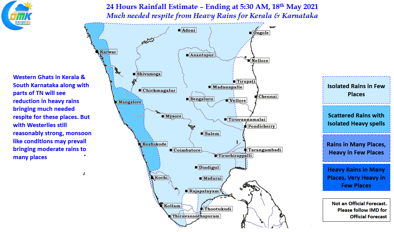
Very Severe Cyclonic Storm Tauk’tae rumbles along the coast
Over time is has been observed more cyclones forming over the Arabian Sea tend to take annular charecterestics compared to the cyclones forming over Bay of Bengal. Gonu, Megh, the cyclone that hit Oman during 1977 are all examples of cyclones that were either annular or were close to getting an annular structure. Very severe…
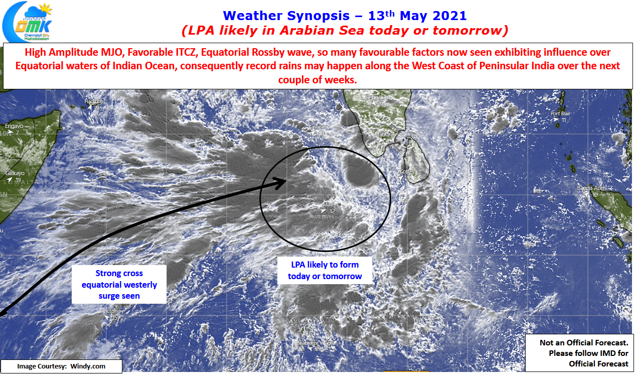
LPA likely in Arabian sea today or tomorrow
It is not often one gets to see multiple factors all falling in place favorably over the Indian Ocean Basin. Last couple of days have seen the influence of a high amplitude MJO over the Equatorial waters of Indian Ocean on the west side. This has also meant the ITCZ has pushed up across the…