
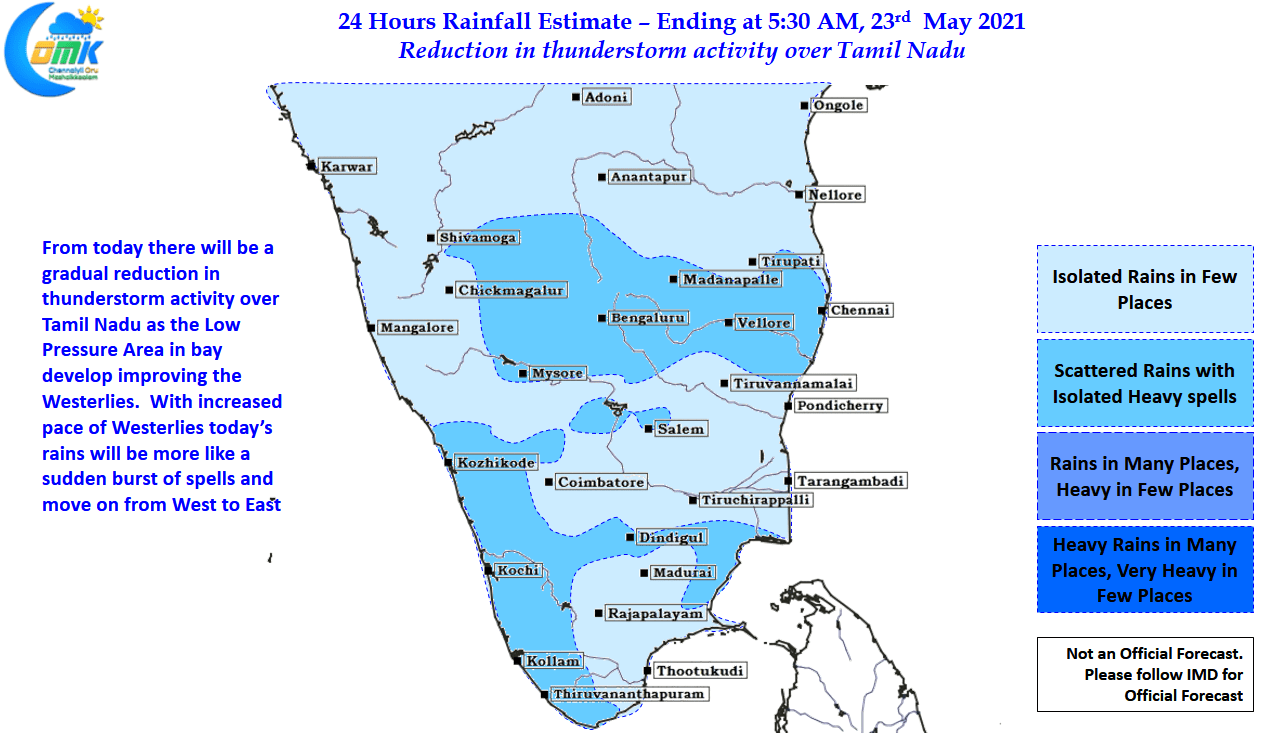
In a classic burst of pre monsoon thunderstorms the last couple of days have seen many parts of Tamil Nadu saw moderate to intense thunderstorm activity. The capital city Chennai saw successive days of rains with some of the southern suburbs nearly accumulating 10 cms of rains during these two days as wind instabilities triggered by the developing Low Pressure Area in Central bay made conditions conducive for thunderstorms to develop. But as the famous dialogue in the movie Devar Magan goes, “ஆனா விதை நான் போட்டது” the seed was planted by Cyclone Tauktae which managed to trigger the Westerlies over the southern parts of Peninsular India.

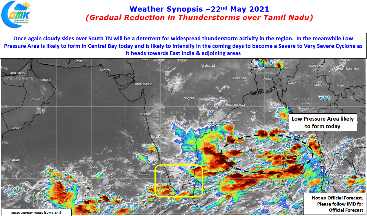
The satellite image shows increasing convection over Central Bay with the Low Pressure area likely to form in the region by today. The disturbance is expected to intensify into a Cyclone over the next couple of days & possibly head as a severe to very severe cyclone towards East India & adjoining areas. While the immediate aftermath of this development in Bay is a gradual reduction in thunderstorm activity as the disturbance intensifies & starts moving towards North Bay we can start seeing some increase in temperatures particularly over North Tamil Nadu where the westerlies will bring the land heat from Rayalaseema.
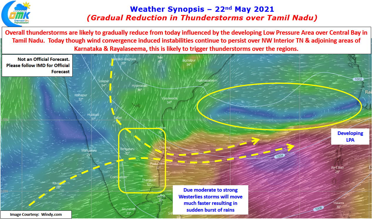
Wind charts indicate Northwest Interior Tamil Nadu & adjoining areas of South Interior Karnataka & Rayalaseema continues to see wind convergence due to the fact that Westerlies have only strengthened up to about 13N latitude & rest of the Peninsular India is still to see proper westerlies. This could mean another day of moderate thunderstorm activity may happen around South Interior Karnataka, adjoining areas of Andhra Pradesh & Tamil Nadu. With Westerlies strengthening the steering for thunderstorms will be much faster than past couple of days thereby changing the pattern of rains to sudden burst of rains & disappear fast rather than the stand & deliver type of rains many places saw on Thursday & Friday.
Overall though with strengthening westerlies, developing Low Pressure Area over Bay of Bengal will mean the wind convergence triggered by the developing Bay circulation, a key component in the thunderstorm equation will be removed bringing an end to the afternoon / evening thunderstorms over interior Tamil Nadu & along the East coast of the state.