
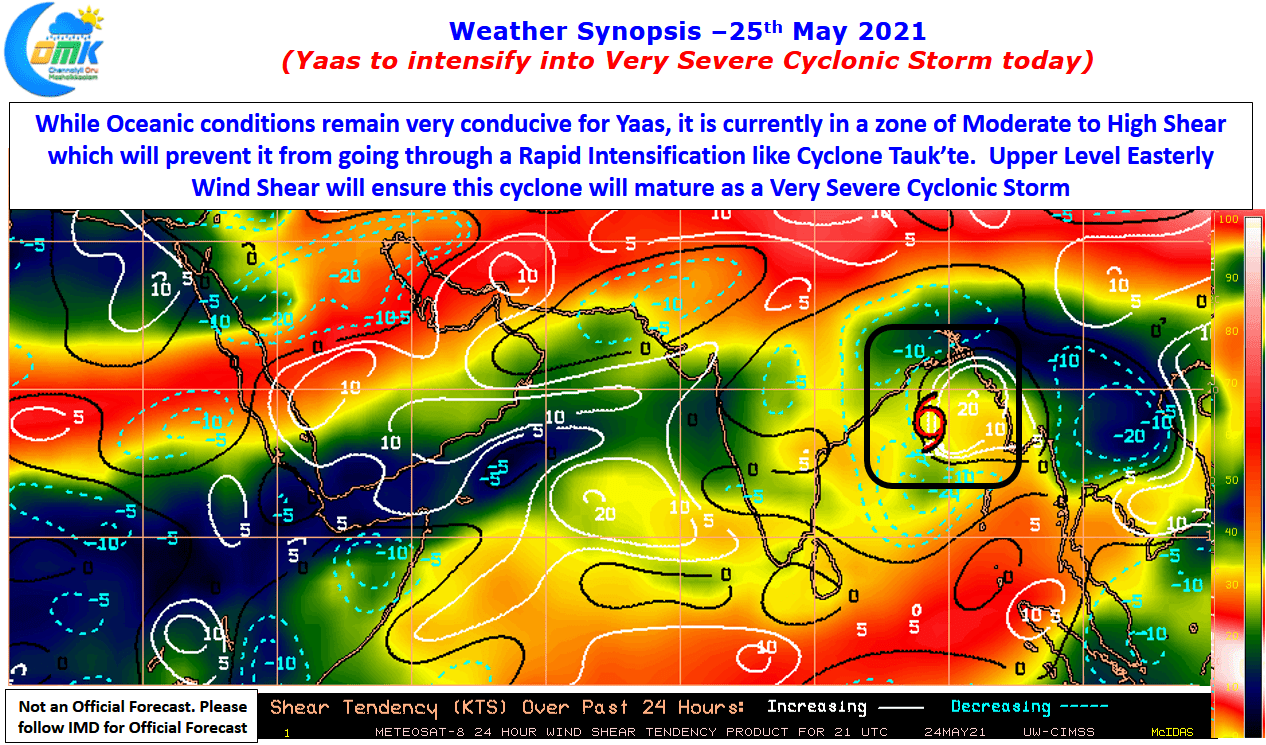
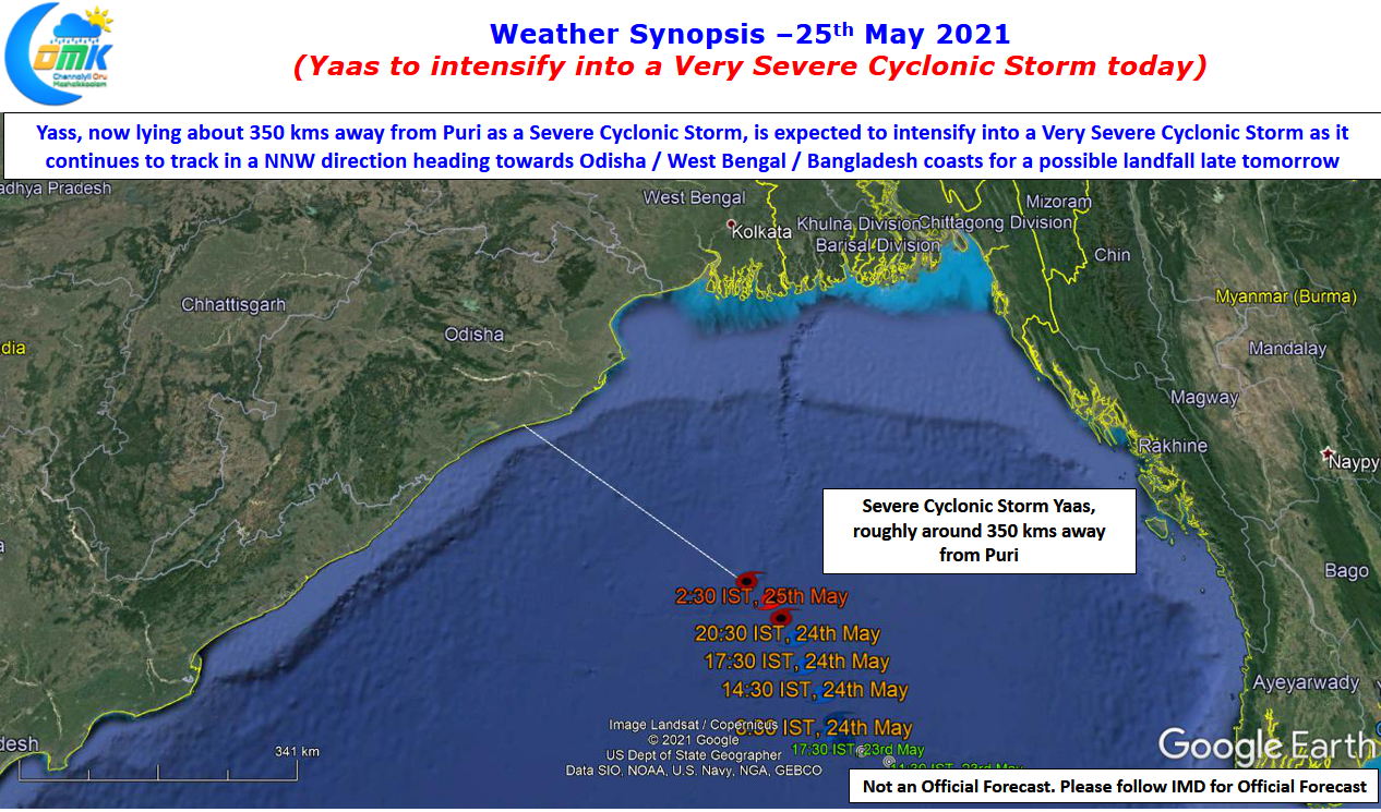
Severe Cyclonic Storm Yaas now lies about 350 kms away from Puri over Bay Of Bengal, in the area straddling Central & North Bay. As it slowly makes its way towards North Coastal Odisha & adjoining areas of West Bengal & Bangladesh it is likely to become a very severe cyclonic storm in the next 6 to 12 hours or so. But crucially it seems to be a typical Yo Yo system that shows up just as Monsoon onset is close by. While Bay of Bengal is very warm with ocean temperature averaging around 31 degrees all around where the cyclone is moving the moderate to high wind shear is not allowing the system consolidate.
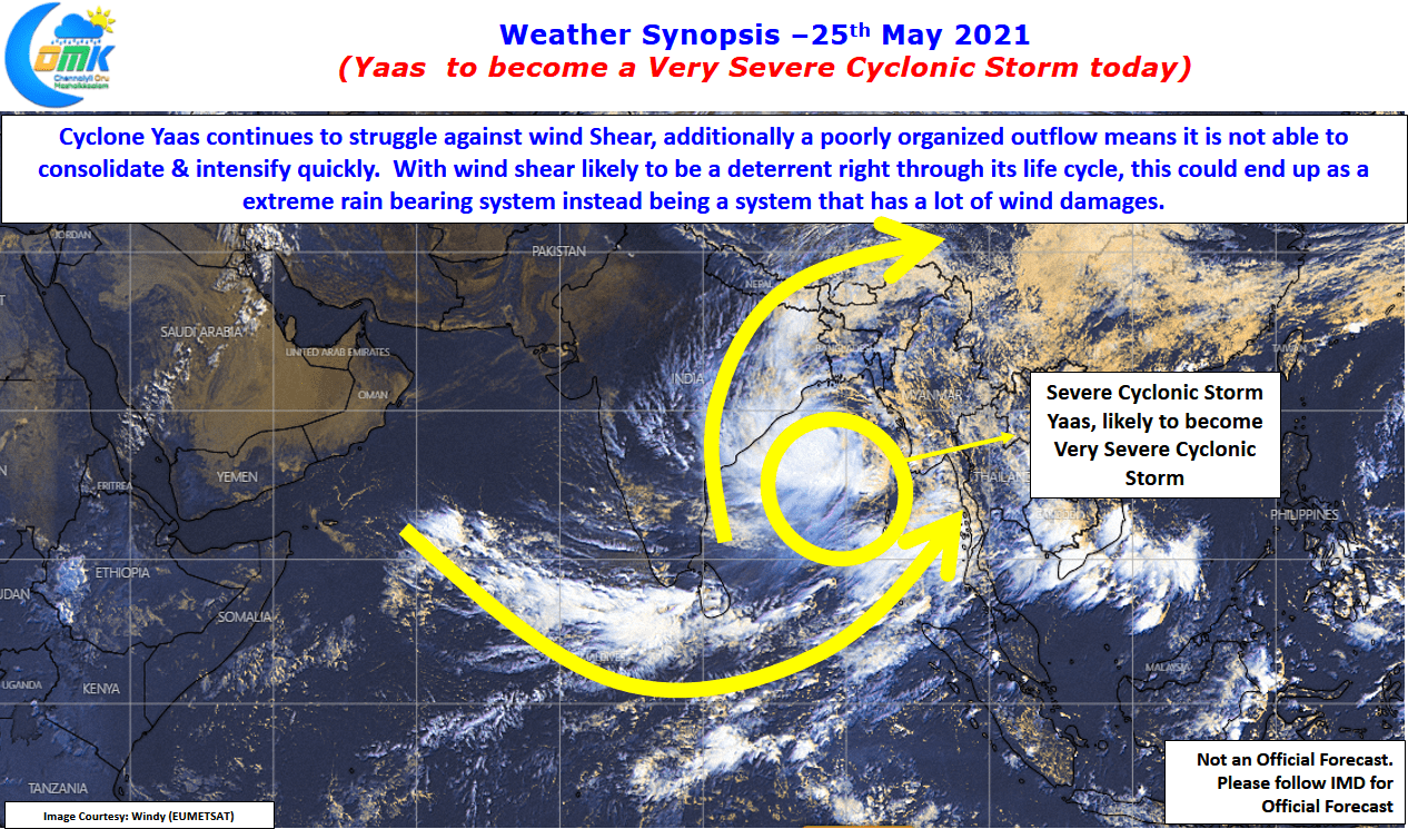

Unlike Cyclone Tauk’tae which pretty much had a free run with no shear worries till landfall time, Cyclone Yaas will continue to struggle against unfavorable shear which will ensure the system does not organize itself well. This is also seen by the weak Poleward Outflow while the Inflow is very robust. The system continues to collapse under its weight while trying to consolidate and is likely to be the pattern as it moves NW towards landfall. This might make the system an extreme rainfall event rather than an extreme wind event at the time of landfall.
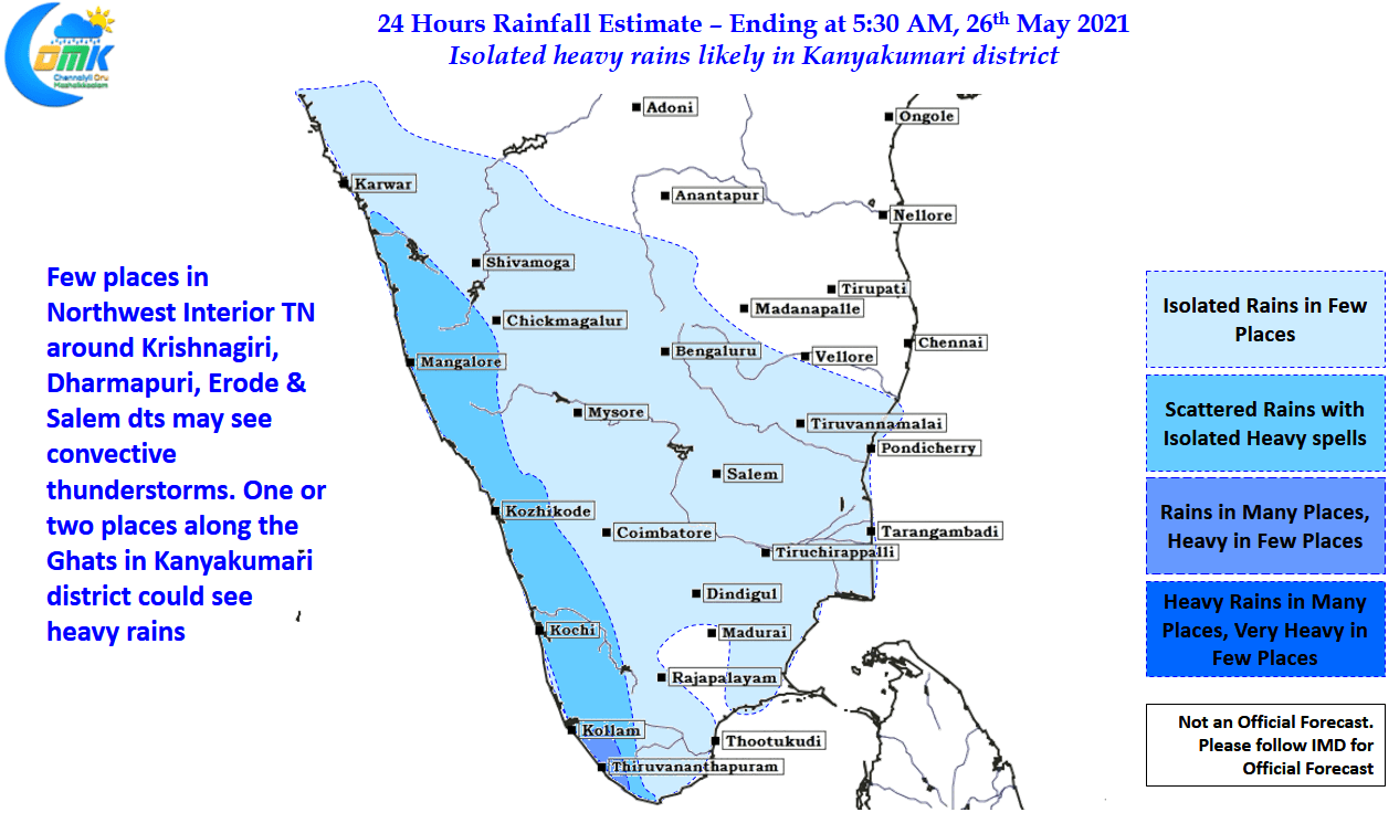
Meanwhile most of Tamil Nadu will remain dry while a few places in NW interior Tamil Nadu is likely to see light to moderate thunderstorms later in the evening. Down South one or two places in Kanyakumari dt along the Western Ghats is likely to see heavy spell of rains along with adjoining areas of South Kerala.