
Over time is has been observed more cyclones forming over the Arabian Sea tend to take annular charecterestics compared to the cyclones forming over Bay of Bengal. Gonu, Megh, the cyclone that hit Oman during 1977 are all examples of cyclones that were either annular or were close to getting an annular structure. Very severe cyclonic storm Tauk’tae has started showing characteristics of getting an annular structure. This is also an indication of the cyclone maturing as well having gone through a bout of rapid intensification as well earlier.
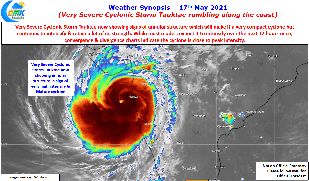
Satellite images certainly confirm Cyclone Tauk’tae as a very compact cyclone that is close to becoming symmetric a feature of annular cyclones. While it will continue to intensify over the course of the day today if one were to look at the Convergence & divergence charts it appears the cyclone is close to maturity status and is about to reach its peak intensify very soon. This is some bit of good news though it does not exactly mean the cyclone will start loosing intensity.
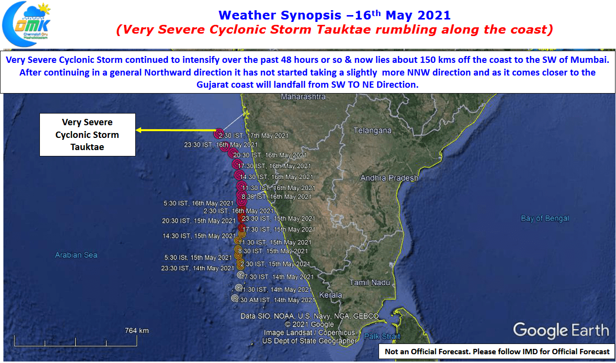
Currently at about 150 kms away from the Mumbai coast it has started to move in a NW direction for the past 12 to 15 hours or so as it shifts the angle slightly before bearing down on the Gujarat coast making landfall from SW to NE direction. Weather charts also indicates the cyclone could possibly enter more moderate shear later in the afternoon that could possibly hold a check on intensification and also drop the intensity a notch or two before landfall. Nevertheless Tauk’tae is likely to be the strongest cyclone making landfall over the Gujarat coast in recent times.

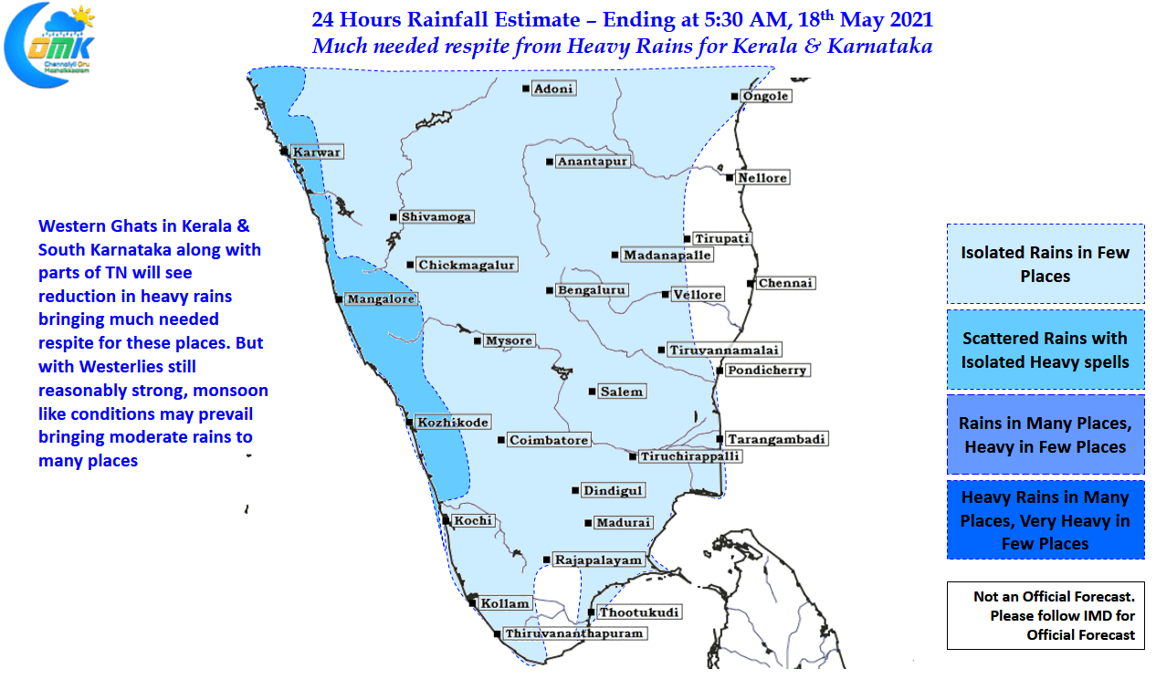
In the meanwhile rains are expected to ease over Peninsular India bringing some much needed respite from heavy rains for the places along the Ghats. But with Weserterlies still flowing we could see monsoon like conditions over the west coast brining moderate rains to many places and isolated heavy spells as well in the Ghats. Isolated thunderstorms may happen over parts of Delta, Trichy, Karur & Namakkal districts in Central TN while over North TN few places in Vellore & Tirupatthur dt could see moderate thunderstorms