

The Extremely Severe Cyclonic Storm after making a very strong landfall over the Saurashtra region of Gujarat has gradually weakened and now lies over Gujarat / Rajasthan / Madhya Pradesh border areas as a depression and is expected to continue losing intensity while tracking NE towards Uttar Pradesh / Madhya Pradesh border areas. In this process the remnant circulation will also be interacting with an incoming Western Disturbance bringing moderate to heavy thunderstorms to parts of North & Central India.
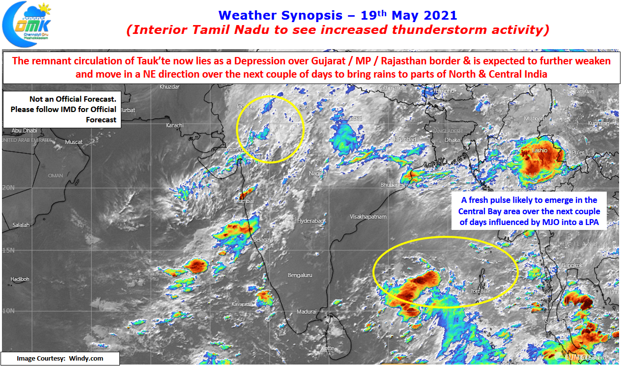
In the meanwhile Bay of Bengal seems in no mood to be left behind & is kickstarting its own churn to trigger a pulse over the central Bay areas in the next couple of days. With MJO influence still seen over North Indian Ocean area this pulse will become a LPA by around weekend and intensifying into the first cyclone of the year over Bay of Bengal by next week. With weather models expecting this cyclone to head towards North Bay this could strengthen the Westerlies further making it conducive for the onset of Southwest Monsoon.
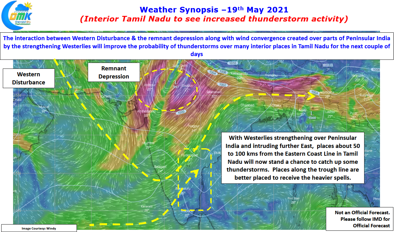
Amidst all this is the good news that interior areas of Tamil Nadu will start seeing increased thunderstorm activity for the next few days. As an incidental benefit of the arrival of Cyclone Tauk’tae and its movement along the west coast has meant Westerlies have strengthened over the interior areas of Peninsular India and are now intruding further East compared to say a week back. This extension of Weterlies into interior Tamil Nadu means places about 50 to 100 kms from the East coast now stand a better chance to catch up a spell or two of thunderstorms.
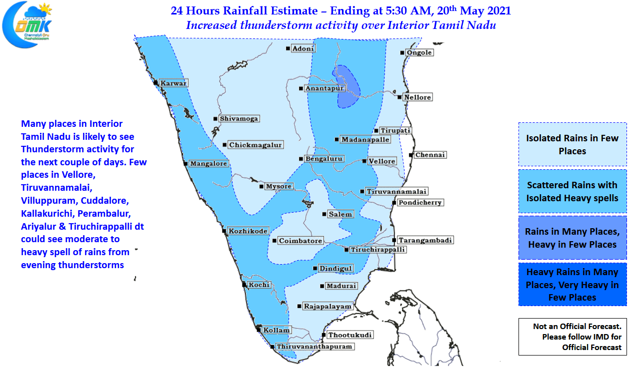
While places like Chennai which sit right on the coast will require a lot of luck with favorable storm movement considering the Westerlies are not yet reaching the East Coast, the solace is somehow Chennai gets atleast one spell of thunderstorms during the few days before the formation of an LPA in Central Bay due to favorable upper level wind conditions. Today influenced by the wind convergence created by the Dipping Westerly Trough we could see a few places all the way from Vellore to Tiruchirappalli dts catch a spell or two of moderate to intense thunderstorm activity.