

It is not often one gets to see multiple factors all falling in place favorably over the Indian Ocean Basin. Last couple of days have seen the influence of a high amplitude MJO over the Equatorial waters of Indian Ocean on the west side. This has also meant the ITCZ has pushed up across the Equator bringing a much more favorable conditions for thunderstorm activity over Peninsular India.
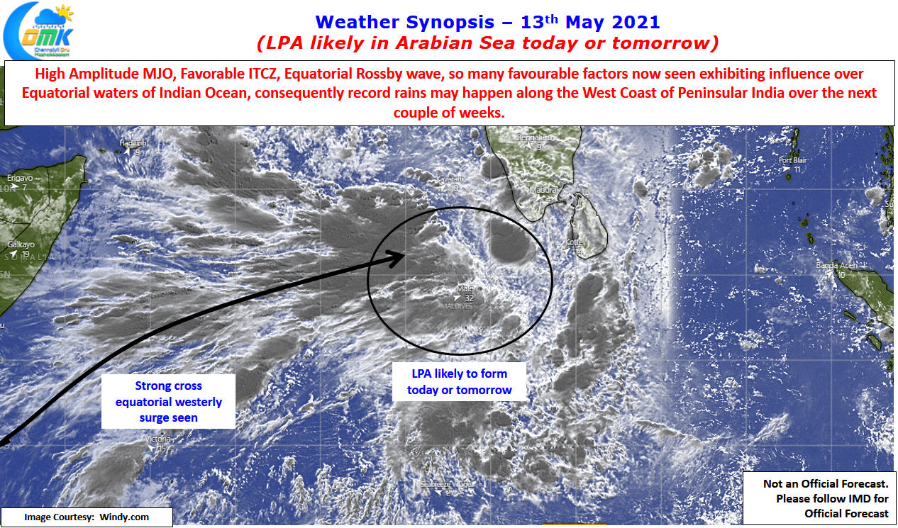
If all this was not enough like the Cadburys Dairy Milk Shots ad, “கண்ணா ரெண்டாவது லட்டு தின்ன ஆசையா” the arrival of Equatorial Rossby wave is now expected to trigger circulations on either side of the Equator. The presence of counter circulation on either side of the equator would mean the cross equatorial westerlies get “Double Engine” boost almost creating a Southwest Monsoon type surge even though we are still more than 2 weeks away from the traditional monsoon onset date over Kerala (MOK)
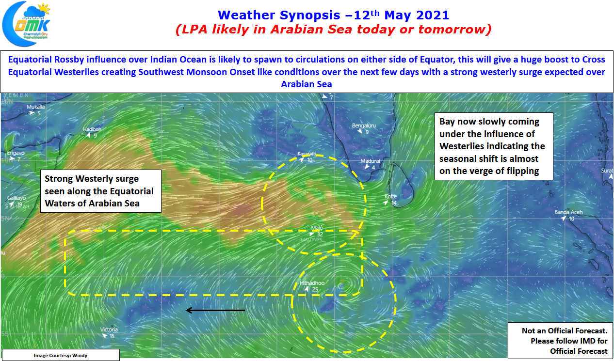
With low pressure area expected to form over the Comorin sea either today or tomorrow we can expect more surge from the westerlies. Models are consistent about this evolving LPA to brush the west coast making a movement like Ochki a few years back. This is likely to trigger heavy to very heavy rains over the Western Ghats as the circulation climbs up. One should also ignore the trapped moisture effect that might continue to give rains in the valleys long after the disturbance has moved up.
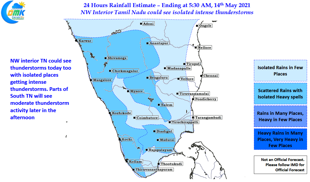
While the current LPA is unlikely to be the only disturbance that may come up over North Indian Ocean in the coming two weeks, it remains to be seen if a possible disturbance in Bay acts as a bane or boon for coastal areas of Tamil Nadu before Southwest Monsoon picks up full steam. In the meanwhile interior areas of Peninsular India will continue to see stormy evenings influenced by wind discontinuities. Today parts of NW interior TN & south TN could see isolated heavy rains later in the evening.