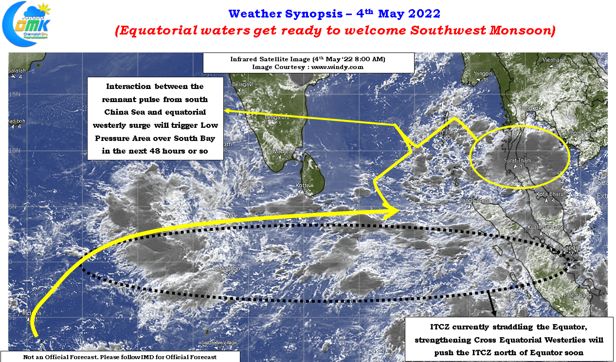
After a reasonably comfortable couple of months where most parts of Peninsular India escaped from scorching summer conditions while the rest of the Indian Sub Continent, particularly the Northwest & Central Indian regions saw a very early onset of summer and associated increase in temperatures even as early as second fortnight of March when places…
Author: Chennaiyil Oru Mazhaikkaalam
Isolated Intense Thunderstorms likely over parts of South TN
The last couple of days have seen thunderstorm activity taper off over the Peninsular India with mostly isolated rains sticking to places closer to the Western Ghats. One of the key reasons for this was the absence of any pronounced wind instability as Easterlies took control after the UAC that gave widespread rains the last…
NW Interior TN may see another day of thunderstorms
With the first fortnight of April behind us, it is that time of the year to look forward to Westerly winds strenthening and making the seasonal shift in wind pattern from East to West. More often than not the pre monsoon disturbance triggers the seasonal shift in winds both during Summer & Winter Monsoon periods….
Action shifts to West TN as Circulation moves into Arabian Sea
The last few days have seen parts of South Tamil Nadu recieve rains like a peak Northeast Monsoon day as convective thunderstorms made the best out of conditions that are not often seen. Bright sunshine & heat from summer days and abundant moisture supplied from a near stationary circulation creating perfect conditions for not only…
Another day of widespread rains likely for South TN
According to IMD’s Daily Rainfall graph for Tamil Nadu & Pondicherry Sub division the accumulated rainfall for the Pre Monsoon Season (March to May) is 26.3 mm against the average of 32.2 mm for the period upto April 10th. Ironically of the 26.3 mm accumulated since 1st of March the last two days has given…


