
Man Proposes Nature Disposes is an adage which many weather bloggers will not forget easily. After running models around for a merry go around for many days Cyclone Asani finally firmed up its mind and ended up making landfall over the Andhra Pradesh coast near Machilipatnam last evening as a Deep Depression. While many bloggers including COMK and IMD expected the system to recurve after reaching AP coast the pronounced WNW movement day before yesterday meant the recurve scenario eventually could not materialize as land interaction robbed the system of any chance to maintain intensity and structure.
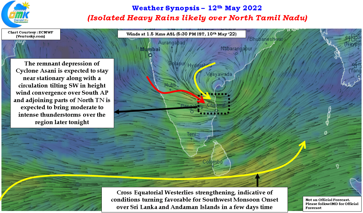
In the meanwhile the remnant circulation which is expected to remain off the AP coast in the same region is likely to add its own contribution to this wonderful script written by Cyclone Asani. Wind convergence created by the circulation is expected to fall over North TN and adjoining areas of South AP and South Interior Karnataka today bringing a possibility of intense thunderstorms over isolated places in North TN. With the trough line passing over Chennai there is a fair chance for Chennai and suburbs to catch a spell or two of heavy rains later tonight.
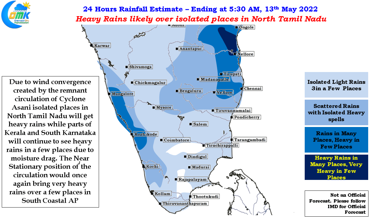
The remnant circulation is tilting with height which means over the course of the next couple of days this zone of wind convergence may move south over Tamil Nadu bringing more areas of the state under the rainfall window until weekend possibly. On the other side of the coast the moisture drag created by the effect of Cyclone Asani circulation has created pseudo southwest monsoon conditions over Kerala and South Karnataka bringing heavy rains to few coastal places and along the Ghats. This is expected to continue today as well with heavy rains likely in a few places over Central Kerala and high ranges of the state.