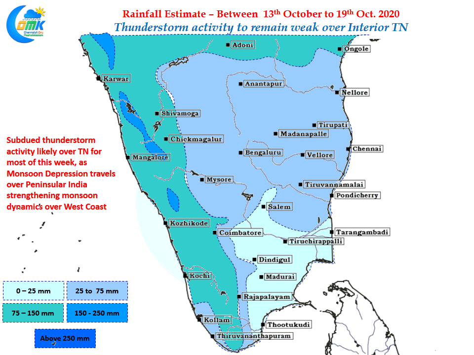
The Deep Depression off the coast of Andhra Pradesh has started making landfall close to Kakinada Coast, bringing widespread rains over the regions along with it. Few places along the coast of AP particularly around Kakinada has recorded more than 10 cms last night. In the meanwhile parts of Chennai recorded moderate to intense spell…
Author: Chennaiyil Oru Mazhaikkaalam
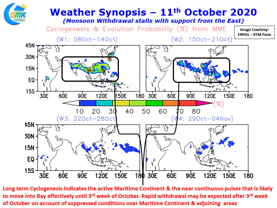
Monsoon withdrawal stalls with support from East
At the time of writing this post the buzz about Northeast Monsoon among the weather bloggers of Chennai will hit the roof with plethora of charts being shared about which day is likely to be the onset day as more often than not the onset window for Northeast Monsoon starts coming within the time frame…
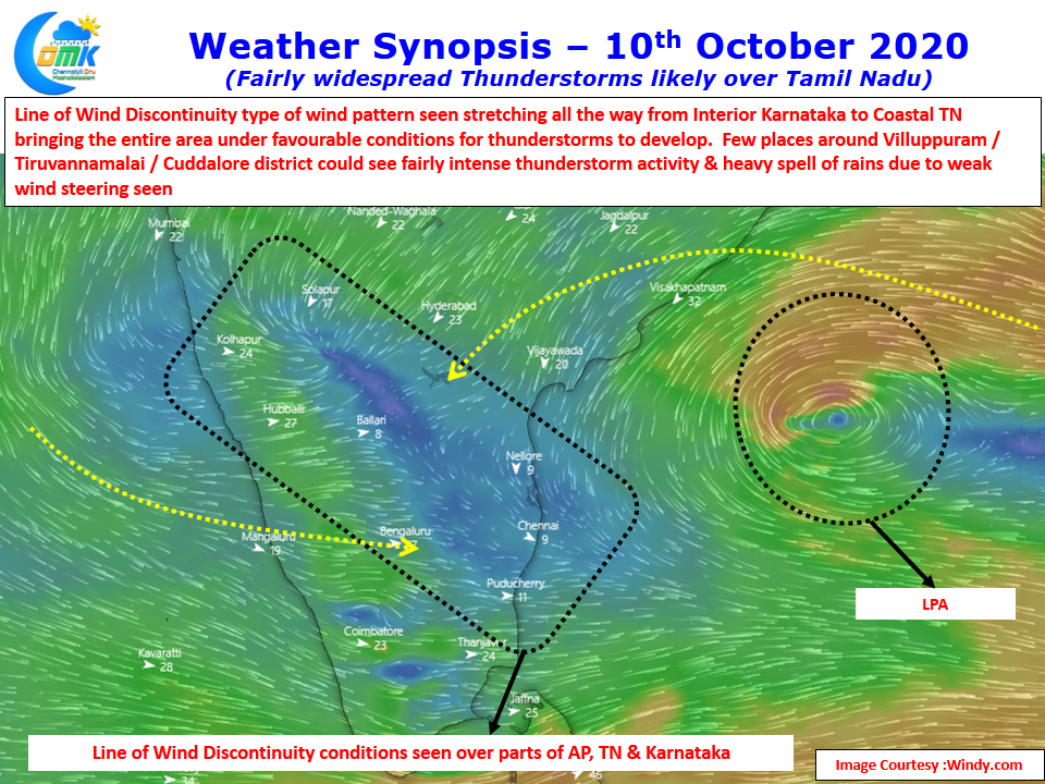
Fairly widespread Thunderstorm activity likely over TN
The period when Southwest Monsoon starts withdrawing over the Indian Sub Continent is one of the most favorable period for thunderstorms just like the pre monsoon transition season. Winds tend to become scrambled leading to situations like Convergence, LWD etc. This year so far predominantly wind convergence has been the trigger for thunderstorms over the…
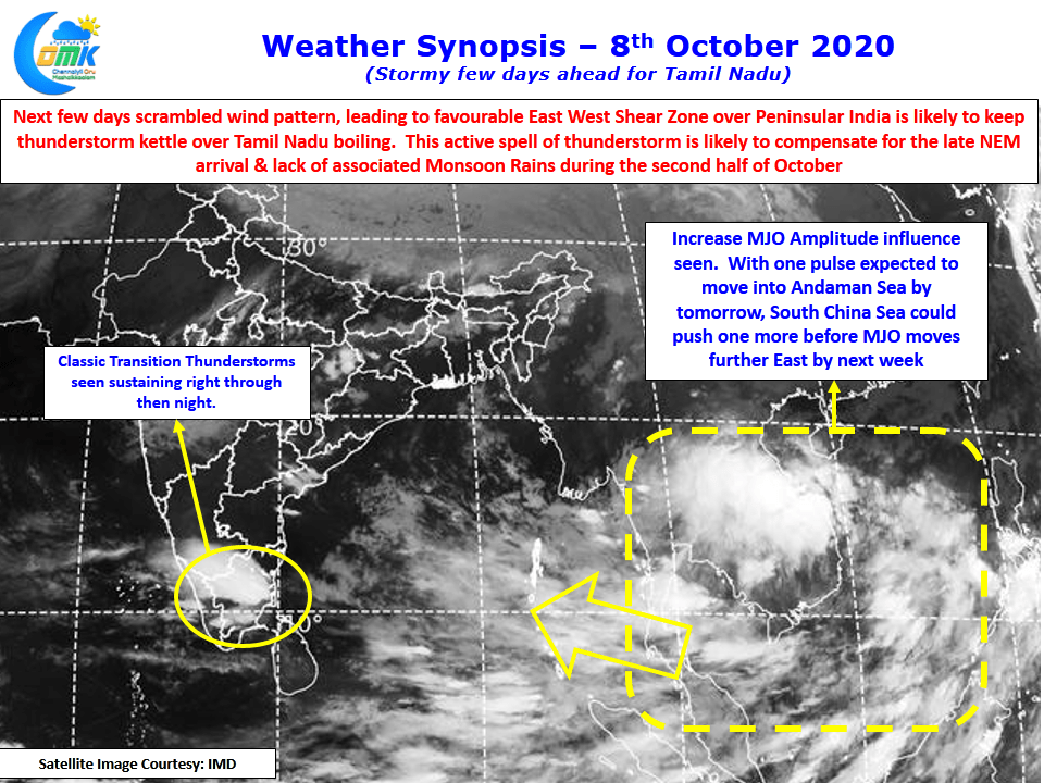
Stormy Spell Ahead for TN
Thunderstorms have returned back over Tamil Nadu. Tuesday saw Madurai & surrounding places record good rains with the IMD observatory recording 88 mm much to the surprise of many weather bloggers who for long feel this observatory is as cursed as Nungambakkam missing every spell of rains in the vicinity. Yesterday after evening storms around…
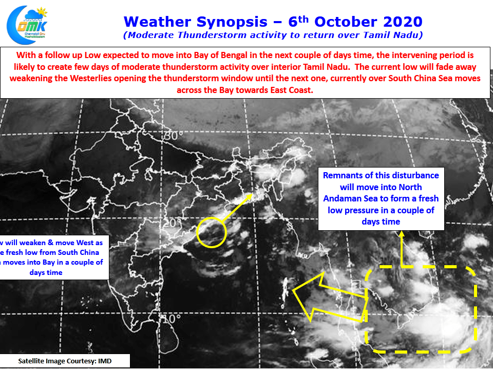
Moderate Thunderstorm Activity to return over TN
The last few days have seen dull weather prevail over most of Tamil Nadu with dry conditions prevailing. It is often seen the wind induced instabilities provide the best conditions for thunderstorms to develop over the interior areas of Tamil Nadu. This instability is seen mostly when Monsoon Lows are evolving over the Bay creating…