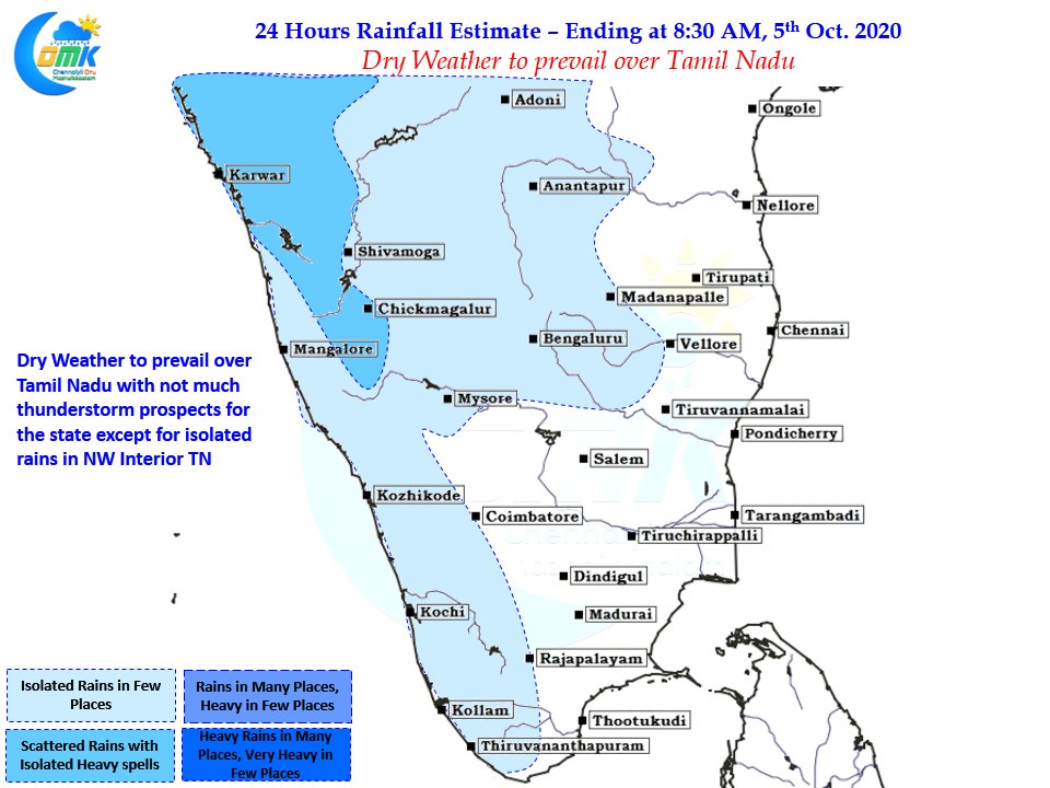
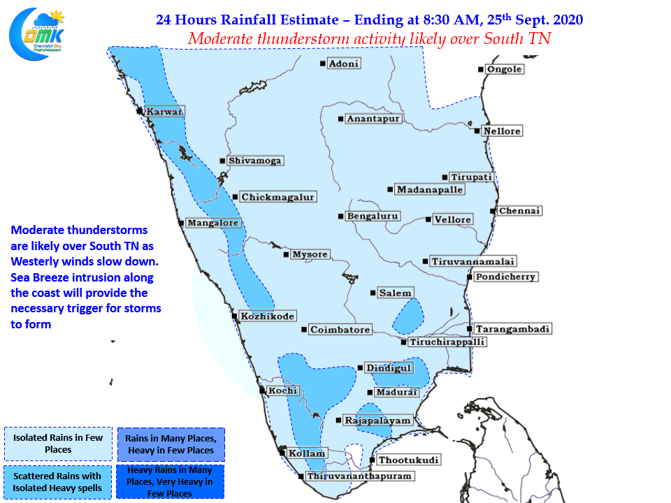
In a welcome relief after many close misses & disappointments not to forget the by now Iconic “Chennai Bermuda – Vada Poche” moments yesterday saw one of the best spell of thunderstorms of this monsoon season for Chennai with the IMD Observatory at Nungambakkam scoring its first half century of the year recording 57 mm…
Author: Chennaiyil Oru Mazhaikkaalam
Weak Thunderstorm activity to continue over TN
Over the past couple of days thunderstorm activity over Tamil Nadu has been weak with Westerlies holding sway over things. Earlier this week the East West Shear Zone was running closer to Tamil Nadu latitude creating unstable atmospheric conditions over the state triggering thunderstorms in the process, with the East West Shear Zone now lying…
Start of Monsoon Withdrawal likely to be delayed
As many would know the traditional start of Southwest Monsoon Withdrawal from the Northwestern Parts of India for many years used to be 1st of September. Over the last decade or so the withdrawal has mostly started around Mid of September picking pace only towards end Sept or early October. Consequently after detailed assimilation of…
Reduced thunderstorms over Tamil Nadu
After a week or so of fairly active thunderstorm spell over Tamil Nadu, can sense a lot of disappointed weather bloggers from Chennai, the development of a Low Pressure Area over Central Bay region is likely to bring back monsoon dynamics over the West Coast. This Low Pressure Area is also likely to pull back…
Thunderstorms to continue over Peninsular India
In an interesting development which normally does not happen often on the one hand Monsoon Trough has been staying closer to the Himalyan Foothills leading to good thunderstorm activity over the leeward areas of Peninsular India. Simultaneously an off shore trough running along the West Coast from South Maharasthra to North Kerala Coast is creating…


