
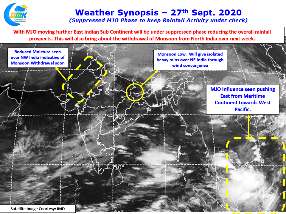
Southwest Monsoon, possibly the largest global weather phenomenon, is slowly getting ready to bid adieu for this year. As the Indian Sub Continent gets ready for the transition we start seeing scrambled winds / weak winds / wind convergence etc triggering thunderstorms in the progress. Satellite image indicates reduced moisture over Northwest India an indication that Monsoon is ready to draw down the curtains for this season.
But if one looks little closer one can also see the influence of MJO seen moving further East from Maritime Continent towards West Pacific which could bring a suppressed phase of rainfall activity over the Indian Sub Continent. While this would not mean a complete cessation of rains but extreme rainfall episodes will possibly be missing along with reduced thunderstorm activity.
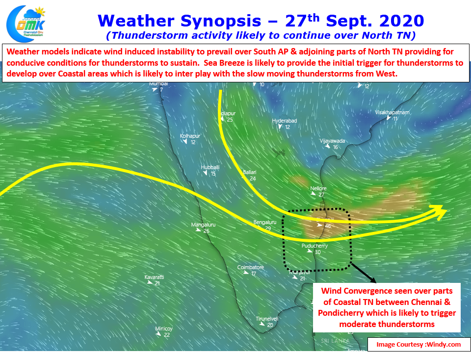
Possibly yesterday was an indication of how even under possibly good conditions thunderstorms may not be as widespread as models expected. Today once again wind convergence is seen over parts of Coastal Tamil Nadu with the stretch between Chennai & Pondy likely to see some moderate thunderstorms in a few places.
It will be interesting to note how much variance happens between what models estimate & the reality in terms of rains