
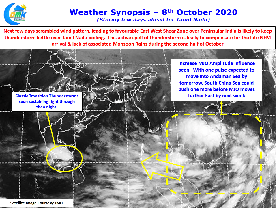
Thunderstorms have returned back over Tamil Nadu. Tuesday saw Madurai & surrounding places record good rains with the IMD observatory recording 88 mm much to the surprise of many weather bloggers who for long feel this observatory is as cursed as Nungambakkam missing every spell of rains in the vicinity. Yesterday after evening storms around South TN the night saw thunderstorms develop all the way from parts of Tiruvannamalai dt to Pudukottai dt giving good spell of rains to many places around midnight & early hours of today.
While there is some concern about the signals coming out with regard to NEM 2020 it makes sense to enjoy the current rather than worry too much about the future. South China Sea has been sending back to back pulses into Andaman Sea which evolve into Low Pressure in due course. With weak amplitude MJO parking itself over the region for the past couple of weeks it was a case of Rinse & Repeat every few days.
Now there is some change in momentum seen which is likely to play a role in the NEM prospects as well. MJO is seen with increased amplitude over the past couple of days which is reflected in increasing convection around the region. It could be a precursor for MJO movement further East towards West Pacific. Some models estimate MJO to loop back to Indian Ocean from here while some expect it to move further into the Western Hemisphere. Depending on how MJO behaves we might have a case of NEM onset window differing by nearly 2 weeks. More on that as things evolve.
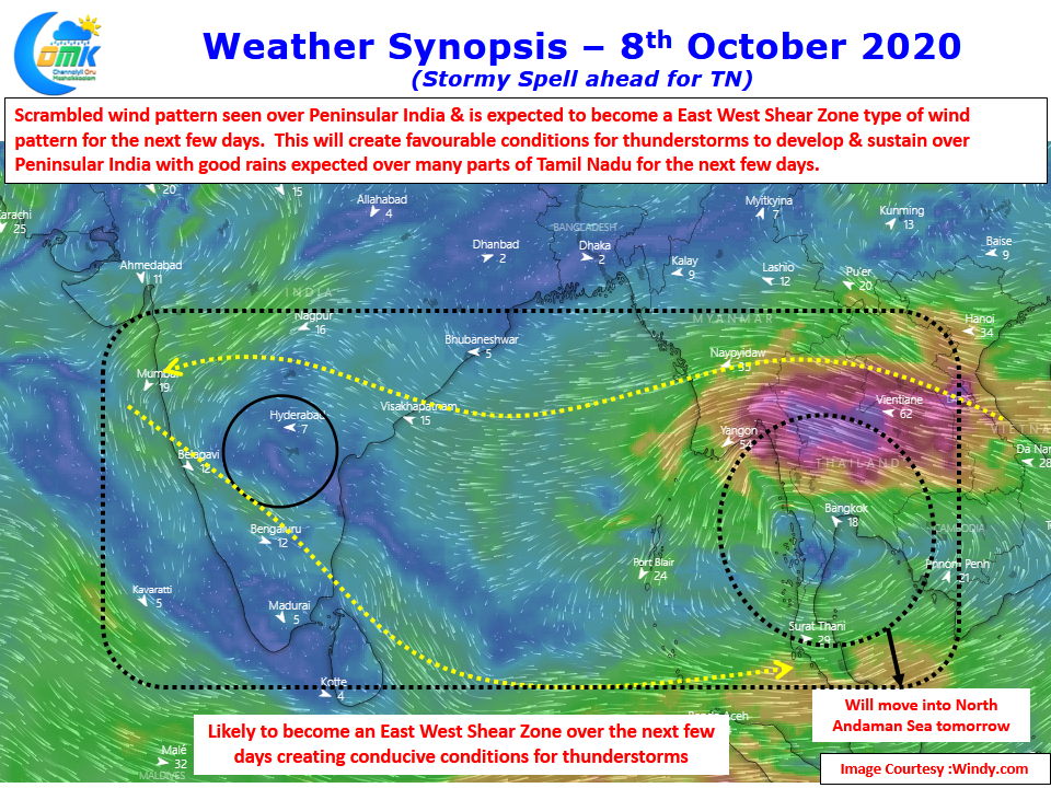
In the meanwhile time to enjoy the current as the next few days are likely to be a stormy spell ahead for most parts of Tamil Nadu with weather models indicating the current scrambled wind pattern likely to evolve into a favorable East West Shear Zone over parts of Peninsular India. This is likely to create favorable conditions for thunderstorms to develop & Sustain for many hours. Over the next few days the back to back lows & possibly one more pulse that might come from South China sea will make it a East West Shear Zone type of wind pattern leading to a story few days for Peninsular India.
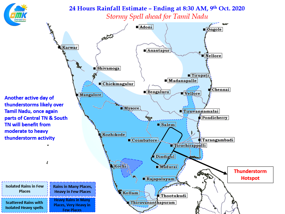
Today once again parts of Central TN & adjoining areas of South TN are likely to be the hotspots for Thunderstorms. Though it might sound enthusiastic for weather bloggers in the area many parts of Delta have Paddy Crops ready for harvest & this continuous spell of rains could lead to potential withering off Paddy Grains even before harvest. As they say Man Proposes Nature Disposes we don’t chose the cards that are dealt to us by Nature whether its thunderstorms or Monsoon at best we can take precautions with a more informed choice.
கீதாசாரம் சொல்வது போல எது நடந்ததோ, அது நன்றாகவே நடந்தது எது நடக்கிறதோ, அது நன்றாகவே நடக்கிறது எது நடக்க இருக்கிறதோ, அதுவும் நன்றாகவே நடக்கும்