
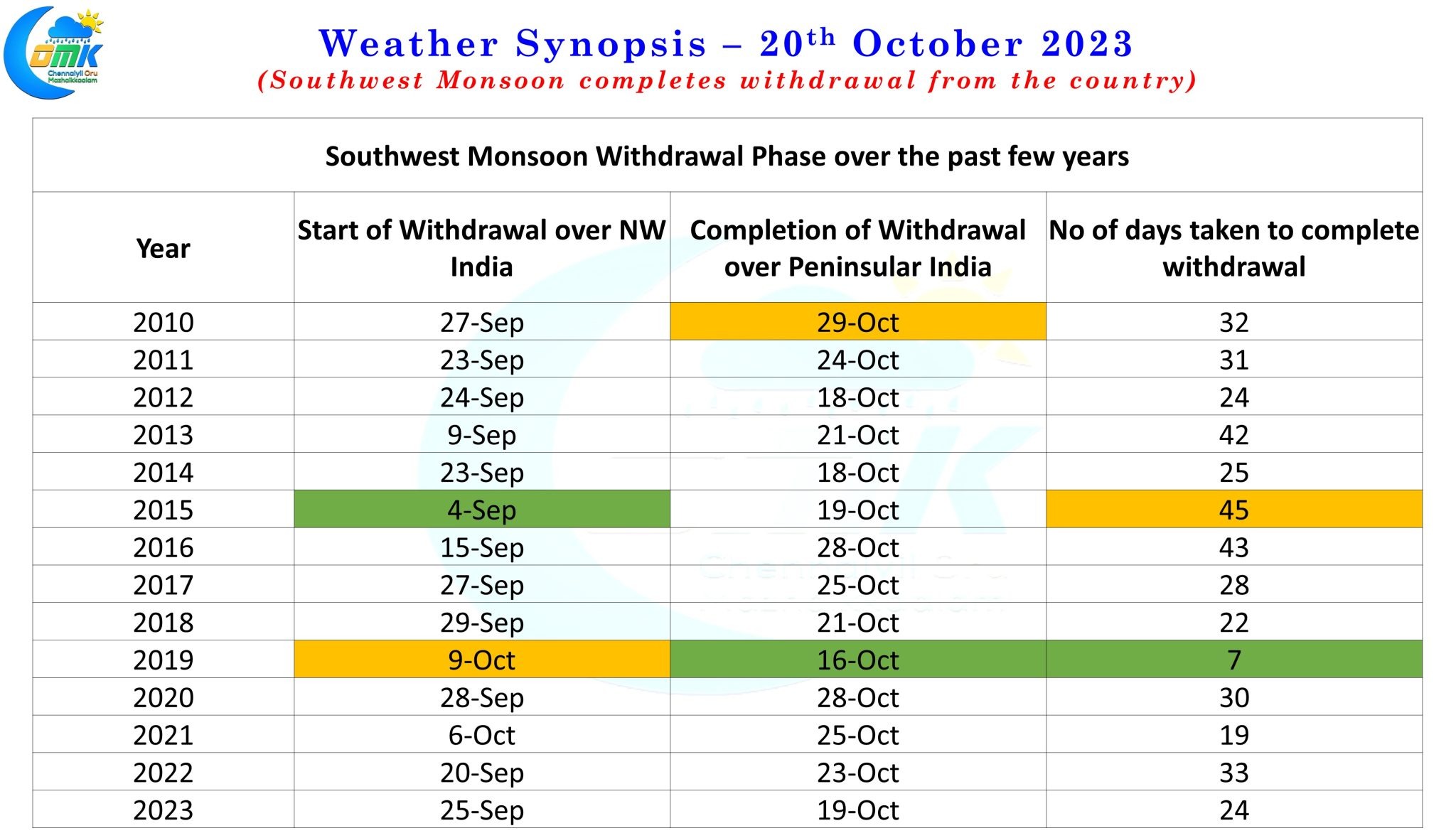
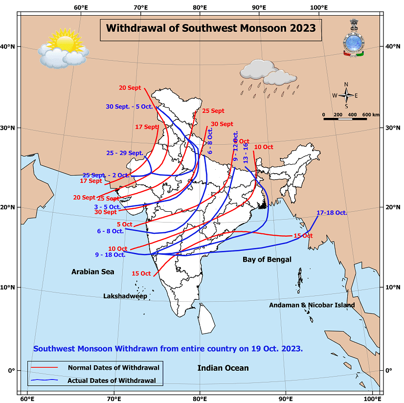
IMD yesterday announced the withdrawal of Southwest Monsoon from the entire country 4 days delayed compared to the normal withdrawal date of October 15th. Over the past decade if one were to see the withdrawal dates 6 out of 10 years the withdrawal has been completed only after 20th October ironically 2019 the year that saw the most delayed start to withdrawal had the withdrawal completed closes to the normal date. 2019 saw Southwest Monsoon withdraw completely from the country in 7 days from the time it started in Northwest India while 2015 saw the lengthiest withdrawal phase taking 45 days to complete the withdrawal after seeing the earliest start to withdrawal in the past decade.
With the Low Pressure forming over Southwest and adjoining Southeast Bay of Bengal we now have a pair of circulation that brings back memories of 2018 when a pair of circulations spun on either side of the Indian Sub continent, Very Severe Cyclonic Storm Luban in the Arabian Sea, and Very Severe Cyclonic Storm Titli in the Bay of Bengal. While Luban made landfall over the Yemen coast, Titli made landfall over the coastal areas of North AP / South Odisha border near Palasa. In a remarkable similarity it appears the current twins could also take a similar path though the intensity may not be similar to the 2018 twins. Nevertheless there is a very high probability for both the 2023 twins to become cyclones with the Arabian Sea possibly becoming severe cyclonic storm at the least before landfall.
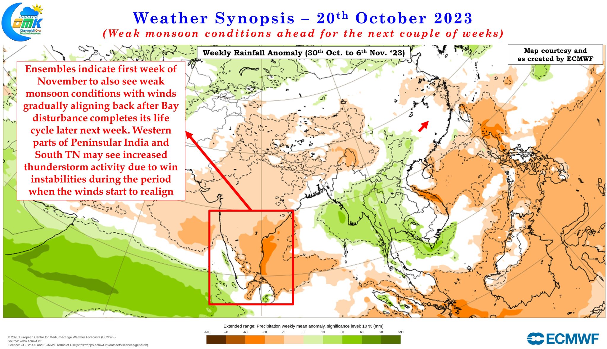
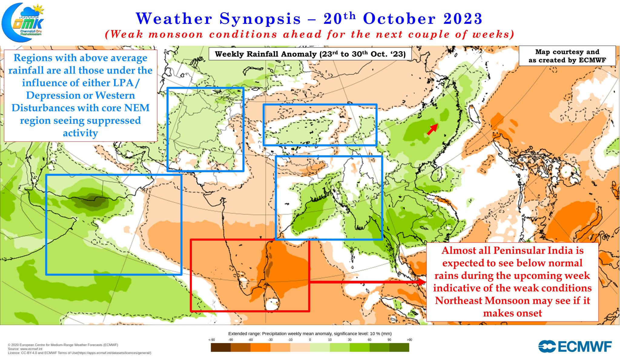
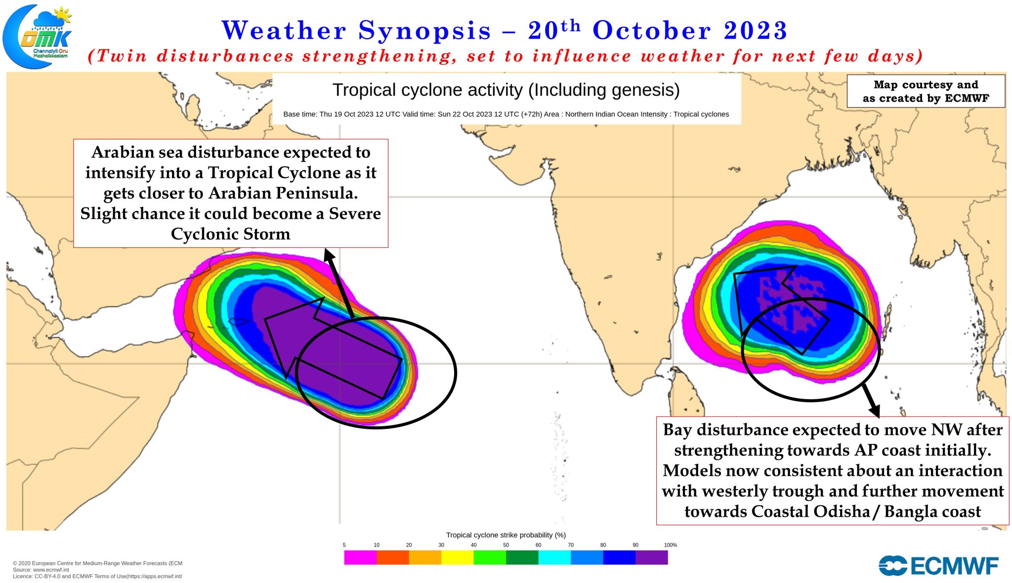
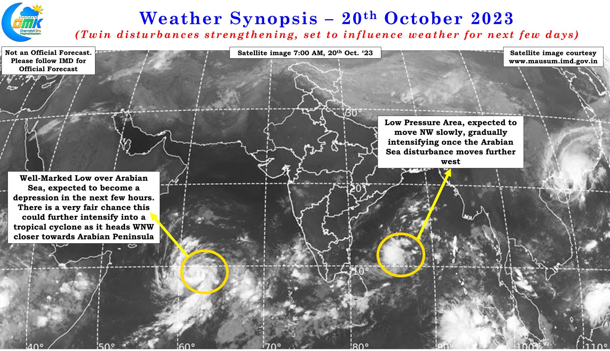
Weather models are fairly consistent about the Arabian Sea disturbance moving in a more WNW direction towards the Yemen coast. Similarly the Bay disturbance is expected to move in a more NW direction towards Central Bay & AP coast. While initially ensembles were showing multiple scenarios which included impact area ranging from South AP to the Sunderbans over the past couple of days things are firming up on a possible interaction between the bay disturbance and an incoming Westerly Trough which is expected to drag the circulation towards Odisha / West Bengal later next week. This could potentially mean Peninsular India may come under drier Northerlies while the circulation heads towards North bay bringing about a period of reduced rainfall activity except for thunderstorms due to wind instabilities.
IMD had also indicated in their press release the possibility of Northeast Monsoon onset in the next 72 hours taking into account the prevalence of Easterlies and Northeasterlies at lower levels over Peninsular India. Looking at how things are shaping up and weather model forecasts for the next fortnight or so it appears even if Northeast Monsoon onset is announced by IMD it may remain academic with the pair of circulations influencing weather conditions over the Indian Sub continent and surrounding areas for the next week to 10 days. Once these twins complete its life cycle and the winds start to realign we could possibly see some light at the end of the tunnel and better clarity on when the most active phase of NEM 2023 could be. The precipitation charts also indicate subdued rains for Peninsular India for the next couple of weeks with rains expected to pick up over Peninsular West coast and South TN towards the first week of November when the wind instabilities bring thunderstorms to the area as easterly winds try to realign.
Till then it is going to time to chew the finger nails in anticipation or in some cases with worry.