
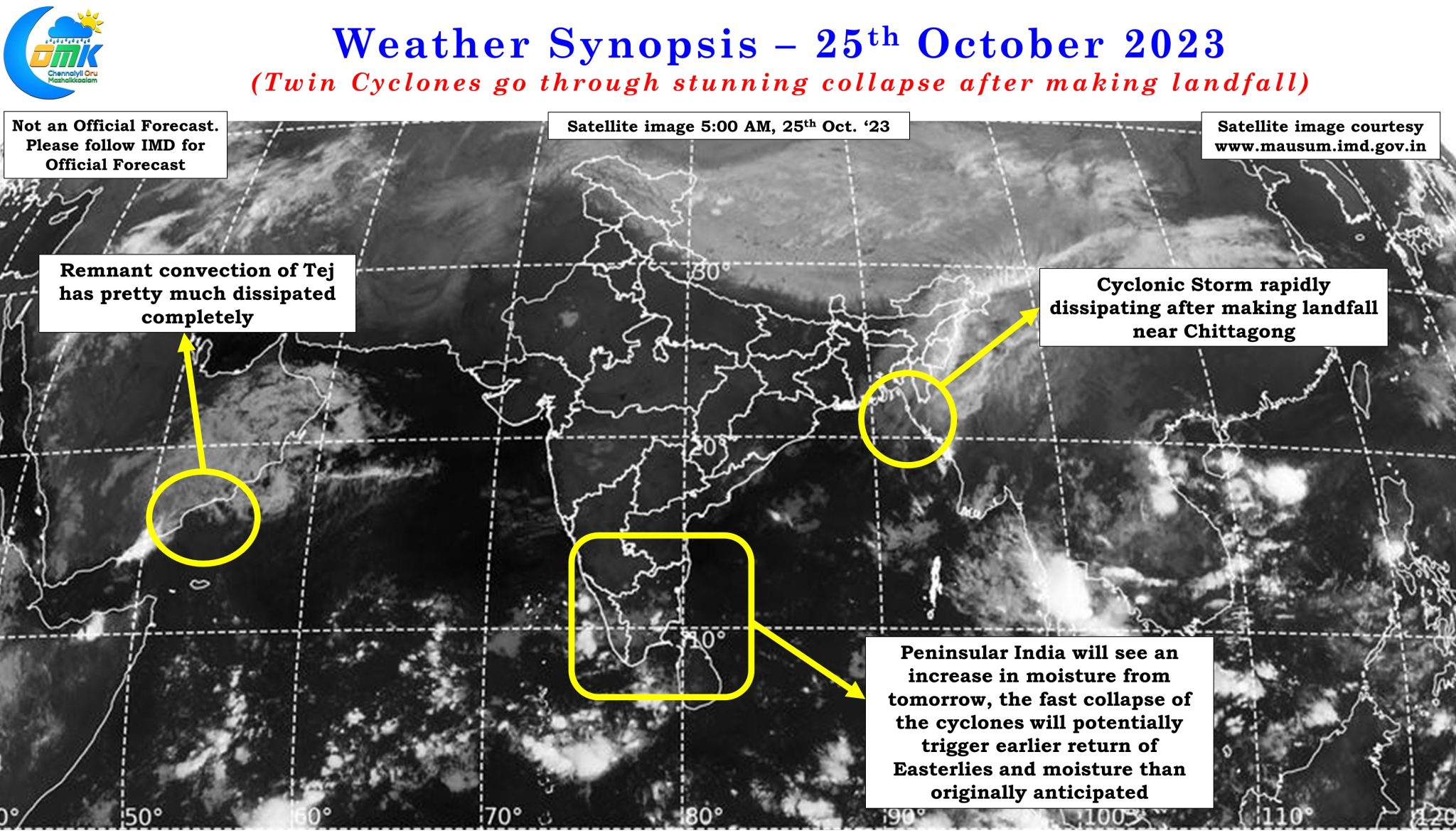
IMD announced the arrival of Northeast Monsoon over Tamil Nadu, Puducherry, Karaikal, and Kerala this year on 21st October. A couple of days before when IMD made the precursor to Northeast Monsoon onset they had indicated the early days of NEM was expected to be weak. In the subsequent days since the onset announcement was made, the disturbance that was prevailing over Arabian sea as a Depression peaked as Extremely Severe Cyclonic Storm Tej before making landfall in a weakened manner over the Yemen coast. Similarly the disturbance that partially triggered the onset over Peninsular India peaked as a Very severe cyclonic storm before weakening and making landfall over Bangladesh coast near Chittagong. The common factor in both these cyclones were the stunning collapse just prior and immediately after landfall.
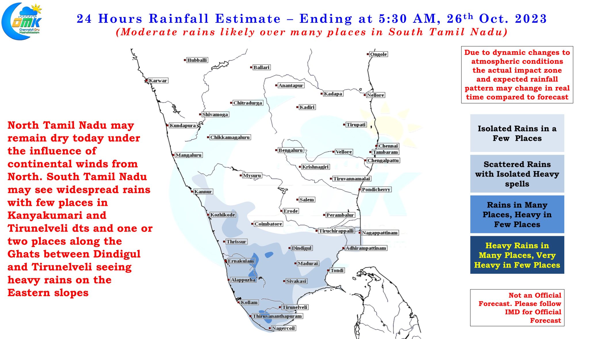
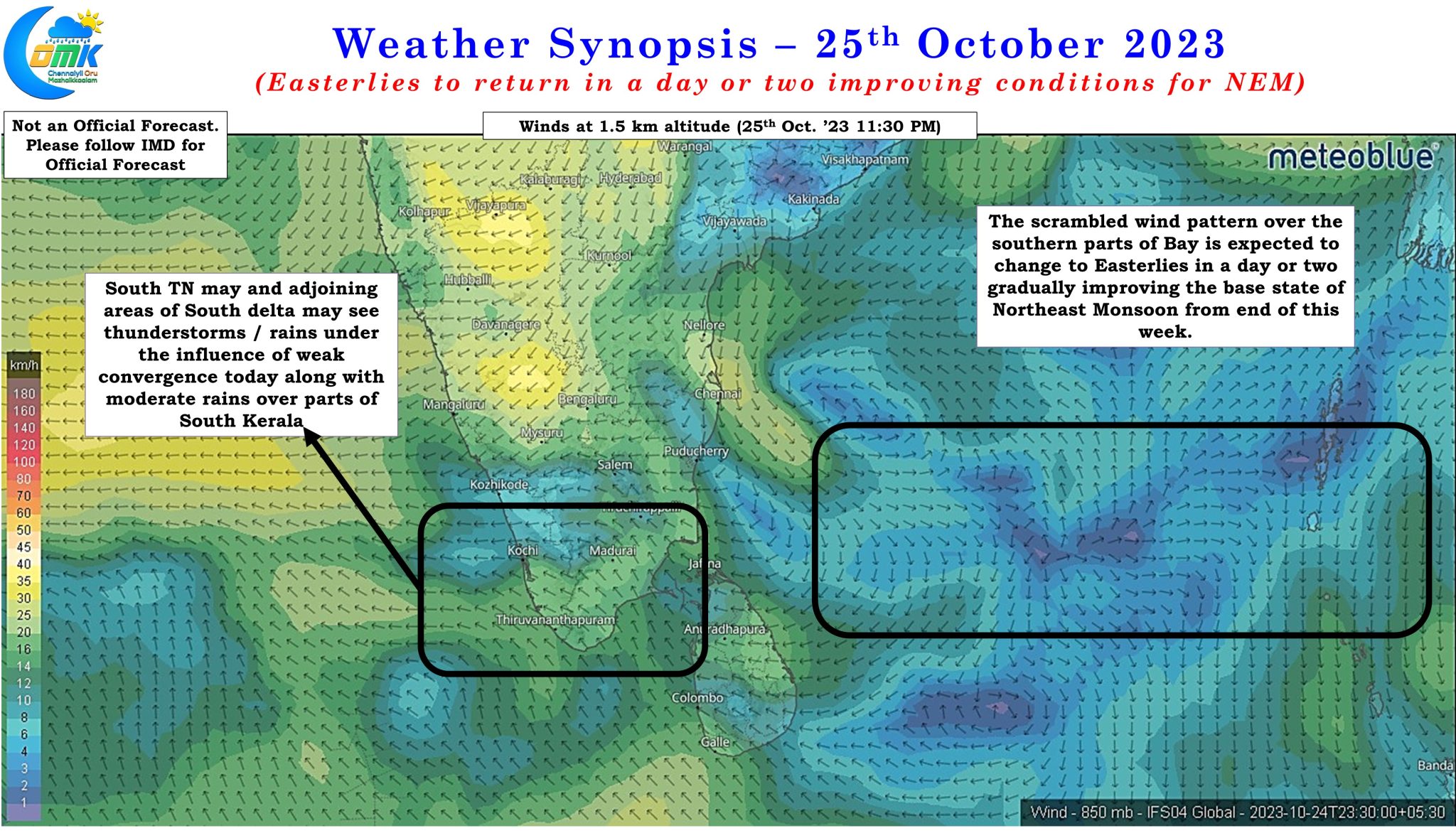
Cyclone Tej made landfall during the early hours of 24th October while Cyclone Hamoon made landfall roughly 24 hours later around the early hours of 25th October. Satellite image a few hours after the landfall of Hamoon show an unrecognizable remnant of Hamoon completely torn apart by a Westerly shear that models picked up well in advance. In a way the stunning collapse of both these cyclones is a blessing in disguise as it could potentially allow the strengthening of Easterlies over Peninsular East coast a day or two earlier than originally anticipated by weather models. Wind charts indicate over the next couple of days parts of South Tamil Nadu and South Kerala may continue to see thunderstorms due to weak convergence as Easterlies slowly make their presence felt. Towards the end of the week Easterlies are expected to strengthen to bring rains over coastal areas of Tamil Nadu like Chennai.
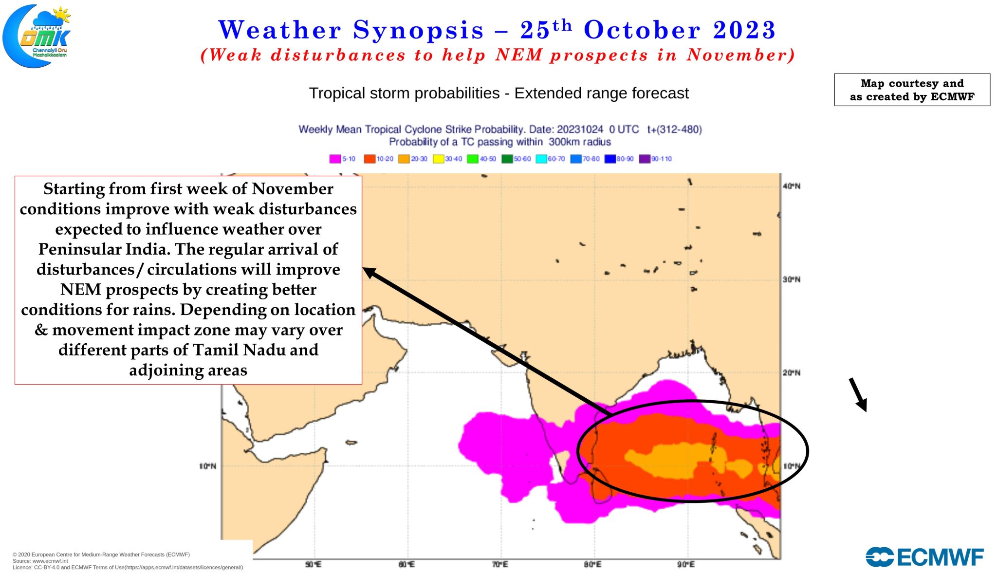
While on the short term we can possibly see Northeast Monsoon give its first proper spell of widespread rains in about three or four days time the larger interest though is to understand how the season could pan out. Long term ensemble models were fairly consistent about October being possibly the weakest month of this year’s Northeast Monsoon. This is confirmed by the 37% seasonal deficit as on date for Tamil Nadu and Pondicherry. While the long term seasonal outlooks for November was not very encouraging a couple of weeks back looking at the trend through intra seasonal ensembles there is a strong hope Northeast Monsoon could pick up from the 1st week of November with the second fortnight of November promising to be the peak period.
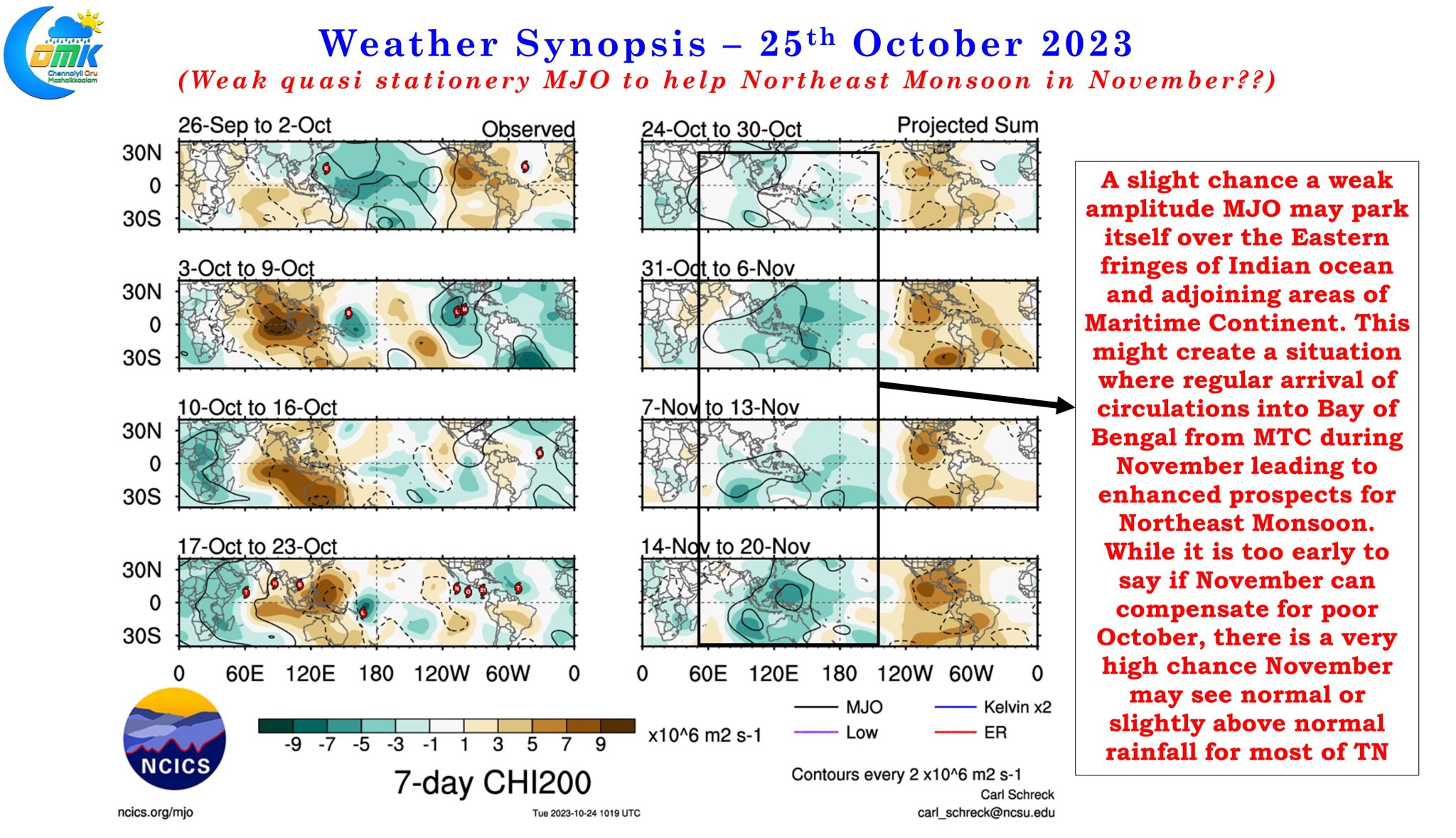
While intra seasonal ensembles indicate near normal rainfall anomaly for most parts of Tamil Nadu, with above average rainfall for parts of South TN and Kerala, from the 2nd week of November a look at the possible evolution of MJO certainly confirms things are expected to turn for the better. There is a very slight chance November we might see a weak amplitude quasi stationery MJO influence seen over the extreme Eastern edges of Indian Ocean and adjoining areas of Maritime Continent. This in turn could potentially help Northeast Monsoon by bringing weak circulations into Bay of Bengal similar to how Southwest Monsoon was helped during the months of July and September.
With two cyclones now out of the way, a quicker than expected return to base state Easterlies and potentially favorable support from a weak amplitude MJO things certainly look much better for Northeast Monsoon compared to couple of weeks back. While the possibility of November compensating for a poor October currently looks little less certain there is a fair degree of assurance November could see normal rains for most parts of Tamil Nadu.