
All of us must have read Land and Sea breeze as a school student as part of our geography lessons. The Indian Summer Monsoon is a large scale Land,Ocean and Atmosphere system and possibly the largest weather phenomenon. In a way it pretty much resembles how Land and Sea Breeze works on a local scale. In simple terms the monsoon winds from the High Pressure over Southern Hemisphere (Cool Waters) make their way to the Low Pressure over the Indian Sub Continent (Source of Heat).
Various factors govern the strength of the monsoon dynamics. The base state of atmosphere like El Nino / La Nina play a role in influencing the position of Walker Circulation. Position of Walker Circulation in turn decide the suppressed / enhanced areas of rainfall directly impacting Monsoon. The trigger for the monsoon dynamics to start though is the heat low over the Indian Sub Continent. Parts of Pakistan and adjoining areas of North India starts to heat up from March. This heating up creates a thermal low, an area of low pressure over North India and parts of Gangetic Plains. Eventually once the monsoon is in place fully this thermal low merges into a larger monsoon trough.
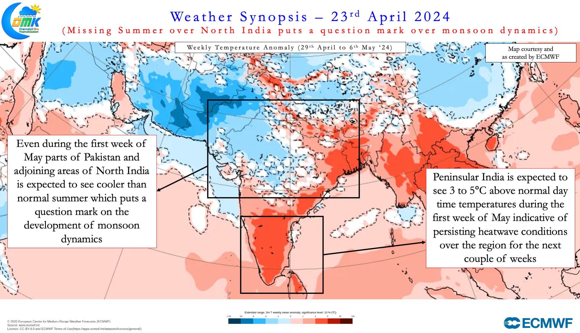
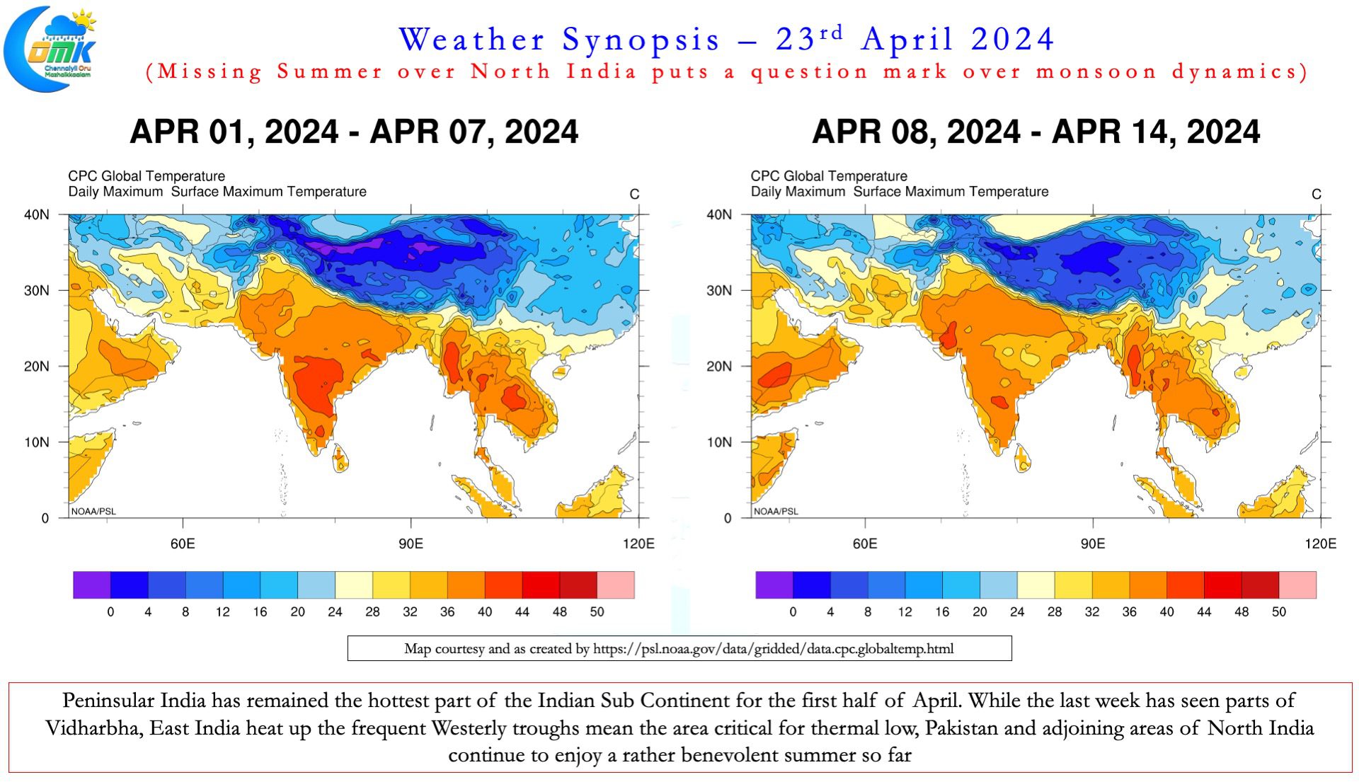
Over the past few weeks while Peninsular India has been abnormally hot, North and Central India has been seeing a cooler than normal summer. Except for the past few days the hottest zone in the Indian Sub Continent has been Peninsular India. Even the past few days it is East India, Odisha and West Bengal and not NW India and adjoining areas of Pakistan. An active late season surge of westerly troughs over the past few weeks is playing a major role in this.
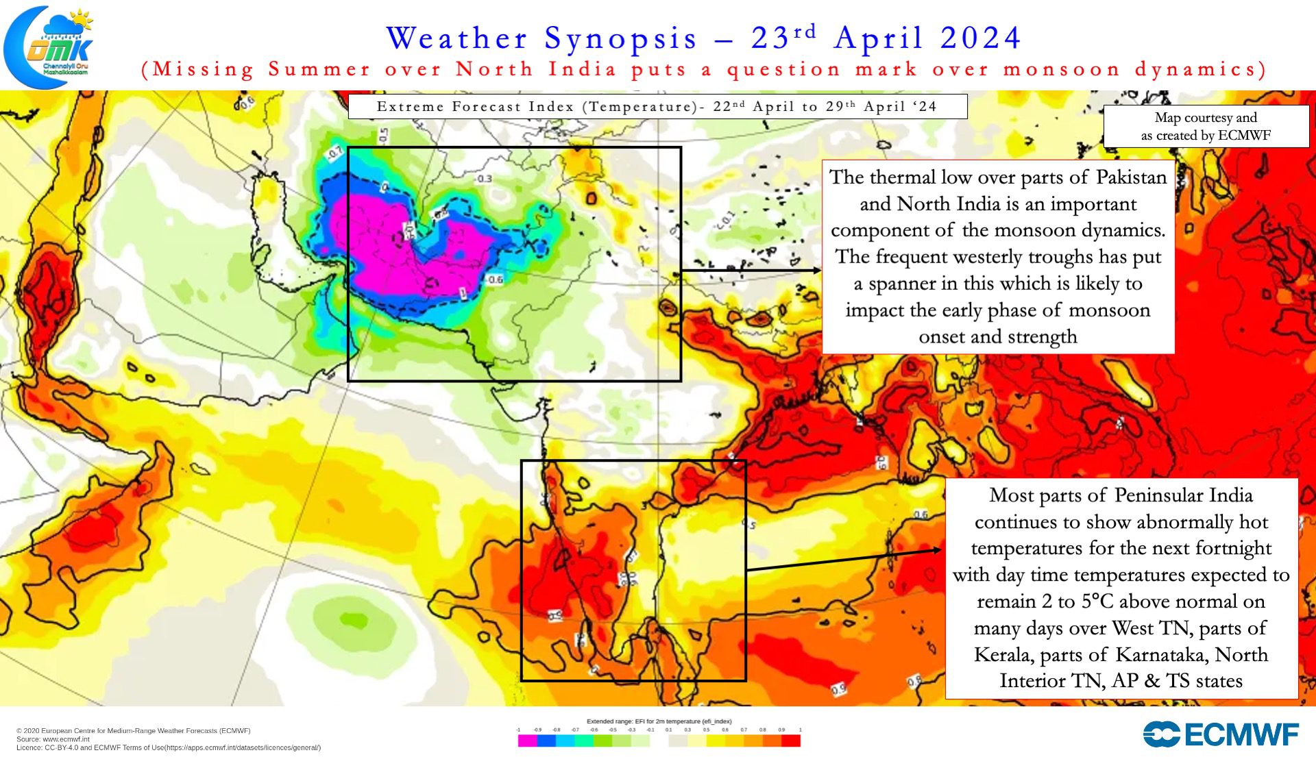
These regular westerly troughs brought large scale rain events to places like UAE. Additionally they also kept the temperatures under check over NW India and large parts of Pakistan. This in turn has put a spanner on the development of a thermal low over the region. A strong thermal low with a well established thermal gradient is essential for the monsoon dynamics to develop. This puts a question mark on the onset of monsoon dynamics.
At this juncture it becomes essential to point out, this delay in the thermal dynamics is unlikely to impact the overall performance of the monsoon. The Indian Summer Monsoon is expected to get a huge impetus once the base state changes from El Nino to La Nina. Most models expect the base state to flip to La Nina by the second half of ISMR. With this in mind we can expect the monsoon to be fairly robust overall. The question mark hence will remain on the trigger for monsoon dynamics and the early phase of monsoon rather than the overall performance of the monsoon.
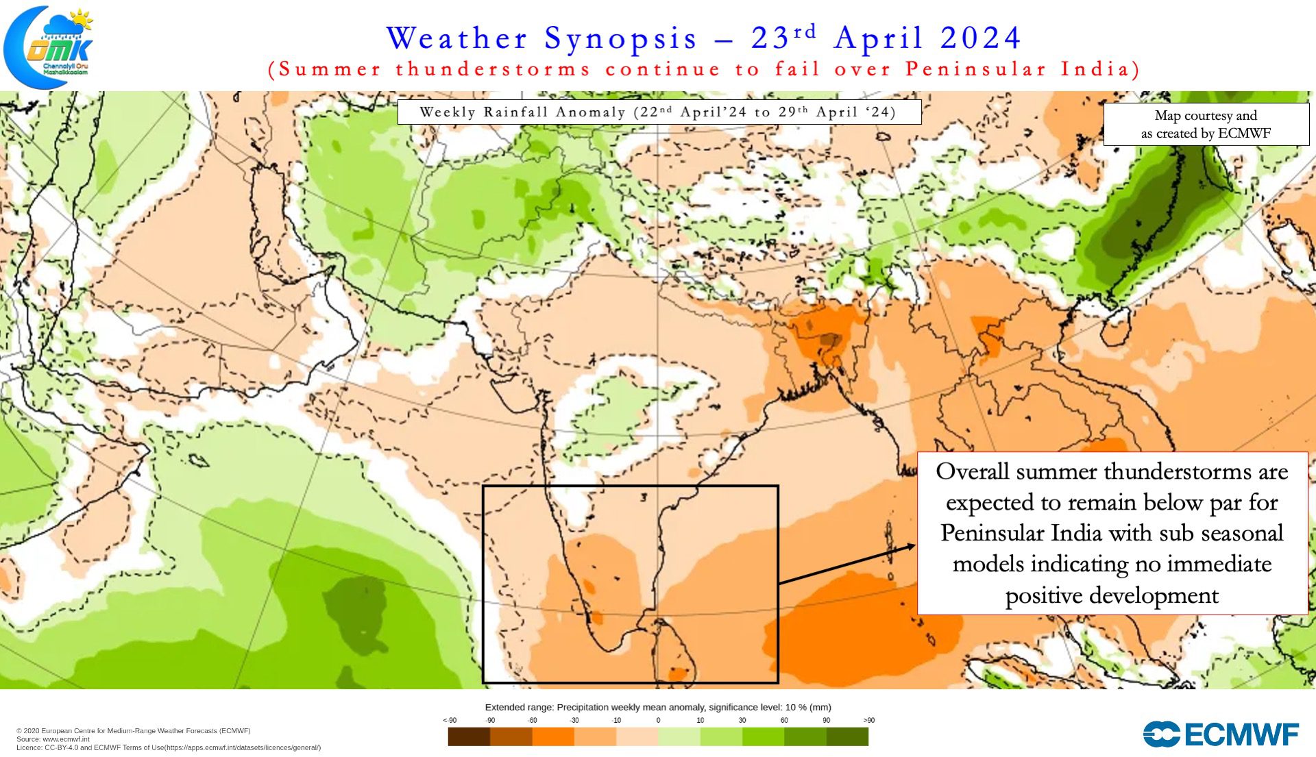
In the meanwhile there is unlikely to be any respite from oppressive heat over Peninsular India. Sub seasonal models consistently indicating large parts of Peninsular India to remain abnormally hot for the next 2 / 3 weeks. Models indicate during the first week of May large parts of Interior Tamil Nadu may see day time temperatures stay 3 – 5°C above normal. Similarly it appears summer thunderstorms may continue to be poor for the next couple of weeks. Weather models do not provide any clear sign seen about large scale summer thunderstorms for the next week to 10 days.