
Not only fans of Superstar Rajinikanth but pretty much most film viewers from the Indian Sub continent may remember the iconic scene from the blockbuster movie Kabali when he utters the now famous dialogue வந்துட்டேன்னு சொல்லு திரும்ப வந்துட்டேன்னு சொல்லு. This dialogue over the years has become very popular among meme creators getting used over wide genres. Heat is a very popular theme for meme creators to use this dialogue pretty much every summer since this movie got released. After a few days of subdued heat over Peninsular India it is time to now look forward to the 2nd phase of heatwave conditions.
Easterlies not only brought some rains over the last few days but also kept temperatures under check. The circulation over GOM is likely to move away leading to a reduction in rains from today. With the reduction in rains the associated cloudiness is also likely to reduce. Consequently starting from today we can expect to see a gradual increase in temperatures over Peninsular India. As was the case last time it appears Rayalaseema is expected to be the focus again. Weather models indicate this region may see daily temperatures of around 41 / 42°C from today. This is likely to continue until first week of May at the least as things stand. During later days of April one or two places could touch as high as 44 / 45°C
While the first phase of heatwave conditions happened for a few days, this one could be longer. Weather models are consistent about abnormally hot afternoons for the next 2 / 3 weeks over Peninsular India. West Interior TN, the area that cools down first in TN, is shown to see hot day time conditions right upto the 2nd week of May. This potentially indicates sub par summer thunderstorm is likely to continue over Peninsular India. Summer thunderstorms pick up when Westerlies strengthen along the Peninsular West coast. Without the wind discontinuity thunderstorms is likely to be below average. A consequent impact of this is abnormally hot conditions.
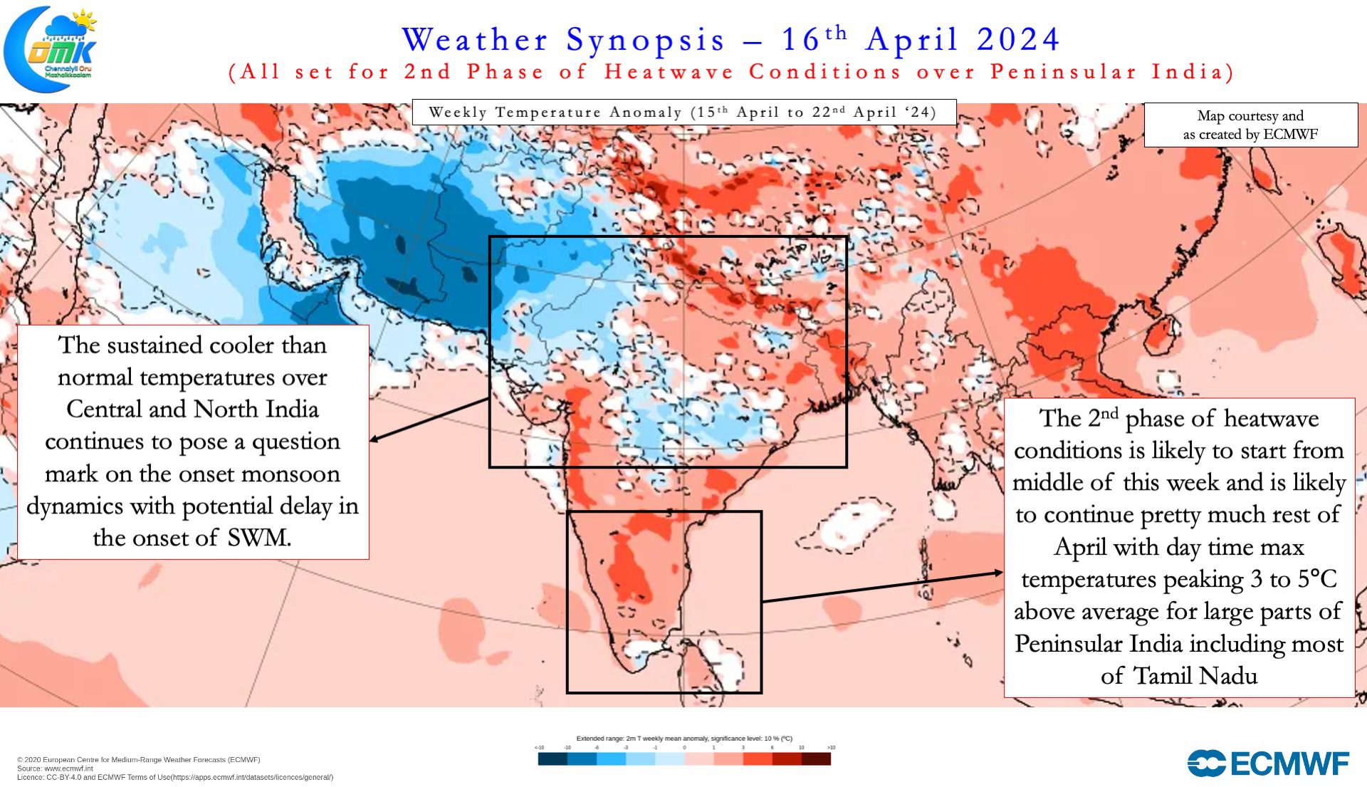
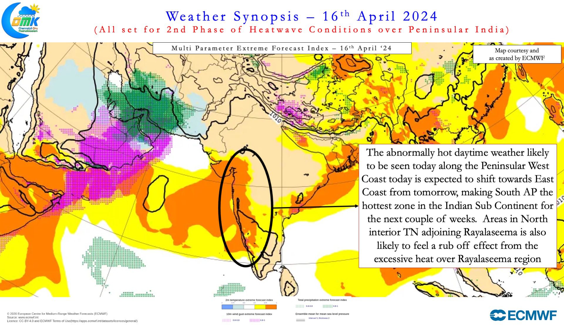
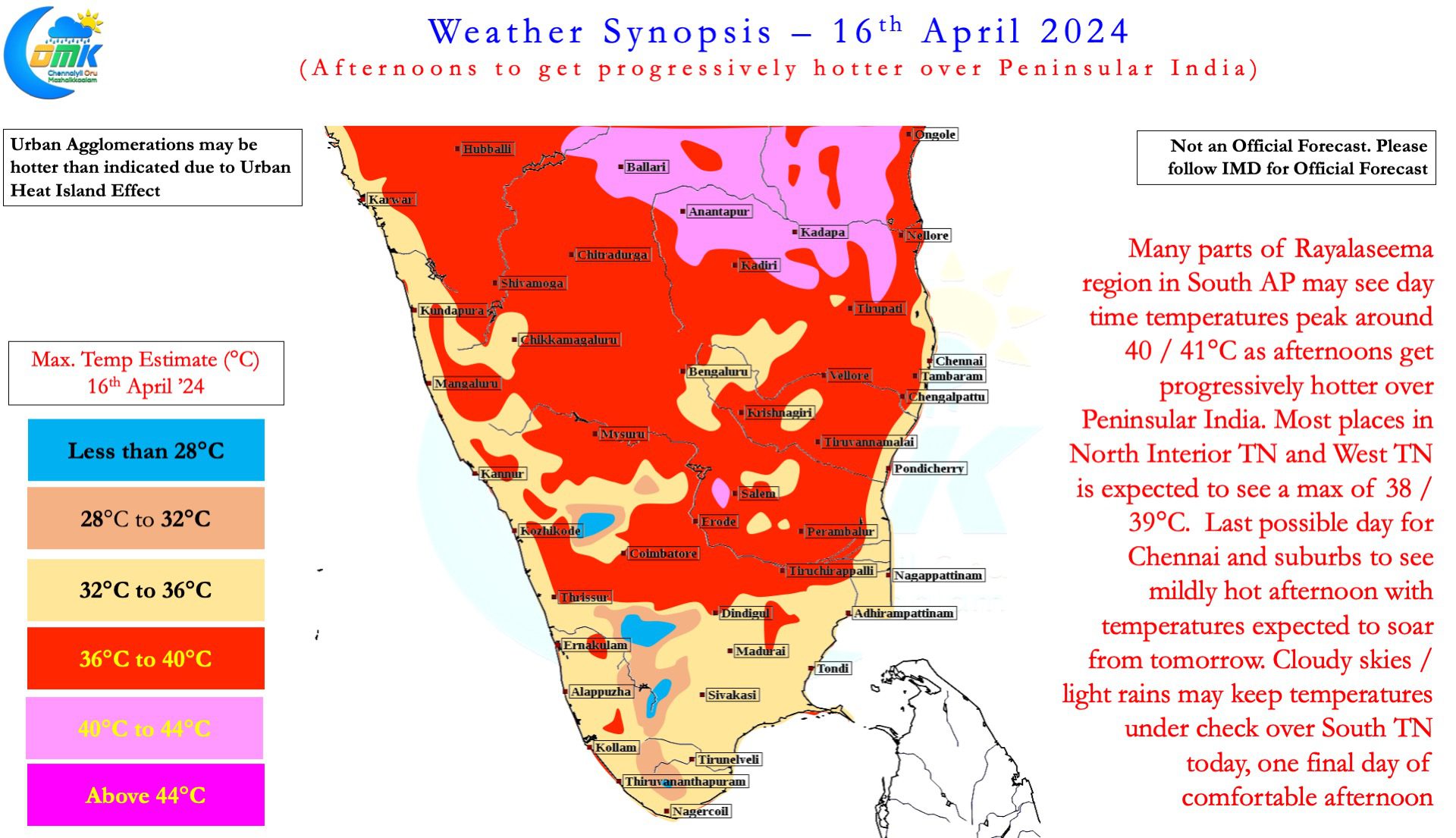
Except for a few days North Tamil Nadu has so far managed to escape the relentless heat of Rayalaseema. All that is likely to change during this phase going by weather model outputs. There is increasing consistency among models of possible rub off into North TN from the excessive heat of Rayalaseema in the coming days. North TN may not reach the heat levels of Rayalaseema but an appreciable increase in heat is likely. Weather models seem to indicate suburbs of Chennai may record 40 / 41°C form later this week. 19th April when Tamil Nadu goes to poll may see most places in the state record 40°C during the afternoon. Starting from Thursday most parts of Tamil Nadu may see 3 – 5°C above normal afternoon temperatures. This trend is likely to continue up to end of April possibly as things stand.
Before we wind up today’s post it is essential to point out IMD may or may not give Heatwave Alert for Tamil Nadu as they have clearly established protocols for calling Heatwave. The idea of today’s post is for people to be alert to the abnormal heat and be better prepared.