
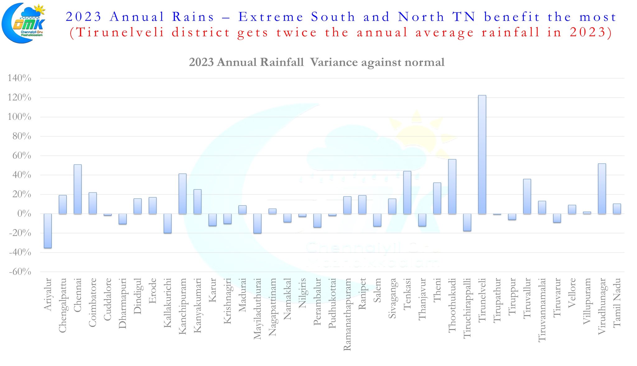
As 2023 gives way to 2024 we wish all our well wishers and followers a Happy and Prosperous New Year. The new year also gives an opportunity to look back, learn from the mistakes and identify areas of improvement. Disaster resilience evolves constantly and as the population grows and urbanization increases new problems come to fore leading to new learning and relearning. With increasing focus on weather from social media platforms in addition to traditional mainstream media platforms here is hoping Tamil Nadu sets the ball rolling in terms of increased awareness about weather events and becomes the model towards a building a climate resilient weather wise country.
The Low Pressure Area over the equatorial waters continue to persist almost remaining near stationery in the region. It is expected to become well marked in the next 24 to 48 hours as it moves WNW gradually with a 50:50 chance to intensify into a Depression. Towards the later days of this week it is expected to weaken and drift into the West coast of Peninsular India as a remnant circulation under the influence of a Mid Latitude westerly trough. This is likely to bring some rains over Peninsular India with one or two places getting heavy spells at times in the Ghats. But overall things are shaping up towards the withdrawal of Northeast Monsoon dynamics from the North Indian Ocean.
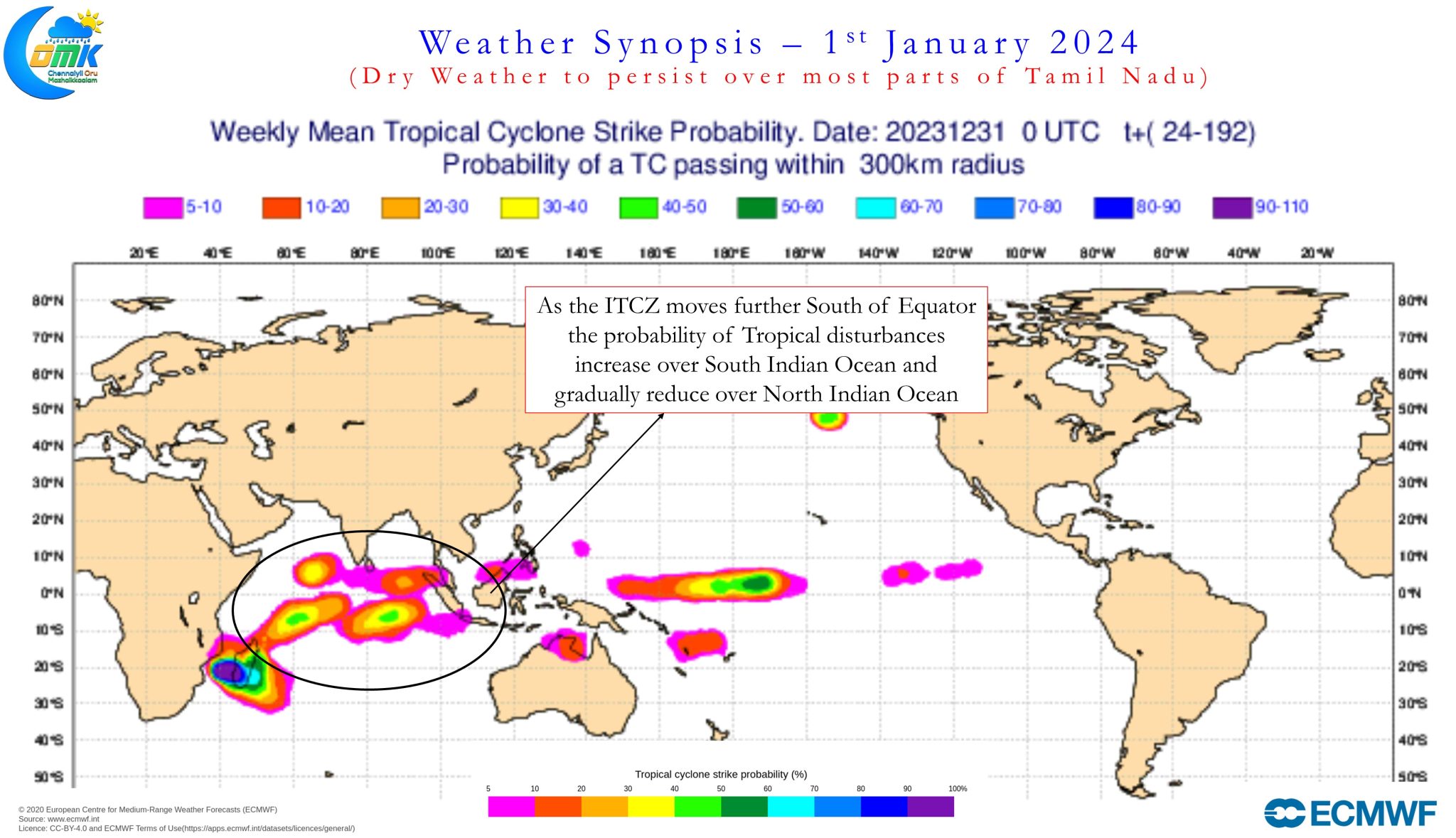
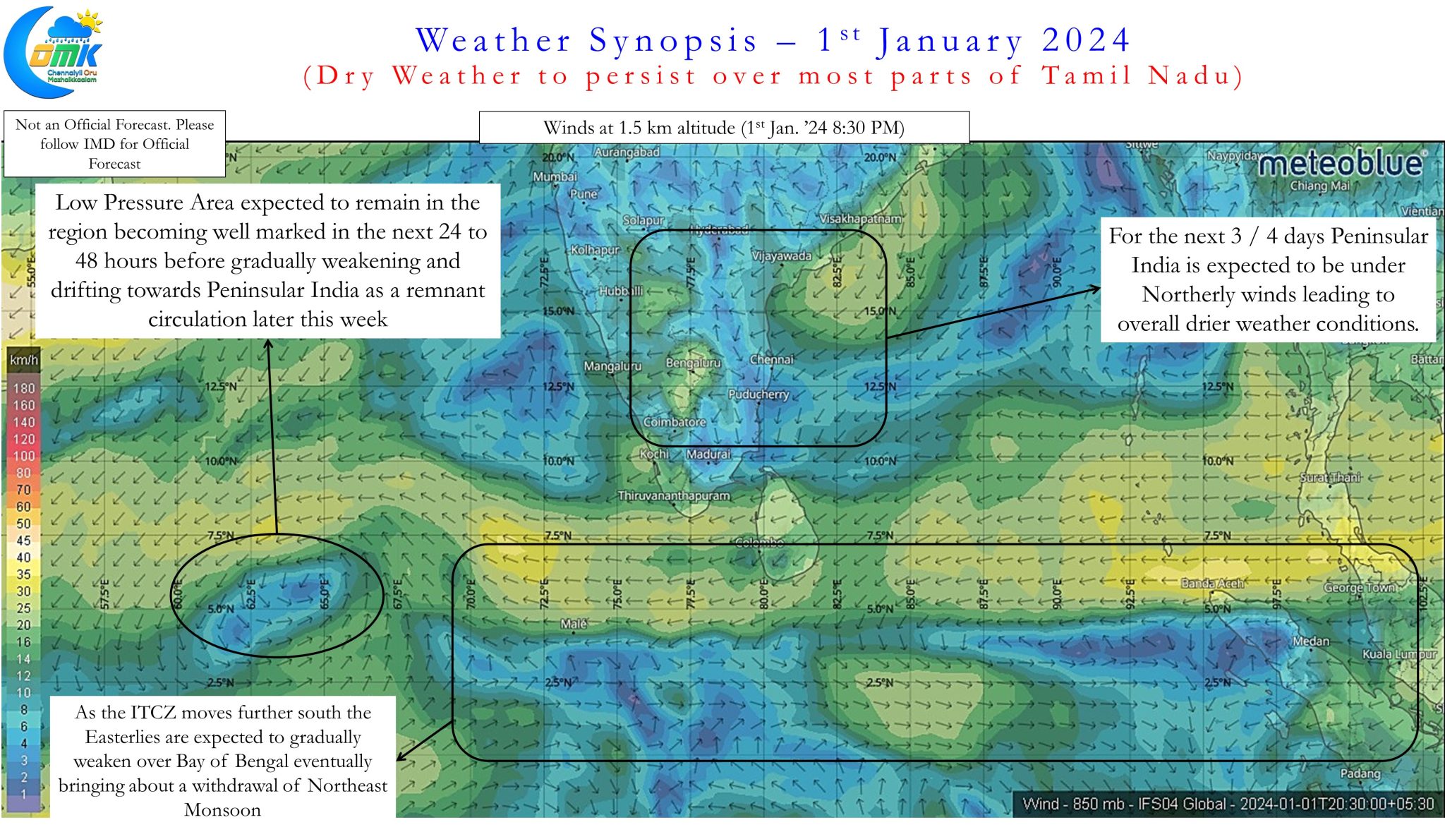
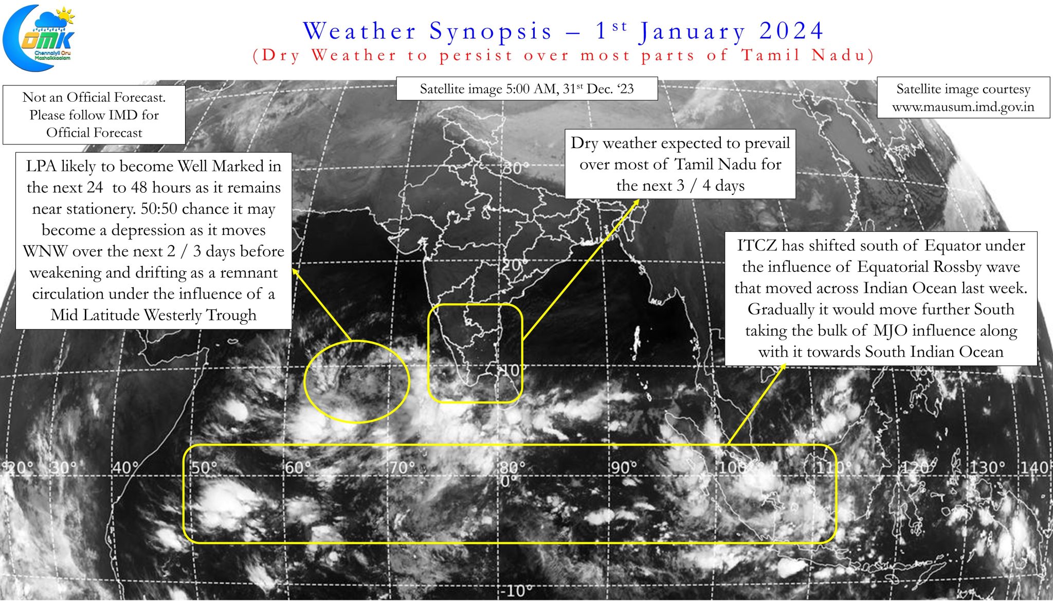
Satellite and wind charts indicate the ITCZ is currently to the south of Equator and is expected to shift further south. This movement is expected to influence weather over the Peninsular India in two ways, in the first instance it could slow down the Easterlies over Bay of Bengal reducing the strength of monsoon dynamics. Secondly it could also mean the influence of MJO over the Indian Ocean Basin may favor places to the south of of Equator in comparison to places North of Equator. Effectively over the next couple of weeks the chance for direct monsoon rains over Tamil Nadu is expected to fade away with rainfall instances happening more through interactions between lower level Easterlies and mid level westerlies.
In the immediate context the next 3 / 4 days is expected to be dry for most parts of Tamil Nadu until the remnant circulation from the Arabian Sea LPA moves over Peninsular India. When it moves over Peninsular India some rains may happen over parts of South TN around 4th / 5th January brining light to moderate rains until 7th or 8th of December. Places in North TN like Chennai may continue to remain dry with the region likely to remain under the influence of drier winds from North.