
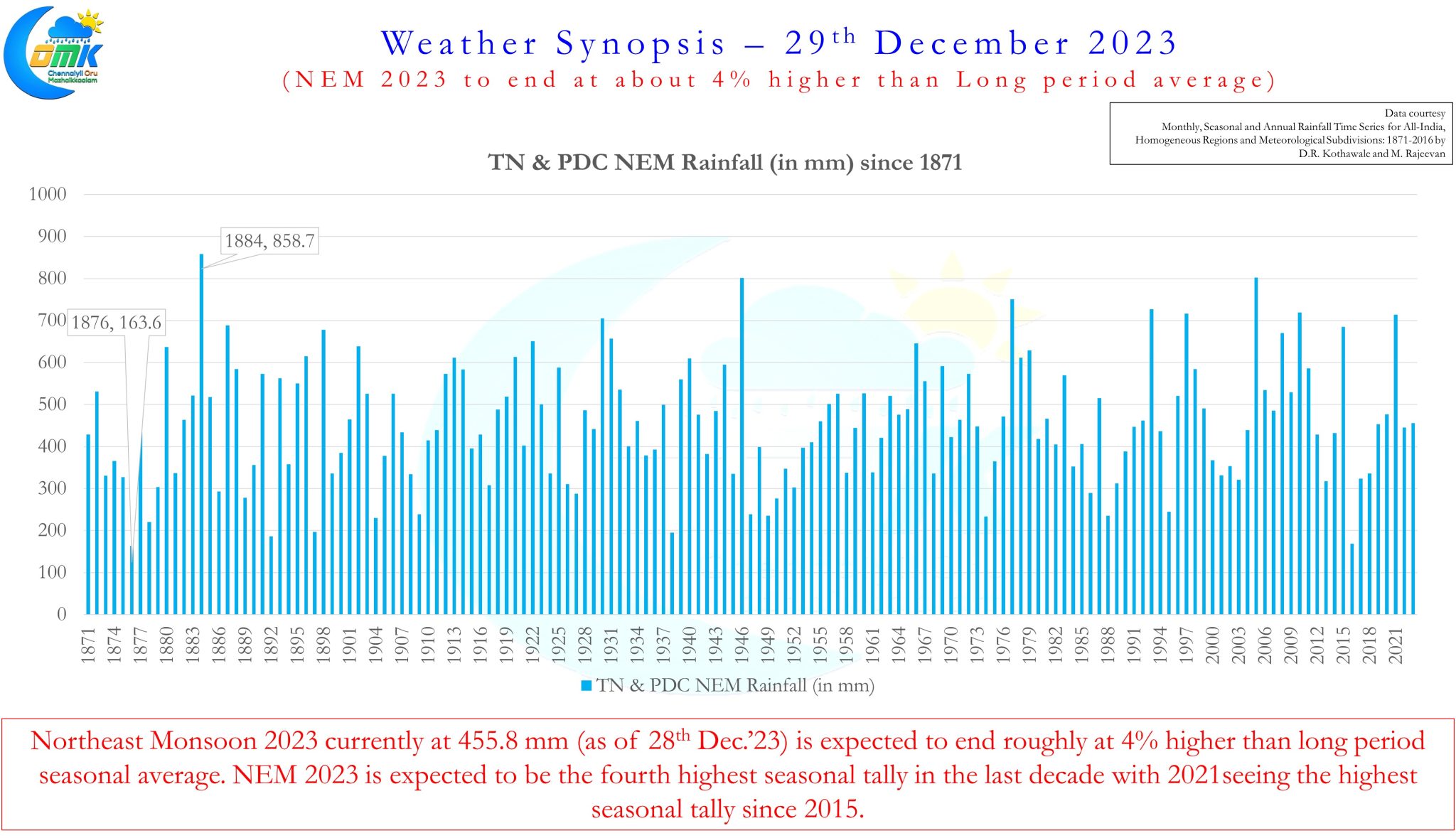
In roughly 48 hours from the time of this post not only the statistical season of Northeast Monsoon 2023 will come to an end but also the rainfall season for year 2023 also will come to an end. The NEM seasonal tally for Tamil Nadu and Pondicherry stands at 455.8 mm with rainfall accumulation from 3 more days left for the season to end this year Northeast Monsoon may end the season at roughly 4% higher than Long period average. This would mean the current season would be the fourth highest accumulation in the past decade with 2021 at 714.3 being the highest for the decade. As explained in our earlier post this year’s monsoon has been erratic in more ways than one hence despite the state witnessing two extreme events over North and South districts the overall average has just about crossed the seasonal tally.
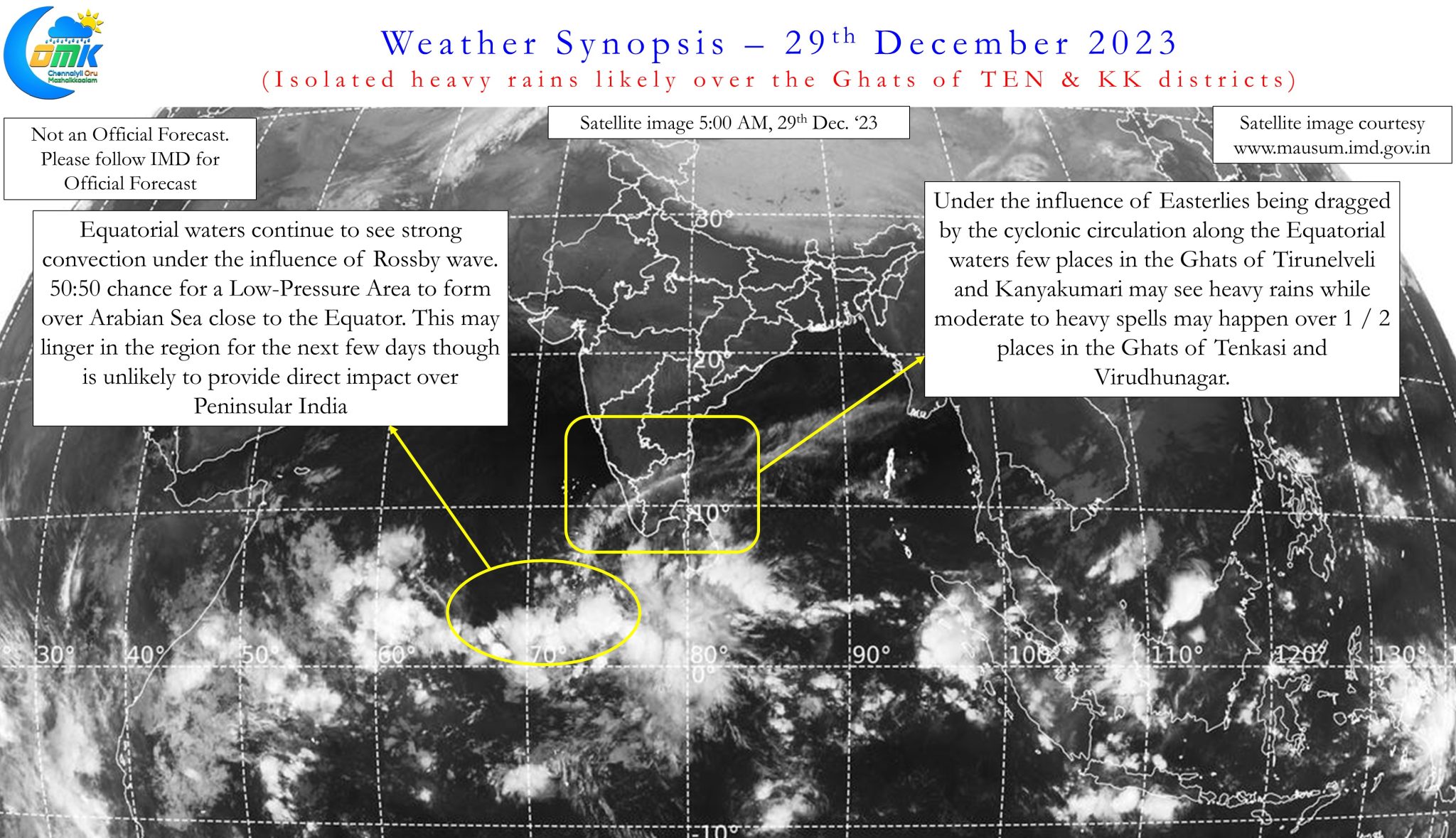
The past 10 days or so has seen a drastic reduction in rains since the South TN event with an overall accumulation of only 5.1 mm since 20th December which is roughly 1/3rd of the average during this period indicating how monsoon dynamics has weakened since the South TN event. While rains have continued in a few places along the Delta coast and South TN the overall dynamics has been weak for Peninsular India. With the ITCZ staying closer to the Equatorial waters any cyclonic circulation during this period was restricted to the lower latitudes. The presence of Equatorial Rossby wave also meant the convection was pretty much glued on either side along the equator.
One such circulation currently seen along the Equatorial waters of Arabian Sea has a 50:50 chance to become a Low Pressure Area though it might be too far away from Peninsular India to influence directly. There is a slight chance a possible interaction between an incoming Westerly trough around 3rd / 4th of January and the remnant circulation over the Arabian Sea which could potentially trigger some rains over Peninsular India later next week. With possible influence of Kelvin during this period we may see some heavy rains around the Ghats of South TN. A detailed post on that would be put up early next week with better clarity on impact zone / intensity / probability of interaction etc.
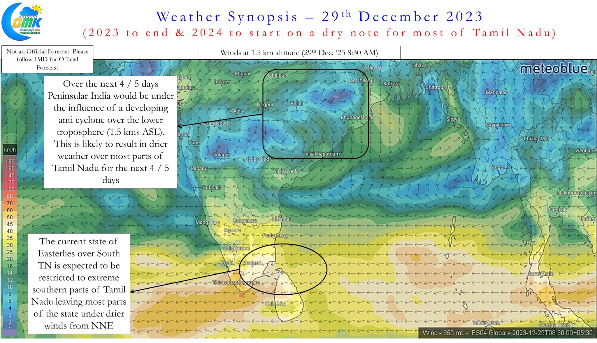
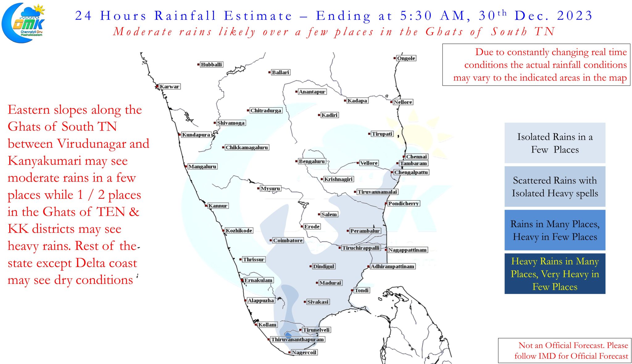
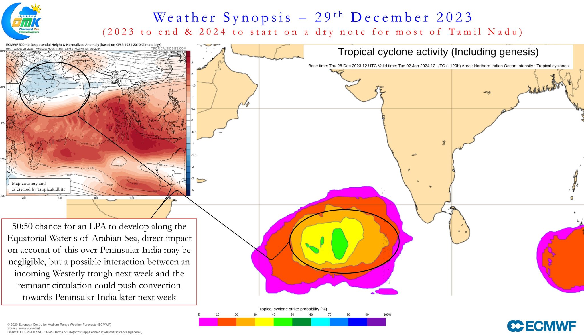
In the meanwhile Peninsular India is expected to come under an anti cyclone at lower tropospheric levels which will bring drier winds from North leading to dry winter conditions over most parts of Tamil Nadu until later next week. Parts of extreme South Tamil Nadu alone could be under some bit of moist Easterlies bringing isolated rains in a few places with parts of the Ghats between Virudhunagar and Kanyakumari seeing moderate to heavy spells of rains at times. Even these places could see a reduction in rains as 2023 gives way to 2024 leading to fairly dry weather conditions over almost all of Peninsular India.
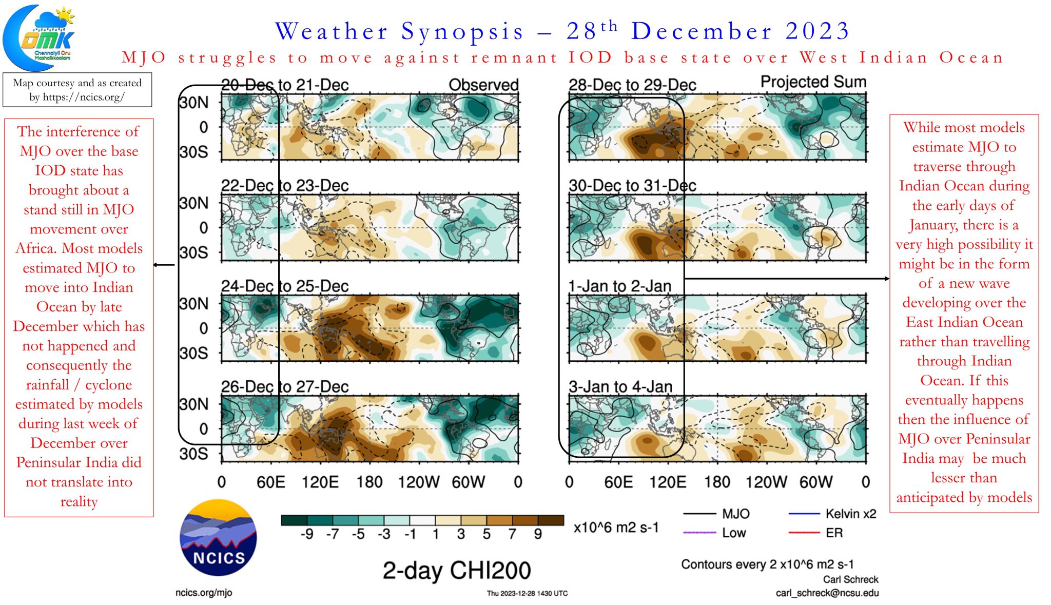
Over the past couple of weeks we have seen some of the numerical weather models showing cyclones / very heavy rains over parts of Tamil Nadu which eventually did not materialize in real time. One of the key reasons for these rains to not materialize in real time despite numerical models consistently showing rains / cyclones was the stall of MJO pulse over African continent as it interferes with the remnant base state of IOD in its movement from West to East. Many models expected a quick transit across Africa towards Indian Ocean resulting in enhanced forecasts while MJO continues to struggle to move into Indian Ocean. There is a possibility in this struggle between MJO and remnant base state of IOD we may see the MJO global circuit come to an end and instead a fresh pulse emerge over the Indian Ocean towards the second week of January. We will cover in detail about the evolving scenarios early next week but it may not come as a surprise if the influence of MJO may be much lesser than what models originally estimated during the last fortnight of December and first fortnight of January.