
subtropical
Weather over Peninsular India is primarily driven by tropical influences though time to time, particularly during the winter period over Northern Hemisphere sub tropical factors interact with tropical factors to bring in periods of rainfall that cannot be associated with typical monsoon rains. Some of the notable events in recent times when such interaction between tropical lower level Easterlies and mid level Westerlies are
- April 2015 when Chennai AP and some parts of the city recorded 10 cms in 3 hours.
- February 2021 when Cuddalore recorded more than 26 cms in 6 hours while neighbouring Pondicherry recorded 15 cms in 3 hours.
- December 2021 when parts of Chennai and suburbs recorded 20 cms in about 9 to 12 hours
More often than not these events are characterised by sudden burst of heavy rains over a few hours before completely coming to a stop. Classifying these events as pure monsoon events may not be the right way to understand and observe weather since in the absence of either of the factor, tropical in the form of lower level easterlies, and sub tropical in the form of mid level westerlies the precipitation pattern does not get enhanced.
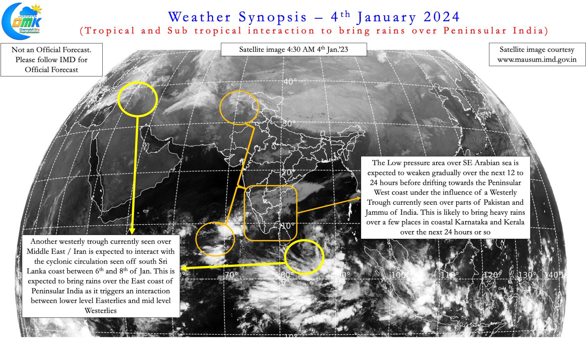
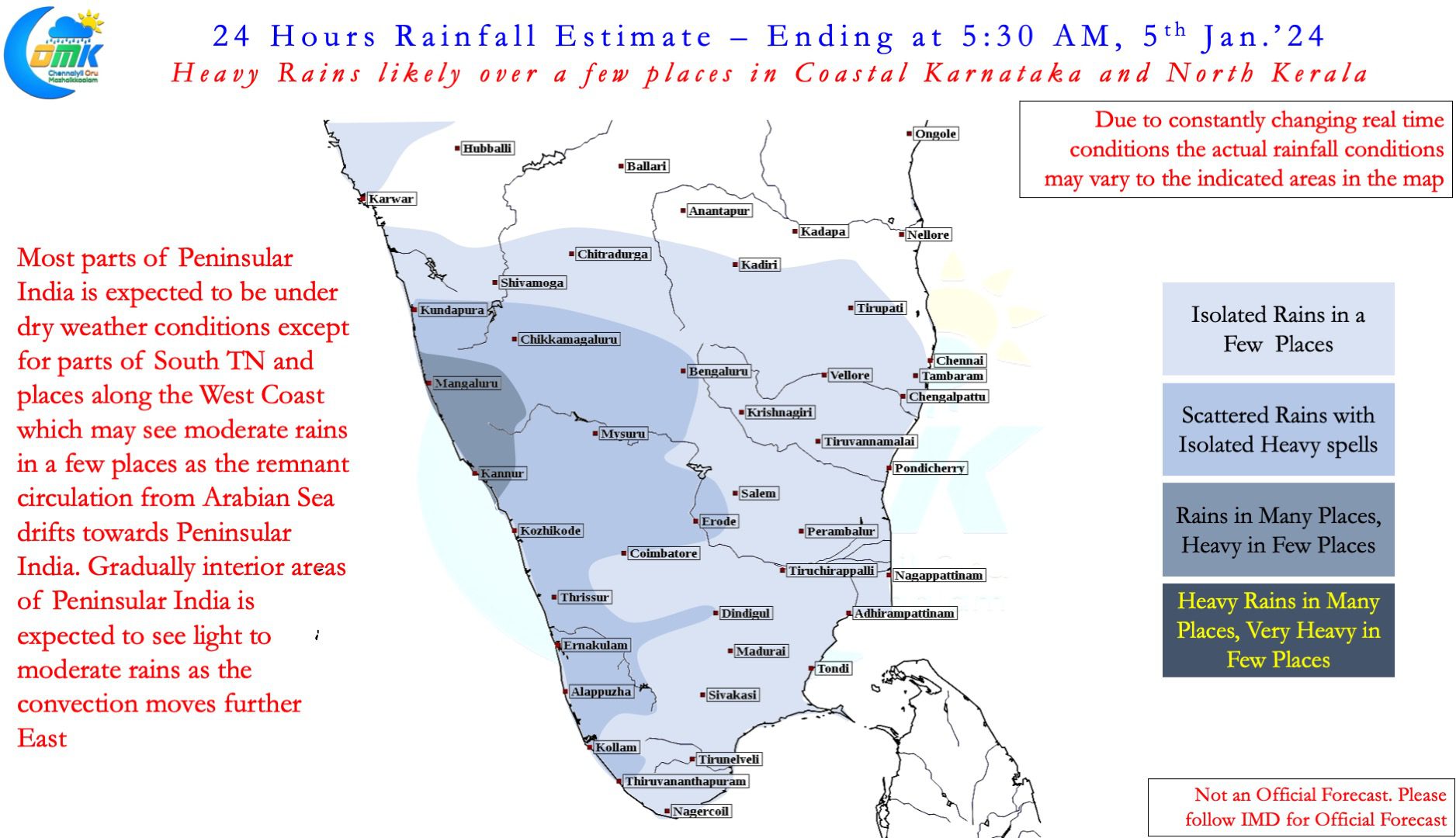
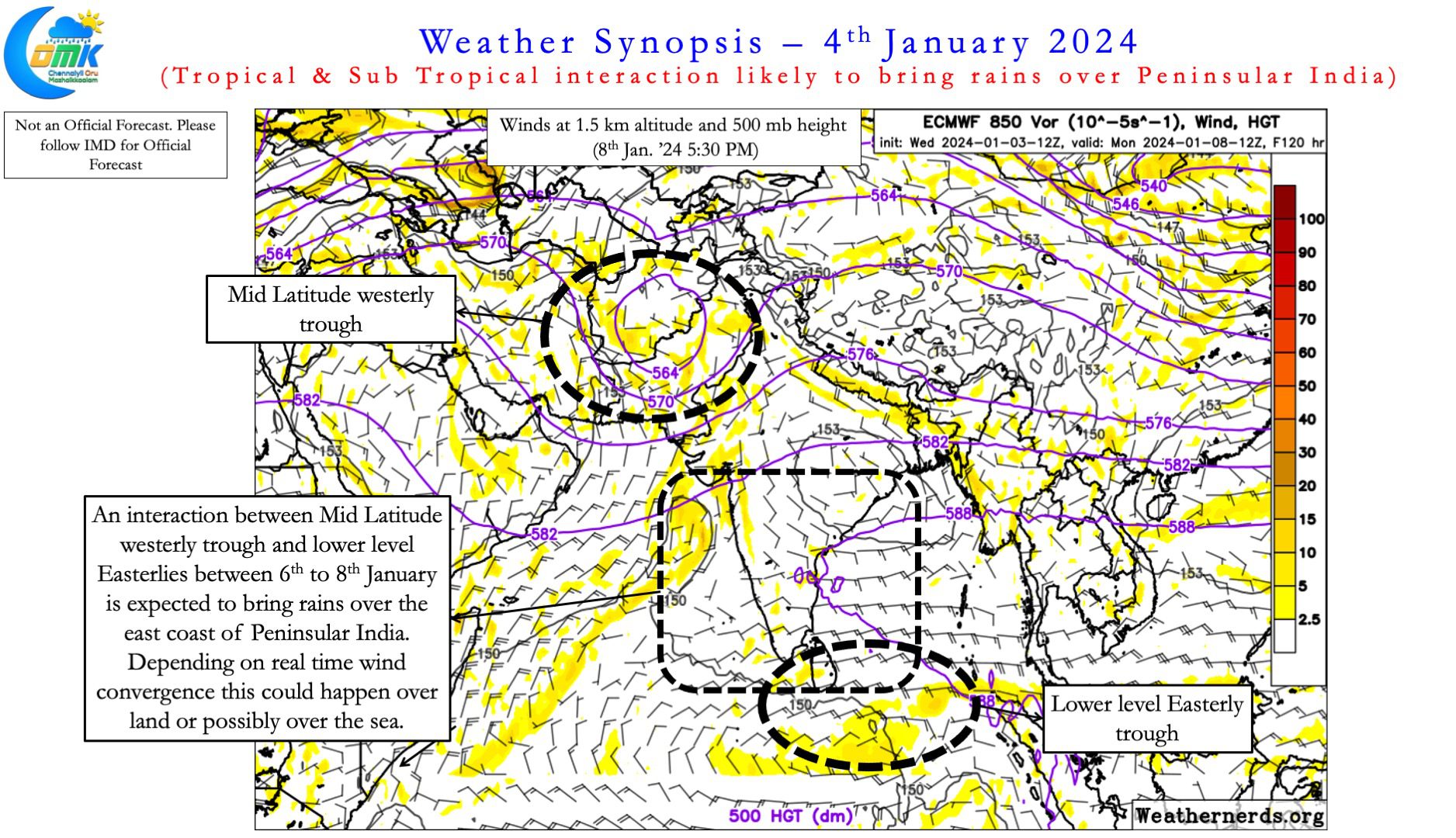
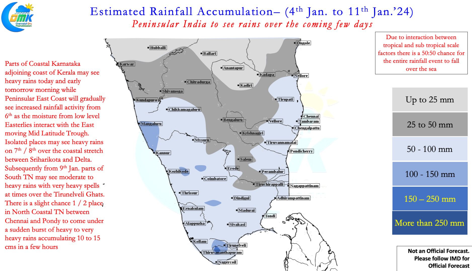
Over the next few days we may witness two such events on either side of Peninsular India though there is a 50:50 chance neither of the event could happen over land. Over the next 24 to 48 hours parts of West coast may come under heavy rains as the remnant circulation from the Low Pressure Area currently persisting over SE Arabian Sea drifts towards Peninsular India from the 1st Westerly trough that is currently seen over parts of Pakistan and J&K in India. This event is expected to happen until tomorrow with the rains gradually moving into interior areas too as the convection drifts across Peninsular India.
The second event involves a cyclonic circulation currently seen to the SE of Sri Lanka and another westerly trough currently seen over Iran which is likely to interact with each other between 6th and 8th January as the trough drips over parts of Peninsular India while moving from West to East. This is likely to bring rains over the east coast of Peninsular India between 6th and 8th with a high chance 1 / 2 places between Chennai and Pondicherry coming under a heavy burst of rains around 7th or 8th bringing 10 to 15 cms in a few hours.
While there is a 50:50 chance the heaviest rains may happen over the sea for both the events, the objective of the post is to alert of a potential rainfall event. Just to clarify neither of the event is expected to be life threatening or create flooding events, considering the time of the year when most people do not expect rains it becomes pertinent to provide advance warning despite a 50:50 chance the event not happening at all.
With the current state of things and divergence in model outputs it is not advisable to provide weather inference for any specific places so we will refrain from specific place alerts in this post.