
How long is too long in Weather is a question for which one can never give an accurate answer. If one asks this question from a place somewhere in Chile amidst the Atacama desert even few months could be short where the proverb “Change is the constant in life” could suitably changed to “Weather is the only constant in life”. This may not be far off for many places in the Horse Latitude which possibly holds some of the driest places globally. If one were to ask the same question closer to the Equator in the tropics even a couple of days may be too long in weather. The same question even in the tropics with a Cyclone around could drastically shorten to few hours is too long in weather.
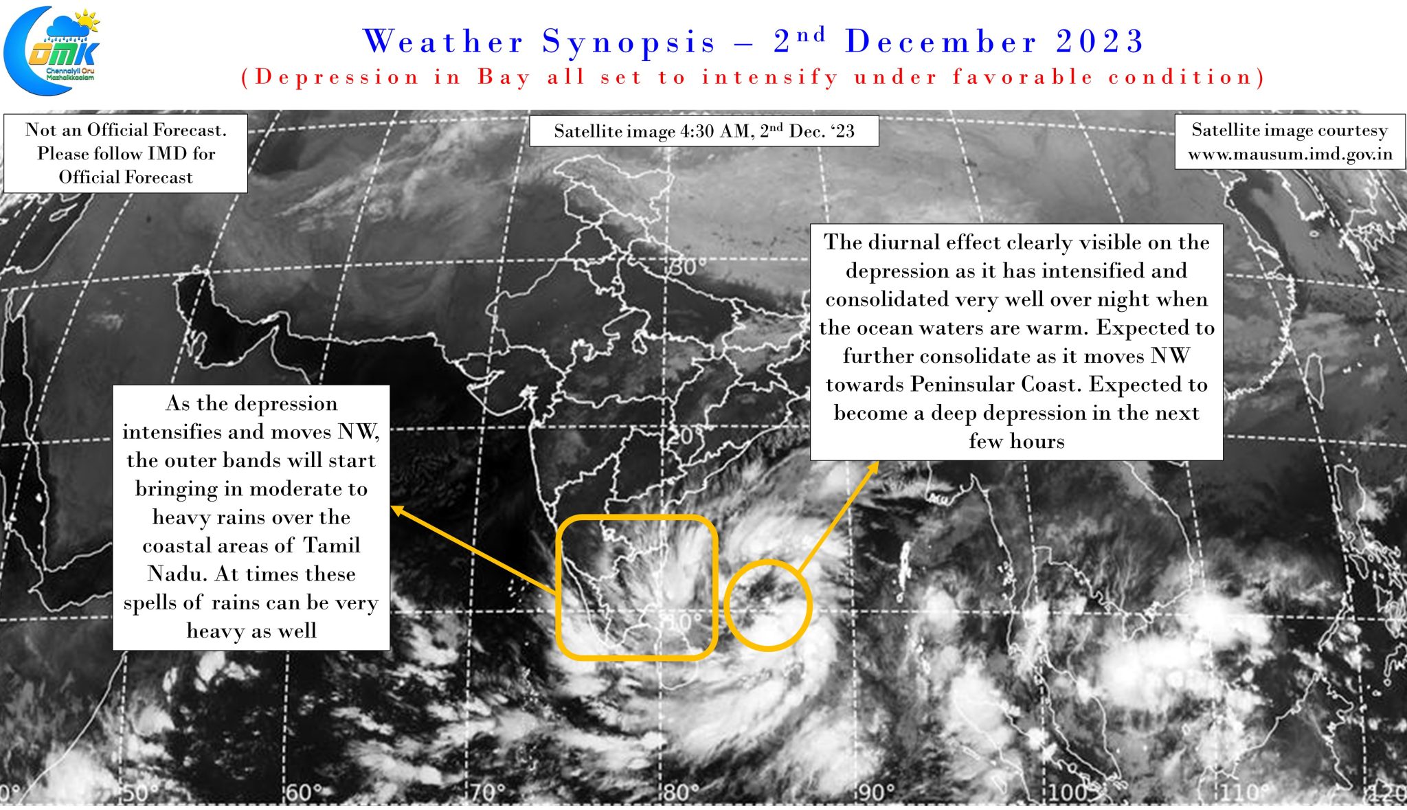
It is in this context it becomes essential to take stock of evolving situation every few hours, despite advances in numerical weather model predictions these days compared to a decade or two back. Satellite image indicates the depression in Bay of Bengal, approximately 500 kms to the East of Vedaranyam, has consolidated very well over night under favorable conditions in the form of a warm sea during the night. With impressive outflow seen in the next few hours it would become a Deep Depression as it possibly becomes a cyclone in the next 24 hours or so. Bay of Bengal remains warm and conducive for the intensification of the deep depression into Cyclonic Storm aided by favorable wind shear over the next 24 hours or so.
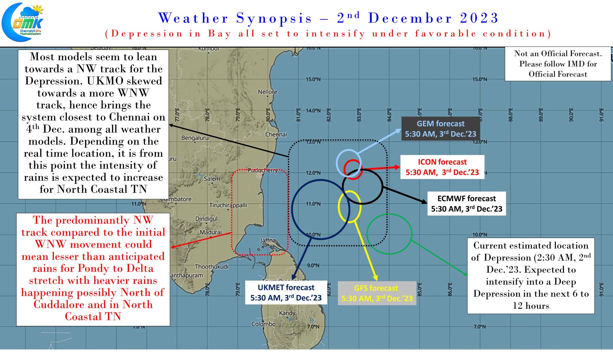
Weather models have now aligned closer in terms of a more pronounced NW movement for this disturbance compared to the initial estimate of a WNW track. While there exists some divergence in terms of expected intensity which is reflecting in different locations as forecast 24 hours from now. Nevertheless this phase is expected to be the most critical phase as far as rains go for North Coastal Tamil Nadu. The 24 hours starting from tomorrow morning when the disturbance is to the SE of Chennai, possibly as a cyclonic storm will create the window for the circulation to push moisture over the coast bringing heavy to very heavy rains in the process.
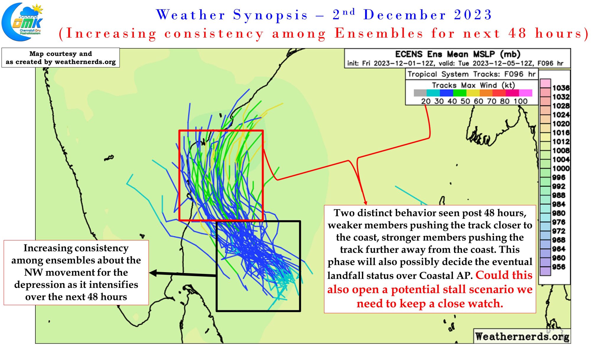
Ensembles are in tight sync as well for the next 48 hours with some divergence seen as two different scenarios emerge. Stronger members pushing the cyclone further away from the coast, while the weaker members seem to be pushed towards North Tamil Nadu coast. This point also has the potential to throw up a different dimension as well in this interesting journey. It may become a point where there could be a stall in case the intensification creates a scenario of the two high pressure zones competing to take control of the steering of the cyclone. This 50:50 situation needs to be kept a close tab as a potential stall may alter rainfall prospects drastically for parts of Peninsular Coast.
In the meanwhile we will take one day at a time and keep a tab through real time observations course correct if need be on what could be the impact. One course correction we may have to make with the now more pronounced NW movement models estimating is possible reduction of rains for Delta districts, though here once again in real time outer bands could bring a sudden burst of rains that may not be picked up by weather models accurately. With the depression deepening, we are now at a stage where outer bands have the potential to bring in rains as the circulation recycles the moisture around.
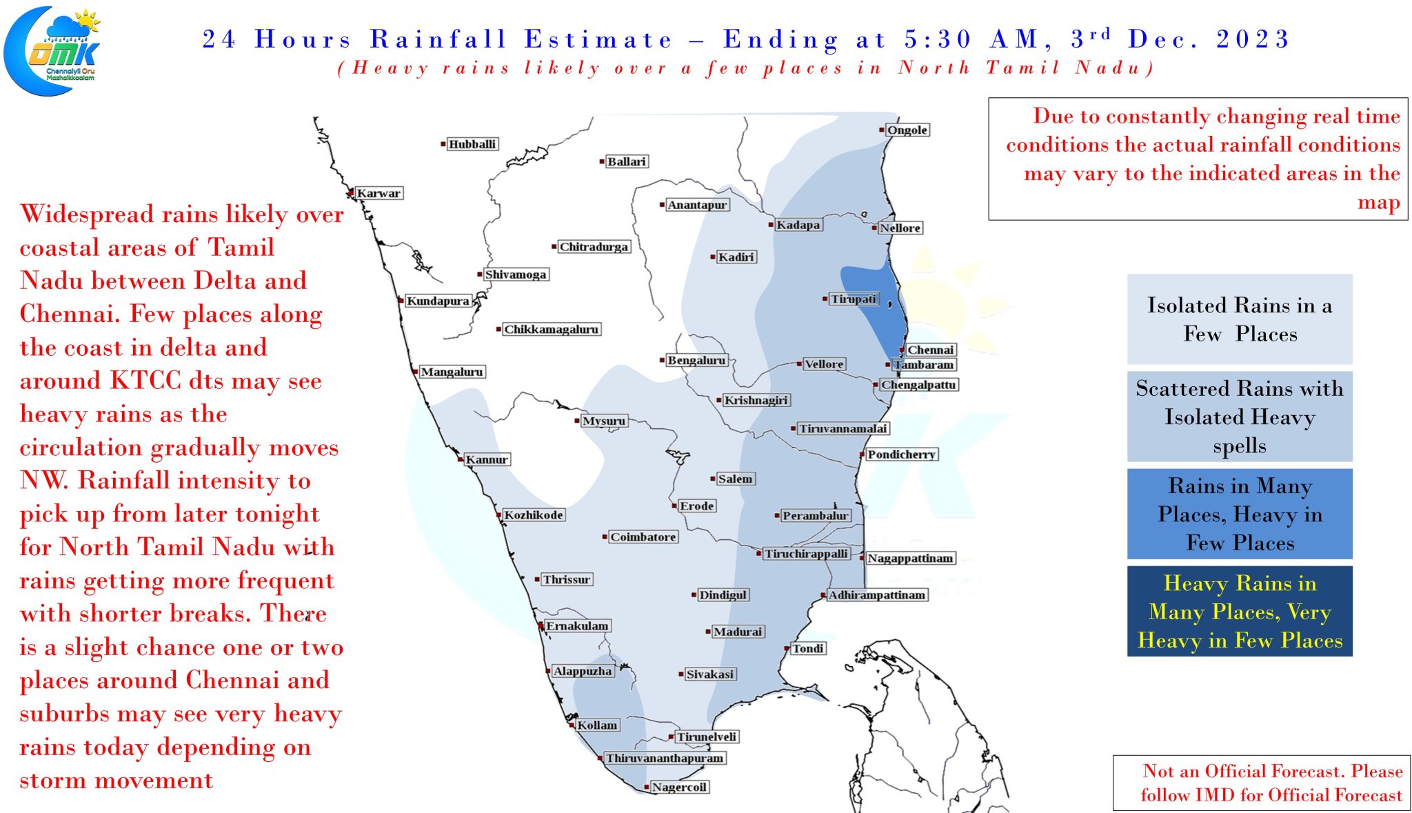
North Tamil Nadu and South Coastal AP may see heavy rains today as the depression moves NW with potentially one or two places around Chennai and suburbs coming under very heavy spell of rains at times. From later tonight / early tomorrow morning the rains will become more frequent and breaks shorter.