
Memory
something that you remember from the past
Over the past couple of days the chatter among a lot of media channels has been whether are we going to see a repeat of 2015. Often human mind tends to store memories, both good and bad, and tends to associate events with such memories. The 2015 Chennai Floods is one such event that will possibly never go away from the memories of the citizens from Chennai. Just like how every flood event in Kerala is benchmarked against the Great Flood of 99 every rainfall event, particularly during Northeast Monsoon will continue to be associated with 2015 though in terms of magnitude of the event 2005 was a larger event spread over longer period.
The Deep Depression over Bay of Bengal has been slowly but steadily consolidating itself over the past 24 hours or so. It is now only a matter of time it becomes a Cyclonic Storm as it barrels down parallel along the east coast of Peninsular India. There seems to be a misconceived notion with weather models becoming increasingly consistent about the Coastal AP landfall Chennai has dodged a bullet. This is possibly because most people tend to associate cyclones with only winds and rarely with rains. While East to west moving cyclones like Gaja, Vardah, Thane are classic examples for cyclones that carried a lot of wind damage cyclones like Burevi, Nivar, or for that matter even the November depression in 2021 which dumped 23 cms in 24 hours at Tambaram and Chengalpattu.
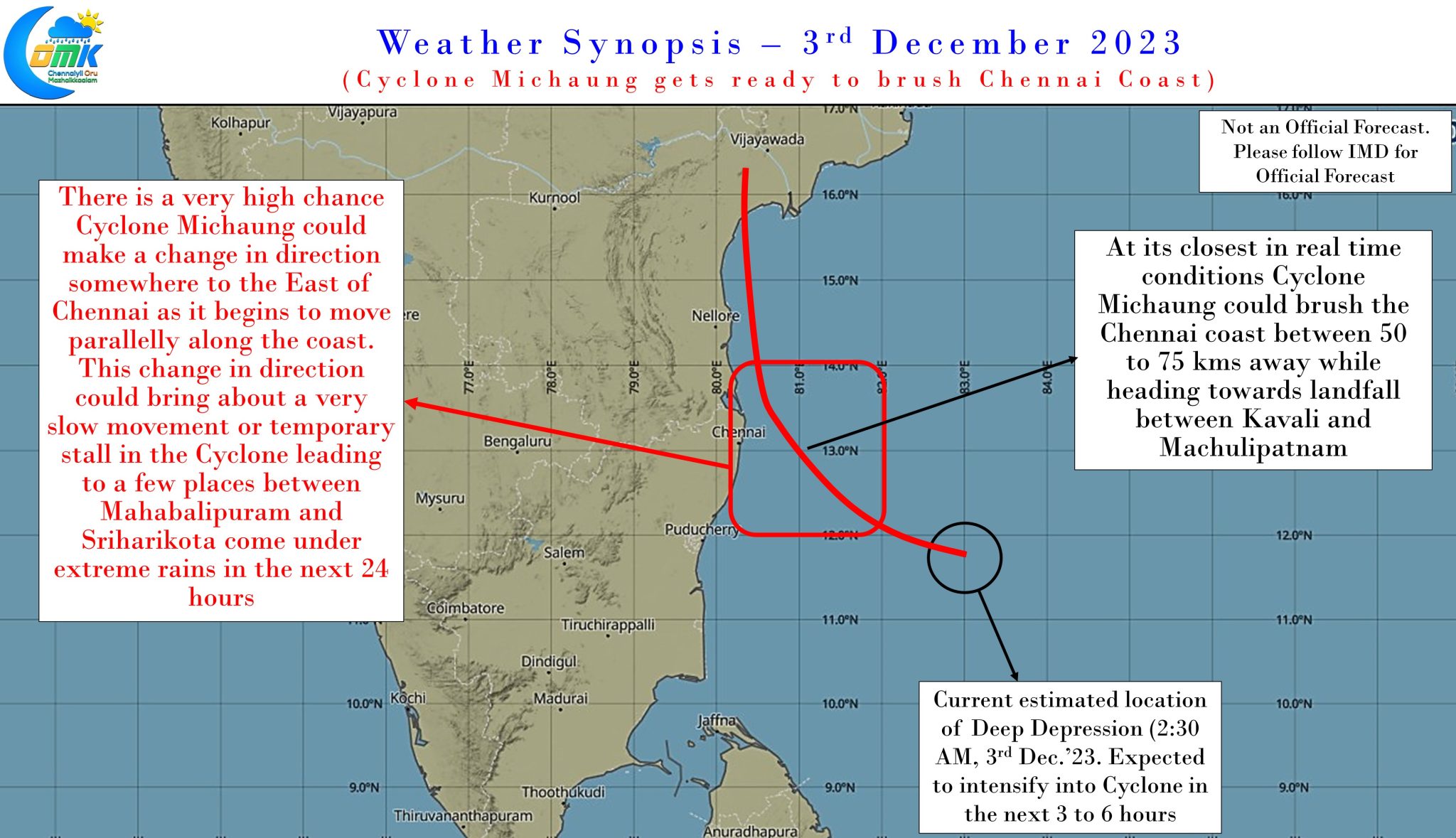
It is in this context it becomes pertinent to ask the question “Has Chennai dodged a bullet with Cyclone Michaung?” based on expected landfall over AP. The emphatic answer to that question is a very strong No. Weather models are fairly consistent now about the Deep Depression / Cyclone Michaung to spend nearly 18 hours around the vicinity of North Coastal Tamil Nadu off the coast of Chennai between Sunday late evening and Monday evening including a close brush with the coast near Pulicat / Sriharikota. It is during this phase that is likely to be the most critical for Chennai when a slow moving cyclone could dump a lot of rains. In particular the northern suburbs of Chennai along the coast and adjoining South AP coast is extremely vulnerable for extreme rainfall.
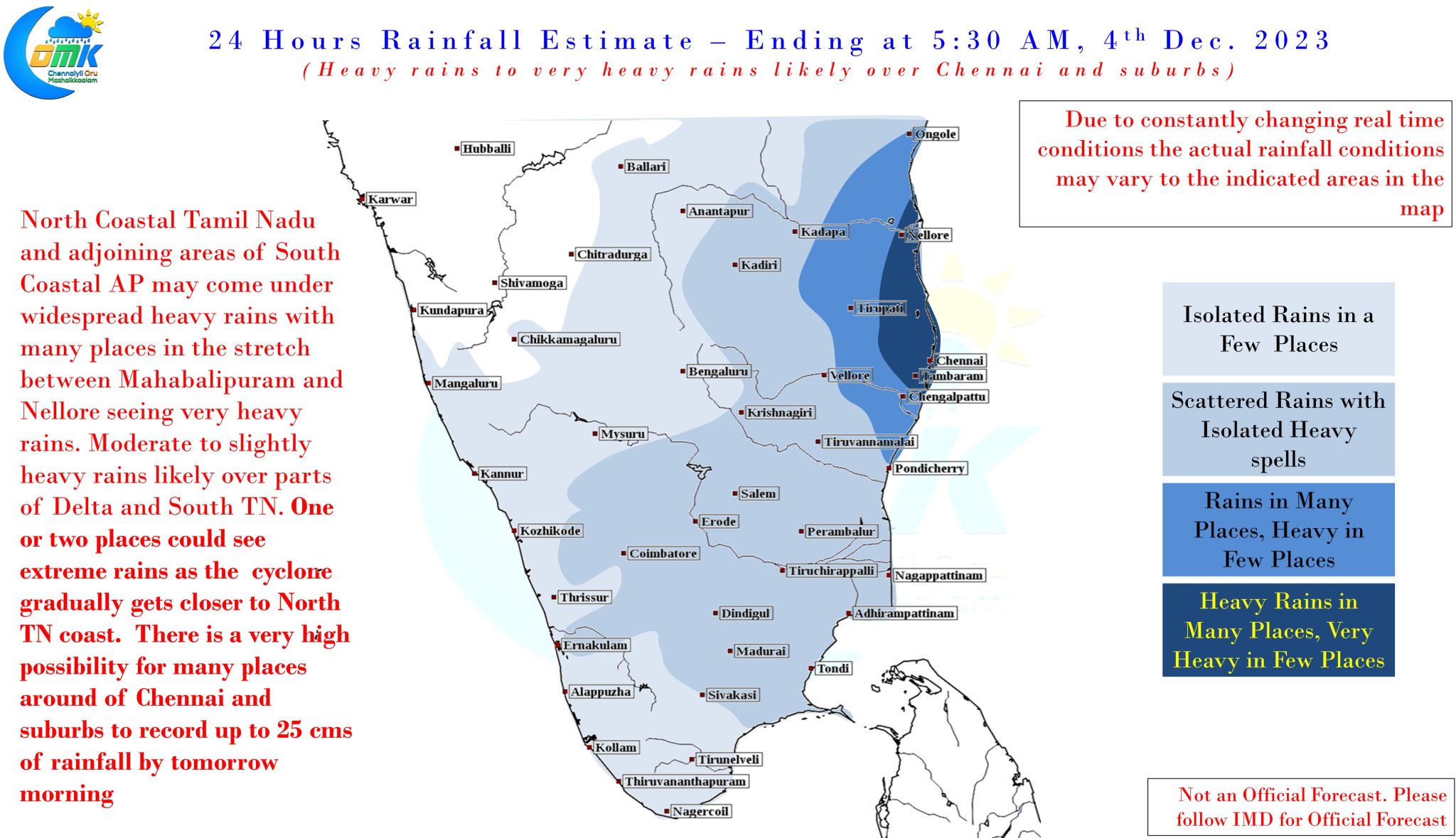
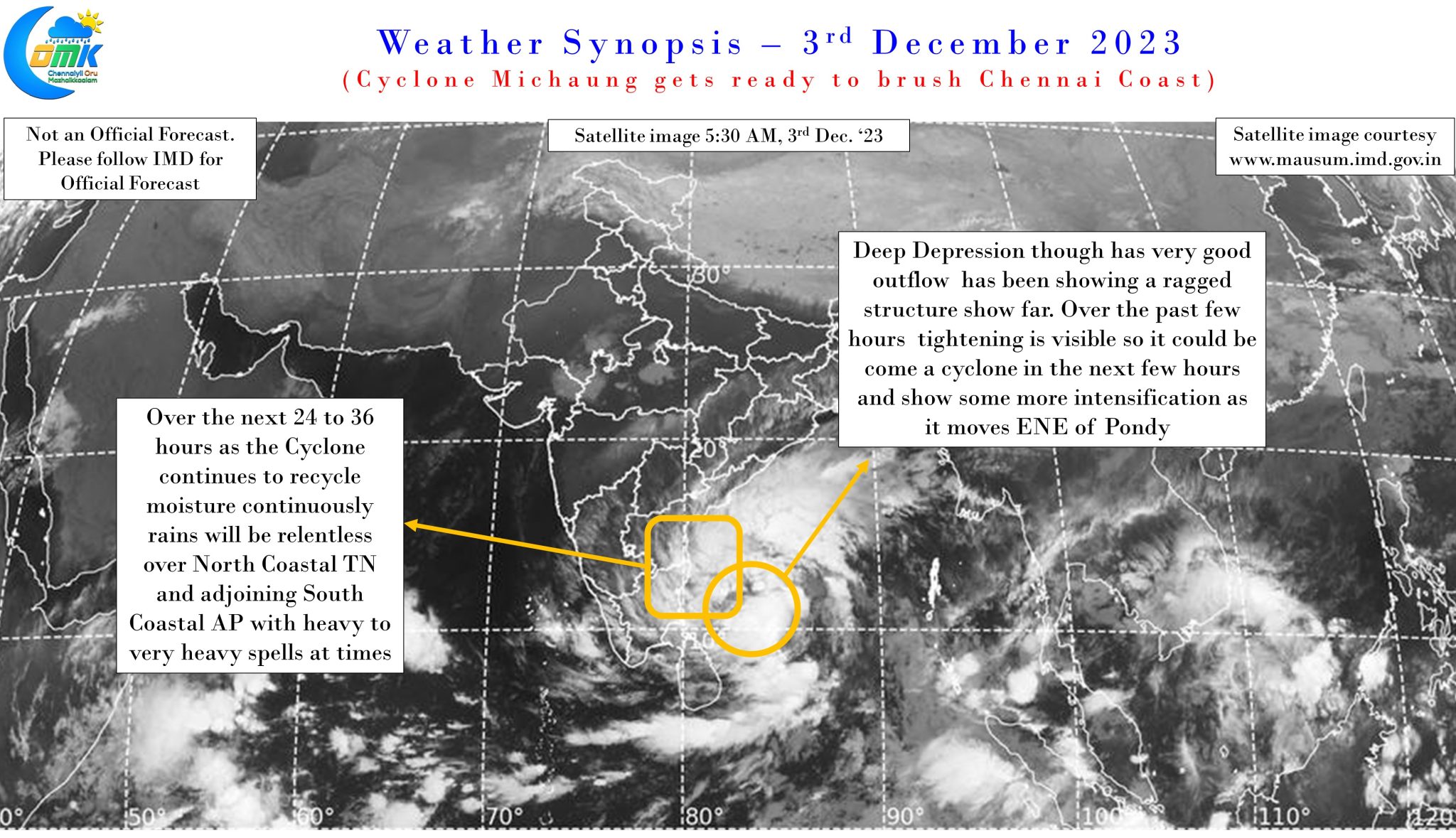
Though the cyclone is expected to spend about 18 hours in the vicinity of Chennai there is a very high possibility of a period of about 24 to 36 hours of near continuous rains for North Coastal Tamil Nadu between Sunday noon and Monday evening. While the initial phase of rains is expected from the circulation recycling moisture over the coast as it reaches around Pondicherry latitude. The subsequent phase would be when the convection developing around the CDO (Central Dense Overcast) falls right over the stretch between Mahabalipuram and Sriharikota as the cyclone moves closer to the coast.
There is a 50:50 possibility due to the friction under the influence of proximity to the coast there may be a possibility the cyclone could move slower than model estimates. This could potentially enhance and extend the rainfall impact for Chennai and suburbs. Similarly going by weather mode estimates after a more WNW track the cyclone is expected to take a more Northward track when it reaches near Chennai, this could potentially mean a slow down or temporary stall close to Chennai coast which may not be the best of the scenarios for Chennai and suburbs.
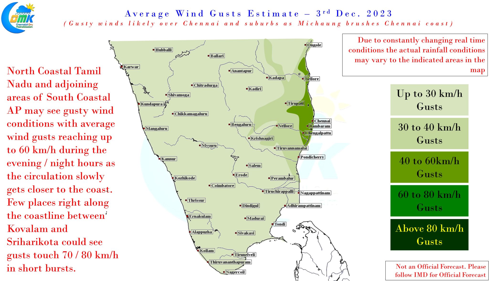
In terms of wind gusts it is fair to say it is lesser of the worries compared to rainfall threat. But still north Coastal TN and South Coastal AP could see wind gusts of up 60 km/h today with few places along the coastline between Mahabalipuram and Sriharikota seeing wind gusts peak at 80 km/h at times. Weather models are having tighter agreement the eventual landfall somewhere around Kavali to Machulipatnam in Coastal Andhra Pradesh which could mean coastal AP also runs into the risk of flood damages as heavy to very heavy rains hit the coast at the time of landfall.
To summarize. It is no more a question of whether Chennai and suburbs will get heavy rains but a question of whether the rains could end up being very heavy to extreme spells of rains. The heaviest rains are likely to happen between Sunday noon and Monday evening. There is a high possibility many places around Chennai and suburbs may record up to 25 cms of rains for the 24 hours ending Monday morning.