
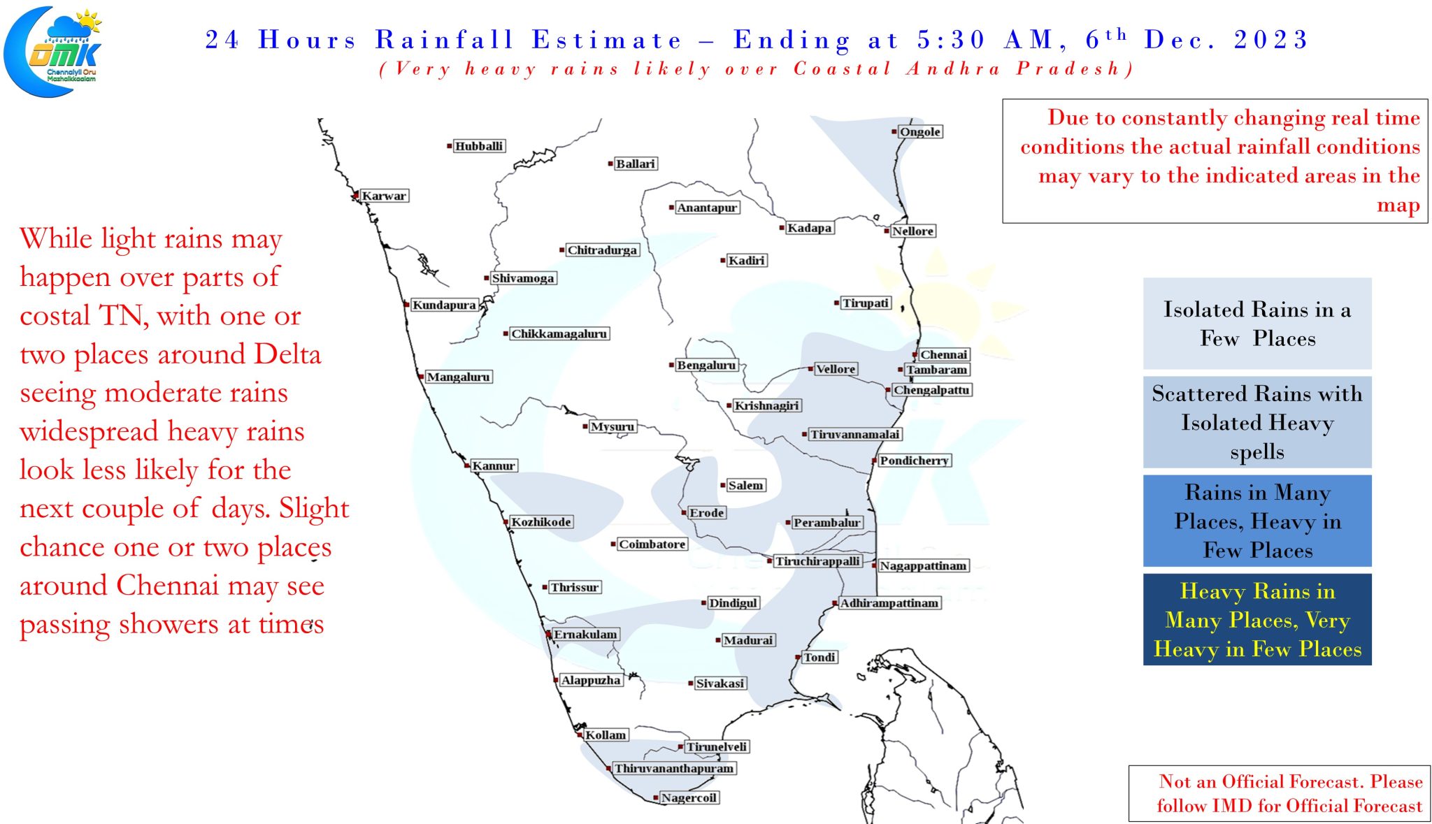
Cyclone Michaung will be a name that will never be forgotten by Chennai. For the past few years every rainfall incident around Chennai was compared to 2015 Chennai floods, it appears now 2023 may become the new benchmark in the coming years as most parts of Chennai and suburbs came under more than 40 cms of rains in 24 hours between 3rd and 4th December. Not only Chennai and suburbs but further upstream catchment areas for rivers like Cooum, Araniar, Kosasthalaiyar also saw very heavy rains. Poondi reservoir received more than 40000 cusecs at around midnight of 4th December indicating how heavy and widespread these rains were due to Cyclone Michaung slowing down close the coast of Chennai.
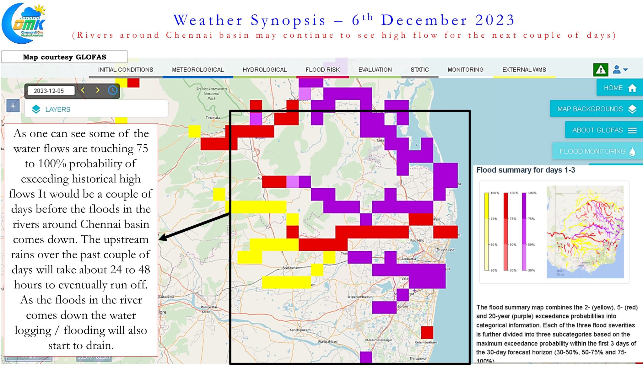
In the immediate context this is likely to make things critical for the next couple of days for Chennai on account of intense water logging the city and suburbs have seen. GLOFAS the flood forecasting model from ECMWF indicates the upstream catchment area runoffs will keep the inflows in the rivers of Chennai basin to remain at high levels for the next couple of days. This could mean it would be tough for the water to drain out of the streets of Chennai, particularly those areas along the banks of these rivers. Hopefully after a day or two when the runoffs eventually slow down we can see some respite from the water logging in most of the localities.
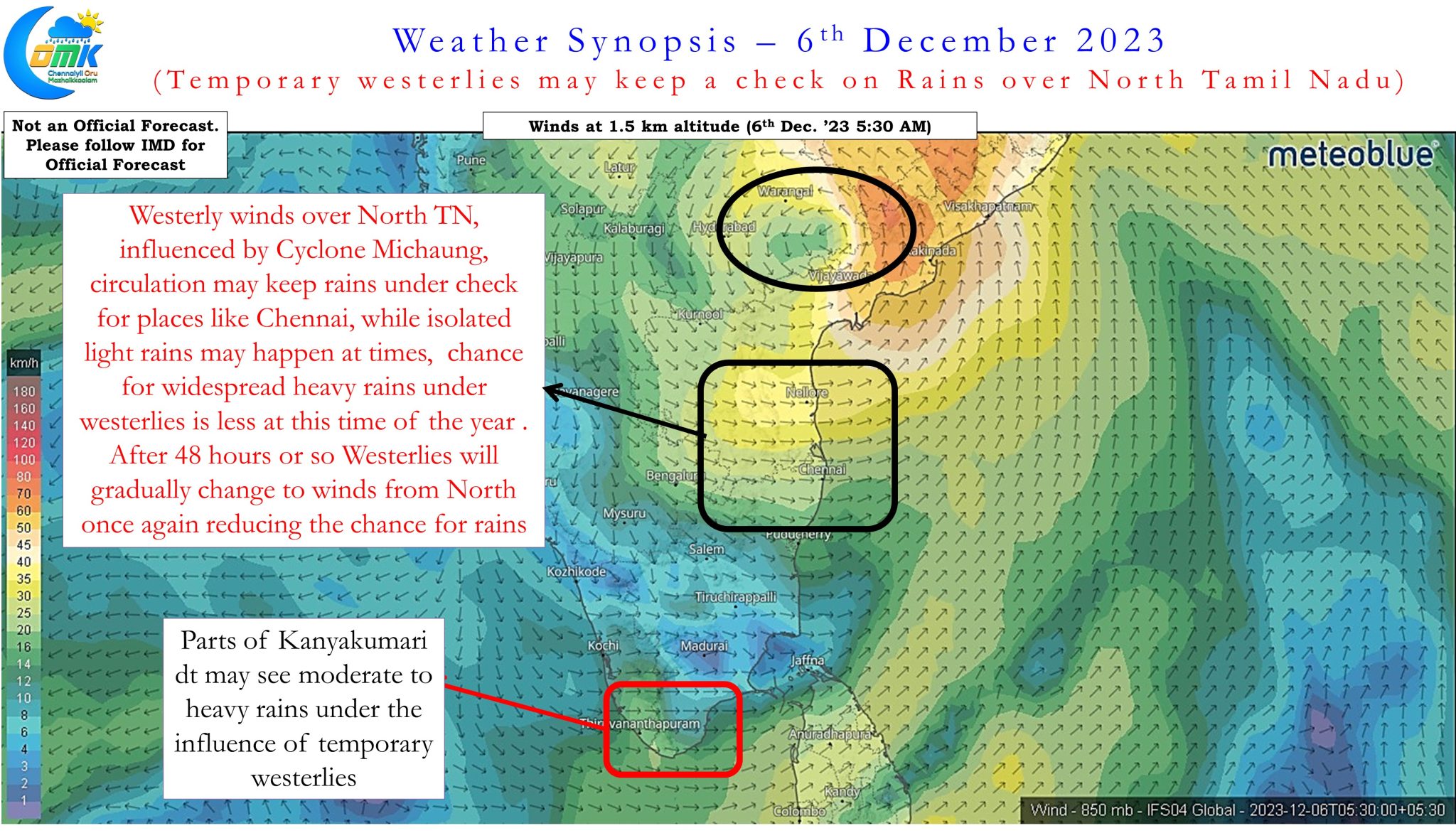
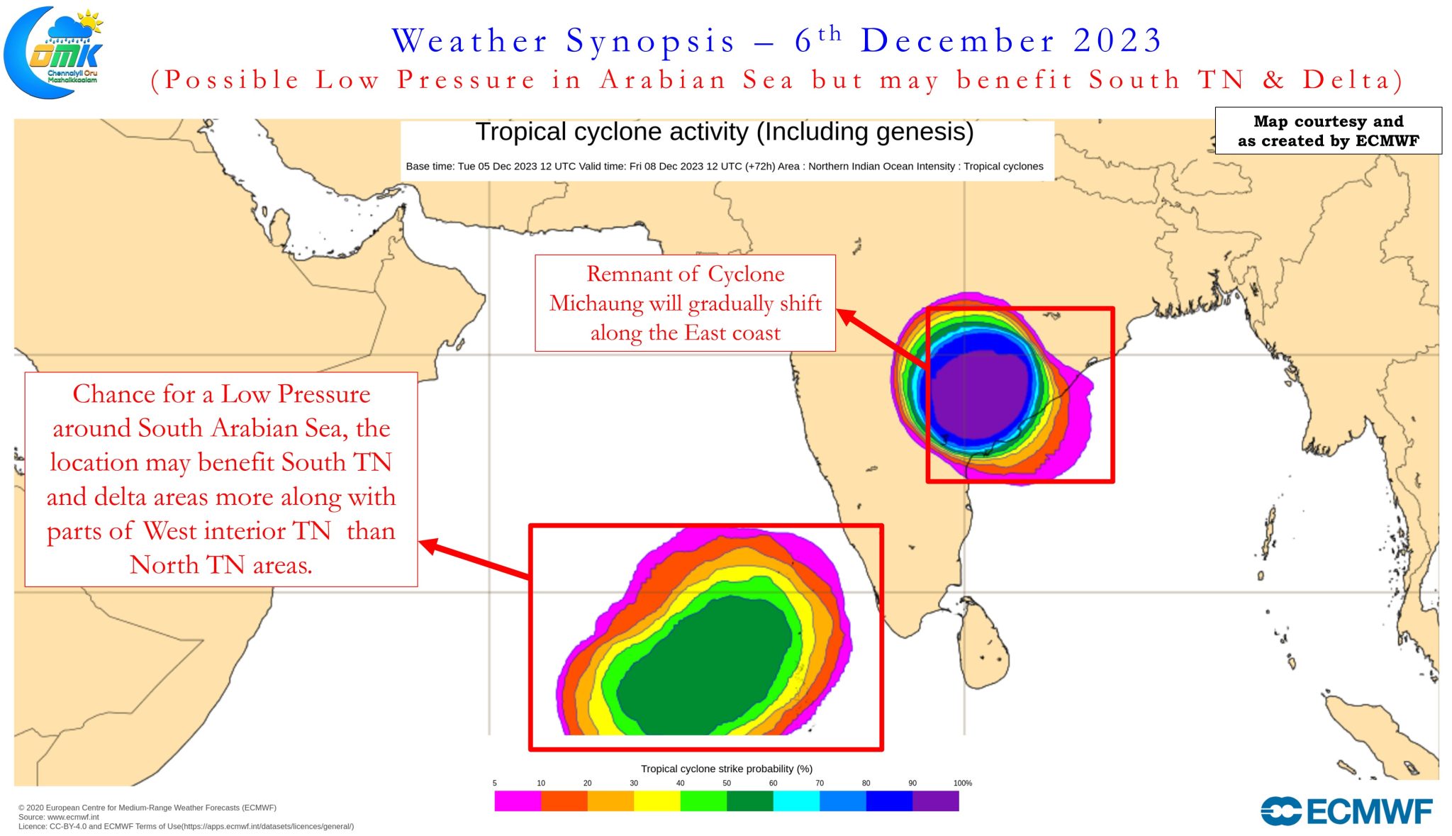
Cyclone Michaung after making landfall near Bapatla yesterday afternoon has moved further inland toward Khamman in Telangana weakening into a Depression today morning it is expected to weaken further into a Well Marked low by today afternoon and gradually drift along the East coast bringing heavy rains to parts of Odisha, Chhattisgarh. Under the influence of the north moving circulation now most parts of Tamil Nadu is under temporary westerly winds which will keep a check on widespread rains over the state. The next couple of days we might see Westerly winds continue which is expected to turn Northerlies over parts of North TN making it less conducive for rains over places like Chennai.
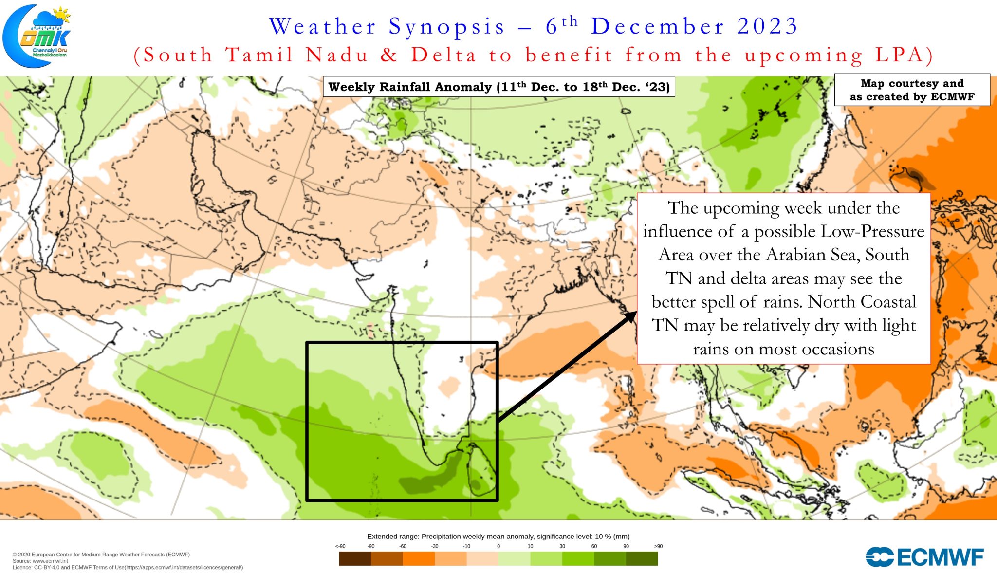
Looking slightly ahead there is a good possibility the coming days may see a possible Low Pressure in South Arabian Sea and adjoining areas of Laccadive Sea. The position of the LPA may be favorable for rains over South TN and delta districts in the upcoming week along with parts of West Interior Tamil Nadu. This could also mean lesser probability of widespread rains over North TN including Chennai during the upcoming few days. In all probability except for some light rains Chennai and surrounding places may not see widespread rains for the next week to 10 days. The rainfall anomaly chart for the week 11th to 18th December also indicates South TN and delta districts to benefit more from the low latitude circulations in the coming days.
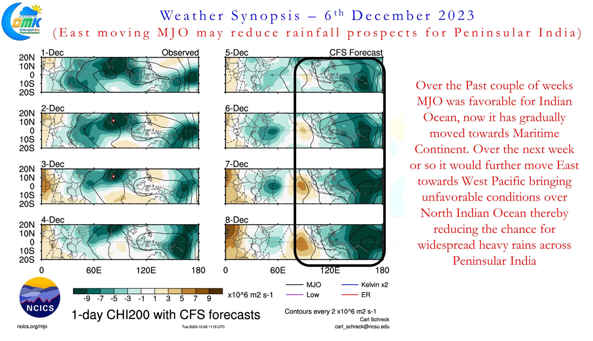
With MJO expected to move further East towards West Pacific possibly we may not see planetary wave support for Cyclone and widespread heavy rains over the coming couple of weeks. South TN though may need to be wary because circulations in Arabian Sea could potentially bring extreme rains over parts of Tirunelveli, Tenkasi and Virudhunagar district along the Eastern slopes of the Ghats. While it may not be Curtains Yet for NEM 2023 as far as Chennai goes there is fair confidence to confirm Peak NEM is possibly over for Chennai and suburbs.