
On behalf of all of us we wish our readers and well wishers a Happy and Safe Deepavali
North Indian Ocean has always been a complex basin for Global weather models. We have consistently seen weather models under estimating forecasts of cyclones over the Arabian Sea with 2023 also adding Biparjoy and Tej adding to the list of cyclones initially under estimated by almost every global weather model before correcting themselves. Similarly the interaction between a cyclone and mid tropical westerly trough happens more often and in a more pronounced manner compared to any other global basin. One of the unique things about North Indian Ocean is the closed nature which makes the dynamics very fluid with long term weather models almost always coming with a much higher degree of uncertainty than anywhere else.
The tropical disturbances (Monsoon Depressions) during Southwest Monsoon are mostly straight forward travelling along the Monsoon trough. Occasionally, particularly during the early weeks and closing weeks of monsoon, some of these disturbances could intensify into a Cyclone taking models off guard otherwise there is very little complexity in the tracks or impact areas. Northeast Monsoon though often proves a point for being treated as a smaller sibling by bringing forth complex interplay between not only local and global factors but also dynamics within the basin in the form of competing circulations in a broad area of disturbance.
One such scenario is all set to get unraveled in front of us in the upcoming week. While the broad area of disturbance is not exactly as pronounced as normal there are two distinct circulations that is expected to play out over next the few days trying to gain energy from each other and evolve into a dominant circulation. The first one is a remnant circulation off the coast of Sri Lanka and the second one is an incoming pulse from Gulf of Thailand which is expected to move further NW as it moves across Bay of Bengal. Most models are consistent about the incoming pulse becoming the dominant circulation after an interaction with the Sri Lanka circulation about 400 – 500 kms to the east of Tamil Nadu coast.
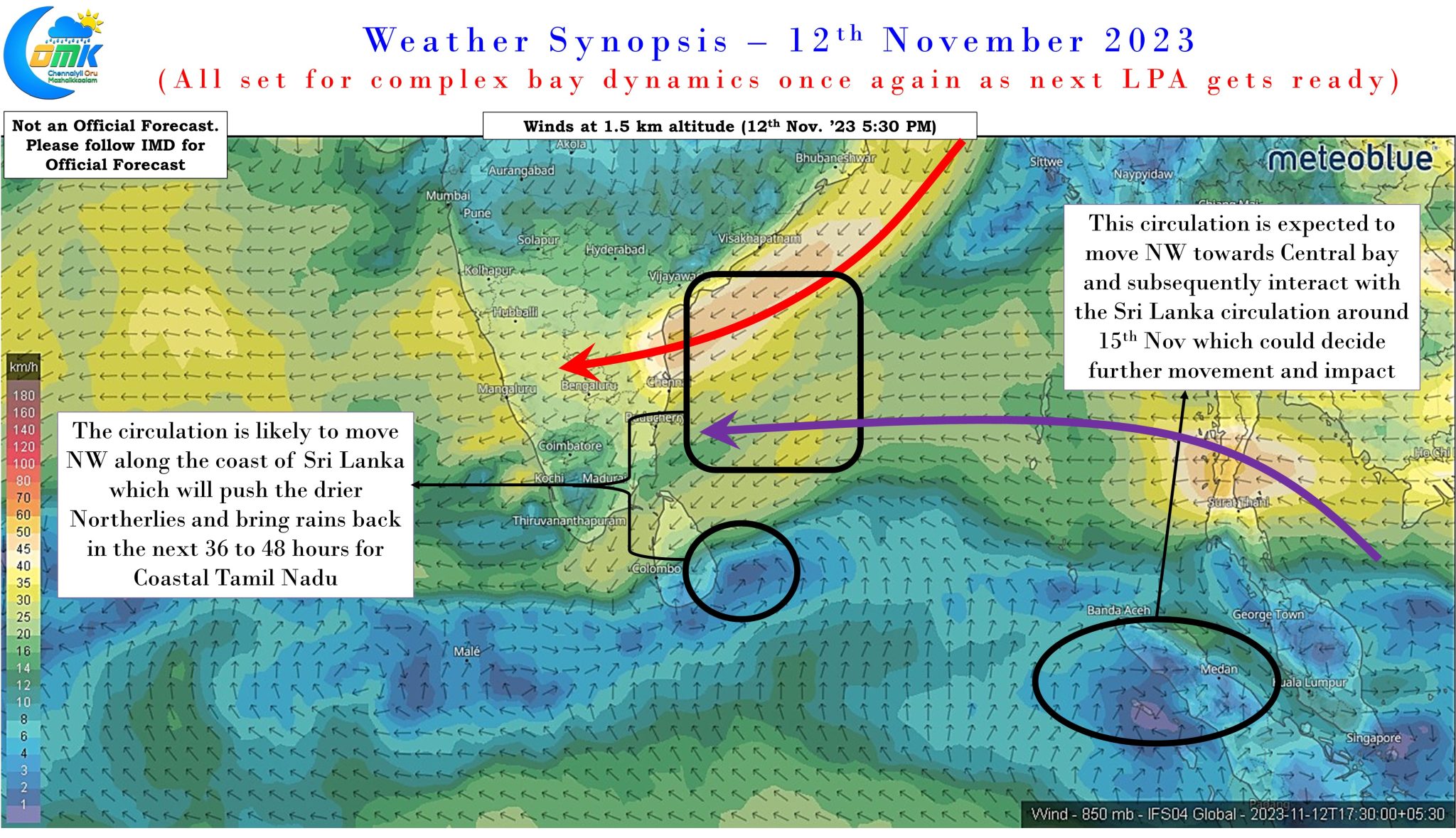
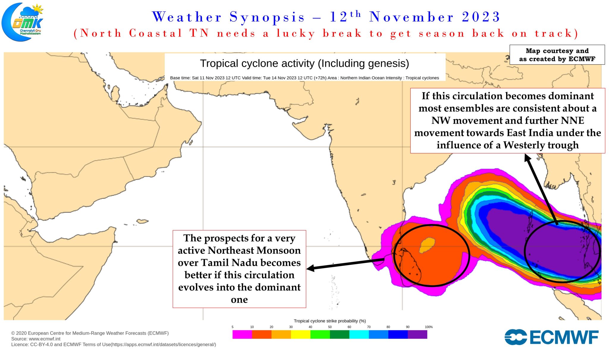
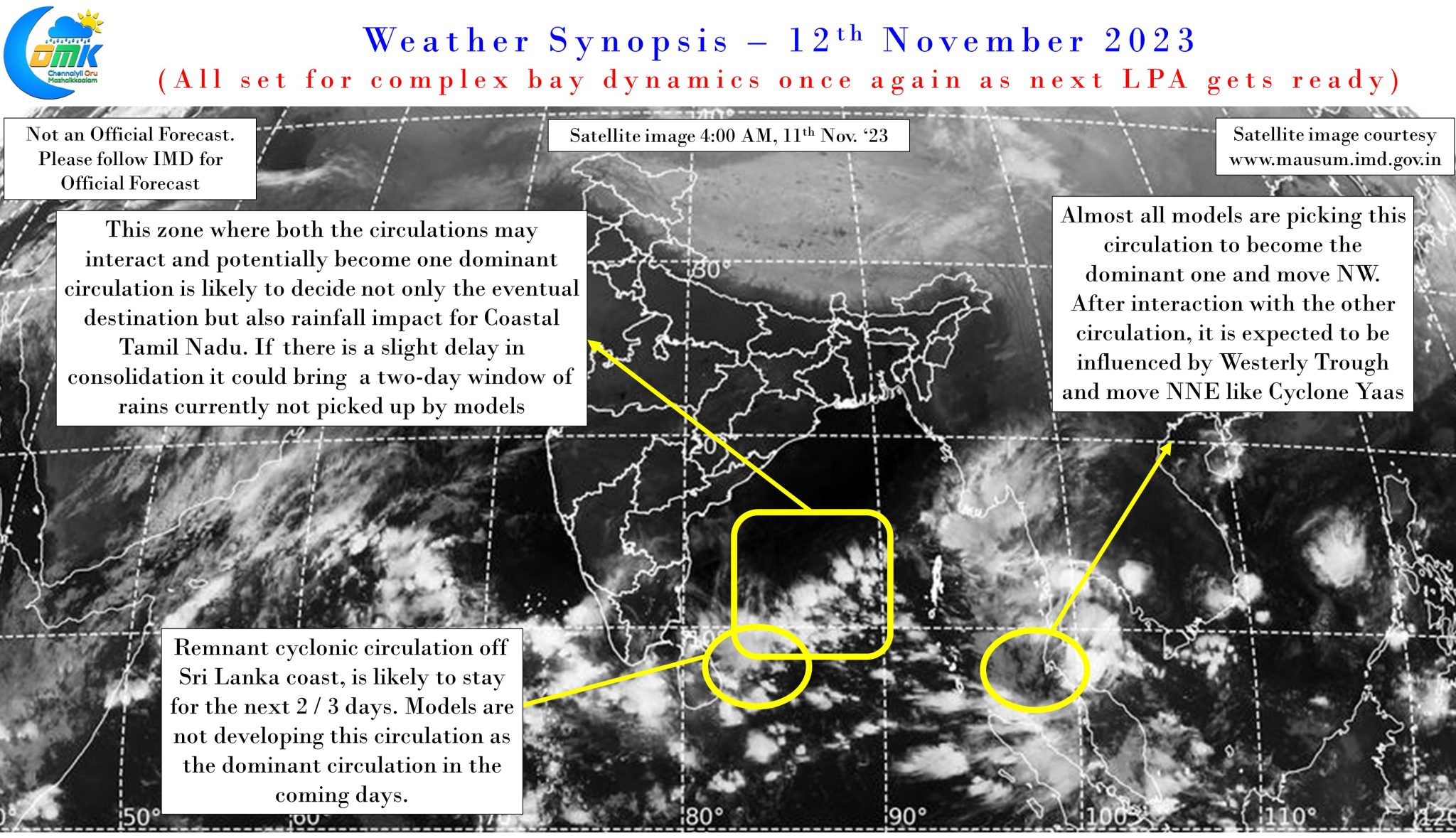
The rainfall prospects for Coastal Tamil Nadu is like chalk and cheese between the two circulations with the first one near Sri Lanka best suited for Northeast Monsoon dynamics while the second one near Andaman could eventually move NW towards Costal AP before drifting towards East India under the influence of the westerly trough. This could mean a similar scenario to Cyclone Yaas during late October when just after IMD announced onset the rains pretty much stopped over most of the coastal areas between Chennai and Delta.
There is a third scenario which may be a lucky break for North Coastal Tamil Nadu and South Coastal AP, though currently this scenario is least picked up by the models, is one where potentially the interaction between the two circulations East of TN coast could bring about a delay in consolidation. This could mean effectively two circulations acting like a conveyor belt to push moisture into coastal TN bringing about some much needed revival of monsoon dynamics for places like Chennai which is reeling under a deficit monsoon so far. If anything close to this scenario unfolds then potentially we could see widespread heavy to very heavy rains along the coastal areas for a day between 14th and 16th November. How deep these rain bands would penetrate the interior areas will depend on how closely the two circulations sync and work together in pushing moisture across the coast of Tamil Nadu.
To cut a long story short. Chennai and North Coastal Tamil Nadu needs a lucky break will it happen this time around after so many misses during this Northeast Monsoon season is going to be the billion dollar question. As usual following Northeast Monsoon is not for the weak hearted.