
ஐயா என் பேரு மாணிக்கம், எனக்கு இன்னொரு பேரு இருக்கு
The above dialogue from the movie Baasha by Rajnikanth is one of his most famous dialogues. Similarly for most the acronym BOB would mean Bay of Bengal. But for the weather bloggers of Chennai it is Boss of Bays. Despite being a much smaller basin compared to Pacific or Atlantic, or for that matter the much more open South Indian Ocean regularly Bay of Bengal and Arabian Sea brings global weather models to their knees in terms of bringing complex scenarios and impacts. This is one of the most important reasons why it always makes sense not to look beyond a couple of days in terms of clear guidance for weather events during both the monsoons, more so, during Northeast Monsoon where things change drastically like a sprinkler tap kept under the control of a kid who decides to have some fun at the cost of others.
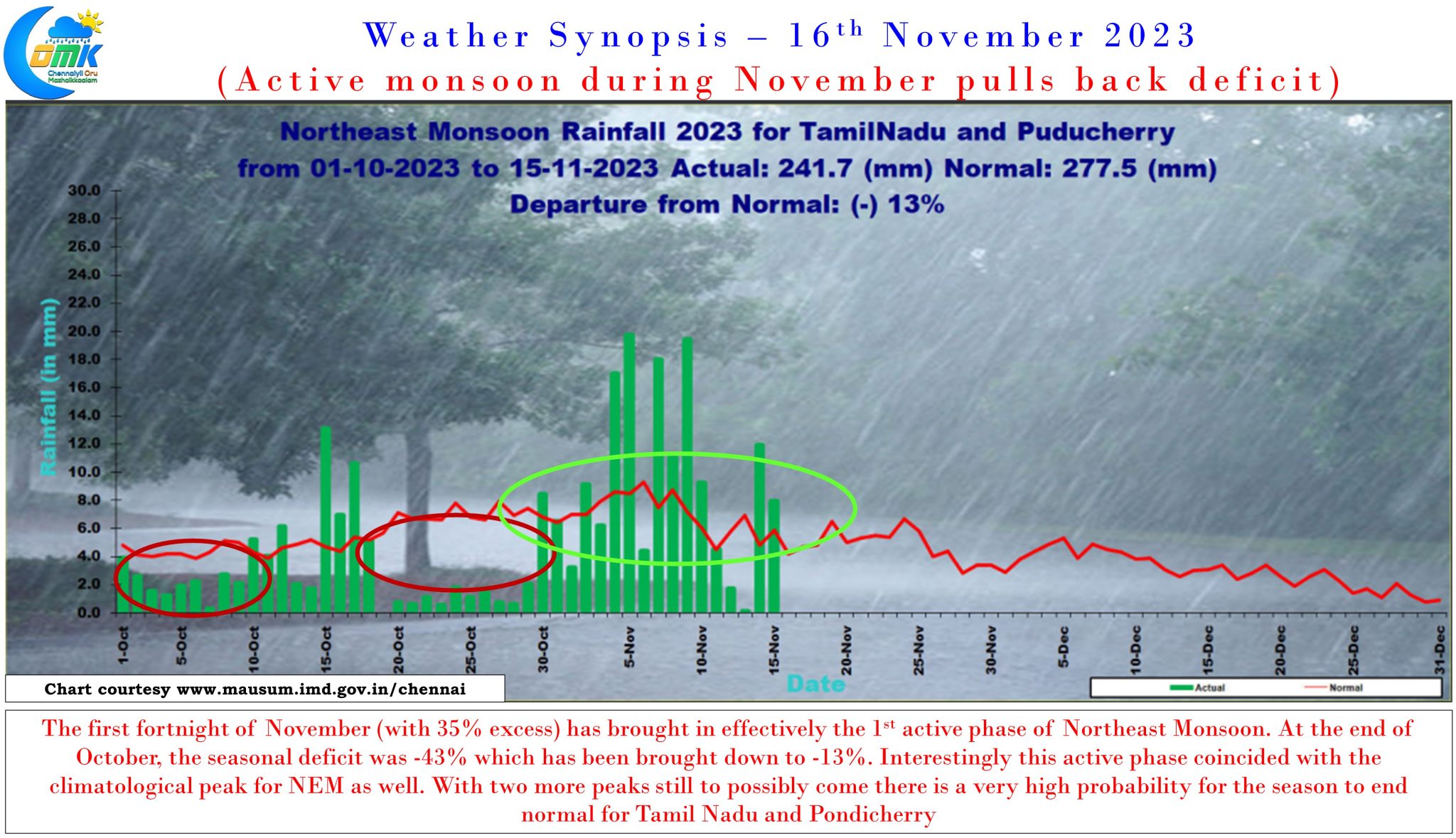
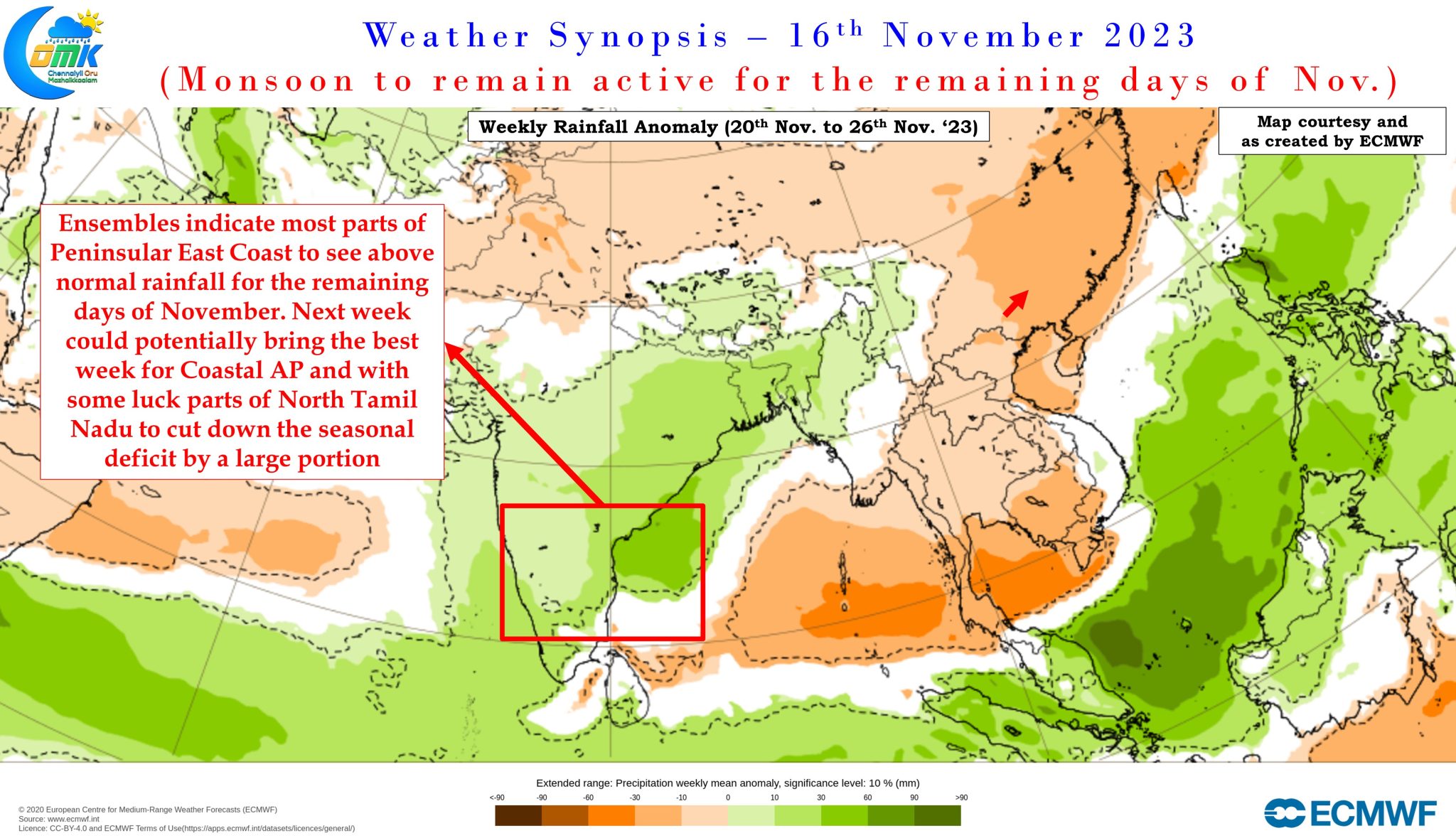
After a poor start to Northeast Monsoon during October, things have certainly picked up during November with the performance for the month individually standing at 35% above average, drawing back the seasonal deficit from 1st October from a whopping -43% to -13%. The most satisfying thing is the -43% deficit was despite the excess in parts of South TN and interior districts while the claw back over the past couple of weeks has been build by the good performance of coastal districts. While Chennai may not have benefitted as much as some of the places between Marakkanam and Delta it has certainly opened the gates for North Coastal Tamil Nadu.
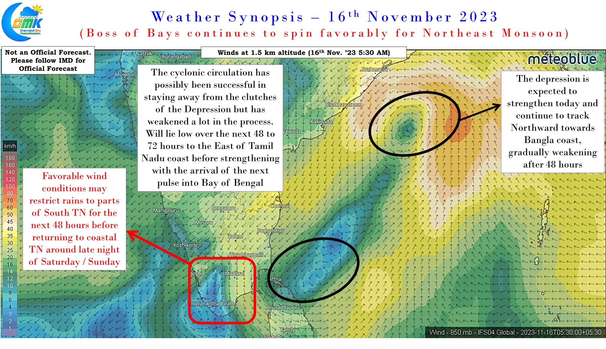
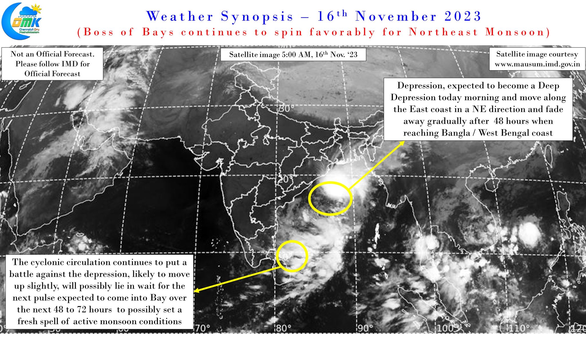
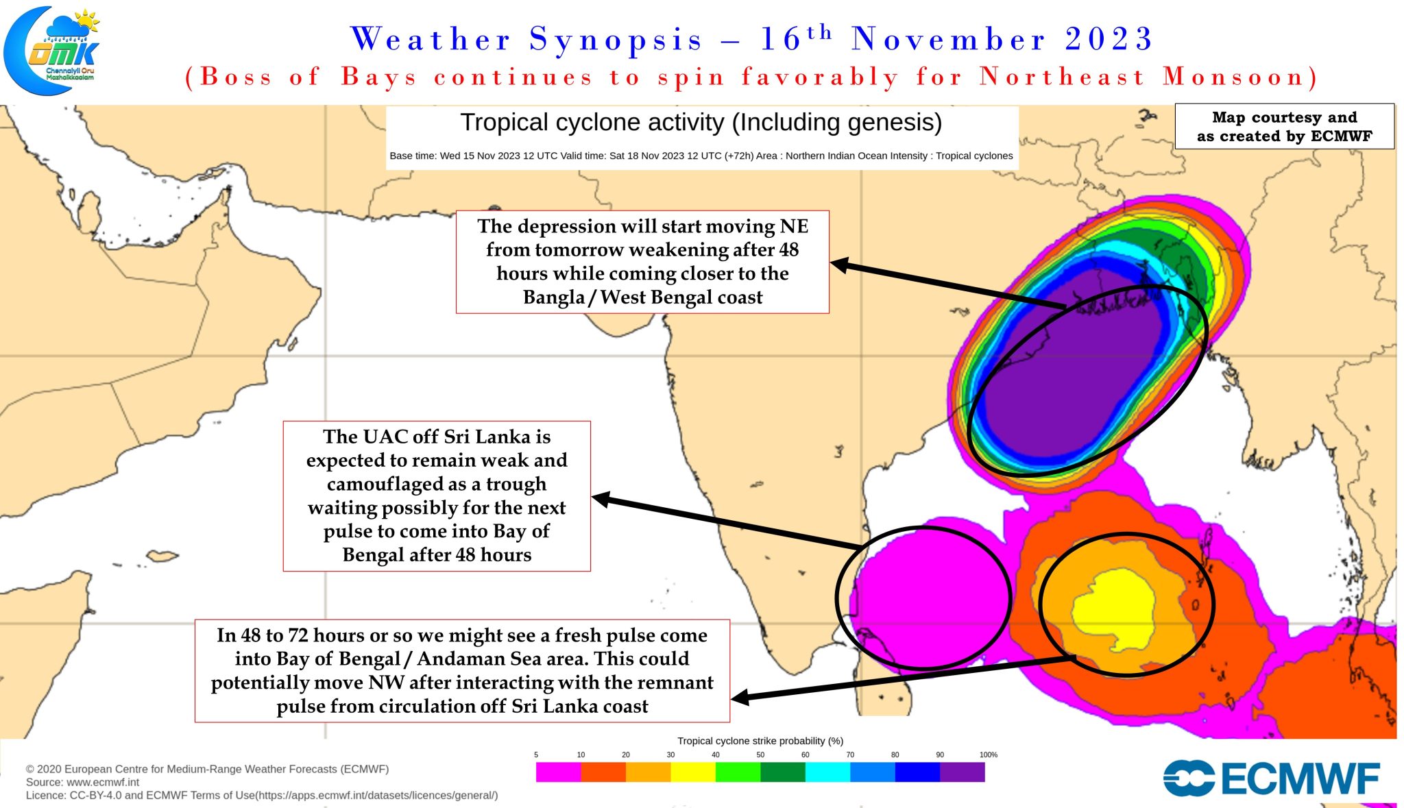
With the gates now open an unlikely hero is expected to bring what may be the best spell of Northeast Monsoon for North Tamil Nadu and adjoining South Andhra Pradesh. Contrary to what most models expected the Upper Air Cyclonic circulation off the coast of Sri Lanka has not only managed to fend off the challenges by its bigger cousin, the Depression in Central Bay that is expected to intensify into a Deep Depression today and head further north, it is possibly going to camouflage itself for the next couple of days in a weak state until the arrival of a next pulse into Bay of Bengal in about 48 to 72 hours from now. When the fresh pulse arrives, this circulation could possibly play the role of guiding it towards North TN / South AP. The exact impact area will possibly depend on where eventually the disturbance reaches with the heaviest rains possibly happening along the coast to the North of the land interaction area.
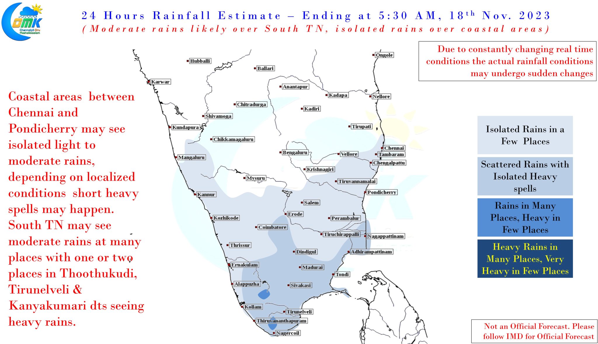
In the meanwhile for the next couple of days while coastal areas between Chennai and Pondicherry may see lesser rains, though compared to what models estimated the dry break is unlikely to be long and complete, due to the persisting presence of the weak CC off Tamil Nadu coast. South Tamil Nadu may see moderate rains for the next couple of days with few places closer to the Ghats and possibly Thoothukudi coast coming under heavy rains at times. From possibly Saturday night we may start seeing rains at more places along the coast. Next week promises to be the best period for North Tamil Nadu and adjoining South Andhra Pradesh.
There is a fair chance Chennai and rest of North Coastal Tamil Nadu may claw back a majority of the deficit by the end of next week. If the LPA moves favorably then some of the North interior districts like Vellore, Ranipet, Tirupathur could also benefit bringing down the deficit. All in all Northeast Monsoon could remain active for the rest of November with a good possibility of the 2nd peak of the season happening between 20th and 25th of November. With some luck this could potentially end up as a higher peak than the 1st one that happened over the past few days.