
As we head to closer towards the last week of November the overall feeling one gets about this year’s Northeast Monsoon is a sense of “so near yet so far”, particularly to the places in North Coastal TN and North Interior TN where the rains have been extremely sub par. While there is no doubt South Tamil Nadu and even delta coast has seen a good monsoon so far the rains have not moved inland on most occasions with interior places about 50 to 100 kms away from the coast line missing out on most spells. South TN though has been an exception where rain bands have consistently made the journey towards the foothills of Western Ghats from the coast.
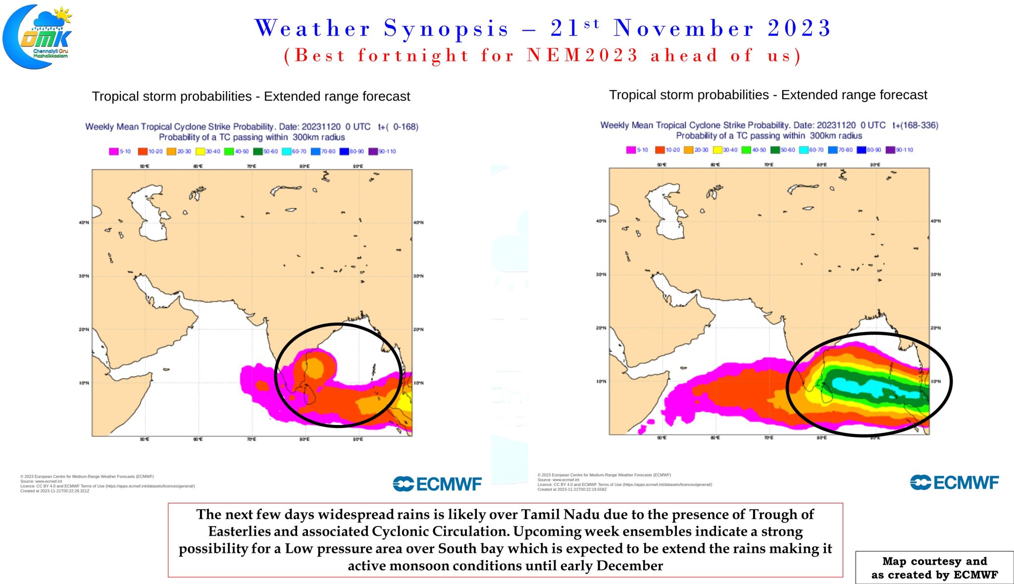
For the first time during the season there is a fair consistency from weather models on an active fortnight of Monsoon conditions. So far this year on most occasions these conditions were restricted to a couple of days or at best 5 to 7 days. Ensembles are consistent about the next two weeks bringing widespread rains over the southern parts of Peninsular India. While this week a fair bit of rains is likely to be brought by the trough of Easterlies falling favorably over coastal Tamil Nadu the upcoming week could see a possible LPA / Depression heading towards coastal Tamil Nadu which may bring another spell of widespread rains for the state.
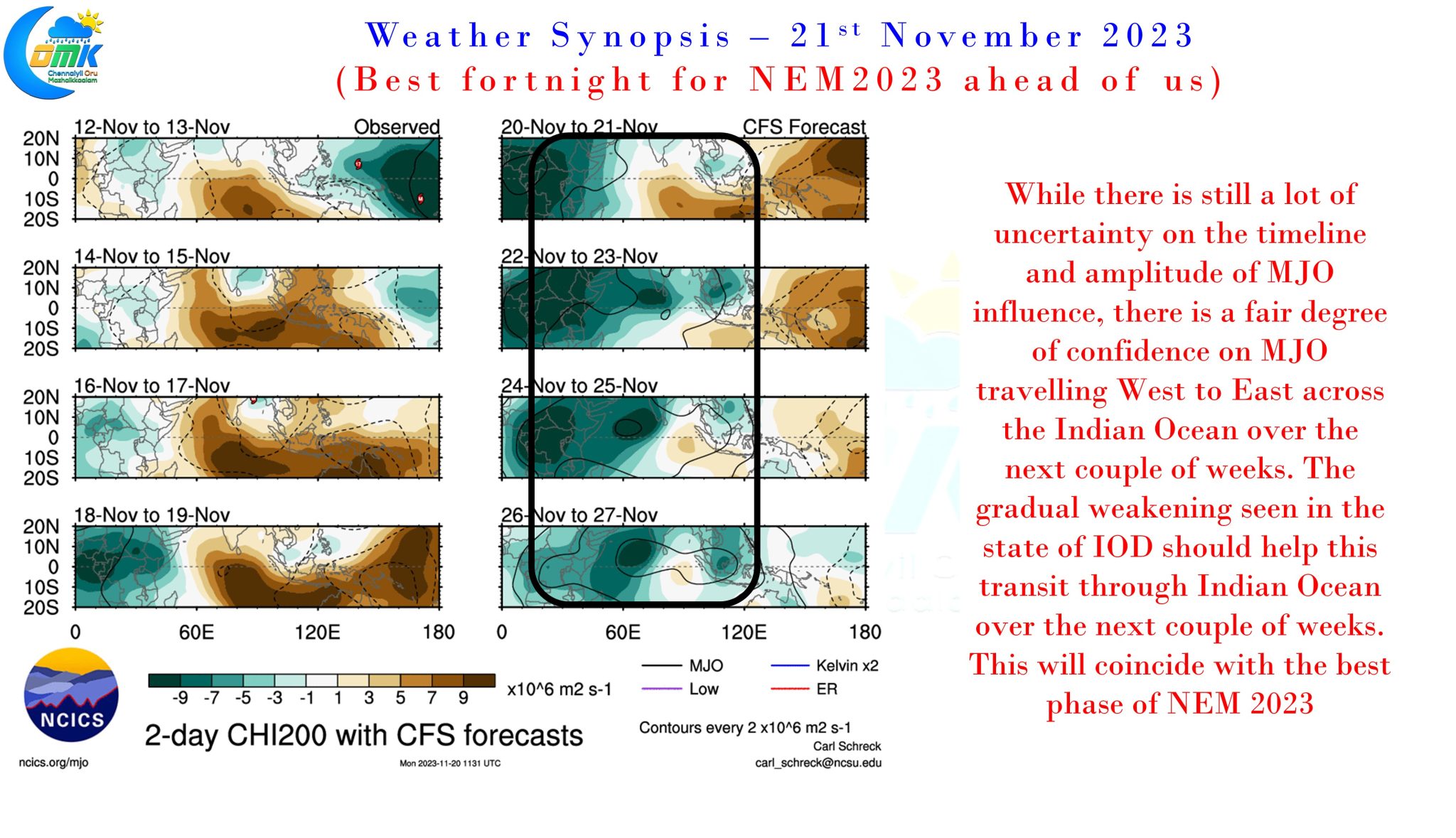
This period is also likely to coincide with the transit of MJO across North Indian Ocean enhancing the convection and increasing the possibility of rains. This year tracking and estimating MJO influence has been very tricky due to the strong IOD that bloomed late in the season. Though IOD continues to remain strong it has peaked late October and now is gradually weakening which could be the much needed fillip for a successful transit of MJO across Indian ocean. Effectively the next couple of weeks when MJO is expected to transit across North Indian Ocean is expected to coincide with the best fortnight of Northeast Monsoon 2023. How MJO influences once it reaches Maritime continent will be a subject of a separate discussion and will be discussed once we get better clarity when the MJO starts transiting across Indian Ocean.
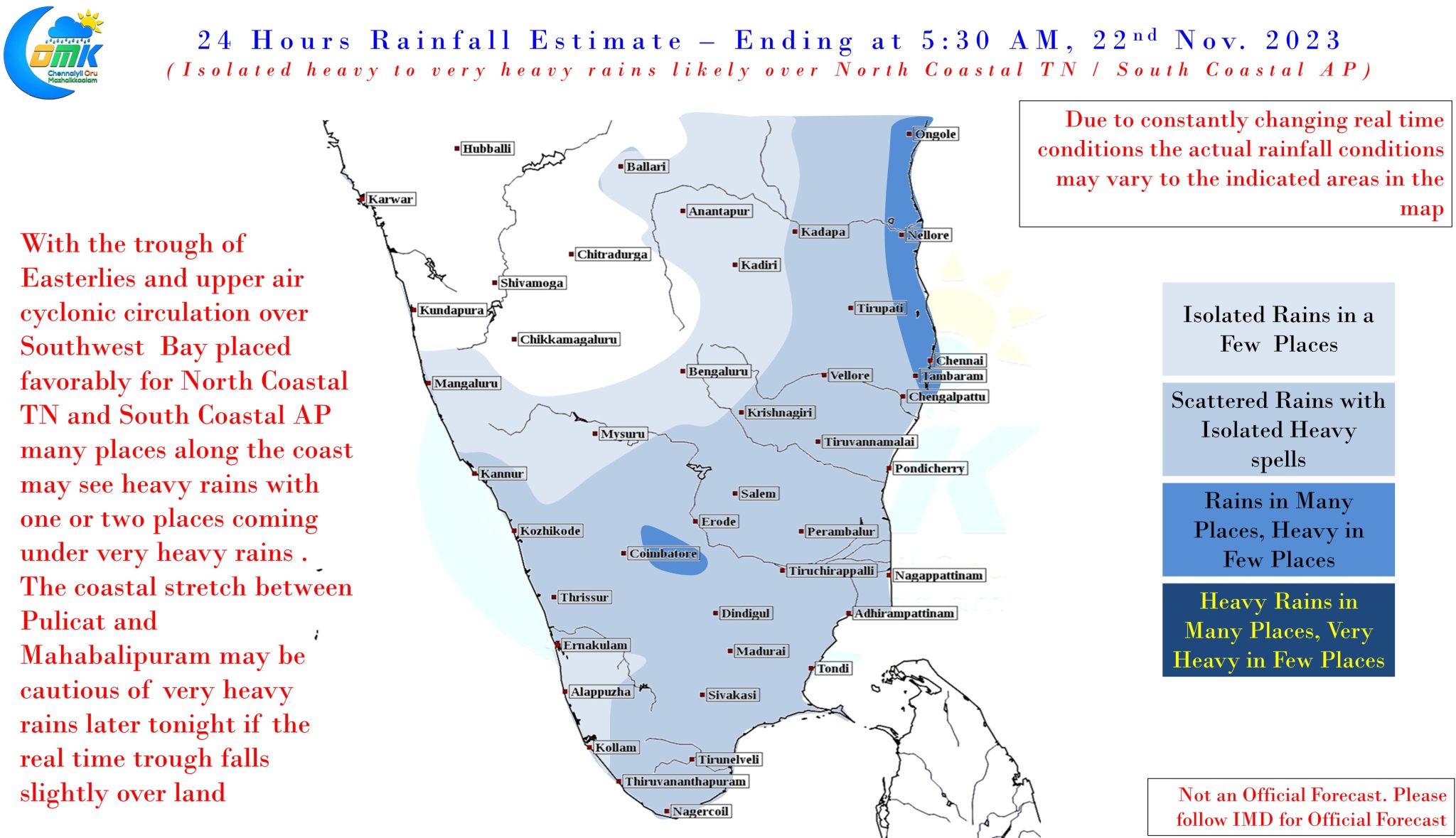
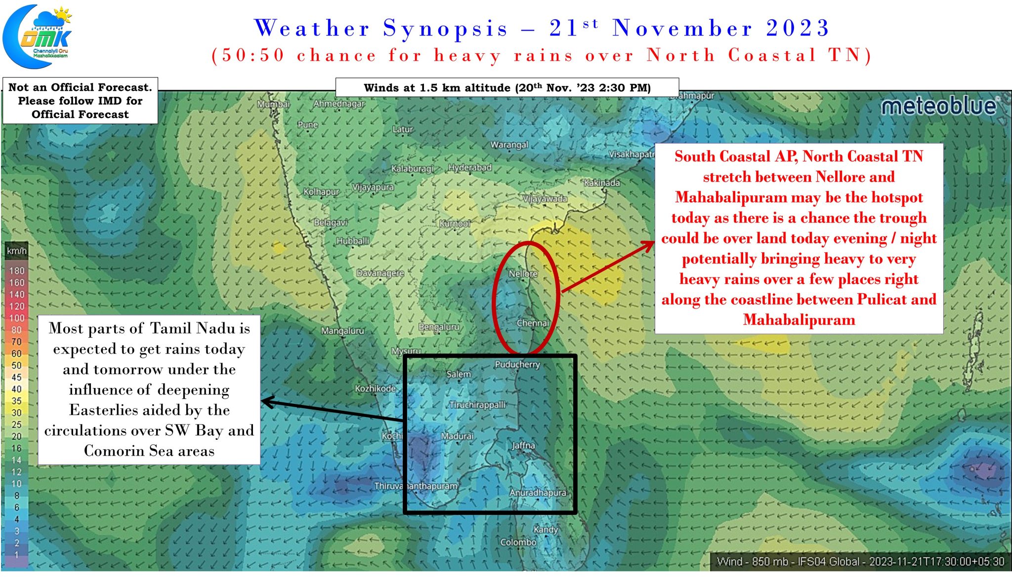
In the meanwhile the trough of easterlies and associated cyclonic circulation is expected to bring another day of widespread rains over South Coastal AP and North Coastal TN. There is a high possibility of the trough line falling right along the coast line later today evening / night which could potentially bring heavy to very heavy rains right along the coast line between Pulicat and Mahabalipuram during the night hours. Chennai and suburbs may see widespread moderate to heavy spell of rains today with bulk of the rains happening during the night hours. The deepening Easterlies is expected to push some of the rains into interior areas of Tamil Nadu gradually.