
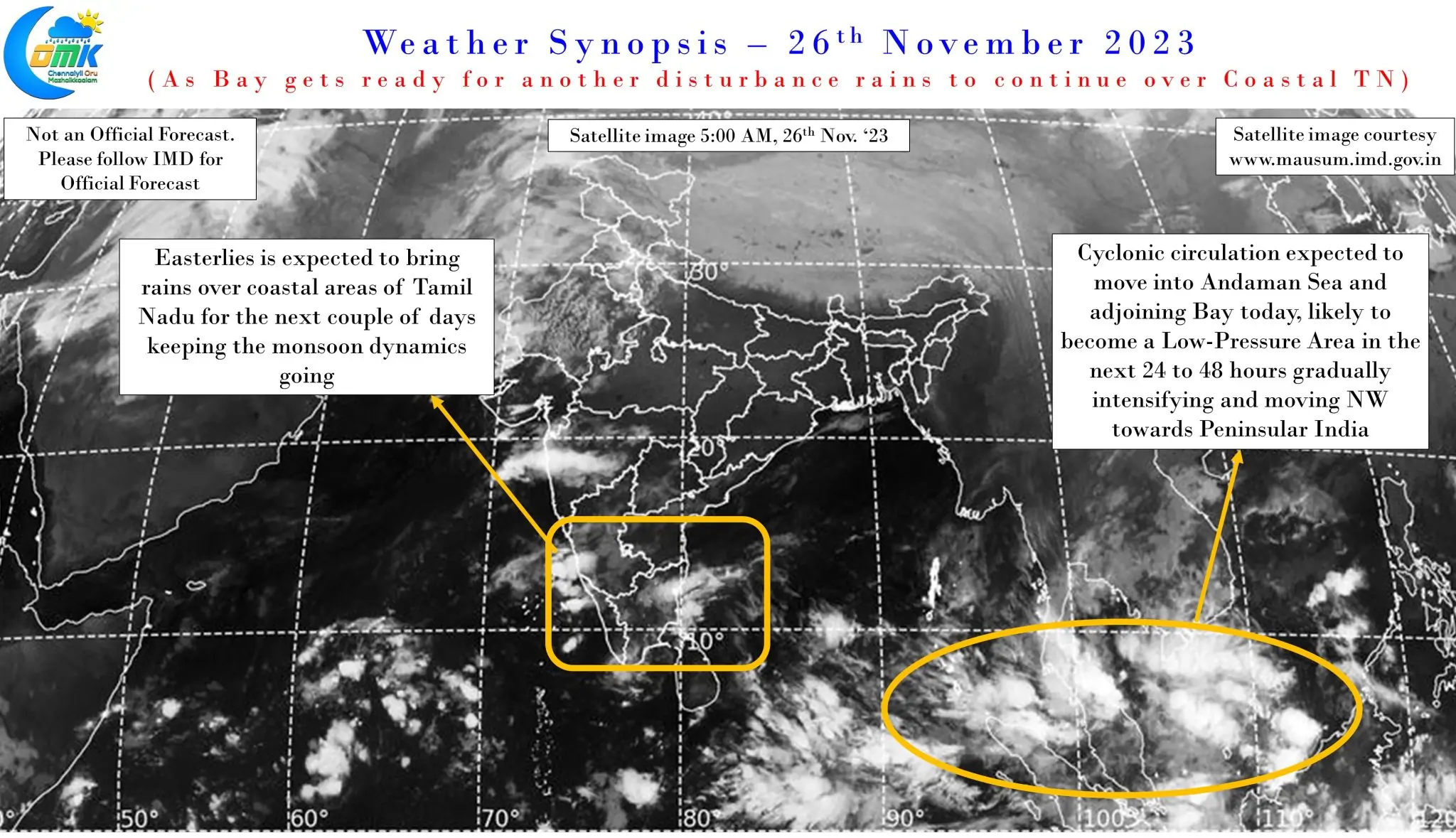
This year’s Northeast Monsoon could head down the books as one of the most complex years for weather observers. Pretty much every event of a reasonably strong magnitude has come with complex interactions and interplay between various factors making it very tough to give a descent inference a few days in advance. One common thread though is the repetitive nature of north moving disturbances in Bay of Bengal. Very Severe Cyclonic Storm Hamoon went all the way to Bangladesh coast after forming over Central bay area while Cyclonic Storm Midhili also went to Bangladesh coast after moving in as a pulse from the Gulf of Thailand.
Bay of Bengal is now ready for the next Low Pressure which is expected to develop from a cyclonic circulation that is expected to move into Andaman Sea and adjoining Bay from Gul of Thailand today. This cyclonic circulation is expected to become a Low Pressure Area in the next 24 to 48 hours gradually intensifying into a Depression and moving Northwest towards Peninsular Coast. It is from this point a set of events that is bringing in complexity to not only the track but also impact areas as well to this disturbance. Weather models indicate a tug of war between two sets of Ridges (High Pressure Zones) to control the steering of this disturbance.
The steering mechanism of tropical cyclones are always under the influence of semi permanent high pressure zones. The cyclones over the North Indian ocean, both Arabian Sea and Bay of Bengal, is often steered by either the Indo Arab Ridge or the Indo China Ridge. Depending on which high pressure zone influences the steering of the cyclone the path could change completely. These high pressure zones govern the movement of cyclones like a large gear wheel driving a smaller gear wheel. While on most times the steering would come under the influence of either of the ridges, occasionally there could be a scenario when the steering gets shifted from one to the other. Gaja was an example of this case when it underwent a mid sea stall for couple of days as the steering mechanism shifted from Indo China Ridge to the Indo Arab Ridge. During such time cyclones tend to become near stationery like a train waiting at signal.
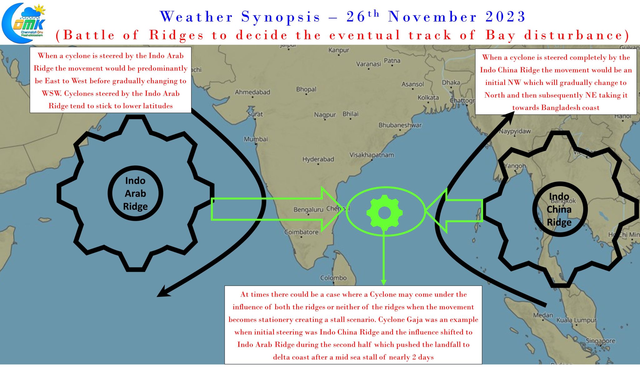
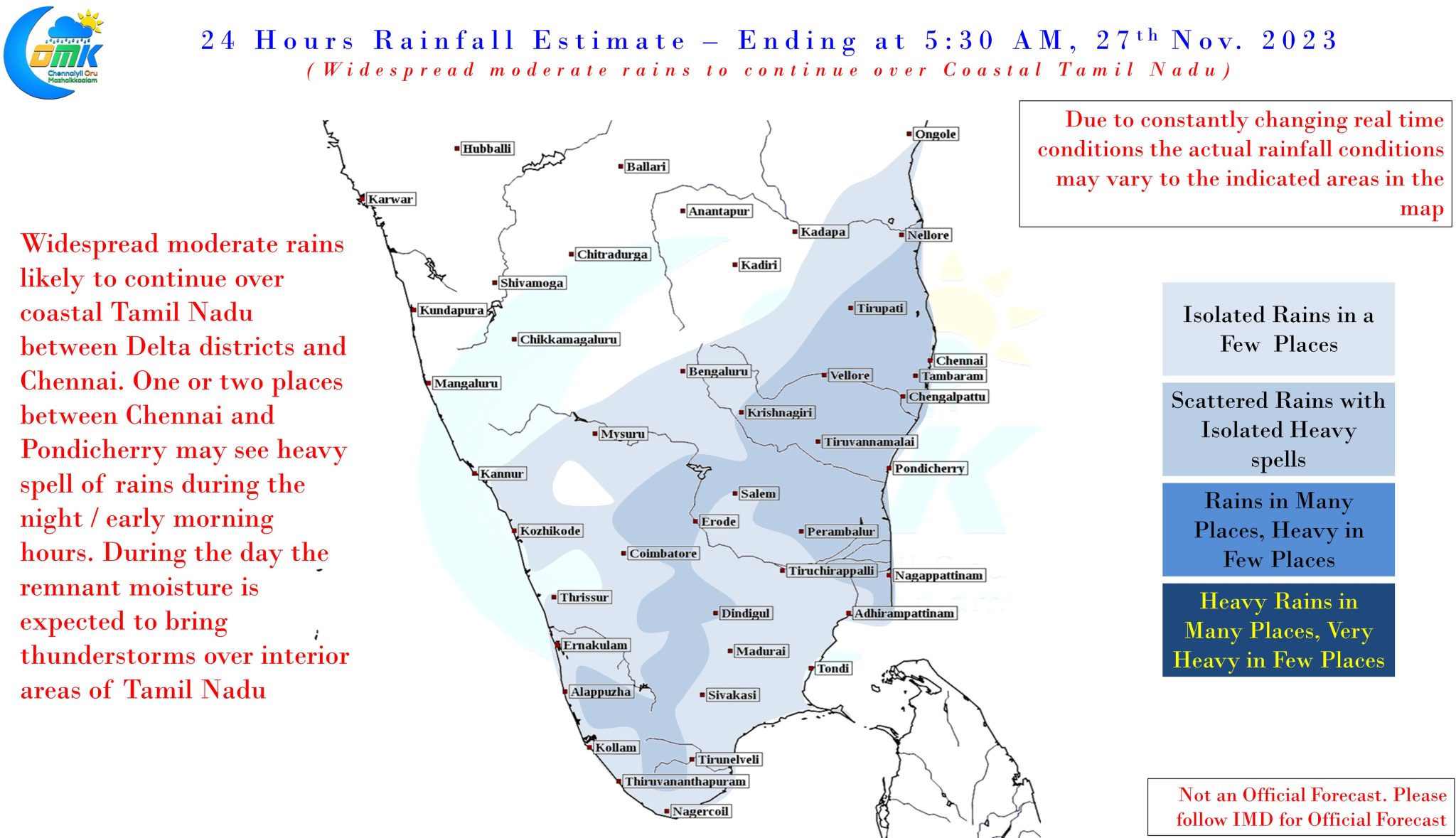
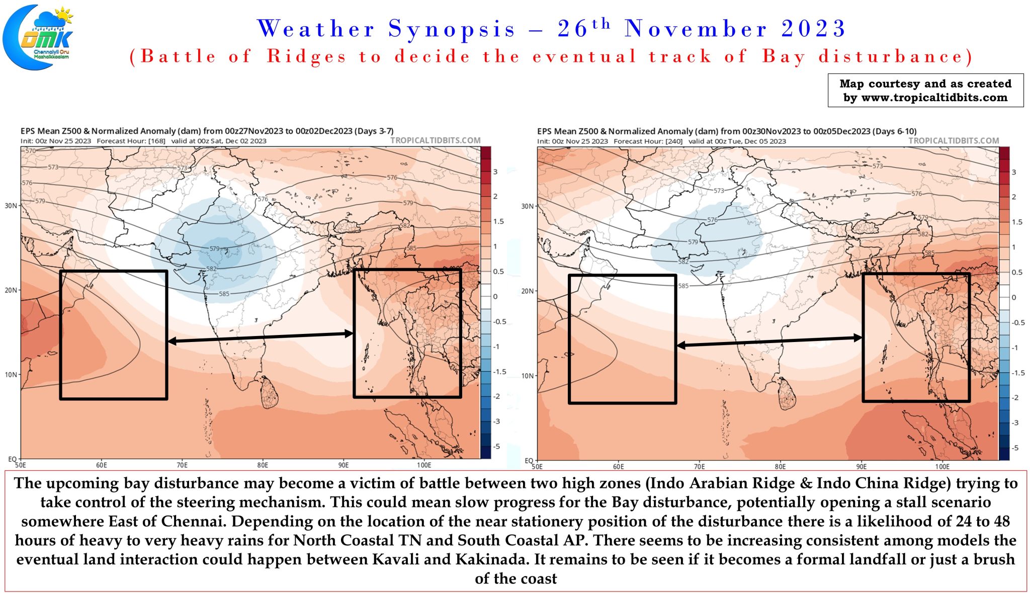
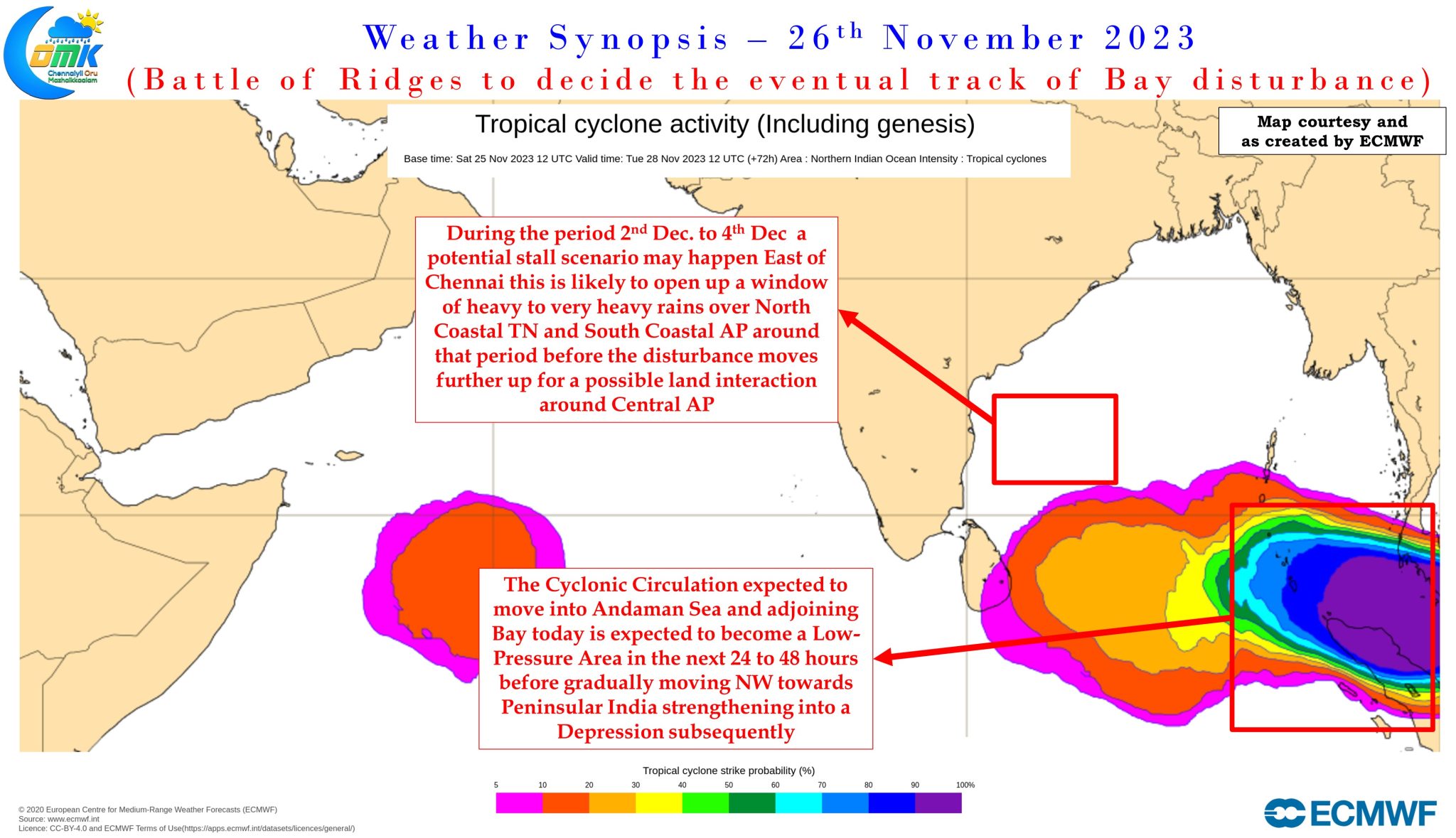
While cyclones steered by the Indo China ridge tend to take a more NW track and head North the ones steered by Indo Arab Ridge tend to take a more Westerly track with a WSW movement in the final phase and often these are the ones that stick to low latitudes. Weather models indicate the upcoming system to potentially under go a mid sea stall scenario for a 48 hour period somewhere to the East of Chennai. How close to the Peninsular Coast may decide whether North Coastal TN and South Coastal AP comes under very heavy rains or heavy rains as a stationery circulation continues to push moisture onto the Peninsular East coast.
Amidst all this flavor of the season “Mid Latitude Westerly Trough” also seems to show up to make already complex dynamics into a potential Kichadi of competing factors trying to gain control of the disturbance. There seems to be increasing consistency of a potential land interaction over Coastal AP between Kavali and Kakinada though it remains to be seen if it would be a proper landfall or just a brush of the coast like Roanu.
One in the hand is better than two in the bush goes the famous saying. While we wait for the disturbance to potentially develop into a Deep Depression / Cyclone and come close to Peninsular Coast during the first week of December rains are expected to continue over coastal areas of Tamil Nadu for the next couple of days to keep the monsoon dynamics going. Over the next 24 hours potentially one or two places between Chennai and Pondicherry could come under heavy spell of rains during the night / morning hours. As the remnant moisture moves inland interior areas of Tamil Nadu may see rains during the afternoon hours.