
This year’s Northeast Monsoon season has been swinging like a pendulum on steroids so far. If October first half saw very good thunderstorms over most parts of Tamil Nadu, readers from Chennai may beg to differ, the second half of October tapered off under the influence of two disturbances that took an unfavorable path bringing a reduction in rainfall during the crucial phase when Northeast Monsoon onset was due. The first week of November saw not only the return of rains but also a fairly active phase of Northeast Monsoon as well. Once again it was South Tamil Nadu and the interior parts of West and Central Tamil Nadu that benefitted the most from this active spell.
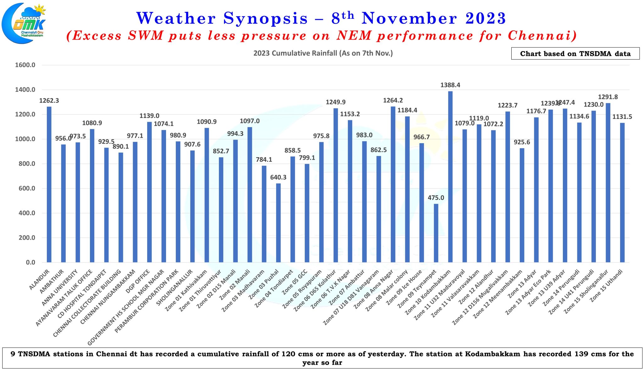
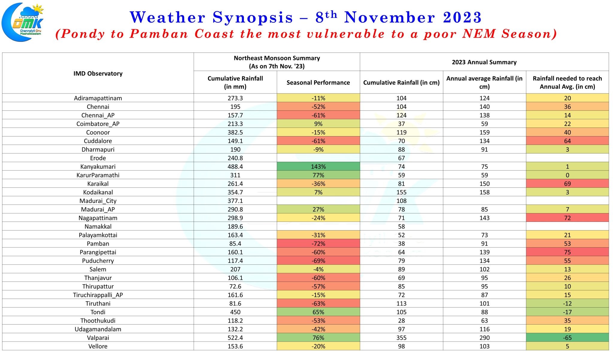
It is ironical when you see the IMD observatory at Karur Paramathi cumulatively recording more rains than not only both the IMD observatories at Chennai but pretty much every coastal observatory between Pamban and Chennai barring Tondi which has recorded 450 mm as against the 311 recorded by Karur Paramathi. While there is no doubt NEM 2023 has been poor so far, particularly to the coastal stretch, a deeper look at the annual rainfall statistics for 2023 indicate the dependence on NEM to reach the annual averages is much lesser this year compared to the past. The coastal stretch between Pondicherry and Pamban is possibly the most vulnerable to a potentially poor NEM season impacting the overall rainfall numbers for 2023. This is supported by the TNSDMA station data for Chennai district where nearly half of the observatories have recorded 1200 mm or more annually as of yesterday. As a matter of fact the GCC observatory at Kodambakkam has recorded 139 cms for the year which is just a cm lesser than the annual average for IMD Nungambakkam.
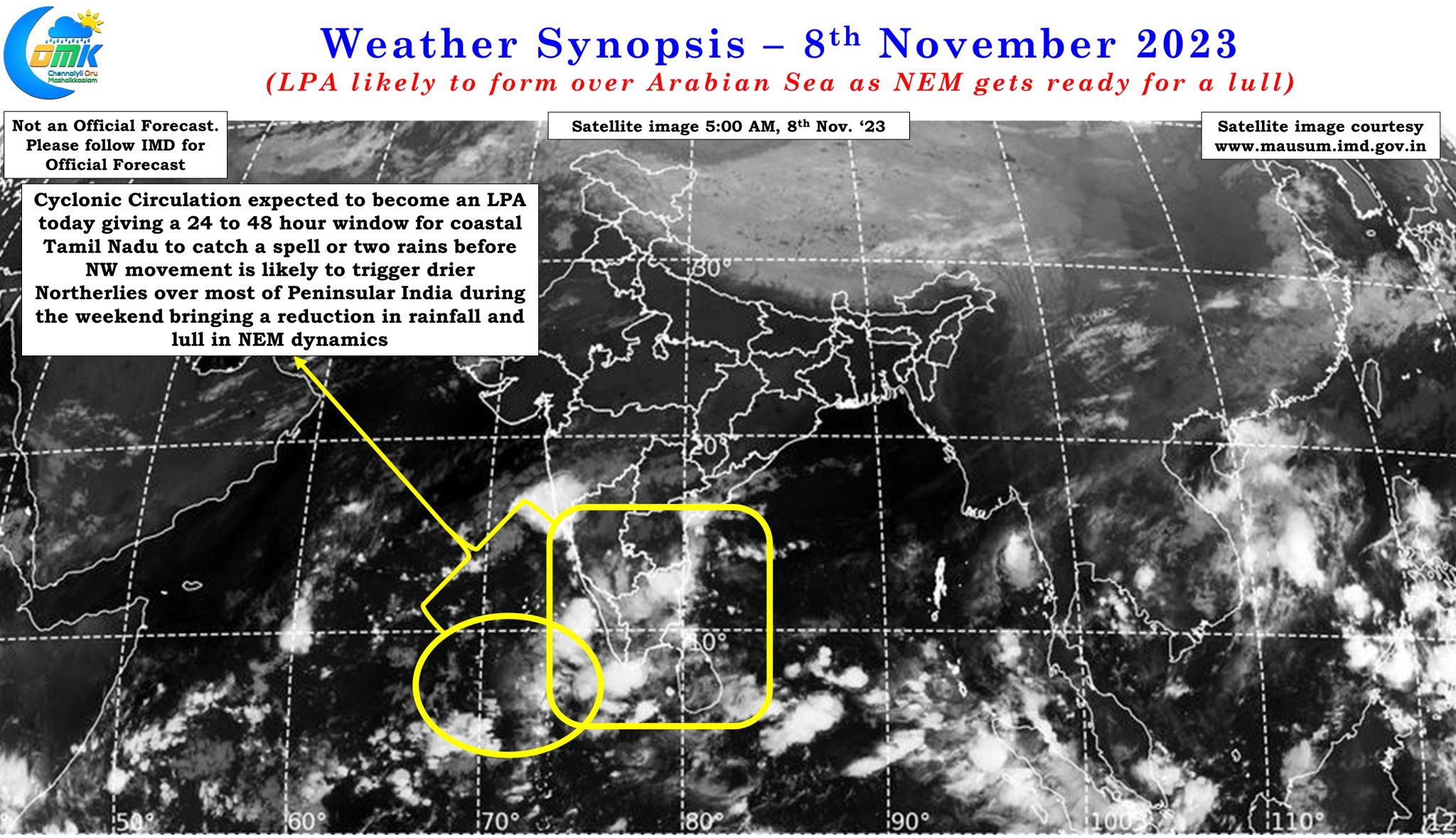
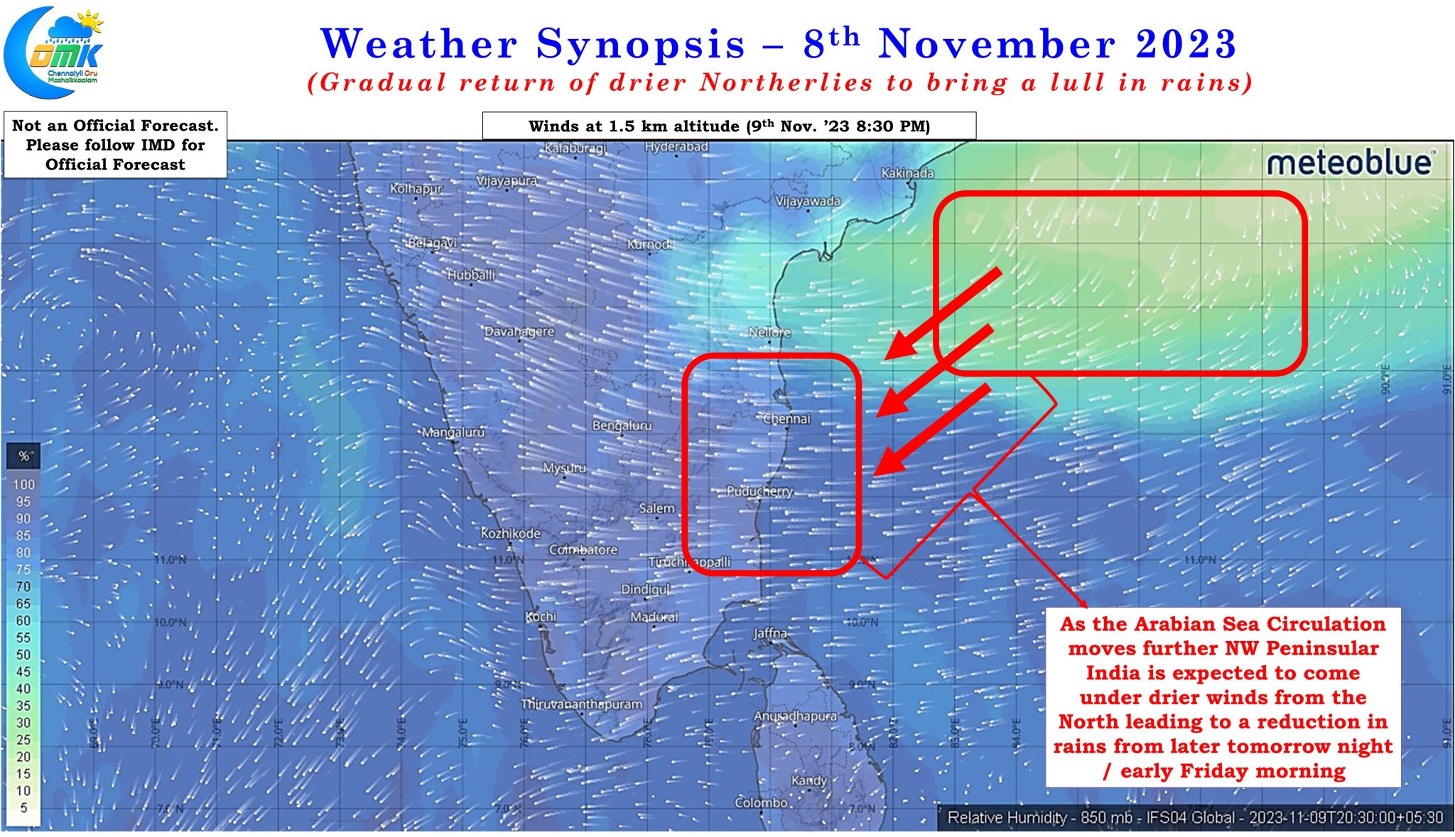
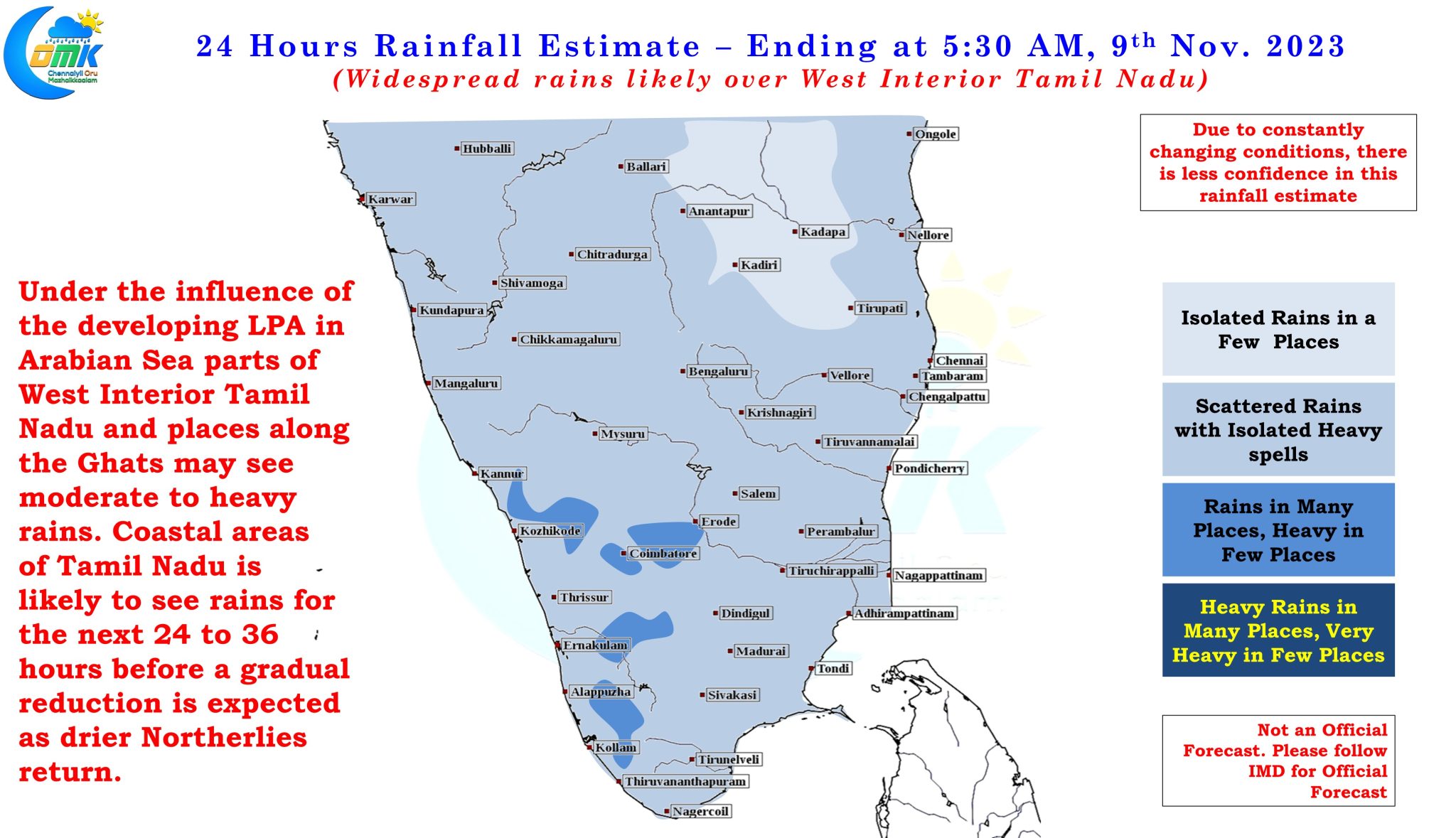
This active spell though is expected to get into a temporary lull as the cyclonic circulation over Arabian Sea is expected to deepen into an LPA today. As this LPA moves NW it is expected to trigger drier winds from North over most parts of Peninsular India bringing a gradual reduction in rains over most of Tamil Nadu except possibly South Tamil Nadu. The next 24 to 36 hours possibly is going to be the last window for coastal areas like Chennai that is struggling to see storms cross the coast and bring in the rains. This 24 to 36 hour period may benefit from slightly better steering allowing the storms to cross the coast. How much of rains actually materializes will depend on overall moisture dragged from Bay of Bengal by the disturbance.
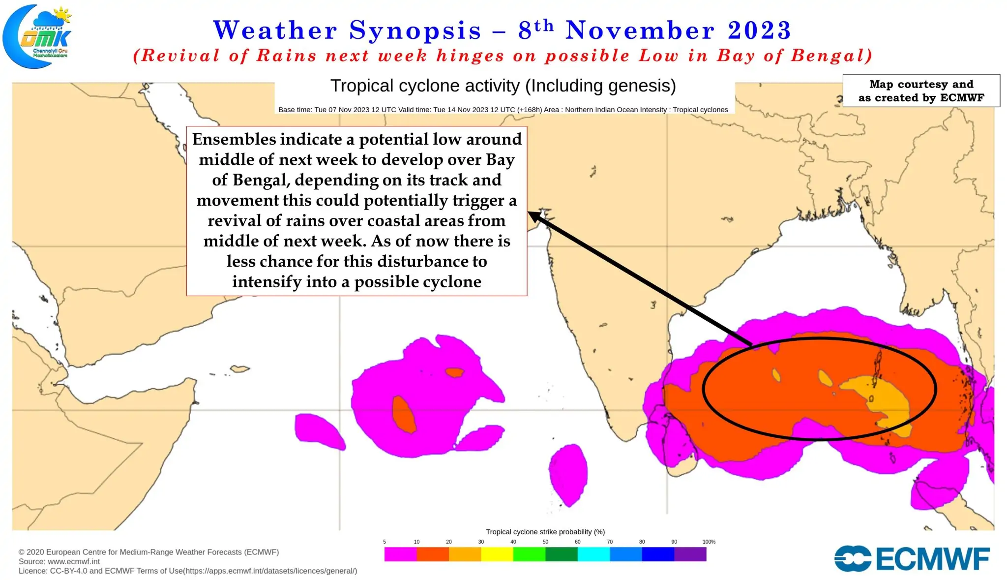
Starting from later tomorrow night or early Friday morning a gradual strengthening of drier winds from North is seen which will be associated with not only reduction in rains but a slight increase in day time conditions and foggy conditions during the morning hours. Towards middle of next week Ensembles indicate a possible Low Pressure developing from an East moving pulse into Bay of Bengal. This is likely to bring about a revival in rains over the coastal areas depending on its track and movement. As of now it appears there is less chance for this circulation to develop into a cyclone though some consensus seem to evolve on this one moving in a more NW direction towards Coastal Andhra Pradesh in the first phase. Further updates on this disturbance as things evolve.
As drier winds move in from later tomorrow / early Friday potentially one or two coastal places between Nellore and Pondicherry may come under heavy rains due to collision of dry and moist winds. This could be a narrow patch of lands and may happen based on real time wind pattern and may not always match with model estimated wind pattern.
It appears Diwali 2023 could be dry for most parts of Tamil Nadu though with Northerlies expected to dominate potentially we are heading for a drastic reduction in air quality on Diwali evening over most coastal areas of Tamil Nadu