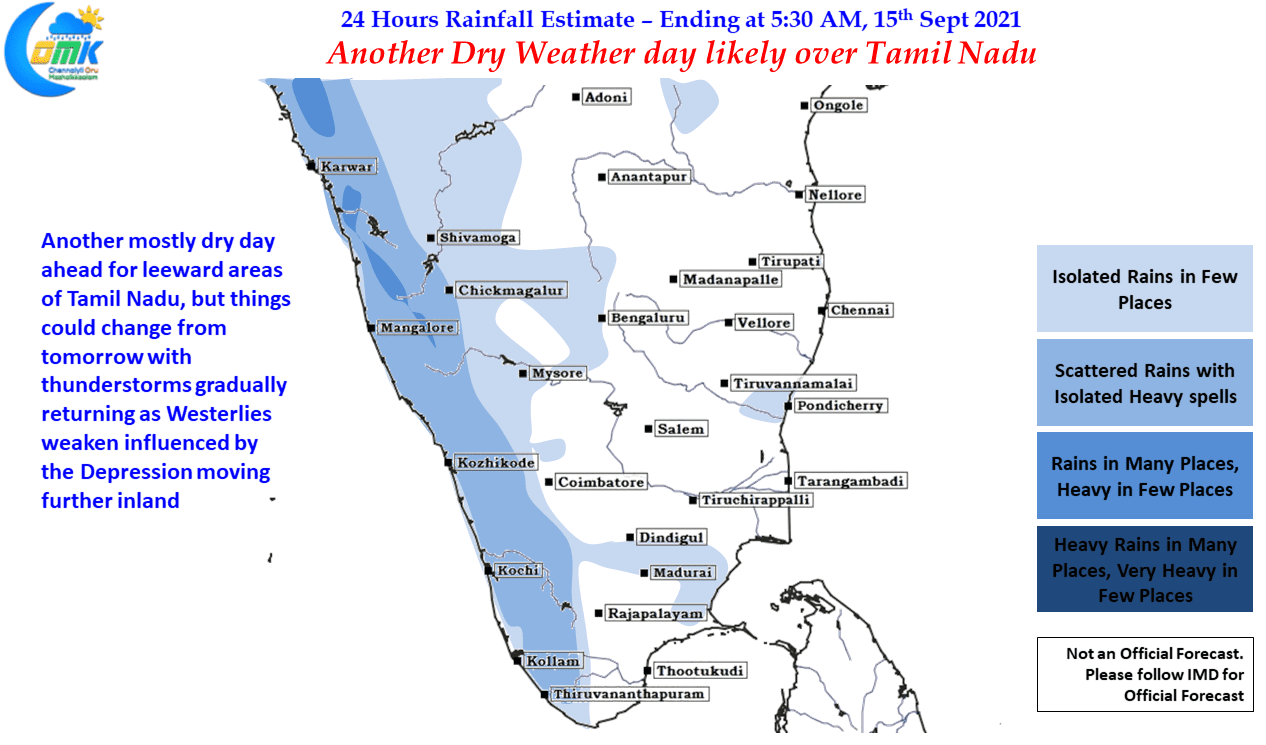
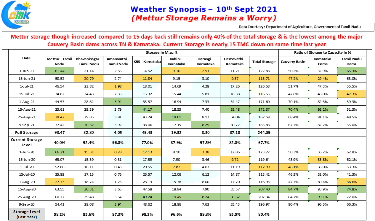
Yesterday once again showed the foolproof period for Chennai as far as thunderstorms go is just as the LPA deepens and gets ready to move inland from the Bay. While day before yesterday saw moderate to heavy rains over many places in Tamil Nadu yesterday saw action pretty much confined to Chennai & surrounding districts,…
Author: Chennaiyil Oru Mazhaikkaalam
Thunderstorms to slow down over Tamil Nadu
Models Propose & Nature Disposes is a phrase regular weather watchers around Chennai can relate very well. For the past few days Chennai & surrounding areas received moderate to heavy rains on paper, as estimated by models, but yesterday when most models expected a much quieter day southern suburbs of Chennai & adjoining areas of…
Increased Rainfall activity over West Coast
The much anticipated Low Pressure over Central Bay area is likely to develop within the next 24 hours or so bringing back some mojo back into monsoon dynamics which is currently at 9% lesser than long term average with less than 4 weeks left for the statistical Southwest Monsoon season to end. While the upcoming…
Isolated thunderstorms likely over North TN
It is often remarked the Tropics are a much more difficult proposition to give out accurate weather forecasting not only in the long term but even in the short term. A few days back there was a lot of talk on the supposedly Red Alert given by IMD for Tiruppur district. While the color coded…
Thunderstorms to continue over Tamil Nadu
Thursday turned out to be one very good day of thunderstorms over Tamil Nadu, though Chennai completely missed out, with the Salem IMD observatory recording 9 cms of rains up to 5:30 AM in the morning. The IMD observatories at Trichy, Pondicherry, Athirampattinam also recorded between 3 to 5 cms of rains during the same…


