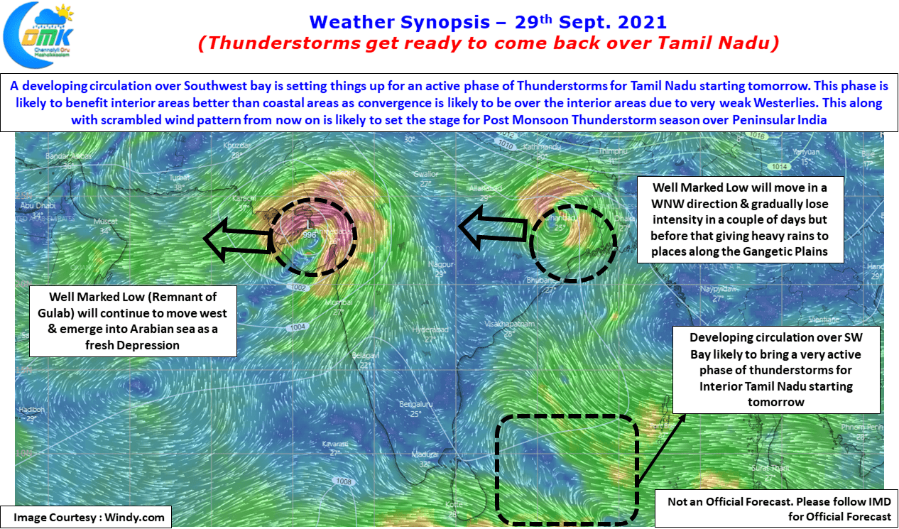
After a few days of quiet evenings over Tamil Nadu things are falling in place for the return of the daily evening Sound & Light Show triggered by Thunderstorms. The development of Cyclone Gulab & the subsequent pulse into a Well Marked Low in the North Bay meant westerlies had strengthened over Peninsular India bringing…
Author: Chennaiyil Oru Mazhaikkaalam
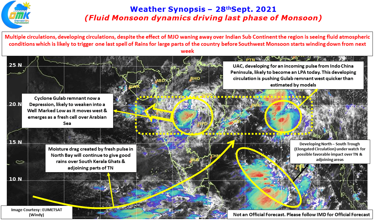
Fluid Monsoon dynamics driving last phase of Monsoon
With just 3 days left for the Southwest Monsoon statistical season to end monsoon dynamics over Indian Sub Continent looks extremely fluid with multiple circulations. On the one hand we have the remnant of Gulab meandering west over the Northern parts of Deccan Plateau as a Depression, on the other we have an impatient pulse…
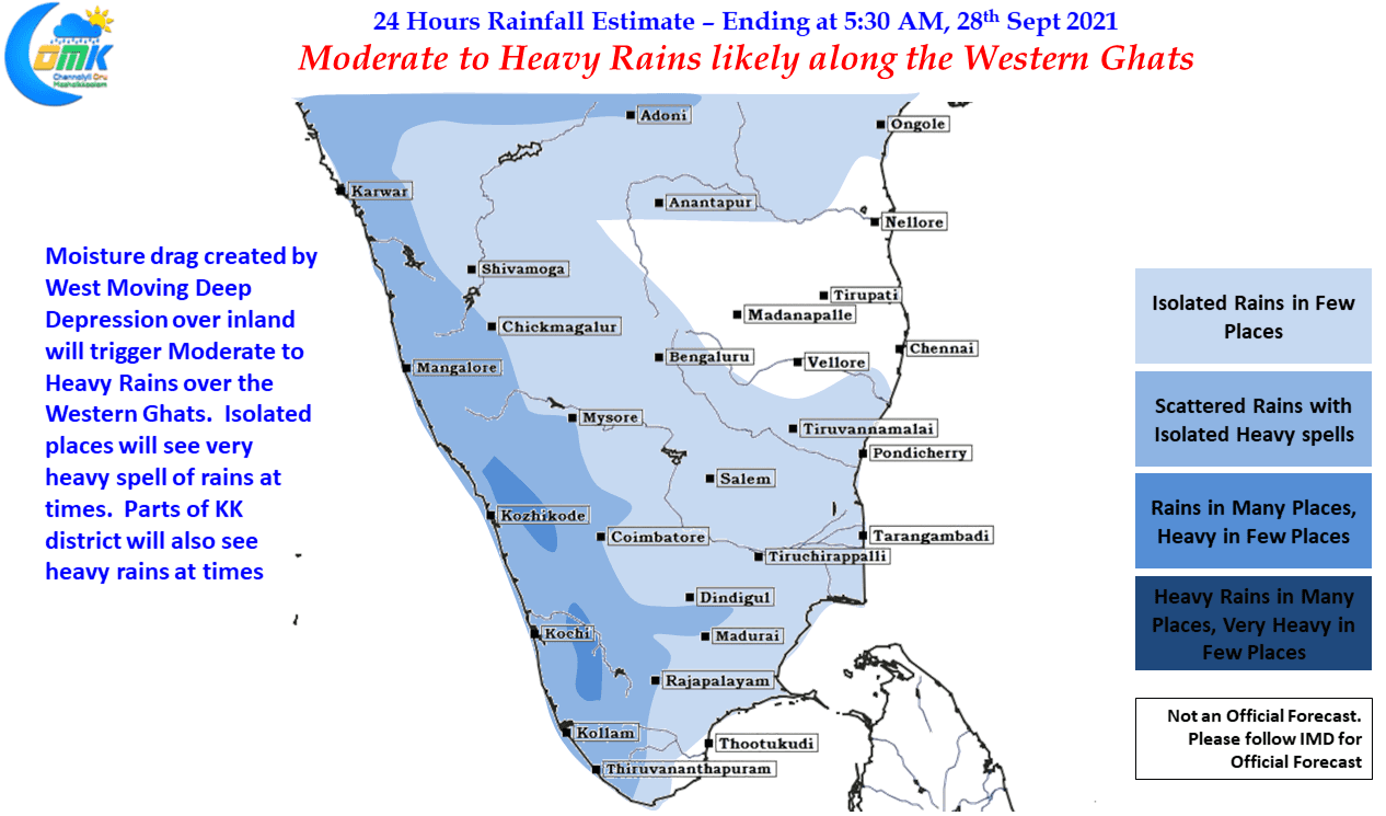
Moderate to Heavy Rains likely over the Western Ghats
Its been many days since Western Ghats, particularly over Kerala & Tamil Nadu, see sustained spell of rains typical of active Monsoon conditions. While most of August was pretty much of a wash out, September saw spells that lasted a couple of days to a few days at times with some moderate to heavy spells…
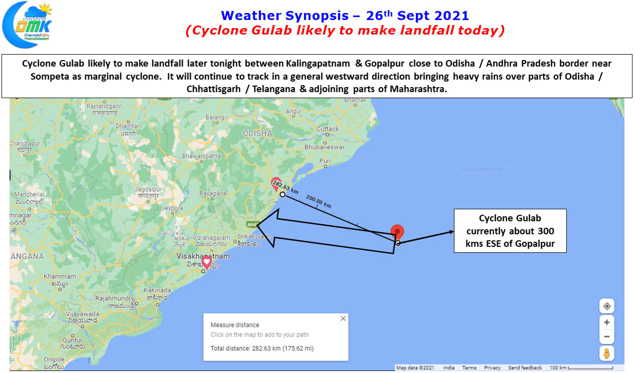
Cyclone Gulab to make landfall later today
Yesterday Gulab became the 3rd cyclone since 2000 to form in Bay of Bengal during the month of September. Not only has it taken genesis in an area similar to Cyclone Pyarr in 2005 it is also exhibiting similar track towards landfall as well. It continues to show a slightly disorganized shape which is expected…
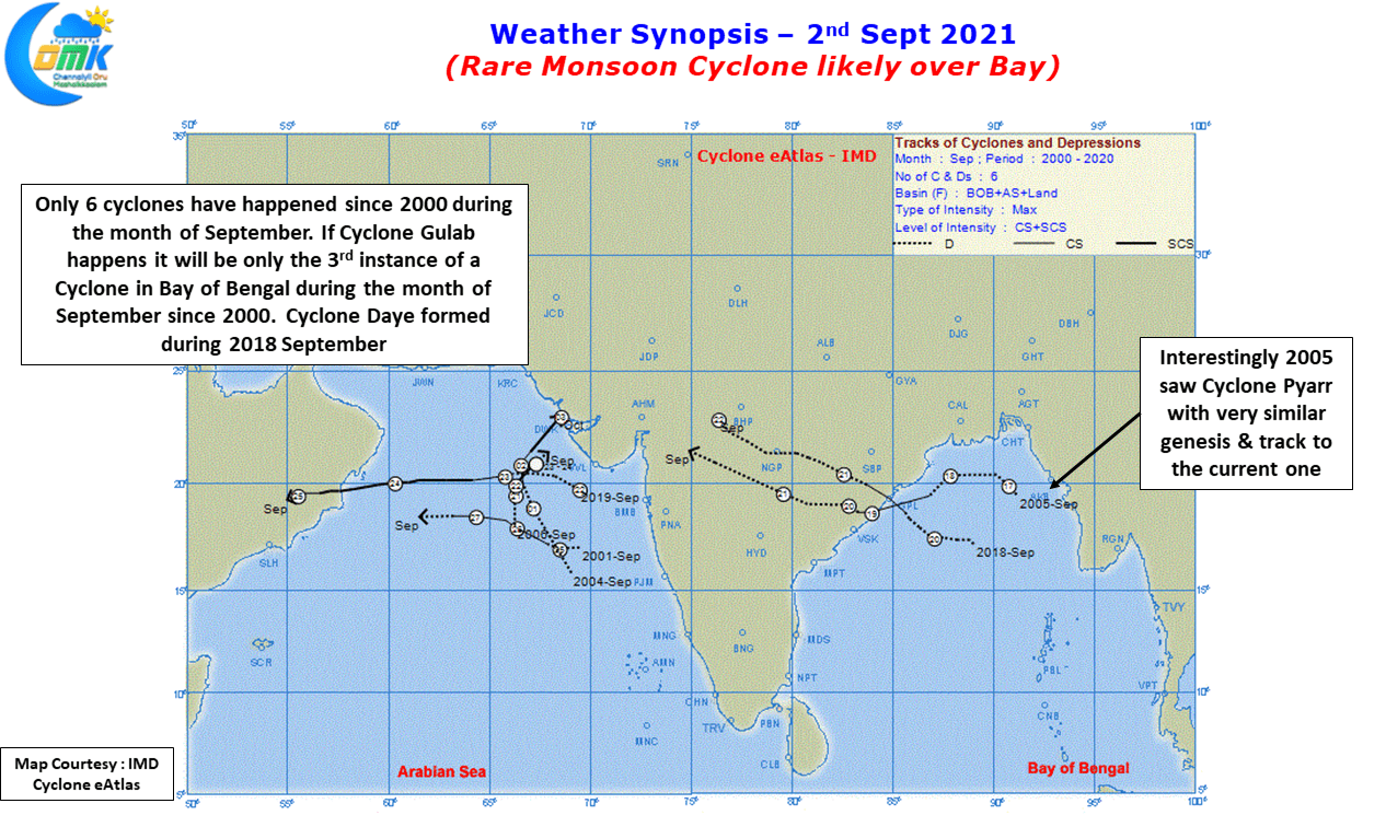
Rare Monsoon Cyclone Likely over Bay
Why Cyclones never happen during Southwest Monsoon? This is one of the earliest questions that come up in the minds of weather bloggers as they discover their interest in weather & slowly start understanding the various nuances involved with tropical weather like that of Indian Sub Continent. This question becomes relevant today in the context…