

After a few days of quiet evenings over Tamil Nadu things are falling in place for the return of the daily evening Sound & Light Show triggered by Thunderstorms. The development of Cyclone Gulab & the subsequent pulse into a Well Marked Low in the North Bay meant westerlies had strengthened over Peninsular India bringing increased rainfall activity over the west coast & the Western Ghats for the past couple of days. Simultaneously the leeward areas of Tamil Nadu saw a reduction in thunderstorm activity as well. Kanyakumari district which was reeling under a 33% deficit last week has pulled the overall deficit to about 14% after a few days of good rains influenced by the above mentioned disturbances.
The remnant of Cyclone Gulab is now lying as a Well Marked Low over West India, on its last leg before it emerges into Arabian Sea as a fresh pulse, & further move away from the Indian Sub Continent. The North bay Well marked low will continue to traverse on a similar westward path like Gulab and provide for some moderate to heavy rains over the places along the Gangetic Plains before fading away in 3 or 4 days time. Once this Well marked low completes its life cycle we can look forward to the Southwest Monsoon getting ready to bid adieu for the season. As the monsoon withdrawal starts & the associated scrambled wind pattern makes a return over Peninsular India we can look forward to post monsoon thunderstorms season to kickstart for the interior areas, some of which see their best spells of rains during the pre monsoon & post monsoon thunderstorm season.
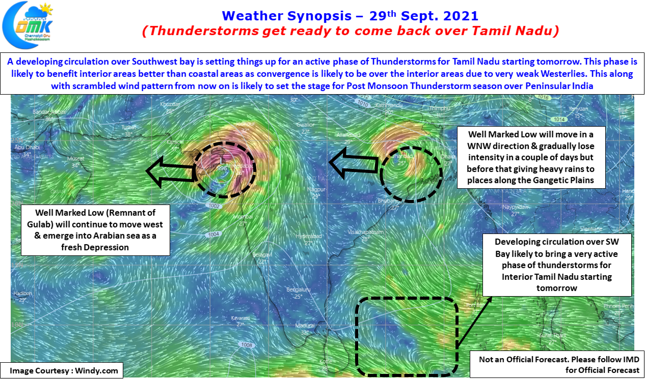
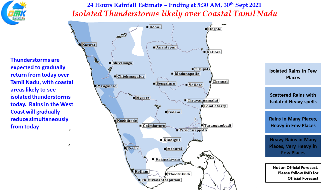
In the meanwhile before all that happens in the immediate context the one to watch out for is a developing circulation over Southwest Bay which is likely to provide for a few days of good thunderstorm activity over Tamil Nadu, particularly the interior parts of Tamil Nadu. The simultaneous weakening of westerlies will trigger a zone of wind convergence over the interior areas of Tamil Nadu providing conducive conditions for thunderstorms to develop. Compared to interior areas coastal areas may have to be satisfied with slightly lesser rains due to the weakening westerlies & the location of convergence zone. But today we could see some isolated thunderstorms along the coast while from tomorrow the activity is likely to pick up over the interior parts of Tamil Nadu.