
Yesterday Gulab became the 3rd cyclone since 2000 to form in Bay of Bengal during the month of September. Not only has it taken genesis in an area similar to Cyclone Pyarr in 2005 it is also exhibiting similar track towards landfall as well. It continues to show a slightly disorganized shape which is expected considering it is September & there is bound to be a shear impact due to the presence of Tropical Easterly Jet. This could mean Cyclone Gulab could make landfall as a marginal cyclone with not much of intensification expected between now & at the time of the landfall.
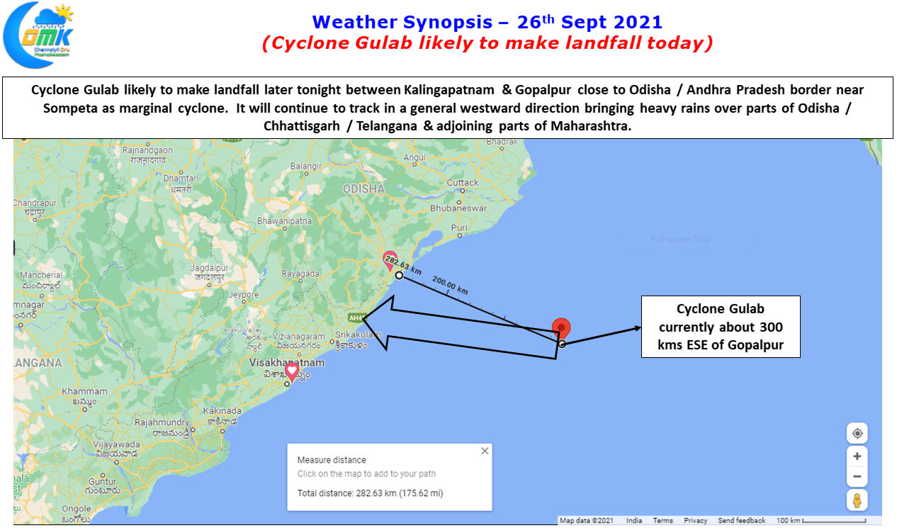
Nevertheless the cyclone is likely to trigger heavy rains over parts of Odisha, Andhra Pradesh and adjoining parts of Chhattisgarh & subsequently after landfall over Telangana & adjoining parts of Maharashtra as it moves further west. Currently lying about 300 kms to the East / Southeast of Gopalpur Cyclone Gulab is expected to take a continue its generic westward track and possibly make landfall later tonight / wee hours of tomorrow between Kalingapatnam & Gopalpur around Sompeta as a marginal cyclone and continue to track westwards after landfall as well in a slow movement.

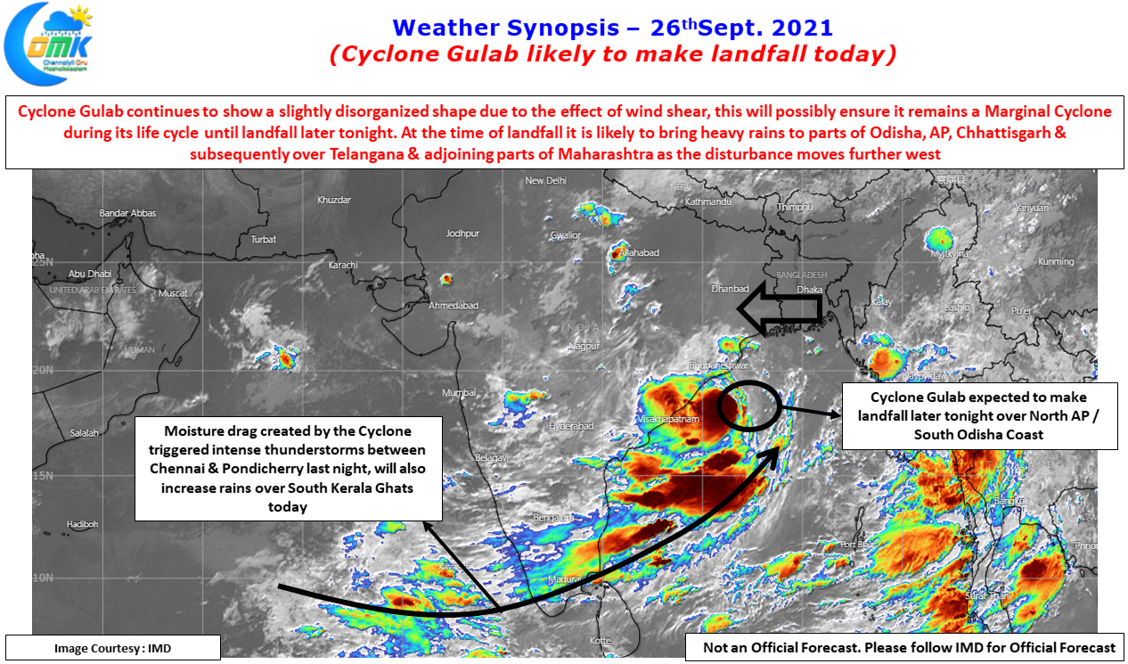
Yesterday saw parts of Coastal Tamil Nadu come under intense thunderstorms, particularly between Chennai & Pondicherry under the influence of the moisture drag created by the Cyclone. While most parts of Chennai missed out on the rains even though there were multiple thunderstorm developments around Chennai & Suburbs right from late afternoon around 2 PM the bulk of the rains happened between Mahabalipuram & Pondicherry. Marakkanam in Villuppuram dt recorded nearly 11 cms while the IMD observatory at Pondicherry recorded 6 cms of rains until today morning. Some of the southern suburbs of Chennai also got good rains from the evening storms while places along the OMR got moderate to heavy spell of rains later in the night.
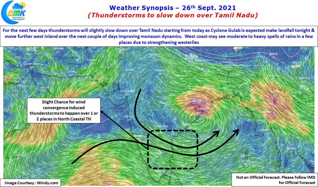
From today though thunderstorms are likely to slow down over Tamil Nadu due to the strengthening of westerlies triggered by Cyclone Gulab. This strengthening of Westerlies could also mean today we could see moderate to heavy spell of rains over the Ghats of South Kerala & adjoining areas of Tamil Nadu. While Chennai missed out on the rains yesterday, though weather models do not indicate much rains over North Coastal Tamil Nadu today, there is a slight possibility that as Cyclone Gulab moves West towards Landfall parts of North Coastal TN around Chennai & suburbs may come under wind convergence to bring one spell of rains before September winds down indicating an end to the Southwest Monsoon season.