

The last few days leeward areas of Tamil Nadu has seen thunderstorm activity slow down drastically with extremely isolated storms seen and mostly only light rains coming out of those thunderstorms. Meanwhile though places along the Ghats have seen some increased rainfall activity though except for few isolated pockets which saw heavy rains mostly it has been moderate rains in the Ghats of Tamil Nadu with the southern Ghats more or less completely missing out. It is indeed not a regular phenomenon when you have two Monsoon disturbances, deep depression over Odisha & adjoining regions and a Low over Gujarat & adjoining regions, prevailing but still no clear surge seen over the southern Ghats.
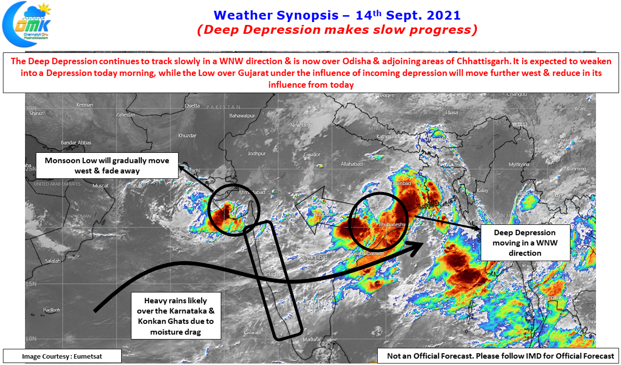
Odisha & Gujarat were two of the worst performing states, deficit since firsts week of July, is receiving heavy rains that there is a very high possibility both these states could end up getting into normal in the next couple of days time. While this could mean good news on the larger context but the devil is in the details. The movement from deficit to normal in just a few days comes with its own set of problems in the form of flooding due to extreme rainfall episodes. Places in Puri dt recorded more than 50 cms yesterday while similarly many parts of Saurashtra came under floods yesterday. Though the movement of Depression & subsequent fading away of the Low over Gujarat could give a day or so respite from heavy rains before it once again will start due to the incoming depression.
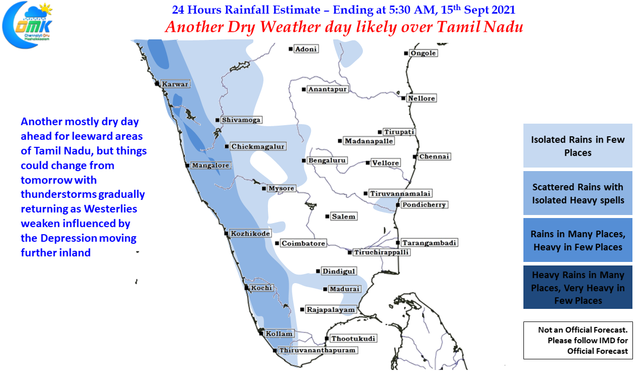
As far as Tamil Nadu goes we are likely to see another dry weather day today though with the depression moving inland we may see weakening of the Westerlies, this weakening of Westerlies could give an opportunity for the sea breeze to sneak in providing for some weak thunderstorm activity to return over leeward areas of Tamil Nadu from tomorrow. But before that we might have to bear with another hot day today.