

The Monsoon Low that was over Central Bay yesterday intensified into a Depression during the course of the day & during the early hours further intensified into a Deep Depression before making landfall over the Odisha coast at around 6:30 AM today morning. Odisha which has been under deficit pretty much for the entire monsoon season this year so far in a late flourish may end up getting into normal category in a couple of days time considering the amount of rains that has fallen over night in parts of the state. While places like Paradeep & Bhubaneswar got around 20 cms for the day till 5:30 AM in the morning, Puri recorded nearly 33 cms as heavy rains lashed the state while the Deep Depression crossed coast.
Interestingly places in the West Coast also has been seeing rains as parts of Gujarat has been receiving moderate to heavy rains under the influence of the Monsoon Low embedded to the western end of the Monsoon Trough. This Monsoon low will gradually fade in influence as the Deep Depression moves in a WNW direction over Odisha / Chhattisgarh weakening into a Depression in the next 24 hours or so. With to back to back lows taking the same track parts of Central India & in particular the western state of Gujarat may see late season flooding which is often seen during La Nina years.
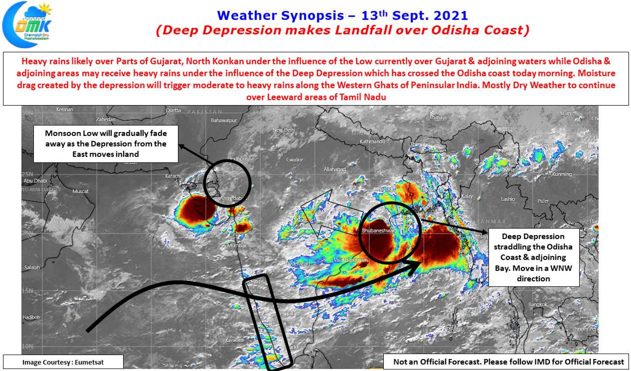
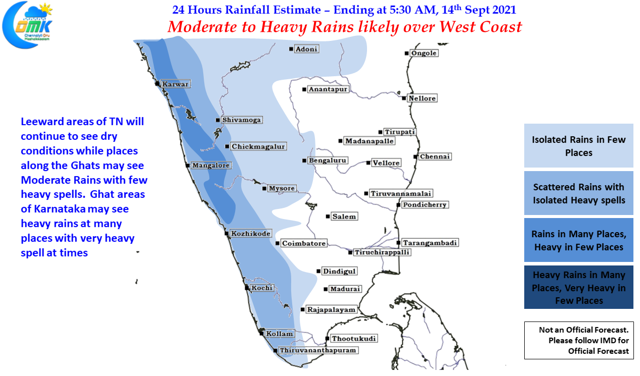
Meanwhile down south due to moisture drag created by the Deep Depression places along the Ghats may see an increase in rainfall activity with few places in Karnataka coming under heavy to very heavy spells while moderate to heavy rains may be seen in the Ghats of Kerala & Tamil Nadu. Kanyakumari dt which has been seeing subdued monsoon this year could see some rains today like yesterday with rest of the state mostly remaining dry.