

Among the weather bloggers there is always a point of view, the Indian Ocean, particularly the Bay of Bengal is the younger brother of the might West Pacific. Time to time like every caring elder brother who takes care of his younger sibling the West Pacific also takes care of the Bay. While the elder brother has all the strength in the world thanks to the large expansive ocean he is, the younger brother being a closed basin at times needs some support from his elder brother to show case himself which on most monsoons, whether Southwest or Northeast, the elder brother obliges.
Occasionally when the West Pacific decides to be little selfish he behaves cranky in the form of NE recurving Typhoons giving next to nothing support to Bay of Bengal. Last years was slightly below normal with West Pacific seeing lesser than average typhoons. On both these occasions there is some impact over Bay in the form of lesser pulse from South China Sea to Bay of Bengal. Being a closed basin the Bay of Bengal can generate energy of its own only to certain extent. This was one of the reason why August 2021 saw a poor performance with not much help from West Pacific coming into Bay of Bengal. Similarly even during Northeast Monsoon time Bay of Bengal gets benefit from pulses moving in from South China Sea.
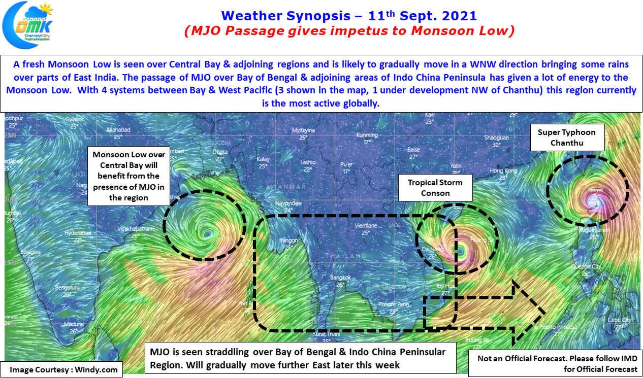

This year unfavorable MJO passage also was a reason why August was poor overall for Southwest Monsoon season. Currently the MJO is seen straddling the Bay of Bengal & adjoining west Maritime continent areas. This is likely to provide impetus to the Monsoon Low which is forming in Central Bay. The result of support from MJO will mean it is likely to become a Monsoon Depression as it heads towards East India & adjoining areas of Gangetic Plains . In the meanwhile mostly dry weather is likely to continue over Tamil Nadu with rains restricted to along the Ghats. Parts of Western Ghats in Karnataka may see heavy rains in a few places.