
அகழ்வாரைத் தாங்கும் நிலம்போலத் தம்மை
அதிகாரம்:பொறையுடைமை குறள் எண்:151
இகழ்வார்ப் பொறுத்தல் தலை
Weather blogging is a hobby that teaches one to develop a lot of patience. On the one hand we have no control on the various forecasts put out by models on the other nature runs at its own pace and does not change because humans want it. Over time we have seen rains not turn up when the farmers desperately look out for it and in the same context rains do not stop when we want it to stop either. So in a way this particular quote from கீதாசரம் becomes relevant. At times as weather bloggers our responsibility lies in trying to develop a keen understanding on what is happening and aim to provide a clear inference on what to expect without a bias.
எது நடந்ததோ, அது நன்றாகவே நடந்தது
எது நடக்கிறதோ, அது நன்றாகவே நடக்கிறது
எது நடக்க இருக்கிறதோ,
அதுவும் நன்றாகவே நடக்கும்
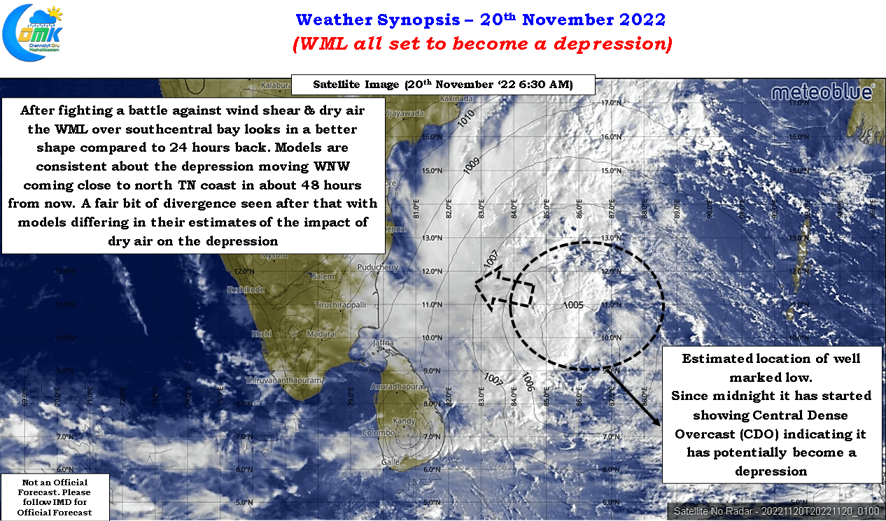
The current well marked low pretty much sums once again why we have to wait for things to evolve. After a struggle that lasted more than 48 hours not only against sustained unfavorable wind shear but also competing vortices within it that tried to take control of the overall circulation finally we are seeing a fair bit of consolidation. In a way the diurnal effect of warm oceans during the nights have also played a role in enhancing the convection around the center thereby improving the overall dynamics of the well marked low that is already showing characteristics of a depression including a developing Central Dense Overcast (CDO). Satellite images not only show a developing CDO but also a flaring up of convective clusters indicating a bout of intensification happening with the disturbance. Without ignoring the overall condition which continues to remain unfavorable for this system to undergo massive intensification we should at no point ignore the risk this “Depression to be” is likely to be over coastal stretches of peninsular India. The wind shear is expected to remain unfavorable right through its life cycle with dry winds still persisting over peninsular India.
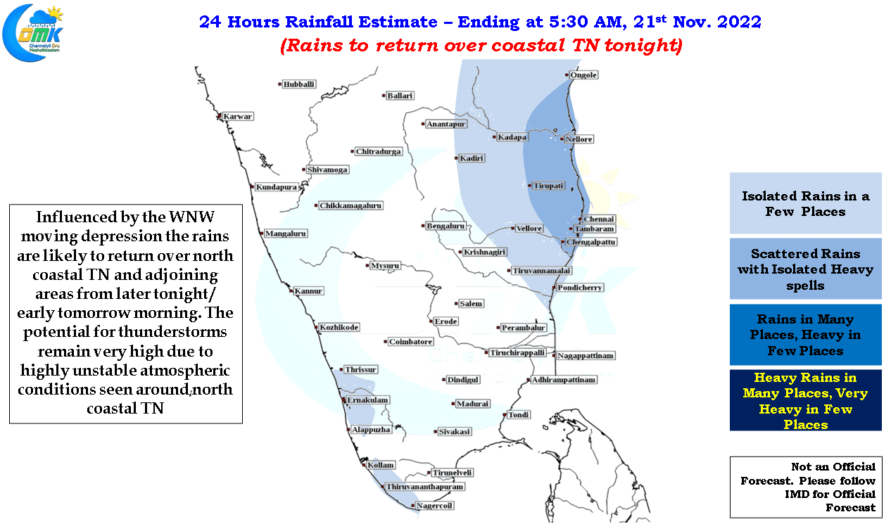
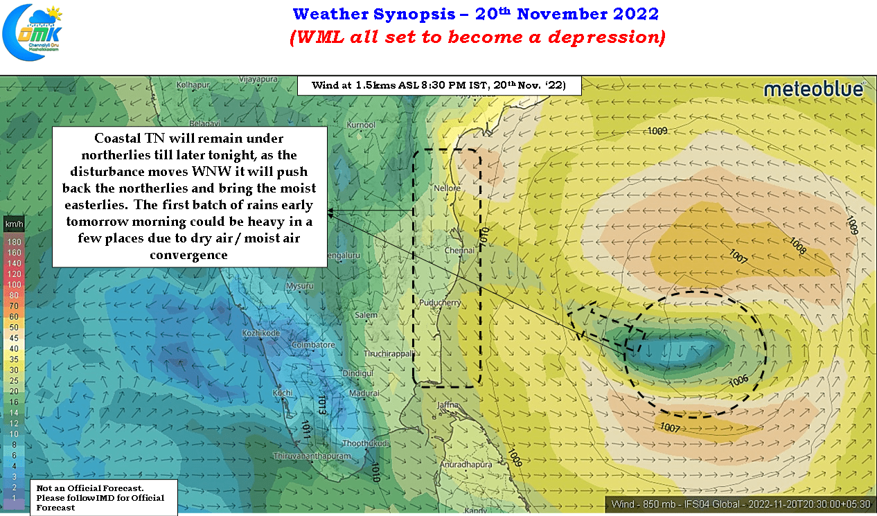
In a way this persisting dry winds along the coast of Tamil Nadu and South AP is likely to provide a bit of an unknown element as well when the first batch of rains start hitting the coast later tonight or early tomorrow morning. The dry conditions since Tuesday over these regions along with clear case of converging fronts of different air masses, dry northerlies & moist easterlies, may mean one or two places could end up getting a very heavy burst of rains.
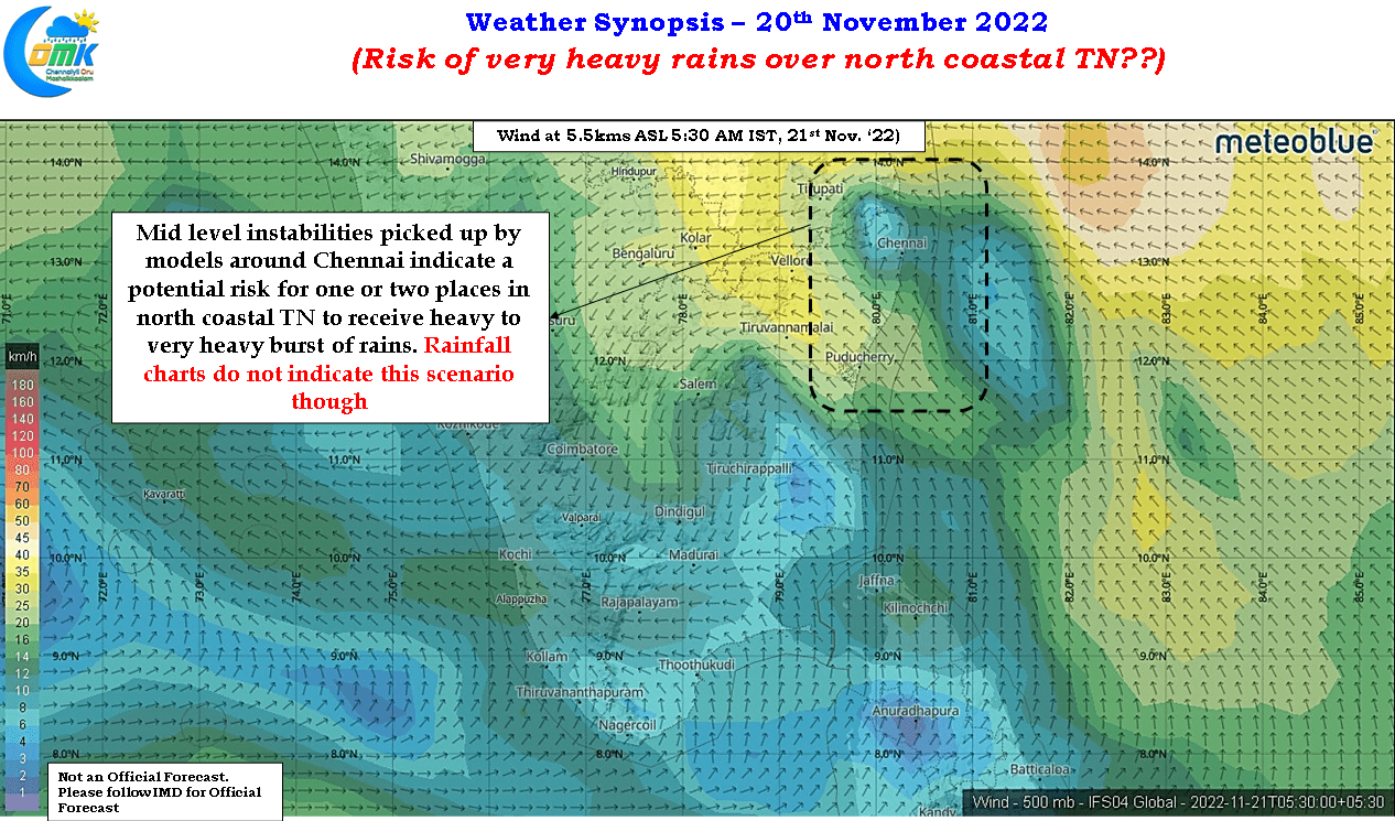
While precipitation outlook are not showing any instance of very heavy spell of rains happening tonight or early tomorrow morning, looking at the wind chart we may have to be wary of one or two places around north coastal TN may come under a burst of heavy to very heavy rains when the moist winds from the east push the dry air away. Mid level instability shown in some of the models around Chennai also indicate this risk should not be ignored.
While overall the rains are expected to return over north coastal TN from later tonight / early tomorrow morning Monday and Tuesday promises to be days with widespread rains across the coast. Interestingly there exists a fair bit of divergence among models once the depression gets closer to the TN coast in about 48 hours from now leading to diverging rainfall estimates from models. Some models seem to bring the weakened circulation in a WSW movement from here while some continue to take it in a WNW movement. This subtle change in the track is the reason for diverging rainfall estimates from models but overall the stretch between Marakkanam to Nellore needs to remain wary for widespread rains from this depression while places between Marakkanam to Delta should also keep a close watch.