
Many a times it is often remarked by the weather bloggers of Chennai. Monsoon is a word and NEM is an emotion. Without doubts NEM must be single largest reason for hair fall among the weather bloggers Chennai as they grow older chasing thunderstorms and cyclones. Monsoon depressions during SWM more or less travel on a set path governed by the location of a large monsoon trough which extends all the way from Pakistan and adjoining areas of Rajasthan to Bay of Bengal or in some cases Northeast India and further onto Indo China Peninsular region. Once the LPA has its genesis more often than not it travels under the protection of the monsoon trough acting like a cocoon.
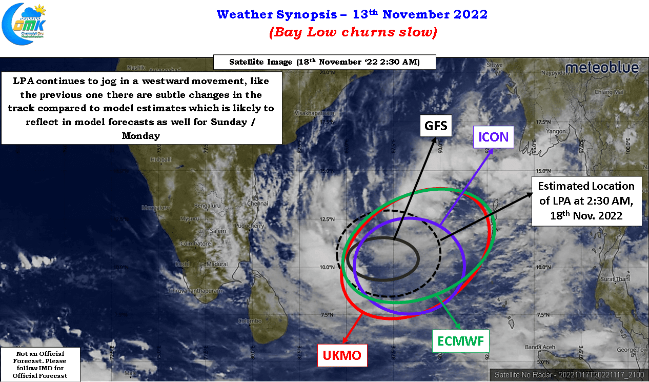
But when it comes to Northeast Monsoon the dynamics completely change in the absence of large scale dynamics consequent to the seasonal shift towards austral summer. This brings forth factors like semi permanent sub tropical ridges that get parked at various locations over the mid latitudes and become the steering mechanisms for any disturbances that evolve over the north Indian ocean basin. Additionally unlike pretty much all the other basins the north Indian ocean basin is a closed basin bringing forth different challenges to weather models. More often than not they struggle to pick the trend correctly during the early stages of the life cycle of a disturbance. Even in the current case a look at the satellite image suggest diverging forecasts from models and most still struggling to pick up the right conditions.
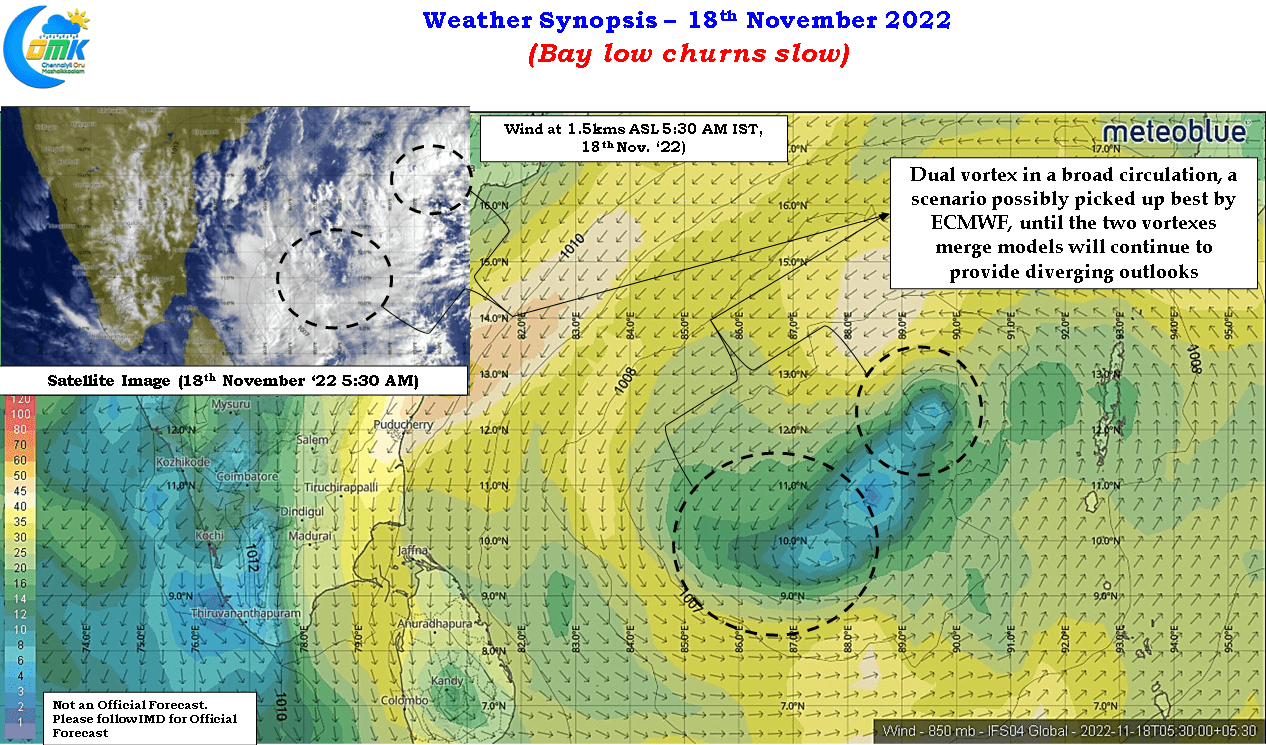
Similarly except for ECMWF most other models seem to have missed out on the multiple vortices within a broad circulation. Whenever multiple vortices spin around in a broad circulation there will be some delay in consolidation by the LPA as the competing vortices try to establish their dominance before strengthening by absorbing the energy from the vanquished one. While the last week disturbance saw the one to the west set the template contrary to what models estimated in the current one it seems the one to the west could set the template. In a way this competing vortex scenario is what has brought about diverging tracks and intensities among model outlooks.
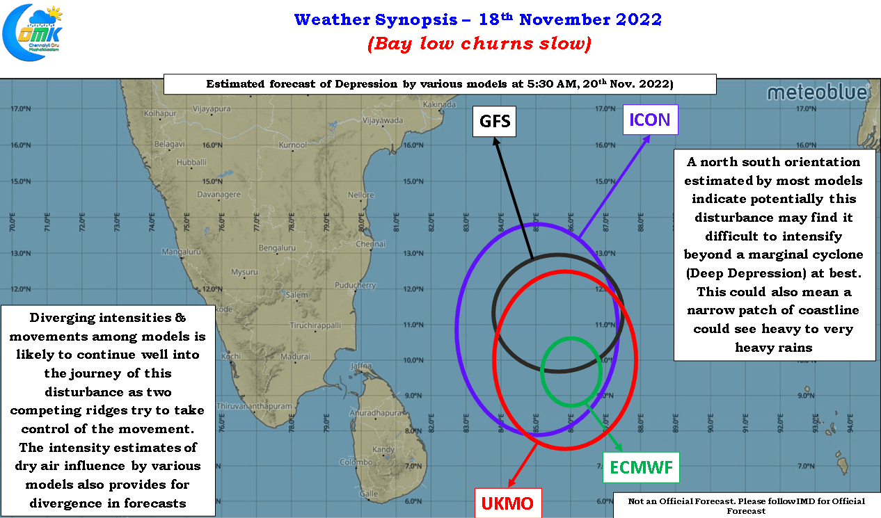
Over the course of the next 24 to 48 hours as the dominant vortex gets established, to the east of the broad circulation we may slowly see models align in terms of not only the potential movement. Nevertheless we still have the “elephant in the room” to be addressed. Dry air will continue to remain an influencing factor and this is possibly confirmed by the north – south alignment of the circulation indicating potentially a lopsided circulation that may not strengthen beyond a marginal cyclone (Deep Depression). But the risk of rains will continue to persist with the north – south alignment in a way confirming a narrow patch of coastal areas may see heavy to very heavy rains due to highly volatile conditions.
While there is still some divergence among the models on which coastal area may fall under this highly volatile zone it may be prudent for the stretch between Pondicherry and Nellore to remain cautious on the rainfall prospects. Once some bit of consolidation happens to the circulation there will be better clarity on the impact zone and intensity of rains as well. Till then fingers crossed