
போற்றுபவர் போற்றட்டும் புழுதி வாரித்
கவியரசர் கண்ணதாசன்
தூற்றுபவர் தூற்றட்டும் தொடர்ந்து செல்வேன்;
ஏற்றதொரு கருத்தை என து உள்ளம் என்றால்
எடுத்துரைப்பேன்? எவர் வரினும் நில்லேன் அஞ்சேன்
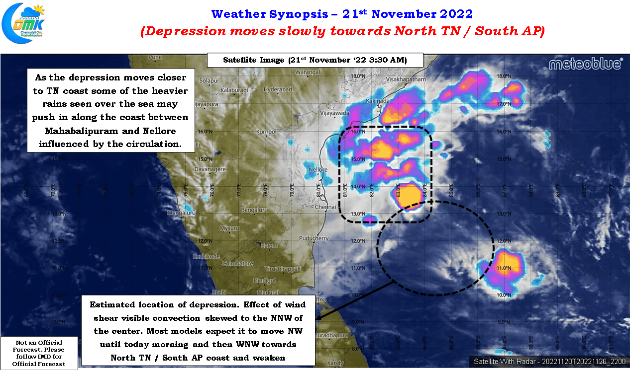
The depression over southwest Bay of Bengal continues to move slowly towards north Tamil Nadu coast. Situated roughly about 500 kms to the southeast of Chennai and about 525 kms ENE of Karaikal the effect of wind shear is visible in the satellite images though a few very intense convective clusters to the NW of the center indicate the depression continues to fight against unfavorable elements as it has been right through its life cycle so far. In a way the depression resembles the ebbs and flows of a high voltage T20 cricket match with phases within the game going back and forth between the two teams.
It is also important to point out here that the weather models have been showing divergent scenarios right thought its life cycle indicating how tough it has been for even some of the most powerful super computers in the planet let alone weather bloggers. Numerical weather models continue to show the heaviest rains to fall just off the coast between Mahabalipuram and Sriharikota when the depression comes close to the coast of north TN, roughly about 200 kms to the east of Chennai. While most models are in alignment up to this point including possible weakening just as it nears the coast. Additionally models are in sync about potentially this depression / well marked low staying in a near stationary position roughly about 200 kms east of Chennai.
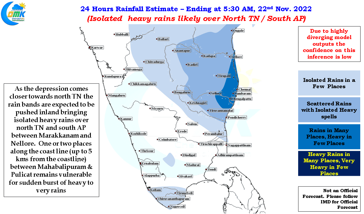
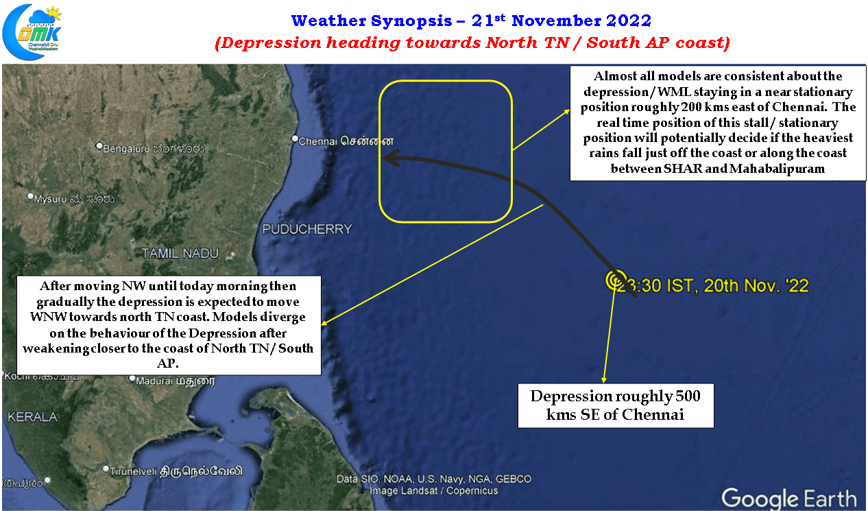
Models once again start to diverge from here with some expecting the disturbance to take a WNW track while a few push the weakened circulation in a WSW track towards Central / South TN. With such complex scenarios being put out by weather models it is very tough to provide for one single and simple to understand inference on what to expect. The period between later today and tomorrow morning when most models are consistent about a potential near stationary position to the East of Chennai we may have to track in real time basis if the heaviest rains fall just off the coast as weather models indicate or they fall along the coastline bringing one or two places between Mahabalipuram and Sriharikota come under heavy to very heavy spell of rains.
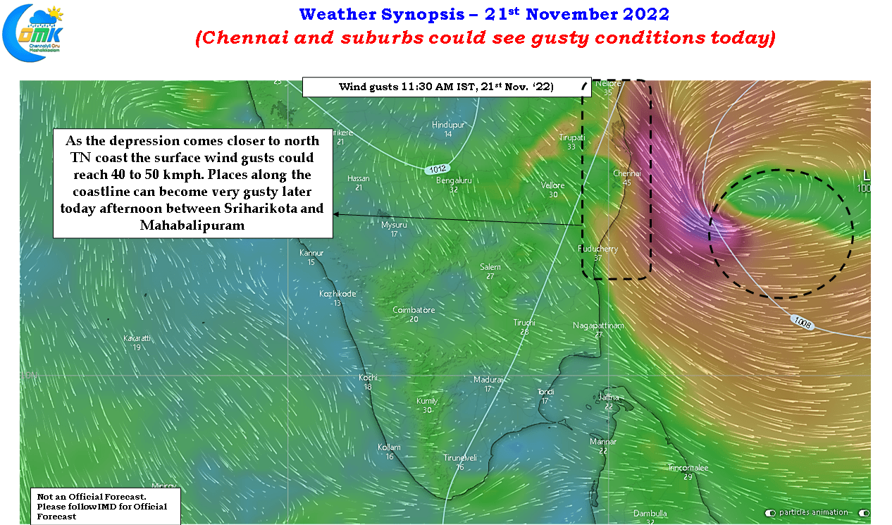
As for Chennai it could be anything between cloudy skies with சாரல் மழை or heavy to very heavy spell of rains later today as the depression comes closer to north TN Coast. The card nature deals to us is not in our hands so it is time to enjoy what ever card nature deals us today whether it is a joker or an ace only time can tell. Irrespective of what happens with the rains Chennai and suburbs could see gusty conditions with wind gusts potentially reaching up to 40 – 50 km/h as the depression comes closer towards the coast