
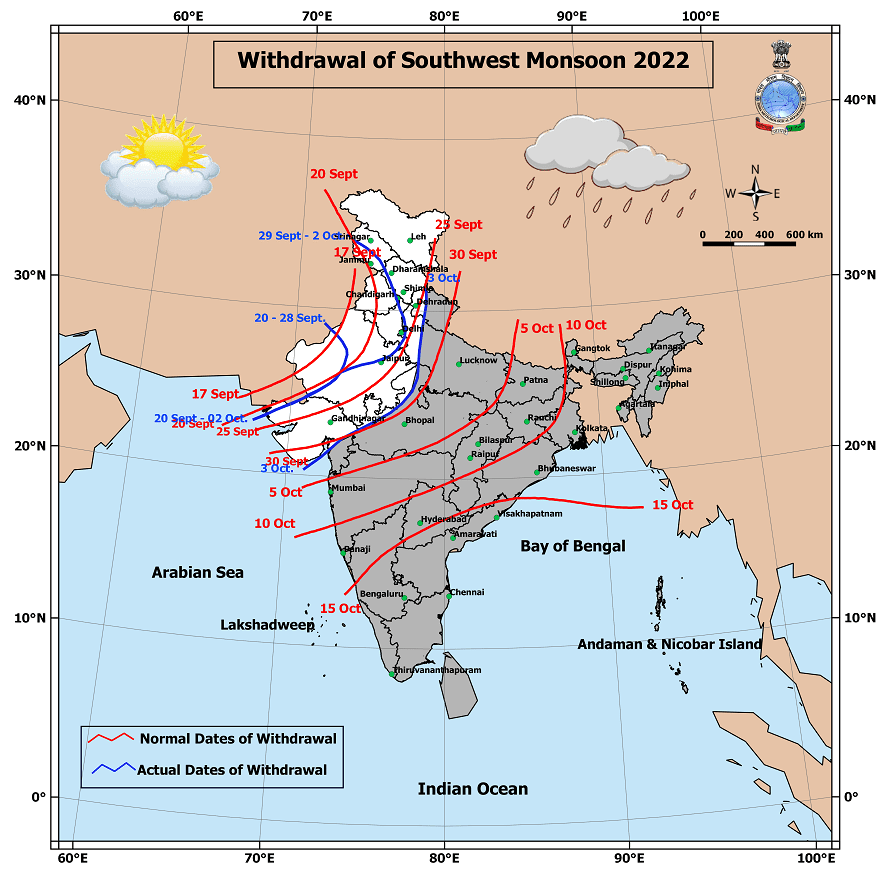
IMD announced further withdrawal of Southwest Monsoon from more parts of Northwest India yesterday. The monsoon has now withdrawn over all of Rajasthan, Punjab, Haryana, Delhi, Himachal Pradesh, Jammu & Kashmir and Ladakh while withdrawing over most parts of Gujarat as well. The next few days though we might see very slow withdrawal as monsoon dynamics will continue over rest of the Indian sub continent under the influence of favorable circulations.
As a weather blogger the period between October – December is not only the most anticipated but also the most stressful. On the one hand you start looking for signs in long range models on possible performance of Northeast Monsoon which is the most critical period for most parts of Tamil Nadu in terms of overall rains. On the other hand you cannot ignore the transition dynamics because there are parts of Tamil Nadu like areas in West and Northwest TN which look forward to the two transition seasons “West to East” and “East to West” which bring the best rains through thunderstorms to these areas. These areas typically miss out on both Northeast Monsoon and Southwest Monsoon and primarily owe the bulk of their rainfall to these transition thunderstorms.
Northeast Monsoon to a great extent owes its performance to the support provided by not only synoptic disturbances but also favorable transition of tropical waves. Weather bloggers cannot afford to miss out short term dyanamics while continuing to set their sights on long term dynamics for overall monsoon performance. The time taken for tropical waves to complete their cycles also bring forth sweet spots for Northeast Monsoon as well. In a way this need for support from tropical waves during the sweet spots has brought about a thought among weather bloggers to expect waves like MJO to favorably influence North Indian Ocean during November coinciding with the rainiest period of the Monsoon.
Over the past couple of years though MJO has not been doing the global circuit often, particularly during the last quadrimester, throwing many of the long range model outputs into the dustbin which often tend to behave in the traditional manner as far as long term dyanamics go. It is in this context crystal gazing becomes complex during the last quater of the year. Keeping this in mind we will continue to stay focussed on short term and medium term as of now.
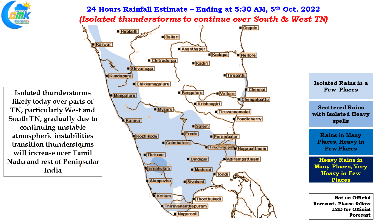
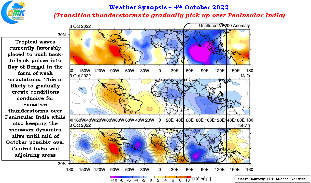
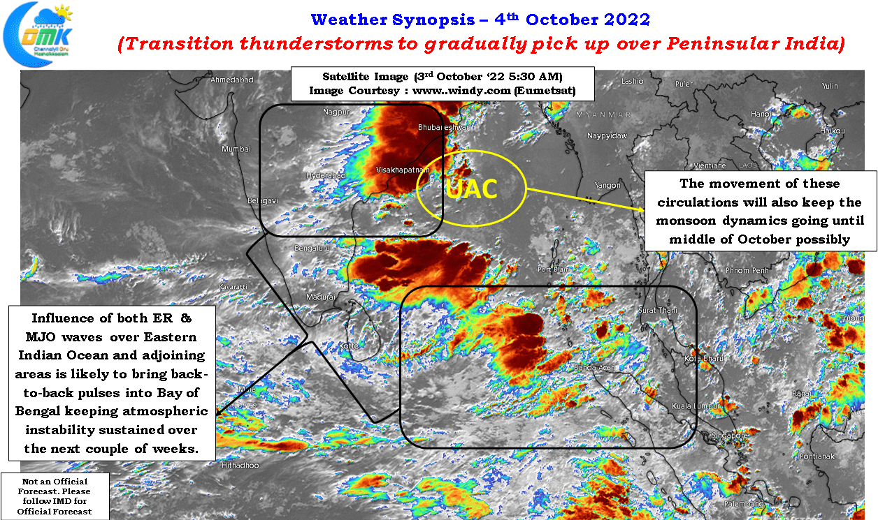
Weather charts indicate the favorable influence of tropical waves over the Eastern parts of Indian Ocean and adjoining areas. This is likely to make conditions conducive for back to back circulations to move into Bay of Bengal though considering the current state of MJO in all probability these pulses will remain weak thereby making it conducive for transition thunderstorms to pick up over Peninsular India. This augurs well for many parts of Tamil Nadu with even coastal places like Chennai coming under a spell or two of rains while providing for interior areas to benefit from transition thunderstorms. This spell of back to back pulses could be a blessing in disguise in the event Northeast Monsoon makes a weak onset during the fag end of October.
But as mentioned above we will cross one week at a time as of now considering the noise currently seen over most long range weather model outputs