
On the back of a fading El Nino, North and South India have been seeing a contrasting pattern of weather. A late season spurt in westerly troughs have not only meant good spells of rains on a regular basis for many parts of North and Central India but also a delay in conditions turning from spring to summer as temperatures stayed below normal on most occasions during day time while cloudy skies on most days have meant nights have been slightly warmer than normal. March so far has not been any different with the second week seeing a strong westerly trough that dipped into parts of Peninsular India to bring about rains over many parts of the Indian Sub continent.
Peninsular India though since the turn of 2024 has been seeing warmer than normal temperatures. While January saw mild winter conditions with night time temperatures remaining warmer than normal as we got into February the day time temperatures started to become hotter than normal leading to early arrival of summer like conditions over pockets of Peninsular India. As we got into March places in Rayalaseema started to see a spike in temperatures with the IMD observatory at Anantapur recording 40°C or more for nearly 15 days so far in March.
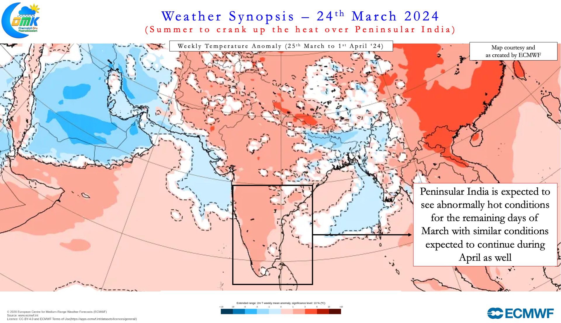
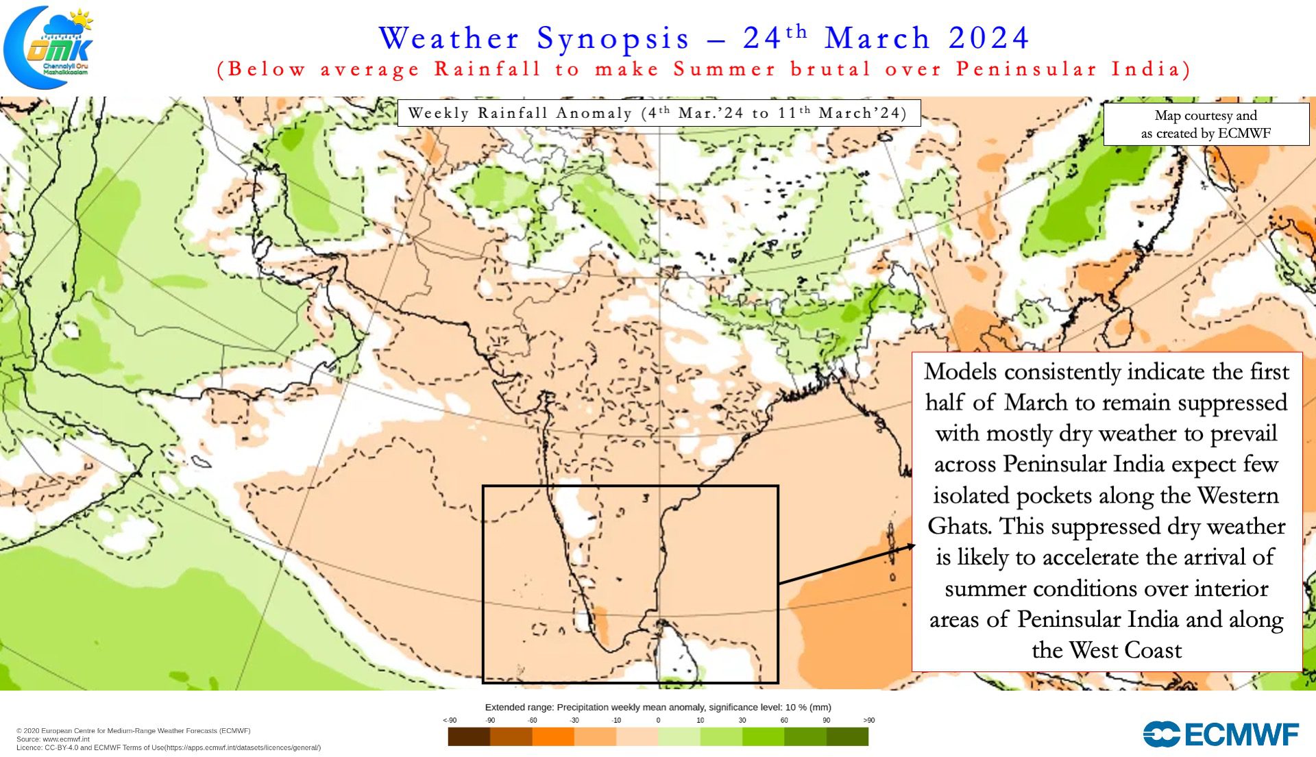
The drier than normal weather in a way has also enhanced the heat quotient with clearer skies and hotter land temperatures adding to the conditions already created by a fading El Nino for a warmer than normal summer over Peninsular India. Sub seasonal weather outlooks continue to indicate summer thunderstorm activity may remain sub par during most of March and also pretty much large periods of April leading to what may be a harsh summer for Peninsular India. The dipping mid latitude westerly trough over the past week brought not only some respite in temperatures but also some isolated rainfall activity created by moisture migration from lower level Easterlies.
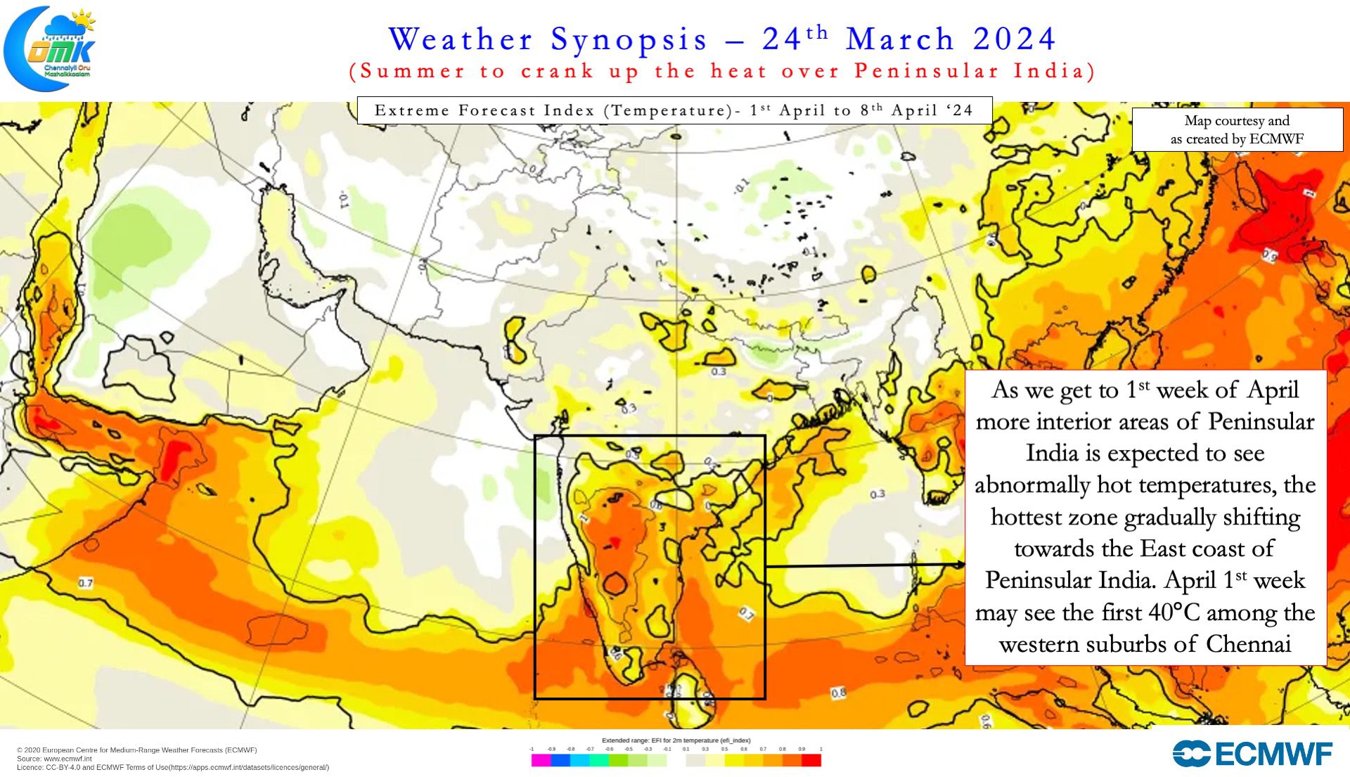
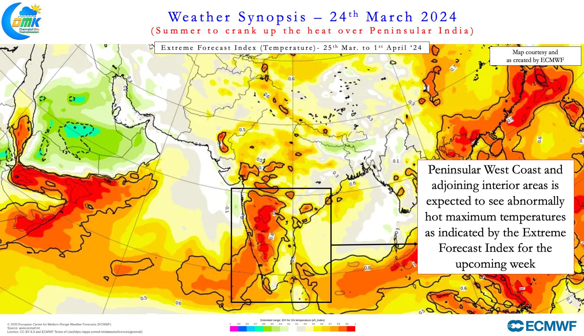
The upcoming week is likely to see temperatures once again increase over Peninsular India with places along the West coast and adjoining interior areas likely to see abnormally hot day time conditions with max temperatures expected to stay 2 to 4°C above normal during this period. As we get to the first week of April the abnormally hot zone may gradually start shifting west consequent to weakening Easterlies pushing the hottest area over Peninsular India closer to the East Coast. There is increasing consistency among weather models the first 40°C among the suburbs of Chennai is not far away and could be recorded in a week to 10 days time as we get to the first week of April.
With polling to the General Election 2024 expected to start from 19th of April it is expected to be a fairly hot and intense campaign trail for the candidates and their supporters. Looking at the phase wise polling map it may not come as a surprise if most places see polling when their respective areas are under peak Summer conditions. Tamil Nadu is going to polls on 19th April and initial indications are polling day could see most parts of the state record near 40°C afternoon temperatures. Better clarity may be available as we get closer to the polling date.