
Indian Sub Continent is unique in many ways with the mighty Himalayas on one side and ocean bodies on three side surrounding Peninsular India. North India in a way not only has seen empires from Central Asia trying to make inroads but time to time Sub-tropical weather events also make its presence through Mid Latitude Westerly Troughs. If not for the presence of Himalayas not only would the Southwest Monsoon cease to exist in its present form but North India possibly would be witnessing harsher summers and winters. In a way the mighty Himalayas not only has acted as a barrier for many a conquering empires from Central Asia but also as a Guardian Angel in terms of weather as well.
Peninsular India in a way has been lesser invasions from rulers outside the Indian Subcontinent partly due to its strong connect to Equator and associated Tropical weather conditions making it uncomfortable to the invaders from Central Asia. Additionally the logistics of maintaining armies a long way from home in hostile weather conditions made the overall prospect less appealing to these invaders. This two contrasting climatic zone makes the Indian subcontinent unique among most similar sized landmasses across the globe. In a way this also makes it more challenging for weather forecasters as well bringing in complex weather events time to time when Tropical weather factors and Sub-tropical weather factors interplay and interact.
This interaction between Tropical and Sub-tropical is not something new for most regular followers of weather bloggers. During Northeast Monsoon period many a times this interaction has led to cyclones taking a more Northward path towards North Bay when in an ideal world it would have taken a traditional NW movement towards the East coast of Peninsular India without the interaction. Similarly over the last few years we have also seen rainfall episodes greatly getting enhanced during such interactions not only during Northeast Monsoon but occasionally during off season rainfall episodes as well.
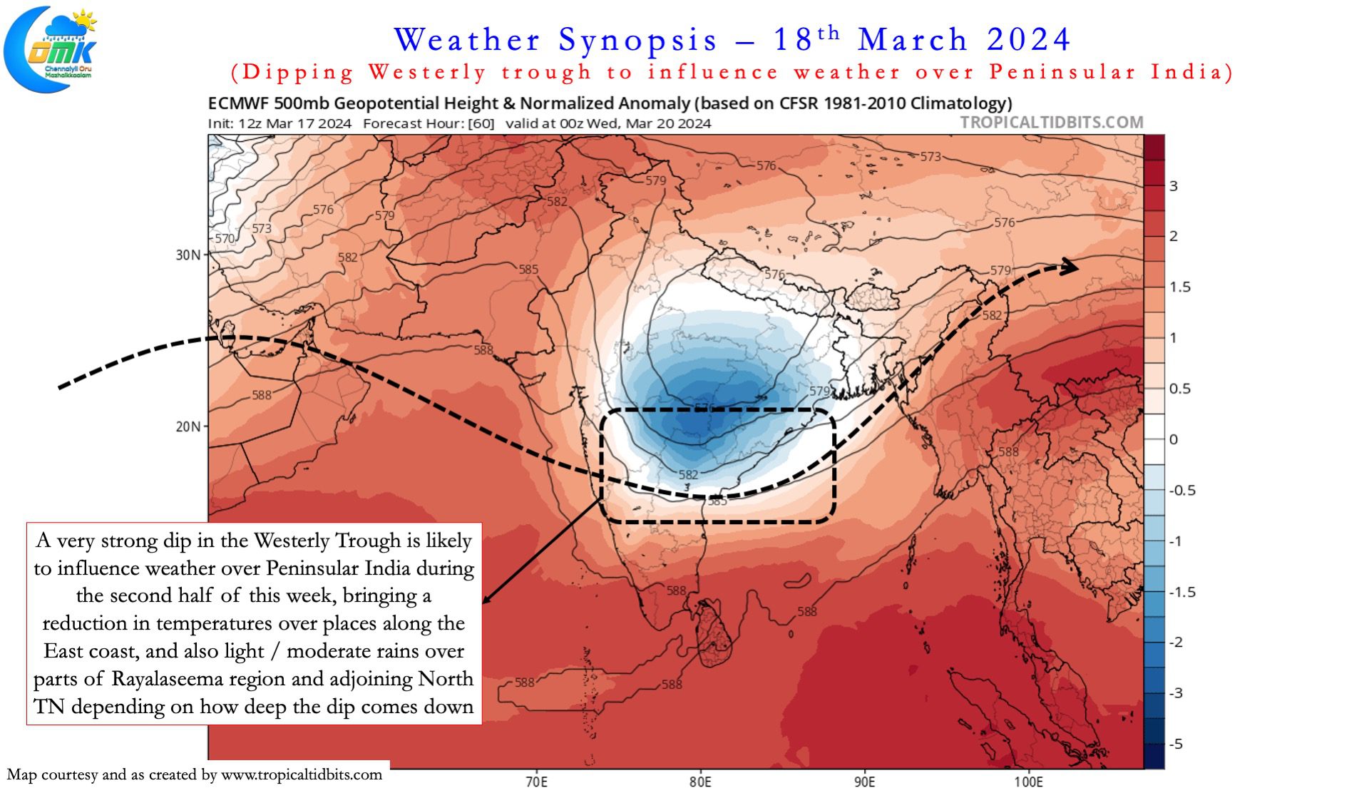
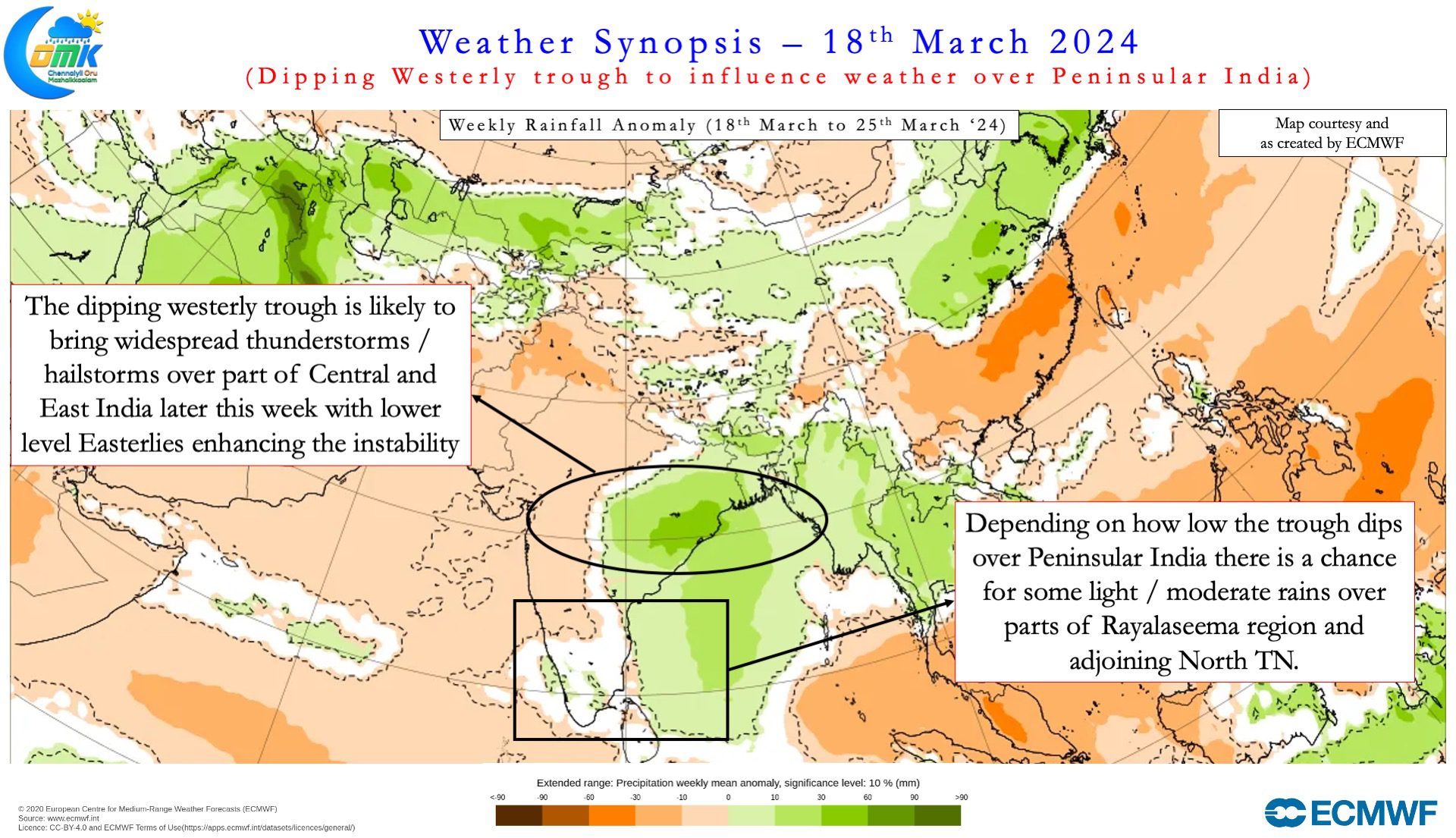
Weather models indicate the upcoming week is likely to witness a fairly strong southward dip of the Mid Latitude Westerly Trough during the second half of this week. Depending on the intensity of the dip the trough could extend up to parts of Peninsular India. The bulk of the influence from this interaction of mid level westerlies and lower level easterlies is expected to be seen over parts of Central India and East India where many places could not only see intense thunderstorms but also possible hailstorms which is likely to bring crop damage over parts of Chhattisgarh, Odisha, even North AP and parts of Telangana if the dip is stronger than estimated by weather models.
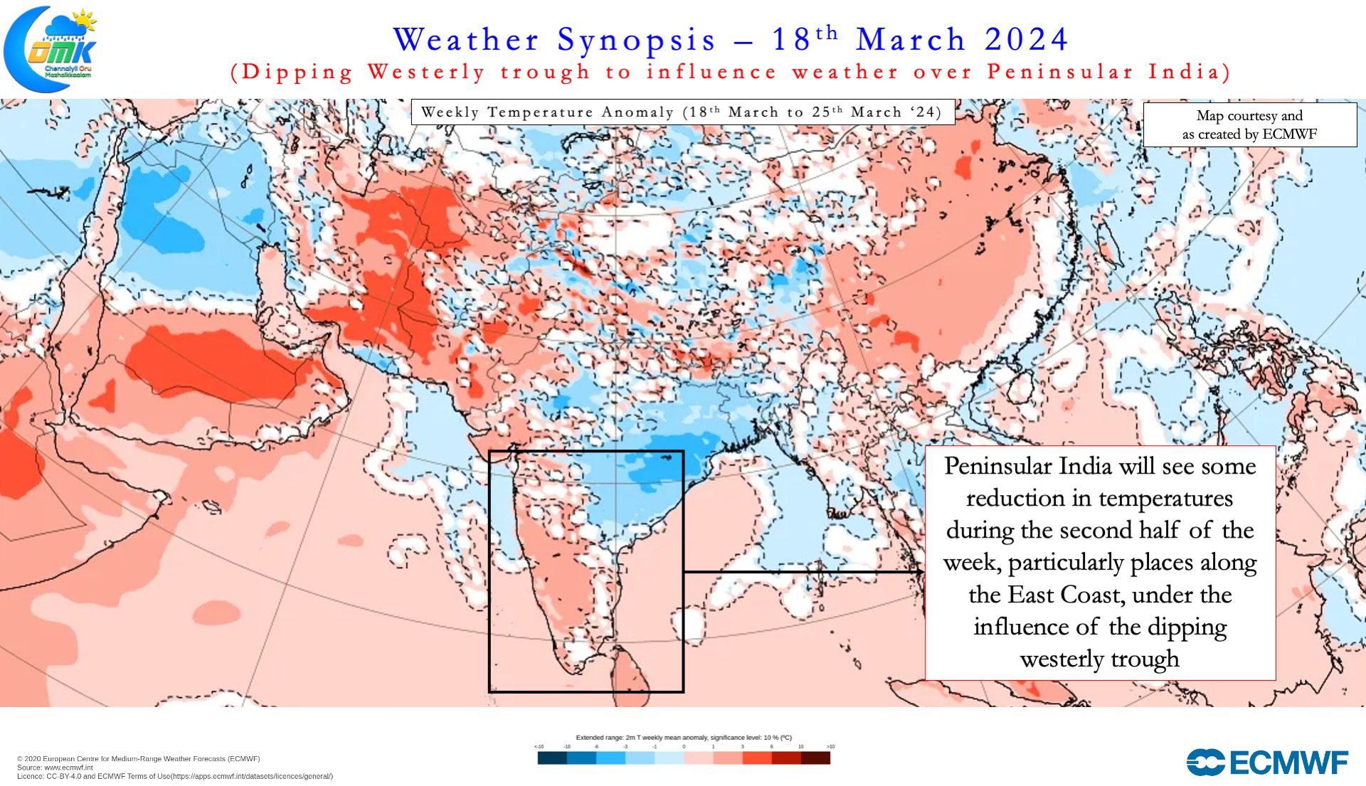
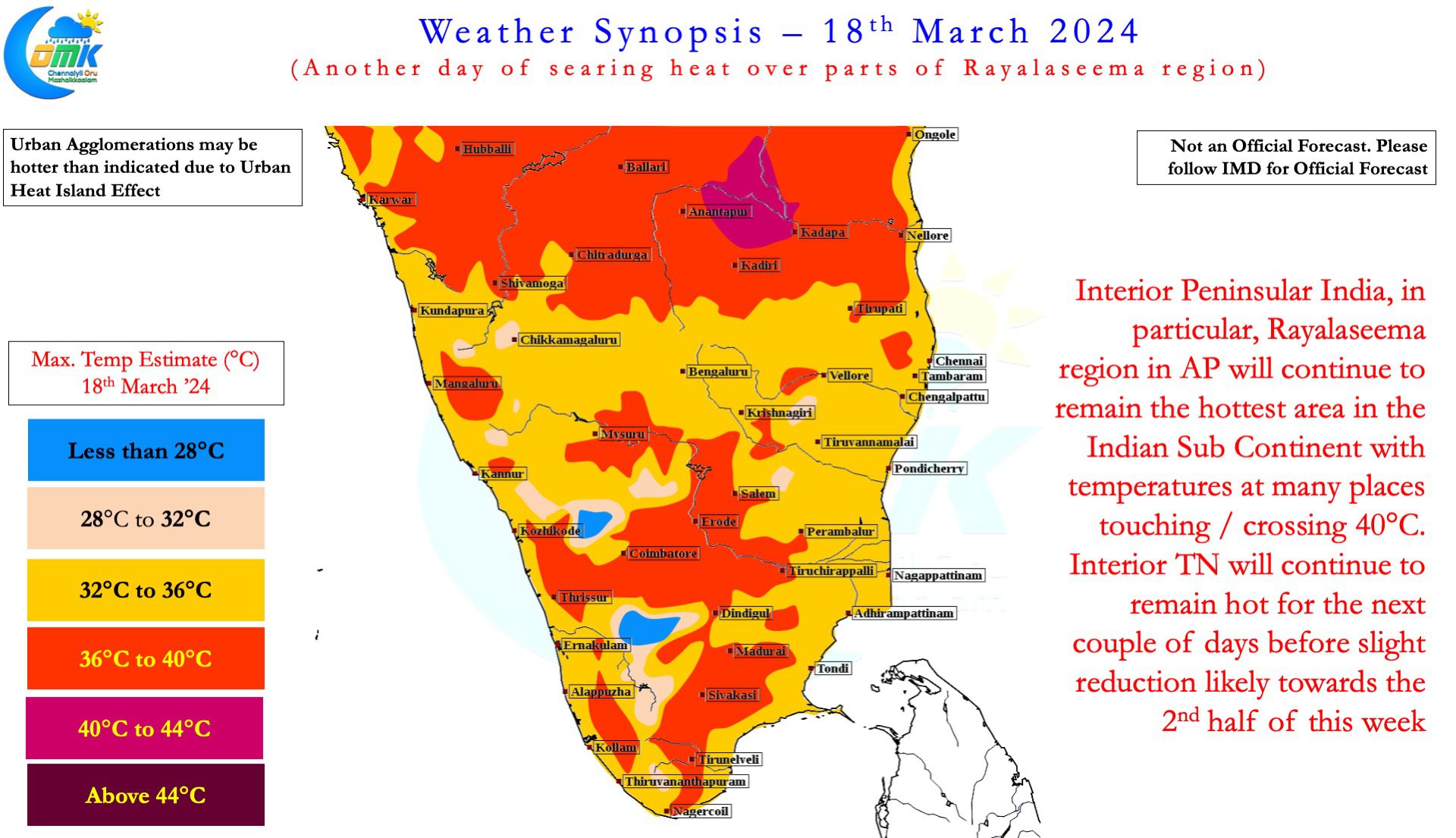
Though this interaction is unlikely to bring a major rainfall episode over the southern parts of Peninsular India it is likely to influence weather over Peninsular India otherwise. Rayalaseema region of AP that has been reeling under searing afternoon heat may get some respite during the second half of the week which is likely to spillover into parts of North TN as well bringing some reduction in day time temperatures under possibly cloudy skies. In terms of rainfall prospects for Tamil Nadu through this interaction the chance is limited with some light rains possible over the North TN areas adjoining Rayalaseema region which might be moderate in one or two instances under right conditions.
Nevertheless as we get to the last week of March we can possibly start keeping a tab on “Veppasalanam Mazhai” or thunderstorms triggered by Line of Wind Discontinuity over the interior areas of Peninsular India.