
Interlude
a musical composition inserted between the parts of a longer composition, a drama, or a religious service (Merriam Webster)
As April gives way to May for almost every one in the Indian sub continent weather becomes an important talking point with Summer, heatwaves and associated temperatures the subject of discussions among not only the media but also common public. As we get to the second half of May the narrative gradually shifts towards the arrival of Southwest Monsoon as westerlies become the dominant wind regime with Sri Lanka and Andaman looking forward to the onset of Monsoon towards the second or third week of May. It is in this context the upcoming week promises to bring a weather interlude that might bring the best phase of summer Rains for interior areas of Peninsular India.
Southwest Monsoon is a fascinating weather phenomenon that is not only one of the most followed globally but also one that plays a vital role in the food security of the world’s most populous country. Weather charts indicate the first indication of Monsoon dynamics falling in place as Winds over the Southern Hemisphere, under the influence of Mascarene High, are seen moving along the East coast of Africa and hitting the Abyssinian Highlands before deflecting across the equator as Westerlies towards the Equatorial waters of North Indian Ocean. The Abyssinian Highlands, also known as Ethiopian Highlands, is a lofty mountain range that reaches more than 3000 mts in altitude at some places plays an important role in the deflection of monsoon winds towards Indian Sub continent in addition to the thermal low induced by intense summer over NW India.
In a way Southwest Monsoon is a tale of two mountains, the Abyssinian Highlands playing the role of a conduit for cross equatorial westerlies while the Western Ghats remaining a barrier to the winds crossing Peninsular India thereby providing a rain shadow region over parts of Peninsular India while dumping a lot of rains along the West Coast. One can also add a third mountain, the mighty Himalayas, to this though the Himalayas play a much larger role in modulating the Sub Continent weather over most months of the year rather than just the monsoon time. It is fascinating to watch nature assemble this complex jig saw puzzle called Monsoon year after year.
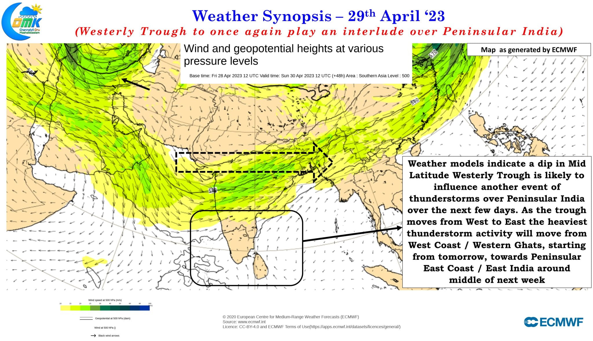
While we keep a tab on the Monsoon dynamics it’s time to enjoy the interlude that is going enthrall us for the next few days. An interaction between the upcoming Mid Latitude Westerly Trough that is expected to dip down into parts of Peninsular India and lower level Easterlies is expected to create highly unstable atmospheric conditions for convective thunderstorms to develop. A very warm Bay of Bengal is expected to pump up a lot of moisture over Peninsular India providing a perfect platform for the mid latitude westerly trough to trigger extremely intense thunderstorms during the afternoon / evening hours over interior areas of Tamil Nadu.
Places like Bengaluru that has seen practically very little summer rains so far may finally get the much needed rains this week. Along with that part of South Interior Karnataka adjoining areas of NW Tamil Nadu and districts like Erode, Salem may see good rains for the next few days. The usual suspects along the Western Ghats will see sudden burst of evening thunderstorms through moisture trap. While Chennai and suburbs may not get as much rains as interior areas the next 5 to 7 days could bring atleast two days of moderate rains with some of the western suburbs seeing heavier spell of rains at times.