
The last few days saw the return of Summer thunderstorms with a bang. A combination of favorable local and large scale factors meant after nearly two weeks the daily rainfall chart for Tamil Nadu & Pondicherry sub division showed above average rains with 24th April recording 8.5 mm, the highest single day rains, since the summer season began on 1st March. The seasonal summer rainfall tally for the TN & PDC sub division stands at 19% above long period average though bulk of it was due to the rains during the month of March when an interplay between Mid Latitude Westerly trough & lower level easterlies brought about highly favorable conditions for thunderstorms.
In a way the last couple of days also was an interplay between the mid latitude westerly trough (WD) and moisture pushed in by the lower level Easterlies that played a huge role in enhancing the thunderstorms over the interior areas of Tamil Nadu bringing about some very heavy spell of rains on Saturday and Sunday. This included places as close as 50 kms from Chennai though the city did not get much rains except for some isolated light drizzles. Gomugi dam in Kallakurichi district recorded 16 cms of rains during the weekend indicating how in certain pockets the thunderstorms were extremely intense. Similarly Jamunamarathur in the Javadhu hills recorded nearly 10 cms during the same period.
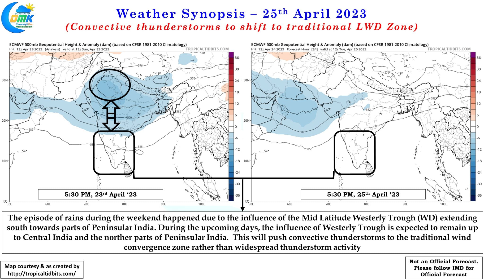
Wind charts indicate the strengthening of Easterlies this week which will have its own influence on not only the temperatures but also the rainfall pattern as well. While on the temperature front it is expected to bring some respite from the heat on the rainfall front it will also shift the convergence zone to the traditional LWD areas closer to the Ghats limited the rainfall prospects to these areas rather than widespread thunderstorm activity which happened during the weekend enhanced by the presence of a mid latitude westerly trough influence.
The Ghat areas, both East & West, will possibly be more favorably placed for thunderstorm activity with convergence zone staying closer to the Ghats partially influenced by the lift provided by the mountains. Coastal areas of Tamil Nadu saw some rains during the morning hours at the time of this post which in a way also confirms the role of Easterlies. These spells of rains could gradually get pushed further west in the coming days bringing coastal areas under drier weather conditions while West Interior TN, parts of South TN and adjoining areas of Kerala along with south interior Karnataka may benefit from LWD influenced convective thunderstorms for the next week or so.