
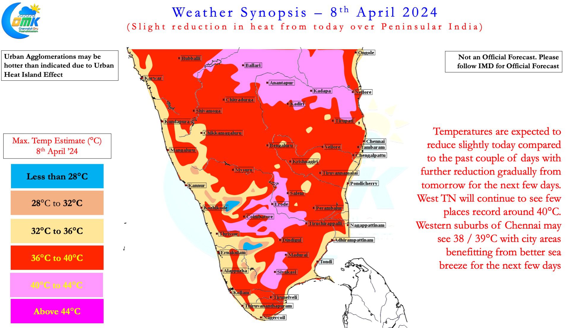
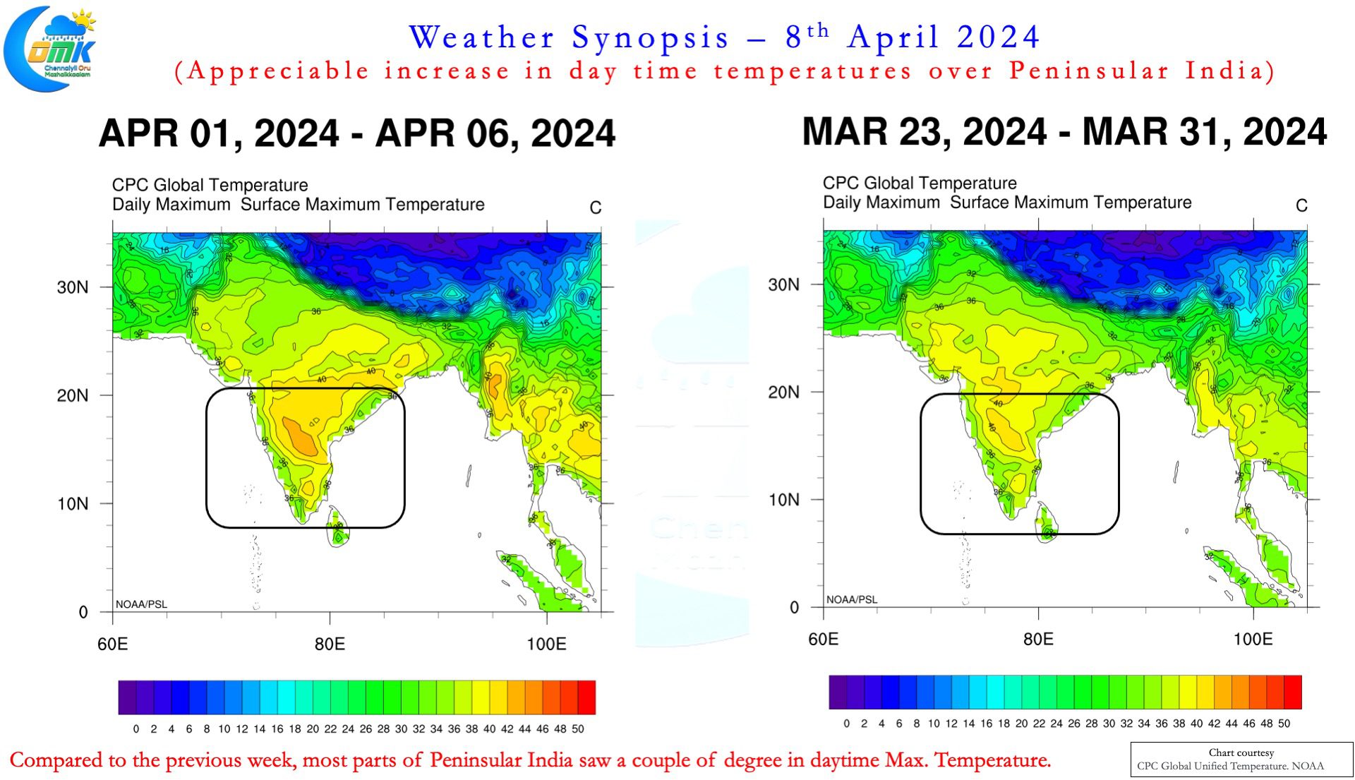
The past week saw an appreciable increase in day time temperatures over large parts of Peninsular India. Nandyal and Anantapur in the Rayalaseema region of Andhra Pradesh recorded 44.5°C on Saturday and Sunday respectively. 30th March, when Akola recorded 42.6°C was the last day when a station from Rayalaseema did not top the All India Temperature charts. Since then either Nandyal or Anantapur has been topping the chart with Kadapa and Kurnool topping the chart on one occasion. Yesterday Erode recorded 42°C, the first occasion when a station in Tamil Nadu recorded 42°C during the current summer.
Chennai and suburbs were better off compared to the interior places though the western suburbs certainly felt the brunt of weak sea breeze for the past couple of days. While city areas closer to the coast benefitted from the sea breeze moving in around noon it pretty much stalled unable to move inland against strong offshore winds leading to western parts of the city and suburbs seeing temperatures stay high until 2 / 3 PM in the evening. On Saturday the difference between the IMD observatories in Nungambakkam and Meenambakkam was nearly 3°C while on Sunday it was 2°C. On both days the Chennai AP observatory recorded 39°C or more.
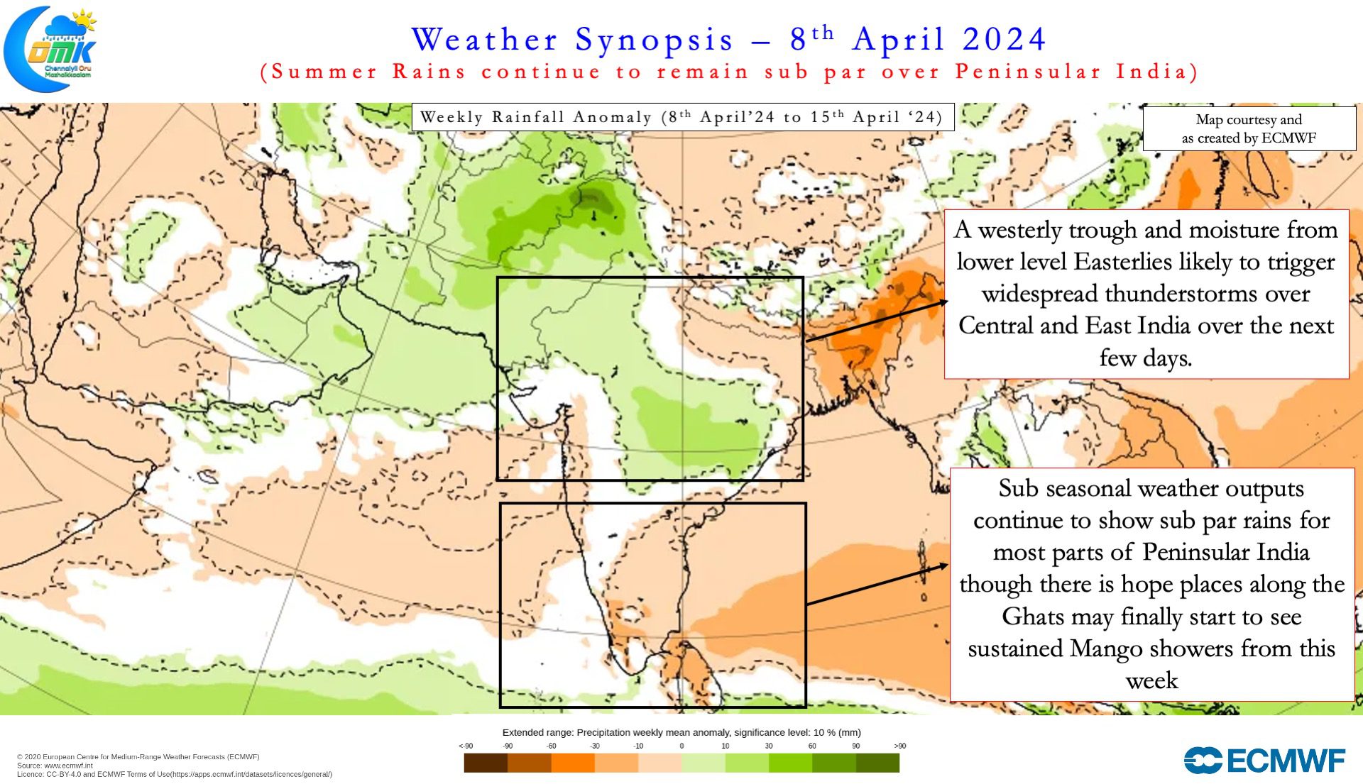
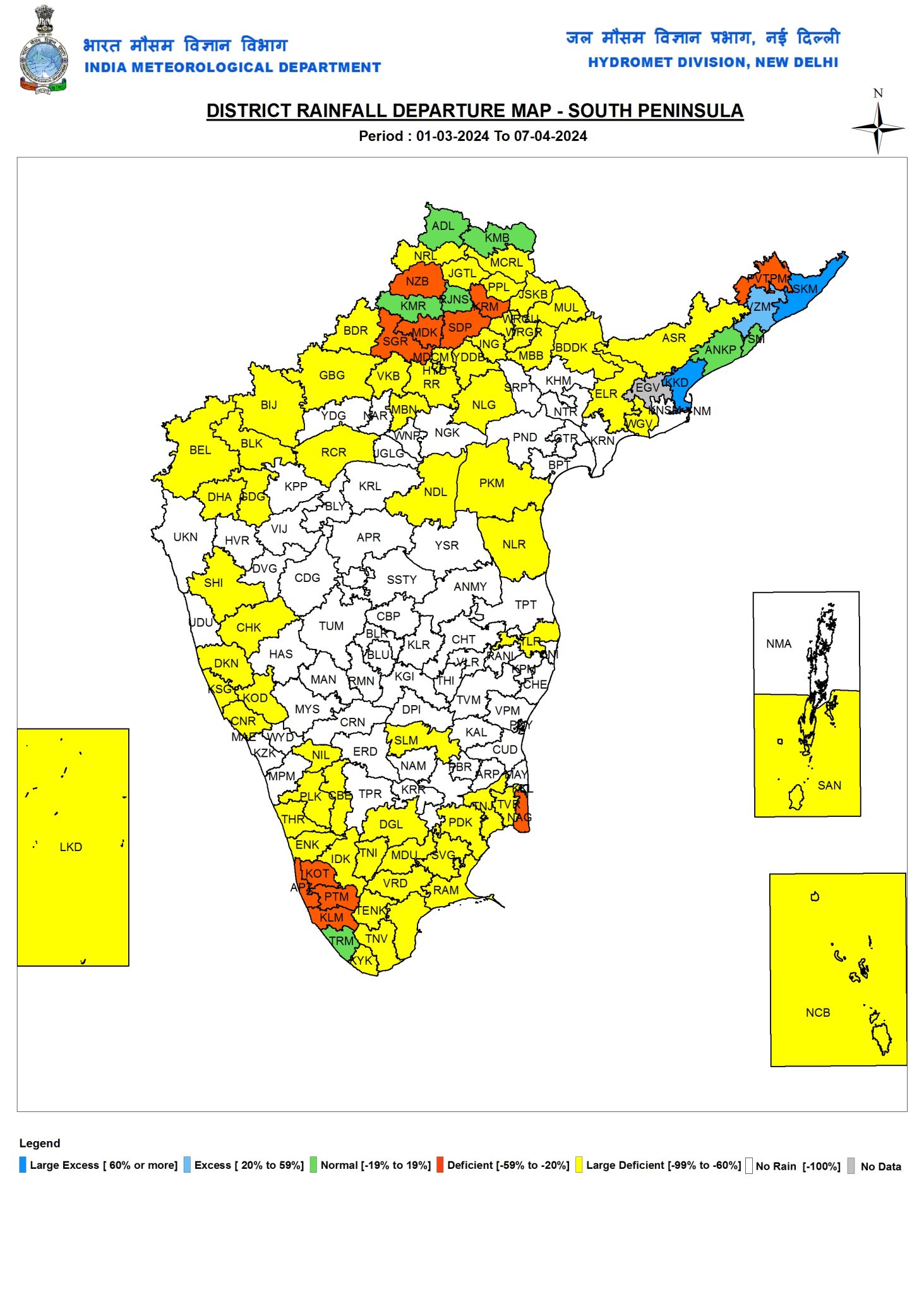
In a way while the heat wave conditions over the past week was not entirely unexpected considering most devolving ElNino years tend to advance peak summer conditions compared to regular climatology. Additionally the poor summer thunderstorms so far over Peninsular India has also created dry conditions enhancing the heat quotient as well. The cumulative seasonal rainfall status for Summer (March to May) over Peninsular India stands at -82%. Against long period average of 21 mm for the period 1st March to 7th April the actual rainfall realisation stands at 3.8 mm. Except for Coastal AP and Yanam which is in Deficit with 55% lesser than normal rains so far during the season all the other sub divisions in Peninsular India is under large deficit including Kerala which has recorded only 16.8 mm against the average of 54.5 mm.
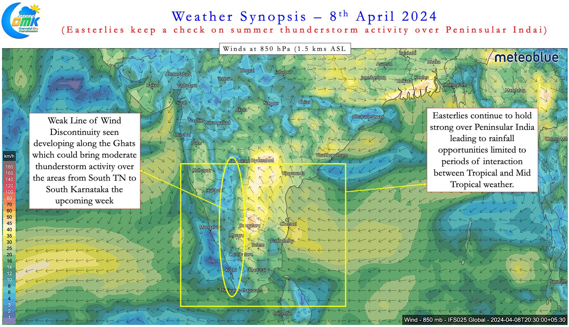
A week or so back weather models were showing a possible tropical and mid tropical interaction which could have potentially brought about a spell or two of rains over Peninsular India. As is always the case with such interactions, it is a tight rope, when things don’t fall into place exactly to the last minute detail the rainfall events either don’t happen or possibly end up being much lesser in magnitude both in terms of spread and intensity. The moisture provided by lower level Easterlies continue to show up in realtime conditions while the dip in Westerly trough is not possibly going to be deep enough up to Peninsular India as originally estimated by the models for a large scale rainfall event to happen.
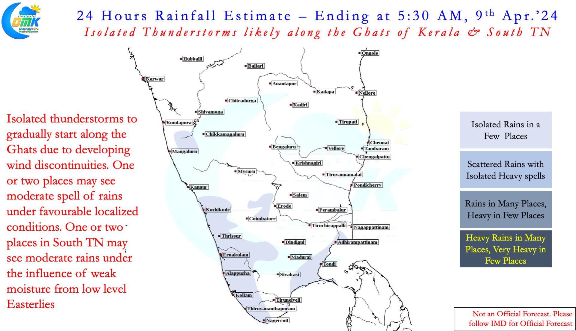
The slightly stronger than normal Easterlies is possibly one of the reasons why summer thunderstorms have not yet picked up over Peninsular India. While one can never discount the role played by Day time heating for the convective process to get triggered it would be naive to ignore the role played by winds in the form of Discontinuity or possible interaction between lower level Easterlies and Mid level Westerlies. Streamlined Easterlies reduce the possibility of such LWD thunderstorms developing over the interior areas. Weather models indicate gradually the Easterlies may provide a window for thunderstorms to developing in the coming week though it might be still below par in terms of overall rainfall trend. Places along the Ghats from South TN to South Interior Karnataka may start benefitting from these thunderstorms which is expected to pick up in a couple of days time. Towards the end of the week one or two days of moderate thunderstorm activity may happen. It makes sense to take one week at a time and see how things evolve. Overall it may make sense to keep a subdued expectation on the summer thunderstorms and enjoy if nature throws up a bonus.
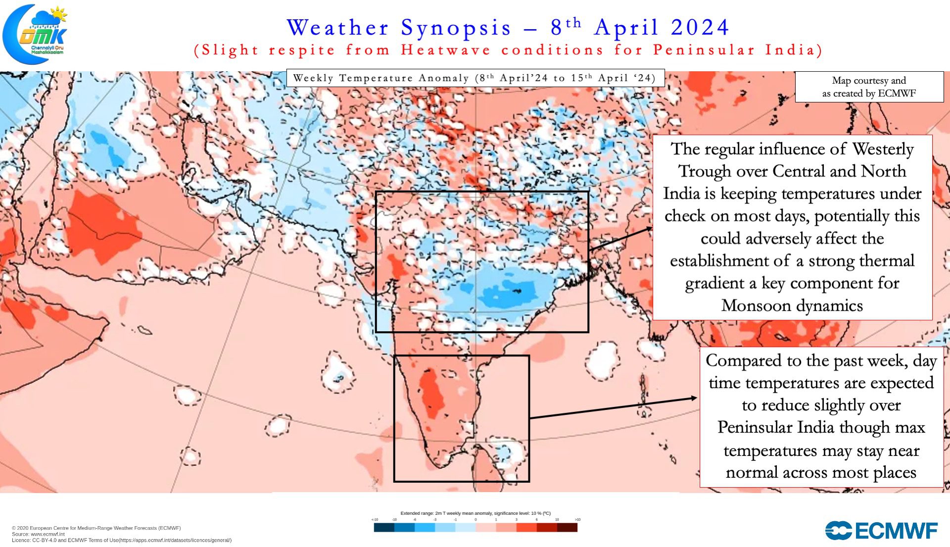
On the temperature front this week may bring some respite with overall trend showing slight reduction in temperatures across Peninsular India. Near normal temperatures would mean most places may see a couple of degree reduction in day time max temperatures compared to the past week. But one word of caution though, summer is not yet over and possibly as we get to the voting day for Tamil Nadu in the General elections things may fall in place for the next round of heat wave conditions over Peninsular India.