
Southwest Monsoon, Northeast Monsoon, Western Disturbance the Indian Sub Continent is home to diverse weather events. India’s strength lies in her diversity. COMK wishes all a Happy Independence Day. May India continue to be the guiding culture for the rest of the globe.
For regular weather observers it is not a surprise when one says the months of July and August are critical to the overall rainfall prospects of the Indian Sub Continent. For the people from Tamil Nadu, on account of the Northeast Monsoon, rains during July and August is not as vital as the rest of the country. It may come as a surprise to many to realize the months of July and August contribute nearly half of the annual rainfall (46% of the annual rainfall for the country on the whole). For Central India these two months contribute 57% of the annual rainfall, Telangana whose northern parts almost see conditions similar to the adjoining Central India receive nearly half of its annual rainfall (48.3%) during these two months. Peninsular India.
It is in this context it is essential to understand Southwest Monsoon needs on most occasions a good July and August for the overall season to be good considering Southwest Monsoon contributes to nearly 3/4th of the annual rainfall to the country. Tamil Nadu is possibly the only state which sees Southwest Monsoon contribute closer to 1/3rd of the annual rainfall due to the influence of retreating monsoon during October to December. This year so far June has been very poor with July bringing back the monsoon dynamics on the back of favorable presence of MJO over the adjoining MTC region which brought in train of pulses into Bay of Bengal thereby keeping the momentum going.
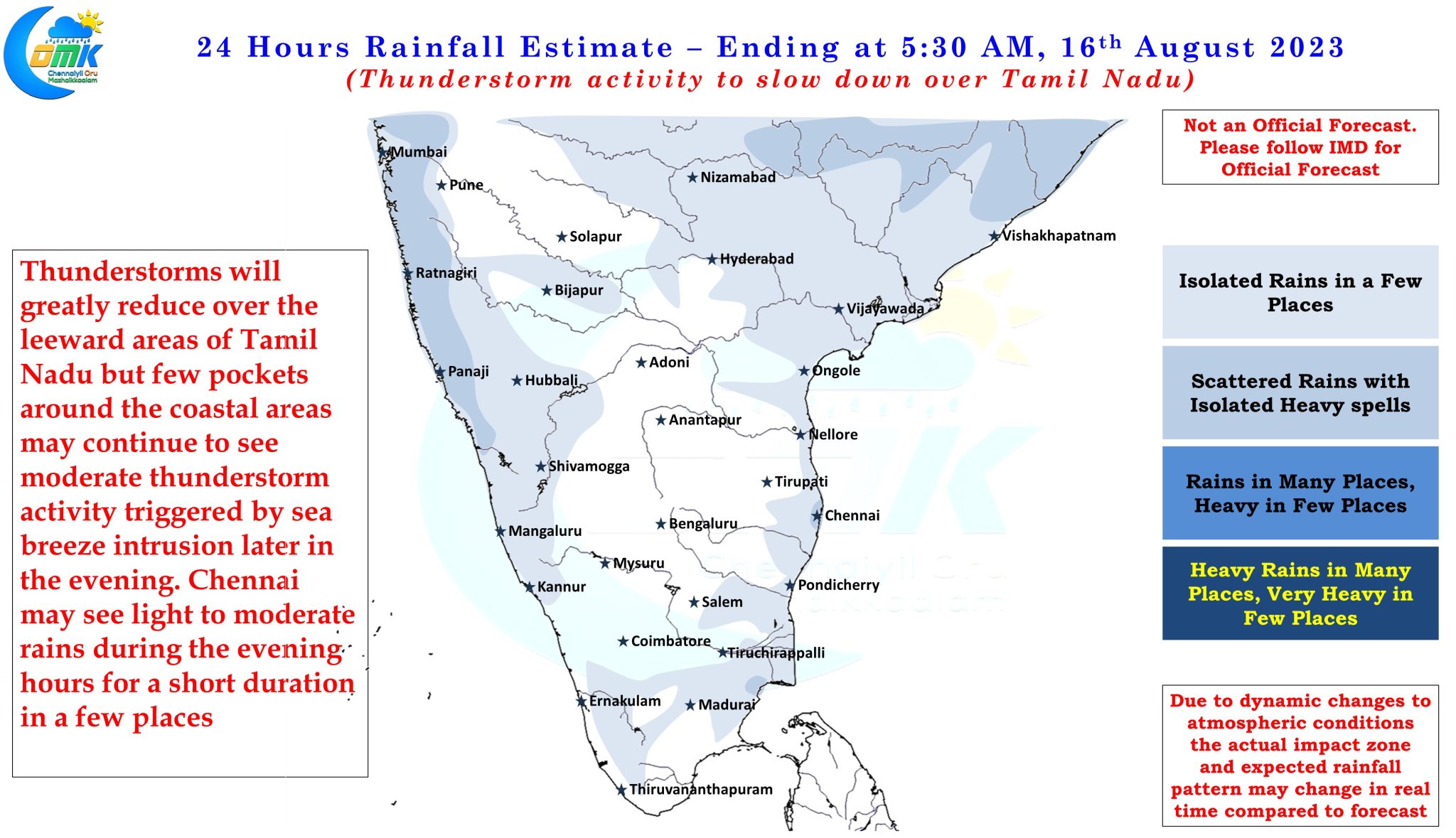
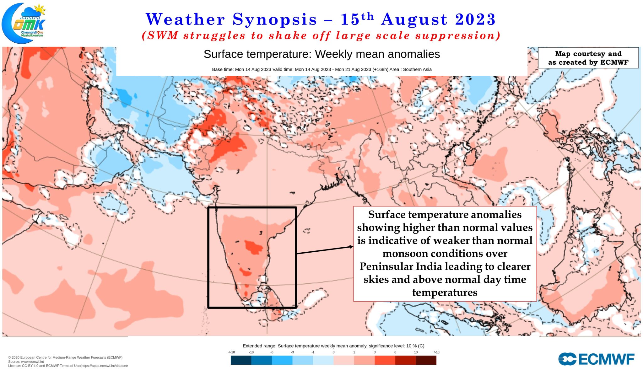
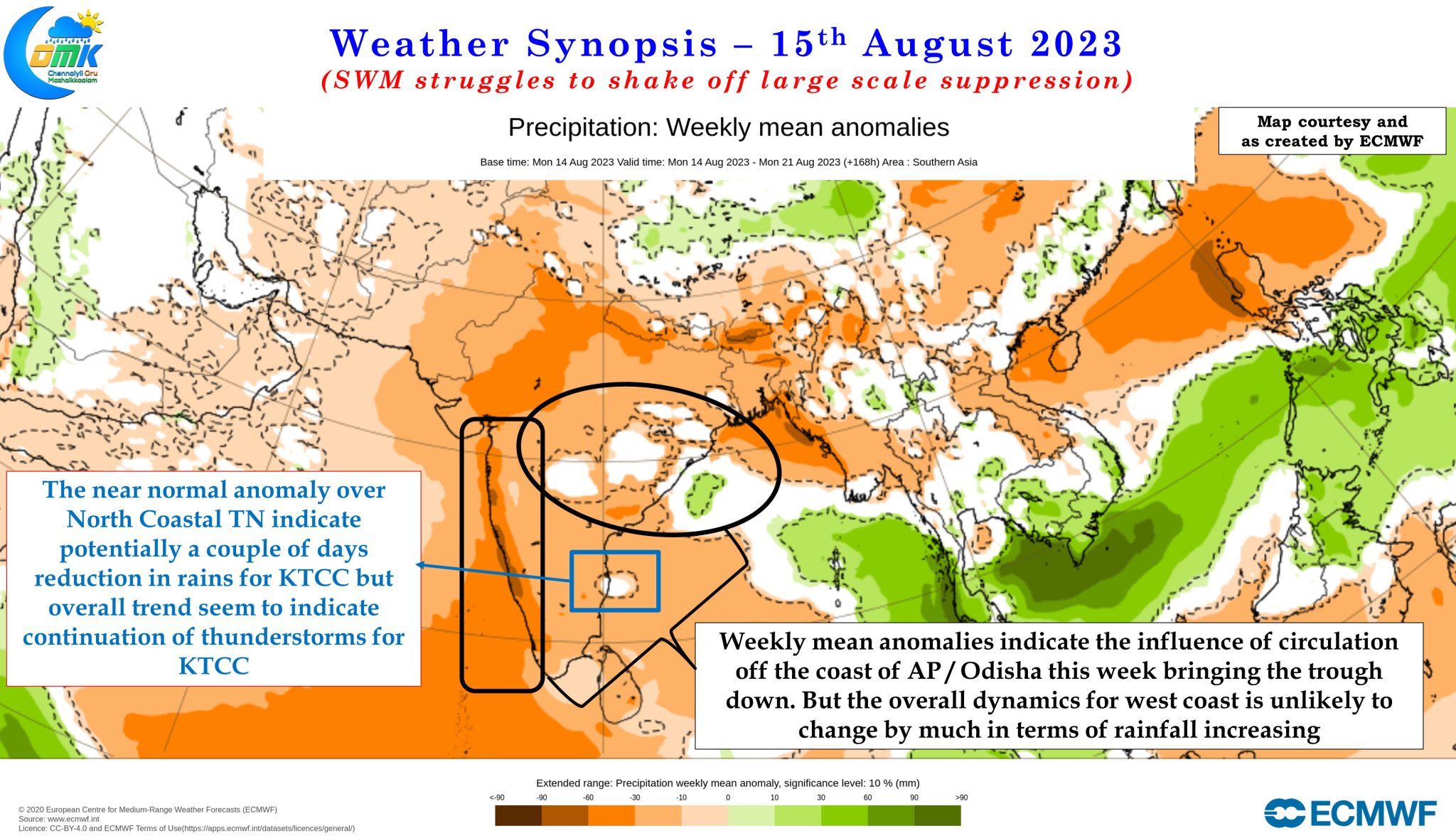
This favorable conditions persisted upto the first week of August before the advent of Break in Monsoon conditions bringing a halt to Monsoon dynamics over Peninsular India. This break in monsoon also brought about an active phase of thunderstorms over the leeward areas of Tamil Nadu along with heavy rains in the Himalayas as the Monsoon trough shifted North closer to the foothills. Weather models indicated thunderstorms to slow down since yesterday over Tamil Nadu. The past couple of days has seen Chennai and suburbs also receive widespread rains while most other parts of Tamil Nadu saw a reduction in rains.
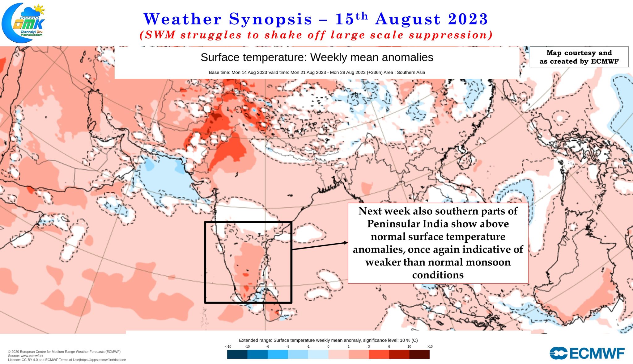
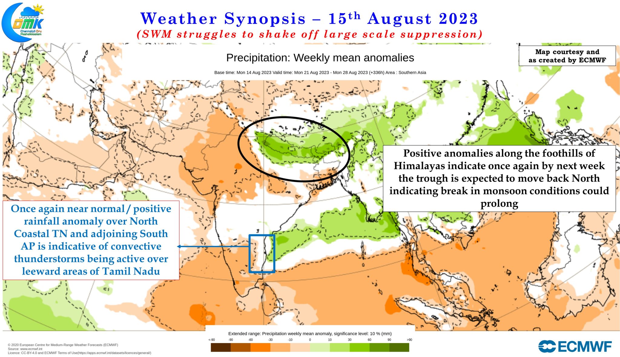
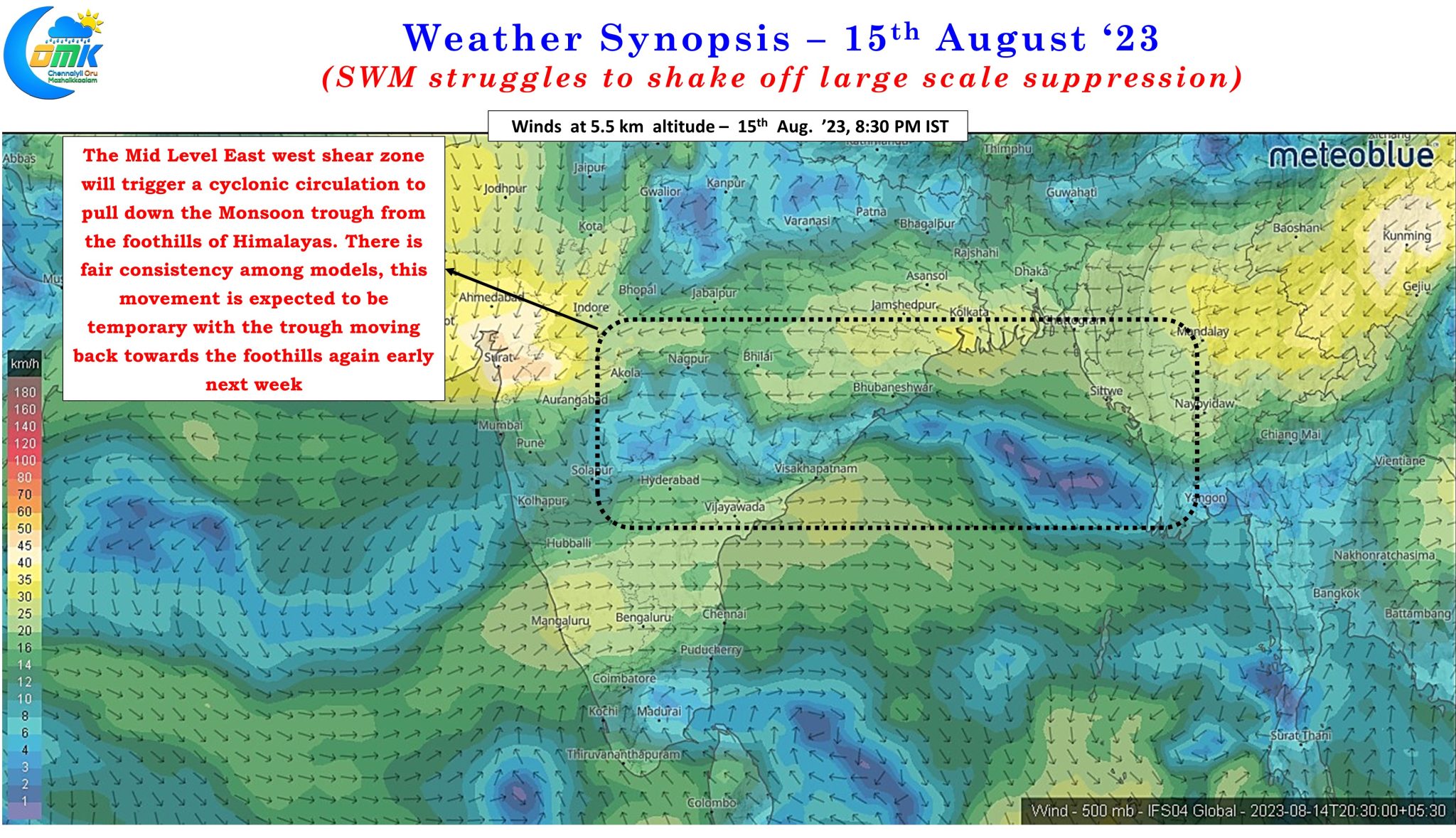
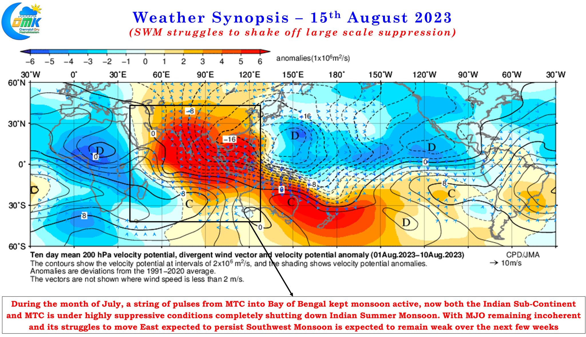
With the East West Shear Zone type of conditions moving further up towards the Central Bay area, we are likely to see a cyclonic circulation develop in this zone of instability which will probably pull down the Monsoon trough in a day or two. Normally this is likely to bring back the monsoon dynamics. But digging a bit deeper shows Southwest Monsoon may struggle on the back of a large scale suppressive conditions that might persist over the Indian Sub Continent and adjoining areas of Maritime Continent. The same conveyor belt which kept July active is likely to remain quiet during most parts of August leading to lesser than ideal conditions for Monsoon. Ensembles indicate potentially the monsoon trough may head back towards the foothills by middle of next week. This is a worry for basins like Cauvery where the net inflows during June and July has been only 60% of the long term average inflows. On the whole it could mean tough times for the water managers of Cauvery Basin.
The weekly precipitation and temperature anomaly charts also reiterate the overall weak nature of monsoon dynamics over Peninsular India and possibly an extended break in monsoon may be on the cards. Ensembles certainly do not indicate a sustained period of dry spell over places like North Coastal TN which in a way shows how monsoon could pan out during rest of August. This could mean Chennai and suburbs may see thunderstorms continue though it may not be widespread and intense like the past couple of days. While today we could see light to moderate sea breeze induced thunderstorms over coastal places like Chennai, tomorrow could be fairly quiet before wind convergence through the developing circulation over Central bay may once again give an opportunity for thunderstorms over places like North TN and adjoining South AP.