
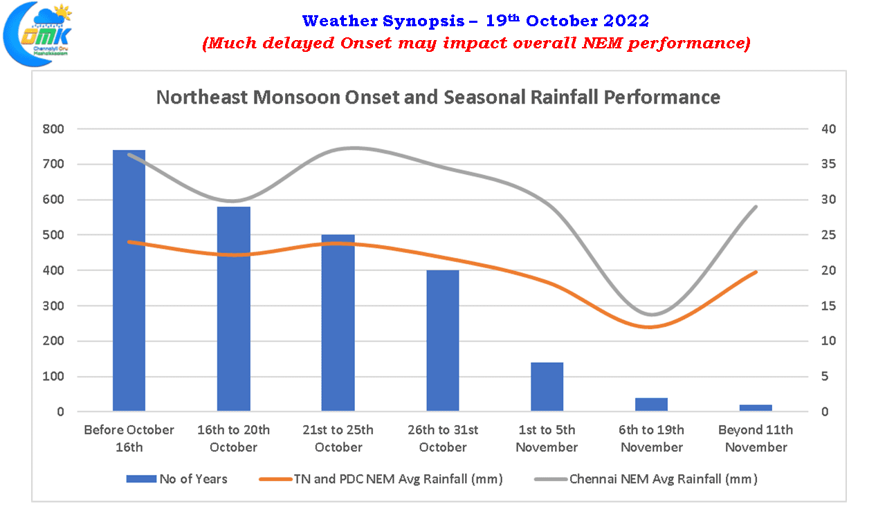
According to IMD 15th October is the traditional date for the settting in of easterlies over Peninsular India which coincides with the traditional withdrawal date of Southwest monsoon over the Indian Sub continent except for Peninsular India. But the setting in of easterlies does not always mean onset of Northeast monsoon and IMD has a defined onset date for Northeast monsoon as well similar to Southwest Monsoon though the onset and withdrawal criteria is not as robust as Southwest monsoon. The traditional onset date for Northeast monsoon is 20th October. Unlike Southwest monsoon often Northeast monsoon onset covers the entire Peninsular India in one go rather than phases as the Indian summer monsoon. But recently during the year 2018 Northeast monsoon onset was announced over two days with some areas including Coastal TN seeing onset on 1st November while the remaining areas of Peninsular India including South interior Karnataka and Rayalaseema region saw onset on 2nd November.
This now leads to an interesting question whether the seasonal performance of Northeast monsoon is affected by the onset window. While performance of individual years will surely vary based on the prevailing factors during that time overall trend does indicate a certain inference based on the onset windows and overall seasonal performance for the TN & PDC subdivision and Chennai individually. The sweet spot for NEM onset is 21st to 25th October with the overall performance of Northeast Monsoon tapering off as we get delayed well into November. About 10% reduction in average seasonal performance of Northeast Monsoon is seen in case the onset happens post 25th October compared to onsets before 25th October.
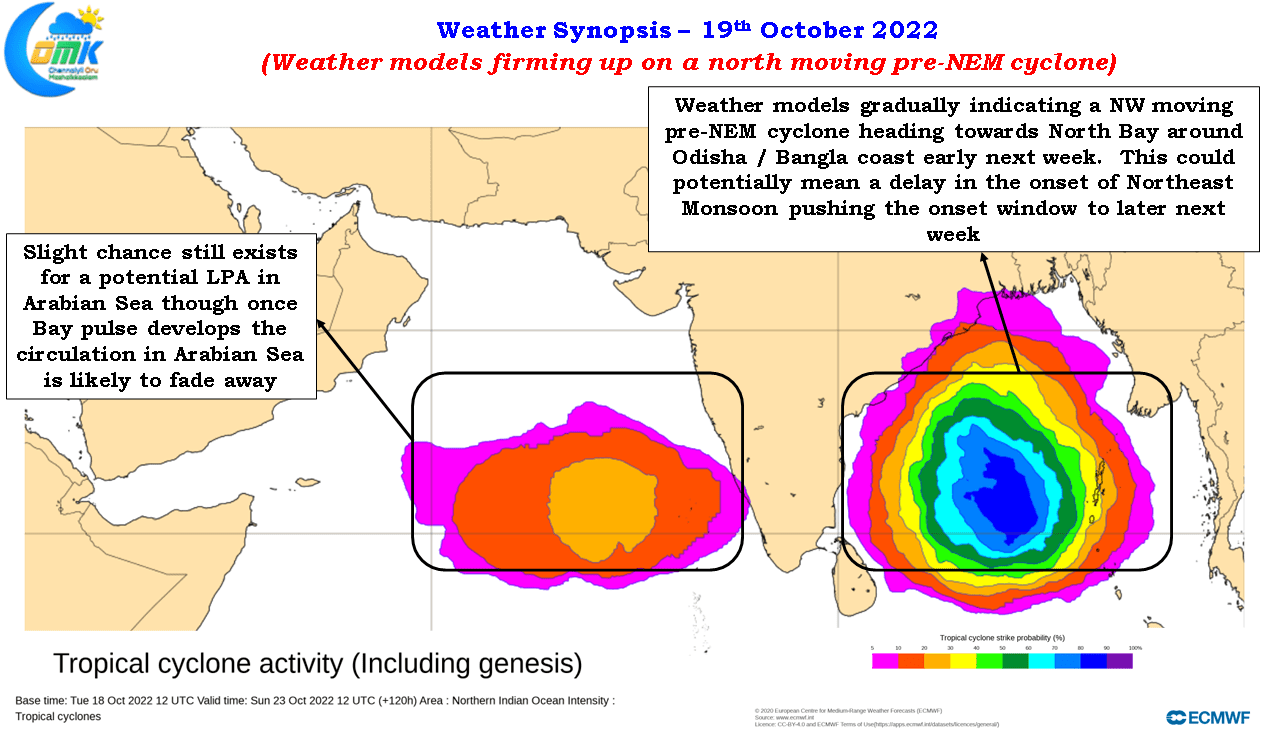
Weather models are now firming up on the upcoming disturbance in Bay of Bengal, expected to become an LPA in the next 24 hours or so, moving in a NW direction as a marginal cyclone towards Odisha / Bengal coast over North bay early next week. This could potentially mean a delay in the onset of Northeast monsoon by a few days on account of time taken for the Easterlies to return back along with the rains over Peninsular India. In the event the upcoming Bay low behaves as expected by the weather models we can potentially look at the next viable onset window around end of October with a delay of 7 to 10 days from the traditional onset date of 20th October.
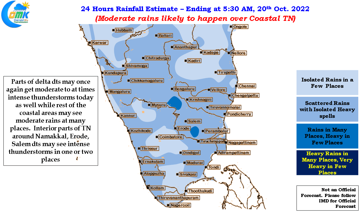
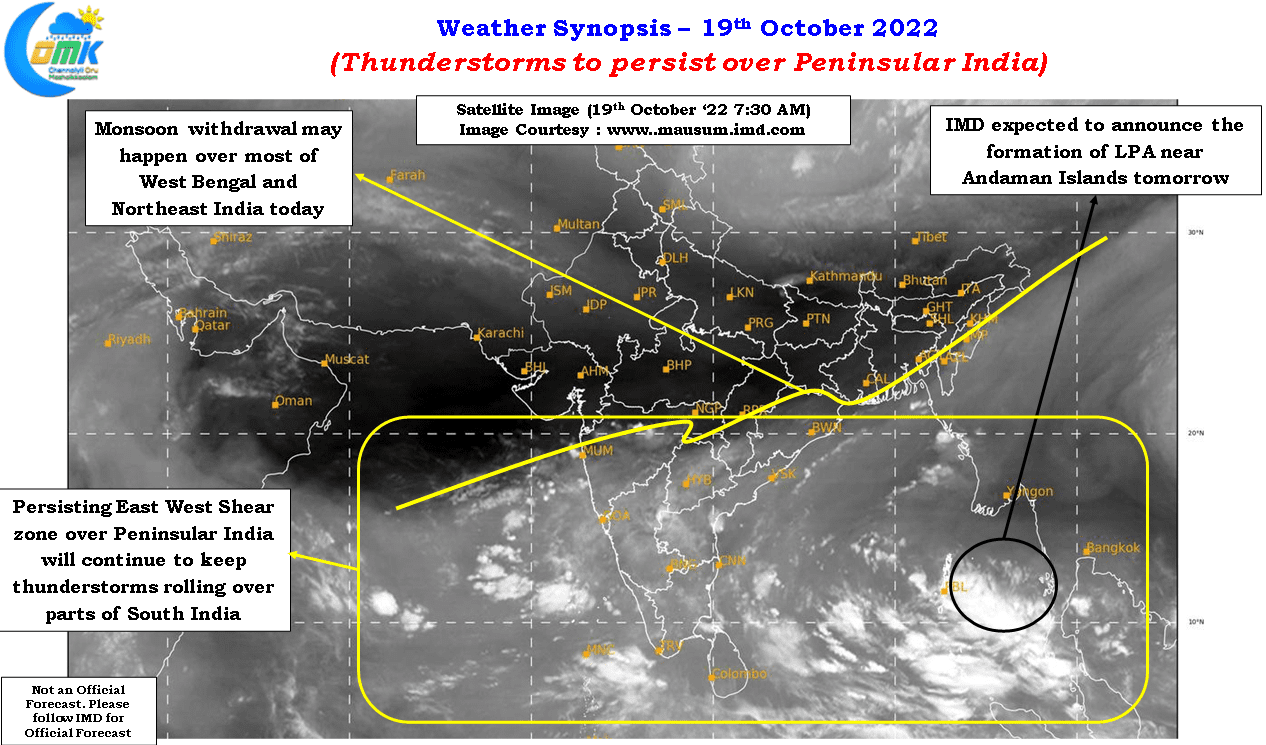
Meanwhile due to the persisting East West shear zone over Peninsular India thunderstorms are expected to continue in the region with few pockets of interior TN continuing to see moderate to intense thunderstorms during the evening / night hours for the next couple of days. Coastal areas like Chennai are seeing lesser rains due to the weaker than expected strength in easterlies though over the next day or two before the LPA firms up into a depression Chennai may see fairly widespread moderate rains which hopefully will bring the accumulated precipitation for October closer to the Long period average.
Northeast monsoon is always a tricky monsoon and is known for sudden mood swings so the current inference is based on how things are prevailing. We will continue to keep a track on how things are evolving and update the progress of both the onset of Northeast monsoon and the performance.