With jut 3 days left for what is the traditional onset date of Northeast Monsoon, 20th October according to IMD, it is expected for some anxious thoughts not just among weather bloggers but also for the larger public as well like the farming community for whom Northeast Monsoon is a vital component of their farming cycle. But in these bouts of anxiety one should not forget what is unravelling right in front of us. As of yesterday 7 districts of Tamil Nadu has already crossed 1/3rd of the Northeast Monsoon seasonal quota even though only the first fortnight of October is behind us. Erode, Krishnagiri, Namakkal and Madurai has already crossed 40% of the seasonal tally.
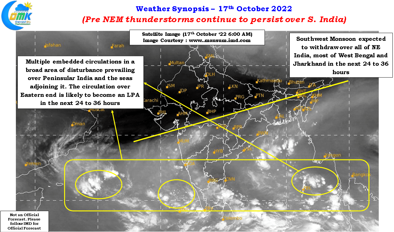
It is no wonder Erode is inching closer towards 2/3rd of the seasonal tally with parts of the district around the Eastern Ghats seeing localized flooding on account of these perssistent thunderstorms over the past few days. In a way many interior districts have benefitted from these pre NEM thunderstorms. Despite no favorable larger scale tropical wave support thunderstorms have been long sustaining on the back of a broad area of disturbance stretching across Peninsular India all the way from East Bay to Central Arabian sea with multiple embedded circulations in it.
These embedded circulations ensure wind instabilities provide support to the convective thunderstorms that develop during the afternoon hours after the clear morning sunshine providing the right platform. As one can observe the remnant moisture pushed across Peninsular India by the weak westerlies interact with day time raising of air particles creating thunderstorms closer to the ghats where orographic lift provides a third dimension to the thunderstorms.
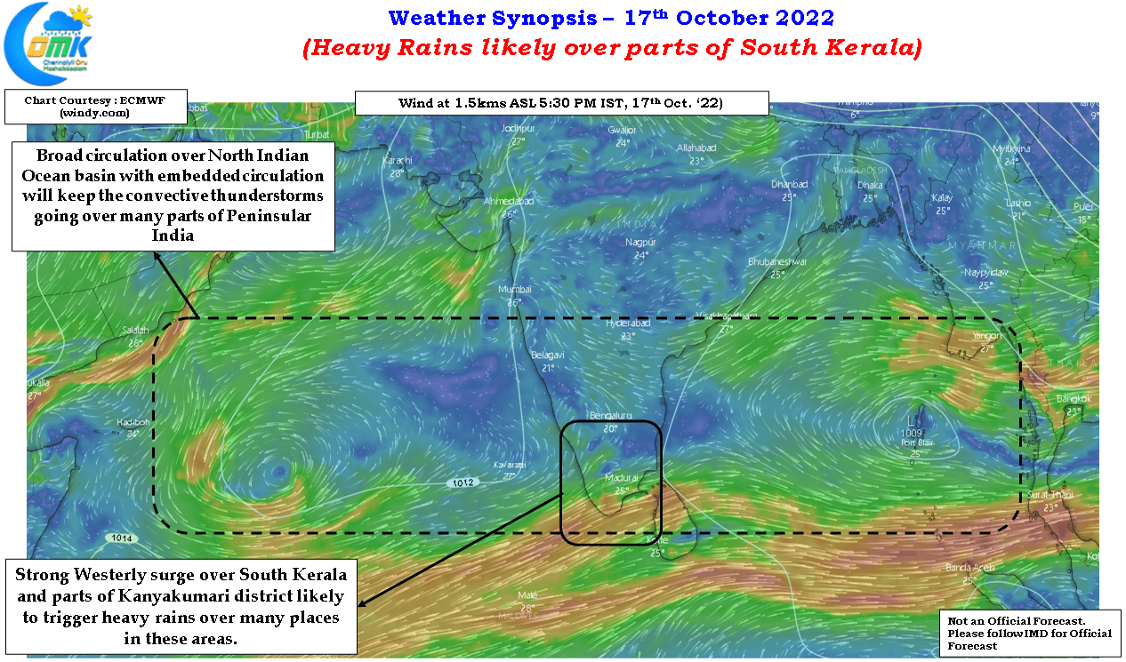
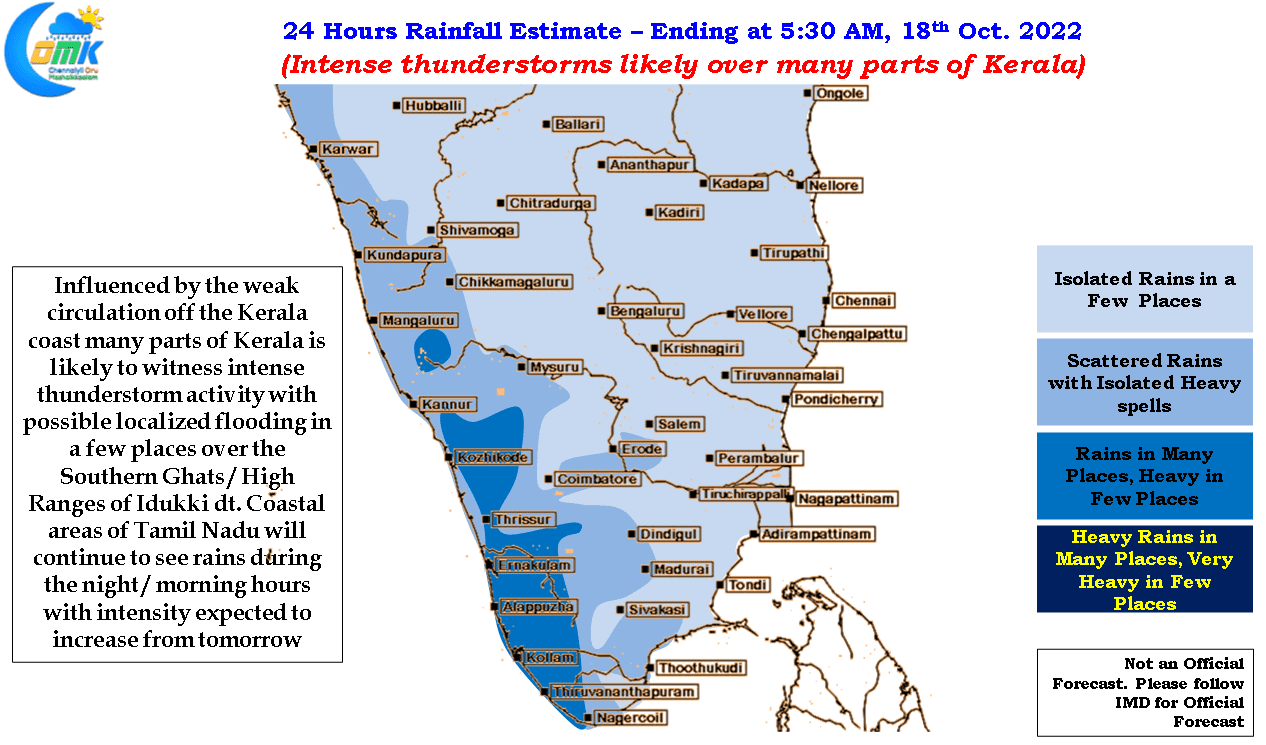
While people in the coastal areas may feel left out it is pertinent to point out the season is long and has not yet started for the coastal places. Today weather models indicate a very active day of rains for parts of Kerala and Kanyakumari district on account of strong westerly surge that is likely to hit these areas influenced by the circulation off the coast of Kerala. Potentially we may see isolated localized flooding in the Southern Ghats and High Ranges of Kerala. Interior Tamil Nadu will continue to see thunderstorms particularly over West & South TN. Chennai and suburbs is likely to see light to moderate rains once again during the late night / morning hours with intensity expected to pick up from later tomorrow night or early Wednesday morning.
Many might wonder why today’s post does not talk about the upcoming disturbance in Bay of Bengal. As the satellite image indicates the Eastern end of the broad circulation is likely to thrown up an LPA over the next 24 – 36 hours or so but with models continuing to show multiple scenarios it may not be prudent to discuss events 5 – 7 days ahead. Once the LPA forms the genesis conditions will give better input for models to firm up on the track, intensity and potential impacts.