
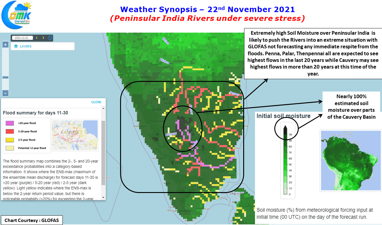
The last week’s rainfall episode triggered a flooding event across many parts of Peninsular India which was not seen in many decades. Rivers like Palar saw inflows cross 1.5 lakh cusecs which has possibly never happened in living memory for most people living on its bank. Similarly Then Pennai saw nearly 75000 cusecs which once again has not happened in many decades while further North the Penna river saw inflows exceeding 4 lakhs destroying everything in its path.
One of the key reasons for such a high inflows when the interior areas recorded heavy rains under the influence of the west moving Depression that crossed near Chennai is extremely high soil moisture. Shimsha a tributary of Cauvery is normally a poor cousin to the more famous Kabini, Hemavathi etc. But Shimsha has possibly been contributing a bulk of the nearly 75000 cusecs which Mettur saw last week. The GLOFAS, an initiative from ECMWF show nearly 100% moisture over parts of the Cauvery Basin which indicates the trouble ahead for us with most parts of Peninsular India seeing extremely high soil moisture due to the active thunderstorm season during Southwest Monsoon and the subsequent rains in interior areas due to the frequent movement of East to west pulses since the onset of Northeast Monsoon late in October.
GLOFAS continues to persist with 20 year old high or more inflows across all major rivers from Penna to Cauvery in the 11 to 30 days window which is indicative of what is ahead of us in terms of rainfall prospects over the Peninsular India. With the upcoming pulse also expected to move across Peninsular India it may be prudent to maintain extreme vigil over these rivers once again for possible floods as the inflows continue to remain high even today. The 11 to 30 days window was chosen to specifically understand not only impact from the upcoming spell but a slightly longer frame to look for a clearer outlook on what to expect during December 1st fortnight.
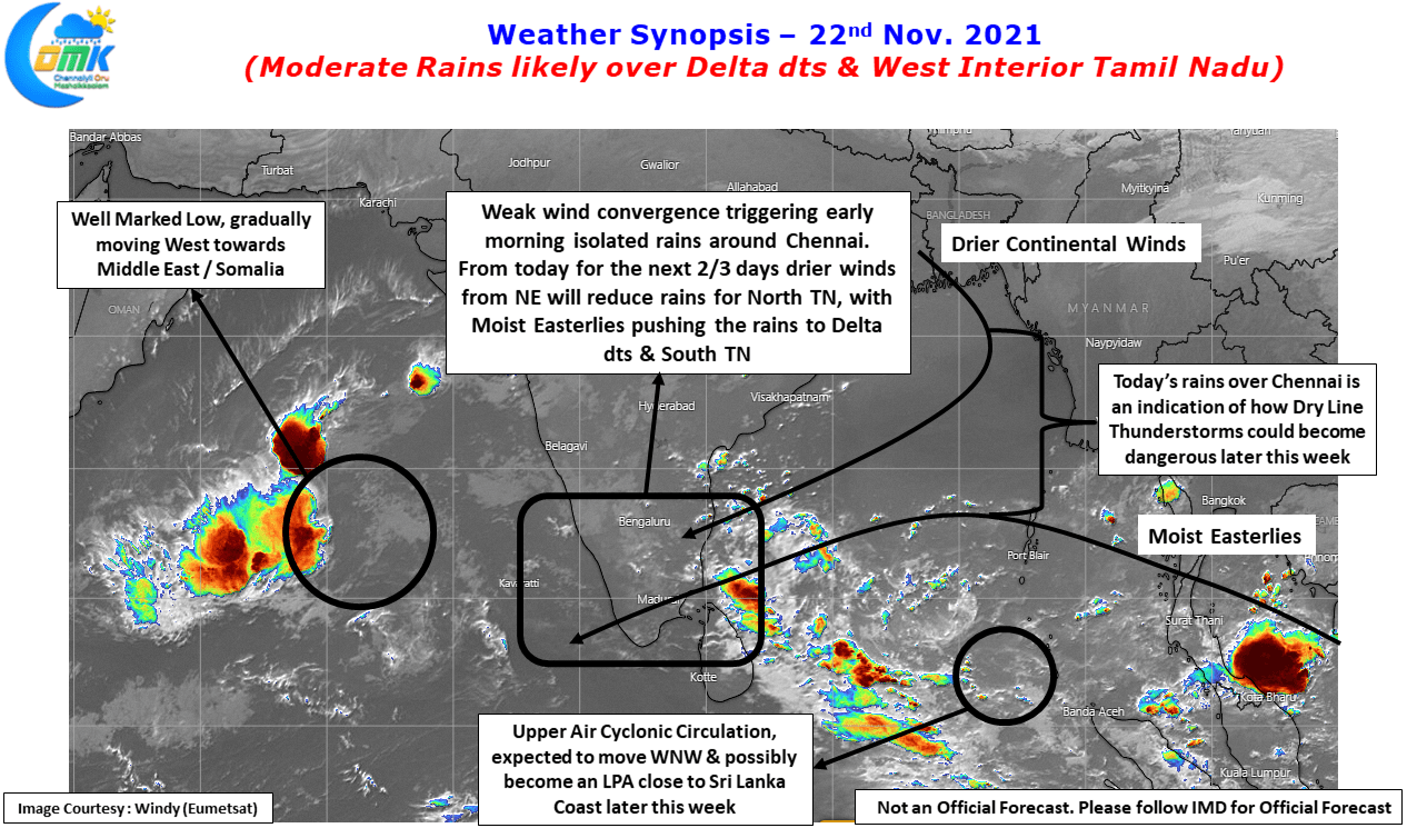
If GLOFAS is giving an indication on why extreme vigil needs to be maintained over the flood situation of Peninsular Rivers, today’s early morning rains around Chennai & Suburbs gave an indication on why the rainfall incident forecasted by weather models later this week & early next week will be a worry for not only Chennai but also most parts of Peninsular India. The regular spells of rains have pushed up the soil moisture levels so high it is no more a case of extreme rains triggering localized flooding / water logging but even moderate spell of rains are enough to create water logging as the infrastructure struggles to cope up with what is likely to be a watershed moment for Urban Storm Water Planning.
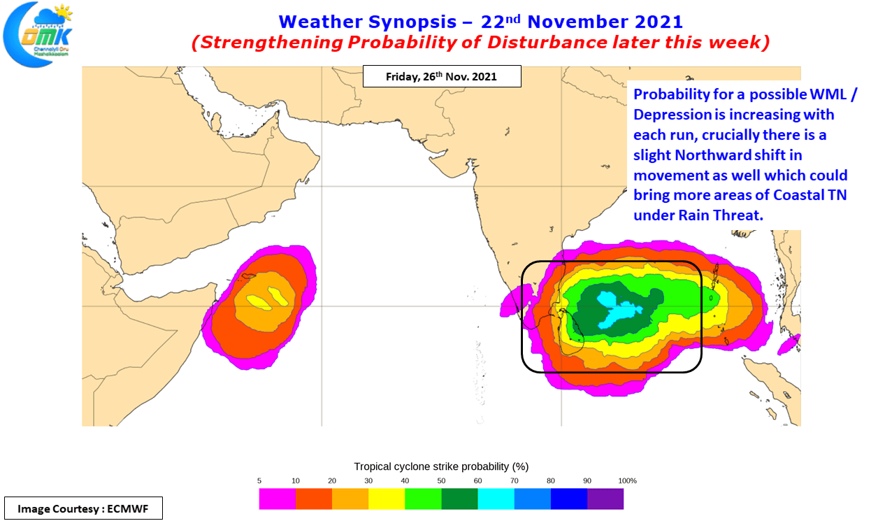
The good news though is places like Chennai & suburbs in North TN may get some respite with drier conditions expected for next one or two days before the rains gradually return back later this week. The next couple of days North TN could be under the influence of drier continental winds from North while the Easterlies get pushed south towards Delta & South TN. The UAC currently over South Bay is expected to gradually move west which will bring back Easterlies & along with it a zone of wind convergence which will trigger at least one episode of Dry Line Thunderstorms over North TN / South AP stretch. The worry though is the trend from Ensembles which are indicating not only a strengthening probability for a WML / Depression but a slight Northward shift as well in the tracks.