
Weather events many a times are decided by fine margins particularly over tropical areas like the Indian Sub Continent and while using Global Models were grid resolutions are lower. The last few days once again reiterate this, while many were upset about the “Unnecessary Hypes about heavy rains and Red Alerts for Chennai on Thursday” events that happened on Thursday about 400 kms from Chennai over a period of about 12 to 18 hours, a pronounced WSW movement from the LPA much in excess to initial model estimates, shifted the heaviest spell of rains that was initially expected over Chennai & adjoining areas to South AP well down south over Pondicherry, Villuppuram & Cuddalore districts.
But the overall binding thought for most disaster managers, particularly those involved with disseminating weather alerts tend to think it is better to have a False Alarms than missed alarms. False Alarms may have just provided for mental disappointments having become ready for a certain event which eventually did not happen. But the consequences of Missed Alarms have far higher ramifications when caught off guard without any head start if a disaster is unfolding right in front of our eyes. Today’s post is also an effort to provide an information to those people who may require a head start to plan things in anticipation of a possible heavy rainfall episode.
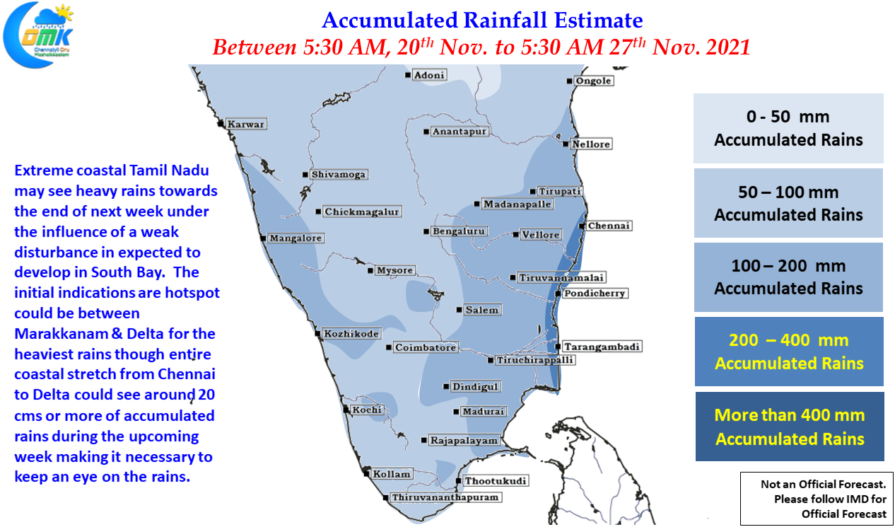
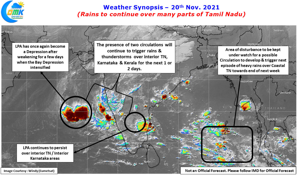
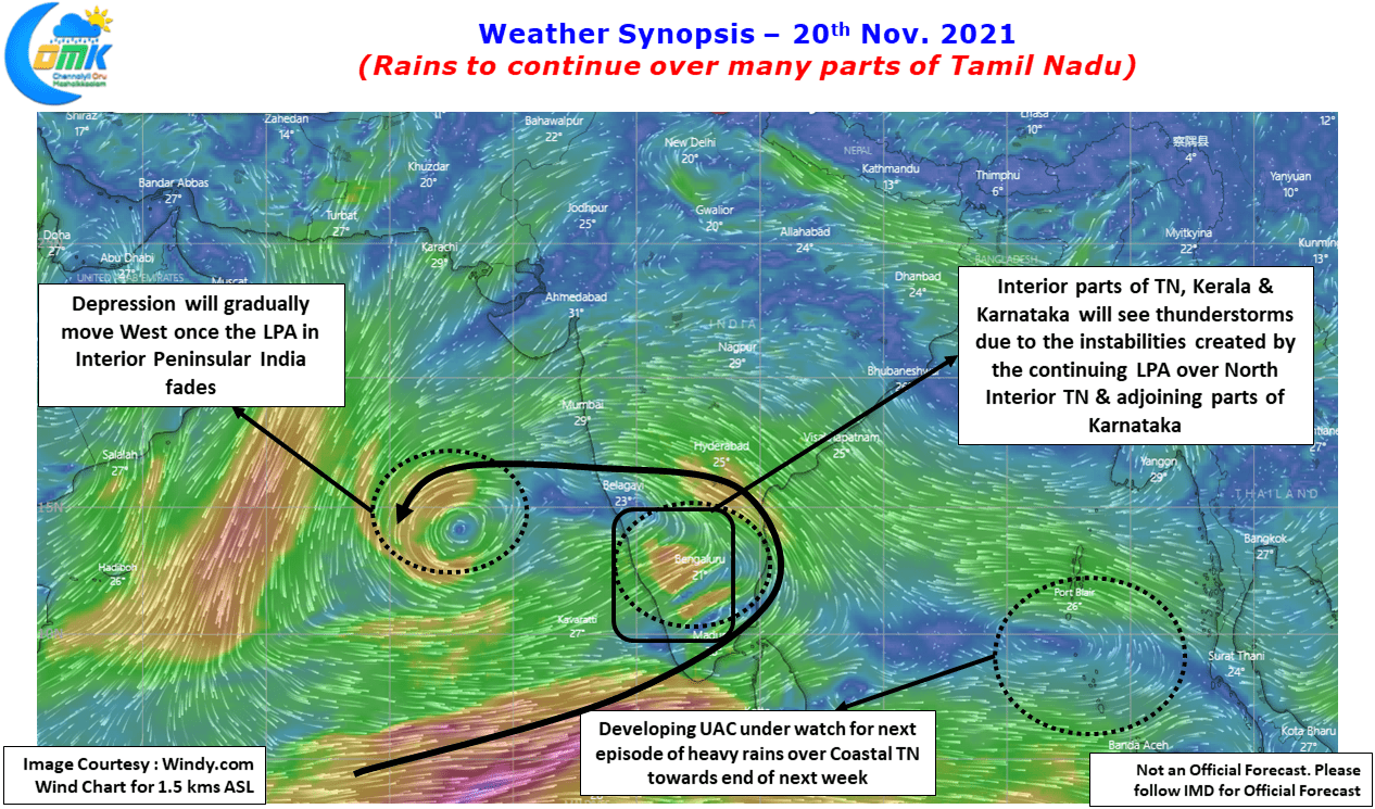
While Tamil Nadu is likely to see moderate rains continue over many parts of the state for the next day or two the area of interest of today’s post is South Bay where a developing circulation could influence what is likely to happen over Coastal Tamil Nadu towards the end next week. Weather models are fairly consistent about a possible disturbance developing in South Bay and moving closer to Coastal Tamil Nadu & adjoining areas of Sri Lanka during the second half of next week which is likely to trigger another episode of Heavy Rains over Coastal Tamil Nadu between Chennai & Delta districts.
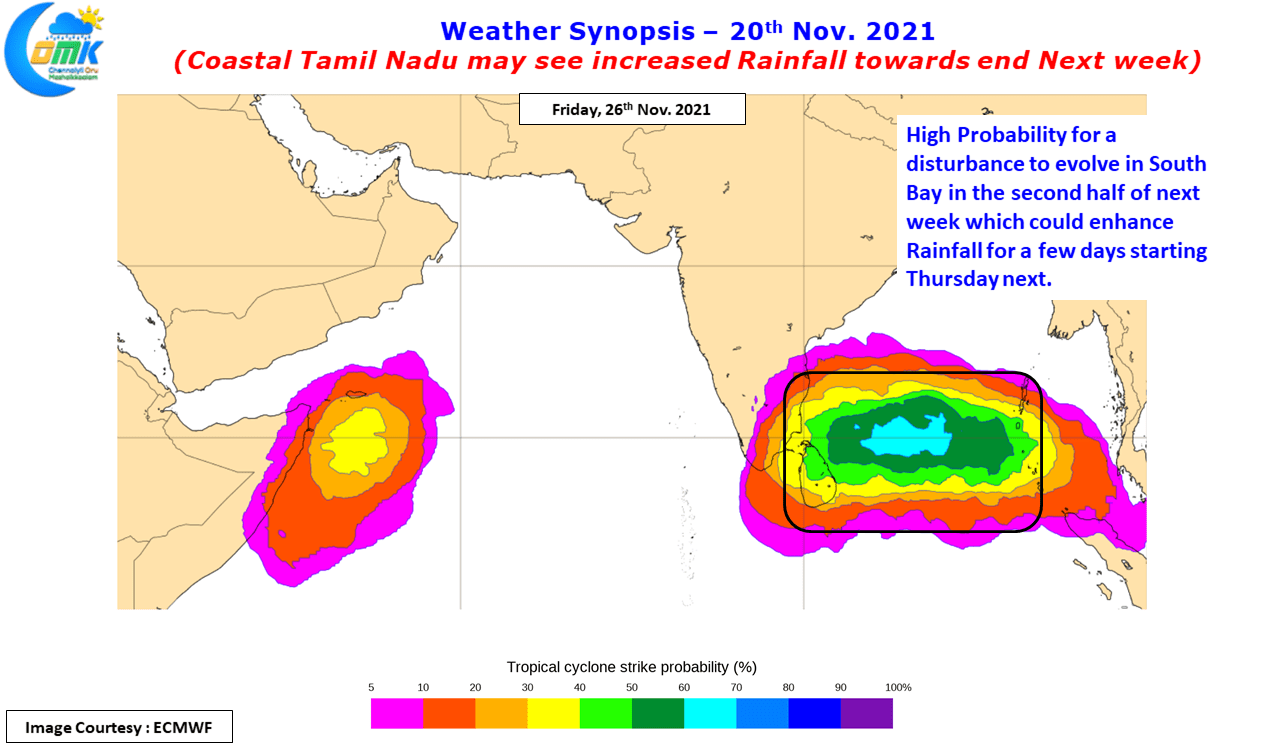
While the heaviest rains may possibly happen between Marakkanam & Delta districts it may be prudent for the entire coast to keep a tab on the developments because the probability for most of the places close to the coast, about 25 to 50 kms from the coast line, to record 20 cms or more of accumulated rainfall by 5:30 AM, Saturday, 27th Nov. 2021. With soil saturation very high all along the coast from Chennai to Cuddalore these areas need to be wary of any heavy rainfall episode that could trigger another round of localized flooding / water logging.
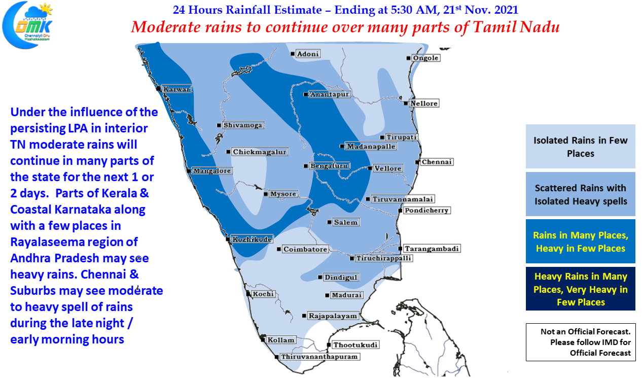
In the meanwhile with the remnant LPA from the depression that crossed Tamil Nadu coast south of Chennai yesterday is likely to influence rains over most parts of the state for the next day or two. Moderate rains with thunderstorms may continue over most parts of the state under the influence of wind instabilities created by the LPA now seen in interior Peninsular India while coastal places like Chennai may see moderate to heavy spell of rains at times during the late night / early morning hours.