As excitement builds in anticipation of the possible onset of Northeast Monsoon weather models have been churning different scenarios based on dynamically changing conditions both locally & globally. Nevertheless it is only fair to expect some bit of concurrence among models about the possible Onset window before the end of the month possibly supported by…
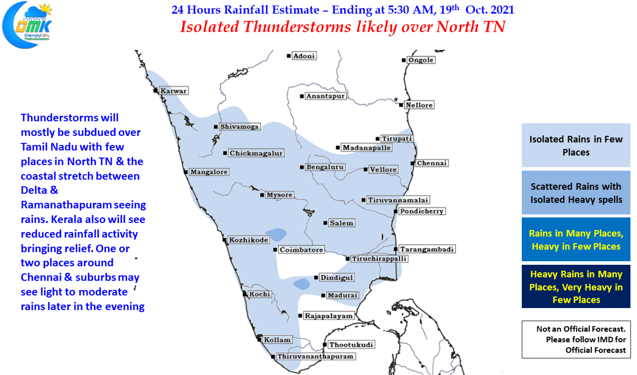
Isolated thunderstorms likely over North TN
Yesterday much to the relief of many rains started slowing down along the West Coast & in the Ghats. In a much needed development this would allow the disaster management teams to focus on relief & rescue operations in places that have been seeing floods & landslides with many reported in the High Ranges of…
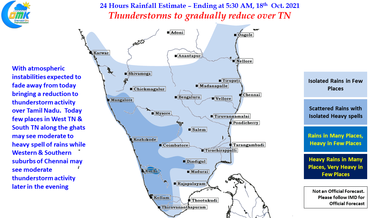
Thunderstorms to gradually reduce over Tamil Nadu
One of the most common debates that happen among weather bloggers is whether LPA or Cyclone gives more rains, there are enough evidences to support both sides of the arguments. Yesterday turned out to be another case of additional support for those who argue for LPAs’. A weak LPA under right conditions can dump a…
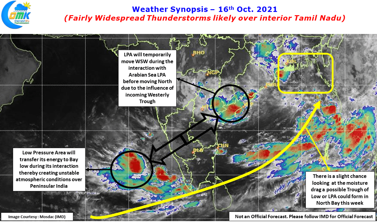
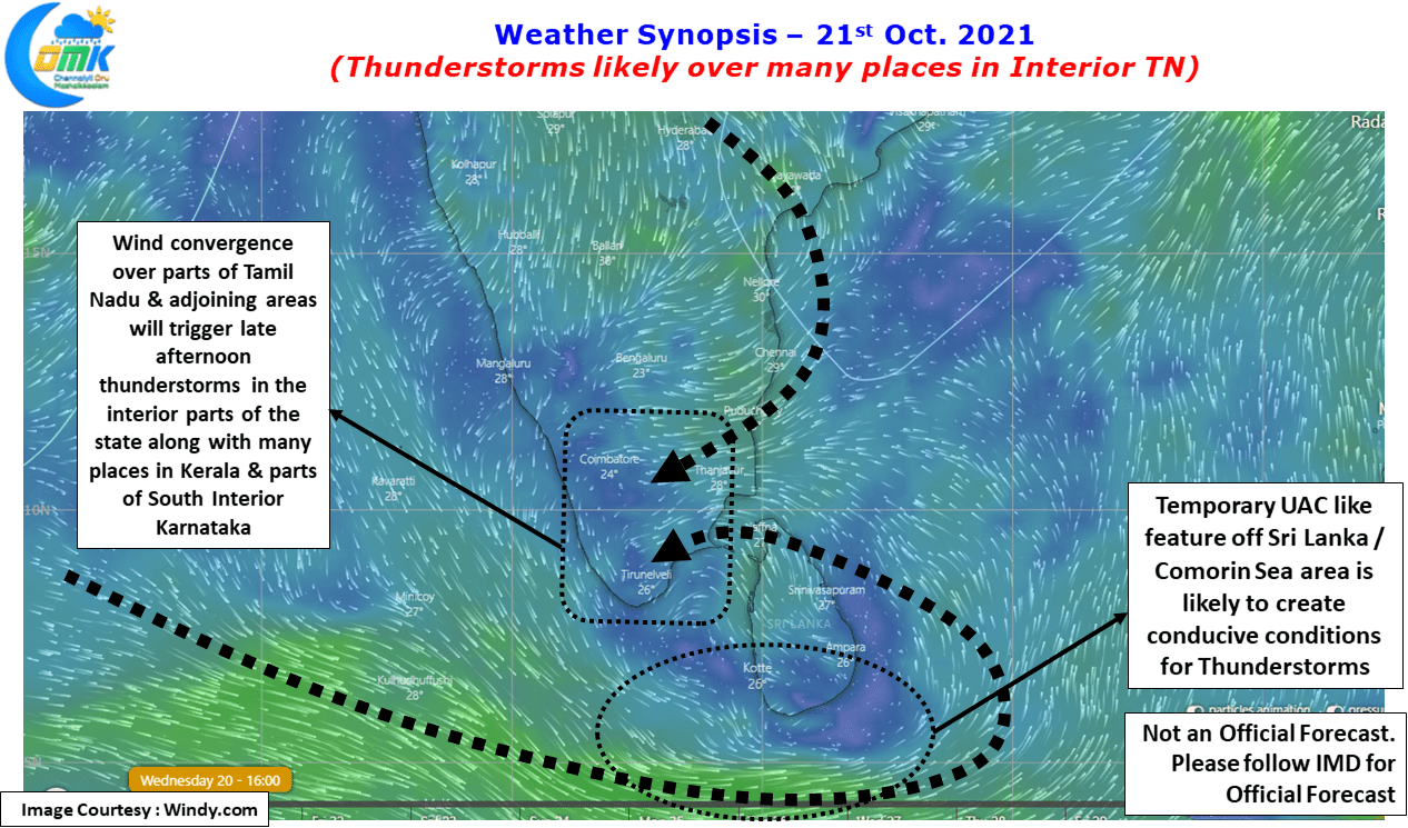
Fairly widespread thunderstorms likely over Interior TN
Since the start of the statistical Northeast Monsoon season on 1st of October yesterday was only the second instance of the daily realized rainfall over Tamil Nadu & Pondicherry falling lower than the daily average rainfall for second straight day in a row. On 7th & 8th of October the realized rainfall was lower than…
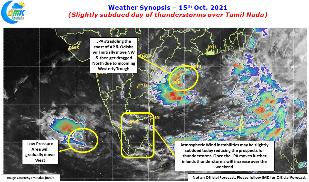
Slightly subdued day of Thunderstorms over Tamil Nadu
With the first fortnight of October coming to an end the seasonal Northeast Monsoon tally is now at 123.9 mm against the Long Period Average of 68.2 mm. Tenkasi, Virudhunagar & Thoothukudi are the only districts currently showing negative anomaly, while Virudhunagar at -30% & Thoothukudi at -63% are indeed in deficit Tenkasi at -4%…