
As excitement builds in anticipation of the possible onset of Northeast Monsoon weather models have been churning different scenarios based on dynamically changing conditions both locally & globally. Nevertheless it is only fair to expect some bit of concurrence among models about the possible Onset window before the end of the month possibly supported by a favorable disturbance in South Bay area.
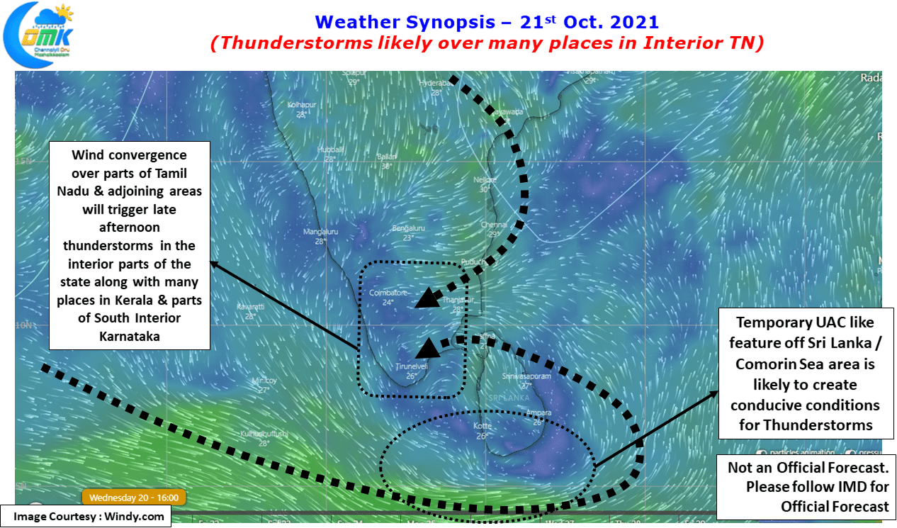
Meanwhile after a couple of days of subdued thunderstorm activity things are once again picking up for interior areas of Tamil Nadu. But this time it is not the Westerlies that is triggering the storms but the Easterlies like conditions due to a temporary circulation like feature seen off Sri Lanka over the Comorin Sea. When Easterlies trigger thunderstorms coastal areas normally miss out on the intense storms but it is the interiors especially places along the Eastern Slopes of Western Ghats & interior areas of West TN that is the major beneficiary.
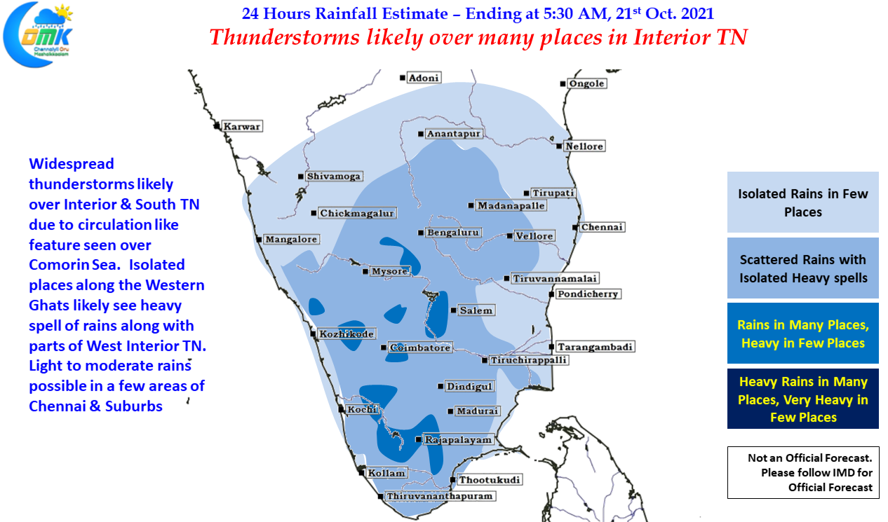
So for the next couple of days interior areas will see the best spell of rains as Moisture pushed across from the East get lifted up as convective activity through day time heating as the air particles move from East to West. This creates instability during late afternoon / evening over the West Interior parts of TN & places along the Ghats to trigger thunderstorms and bring along with it what is popularly called Veppasalanam Rains.
Today parts of South TN particularly one or two places in Virudhunagar, Tenkasi, Tirunelveli, Madurai & Thoothukudi districts along with few places in Namakkal, Erode, Coimbatore & Tiruppur districts of West TN may come under intense spell of late evening thunderstorms bringing heavy spell of rains. With winds remaining slightly slow some of the places may come under near stationary thunderstorms. Places along North Coastal TN like Chennai may see light to moderate rains in a few places.